Pleasant Hills is a census-designated place (CDP) in Harford County, Maryland, United States. The population was 3,379 at the 2010 census, up from 2,851 in 2000. There is no post office with the designation “Pleasant Hills”; most of the residents have either Fallston or Kingsville addresses and consider themselves as belonging to those communities.
| Name: | Pleasant Hills CDP |
|---|---|
| LSAD Code: | 57 |
| LSAD Description: | CDP (suffix) |
| State: | Maryland |
| County: | Harford County |
| Elevation: | 410 ft (125 m) |
| Total Area: | 4.37 sq mi (11.32 km²) |
| Land Area: | 4.36 sq mi (11.29 km²) |
| Water Area: | 0.01 sq mi (0.02 km²) |
| Total Population: | 3,998 |
| Population Density: | 916.97/sq mi (354.05/km²) |
| FIPS code: | 2462175 |
| GNISfeature ID: | 1698807 |
Online Interactive Map
Click on ![]() to view map in "full screen" mode.
to view map in "full screen" mode.
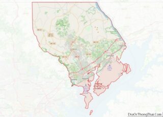
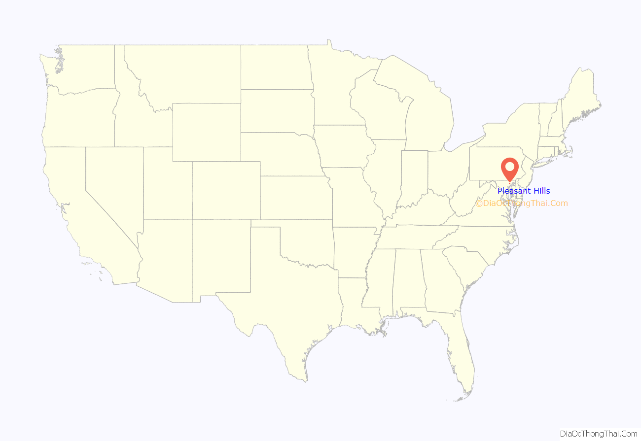
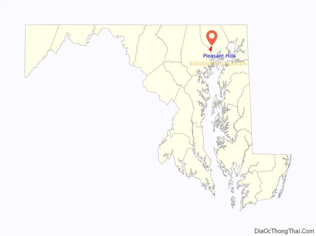
Pleasant Hills location map. Where is Pleasant Hills CDP?
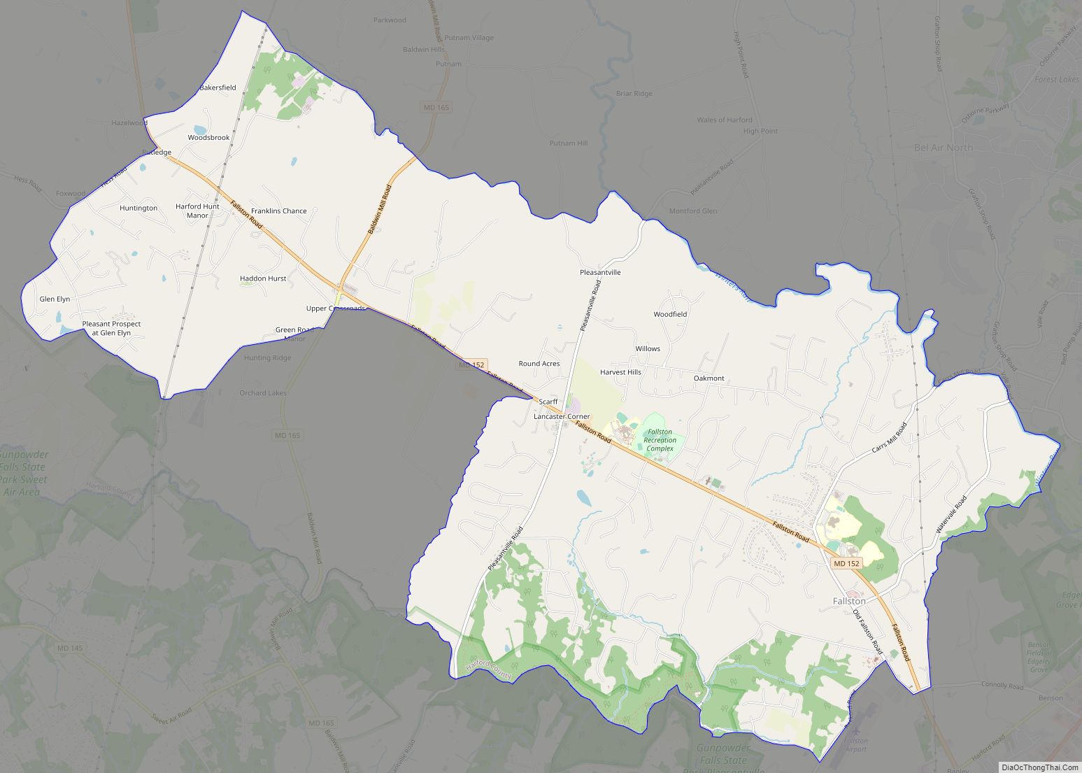
Pleasant Hills Road Map

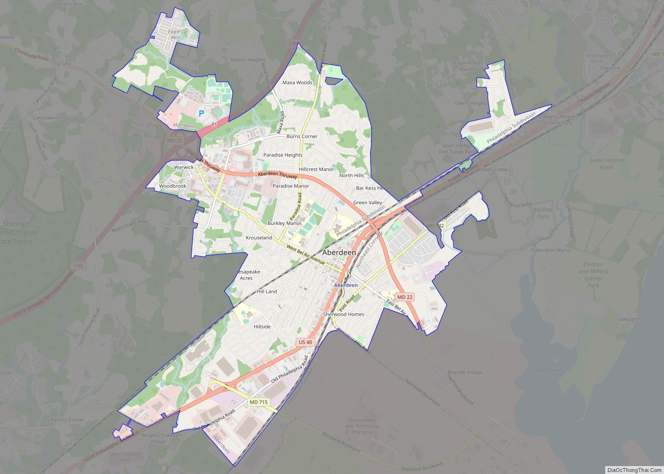
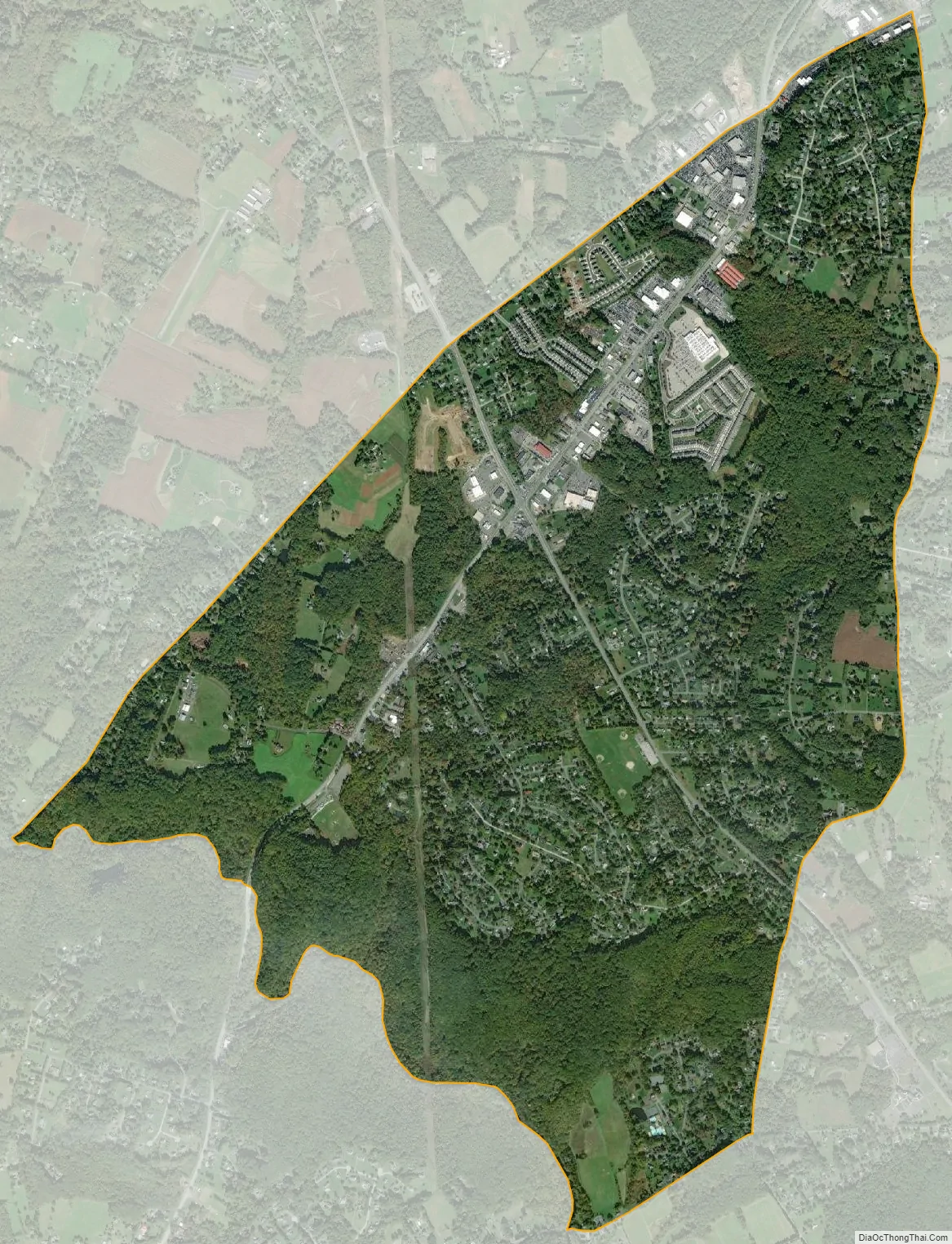
Pleasant Hills city Satellite Map
Geography
Pleasant Hills is located in southwestern Harford County at 39°29′08″N 76°23′40″W / 39.485474°N 76.394553°W / 39.485474; -76.394553. It is bordered to the southwest by Baltimore County, with the county border following the Little Gunpowder Falls. Maryland Route 147 (Harford Road) forms the northwestern edge of the CDP. U.S. Route 1 (Bel Air Road) runs through the community, leading northeast 4 miles (6 km) to Bel Air, the Harford County seat, and southwest 18 miles (29 km) to Baltimore. Maryland Route 152 crosses US 1 in Pleasant Hills, leading northwest 2 miles (3 km) to Fallston and southeast 4 miles (6 km) to Interstate 95 near Joppatowne.
According to the United States Census Bureau, the Pleasant Hills CDP has a total area of 4.4 square miles (11.3 km), of which 0.01 square miles (0.02 km), or 0.22%, are water.
See also
Map of Maryland State and its subdivision: Map of other states:- Alabama
- Alaska
- Arizona
- Arkansas
- California
- Colorado
- Connecticut
- Delaware
- District of Columbia
- Florida
- Georgia
- Hawaii
- Idaho
- Illinois
- Indiana
- Iowa
- Kansas
- Kentucky
- Louisiana
- Maine
- Maryland
- Massachusetts
- Michigan
- Minnesota
- Mississippi
- Missouri
- Montana
- Nebraska
- Nevada
- New Hampshire
- New Jersey
- New Mexico
- New York
- North Carolina
- North Dakota
- Ohio
- Oklahoma
- Oregon
- Pennsylvania
- Rhode Island
- South Carolina
- South Dakota
- Tennessee
- Texas
- Utah
- Vermont
- Virginia
- Washington
- West Virginia
- Wisconsin
- Wyoming