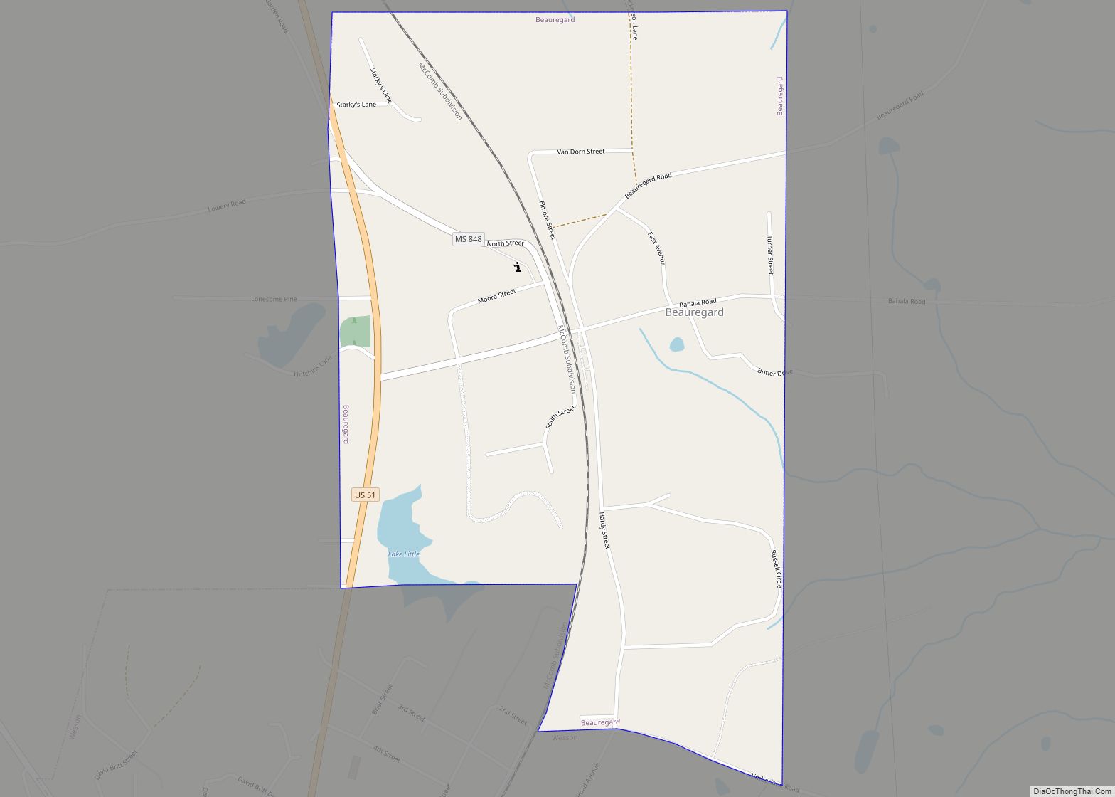
Beauregard is a village in Copiah County, Mississippi, United States. The population was 326 at the 2010 census. It is part of the Jackson Metropolitan Statistical Area. Beauregard is named for P. G. T. Beauregard.
| Name: | Beauregard village |
|---|---|
| LSAD Code: | 47 |
| LSAD Description: | village (suffix) |
| State: | Mississippi |
| County: | Copiah County |
| Elevation: | 463 ft (141 m) |
| Total Area: | 0.92 sq mi (2.39 km²) |
| Land Area: | 0.92 sq mi (2.37 km²) |
| Water Area: | 0.01 sq mi (0.02 km²) |
| Total Population: | 289 |
| Population Density: | 315.50/sq mi (121.82/km²) |
| FIPS code: | 2804540 |
| GNISfeature ID: | 0666684 |
Online Interactive Map
Click on ![]() to view map in "full screen" mode.
to view map in "full screen" mode.
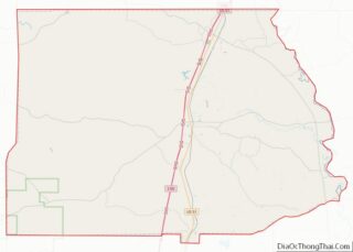
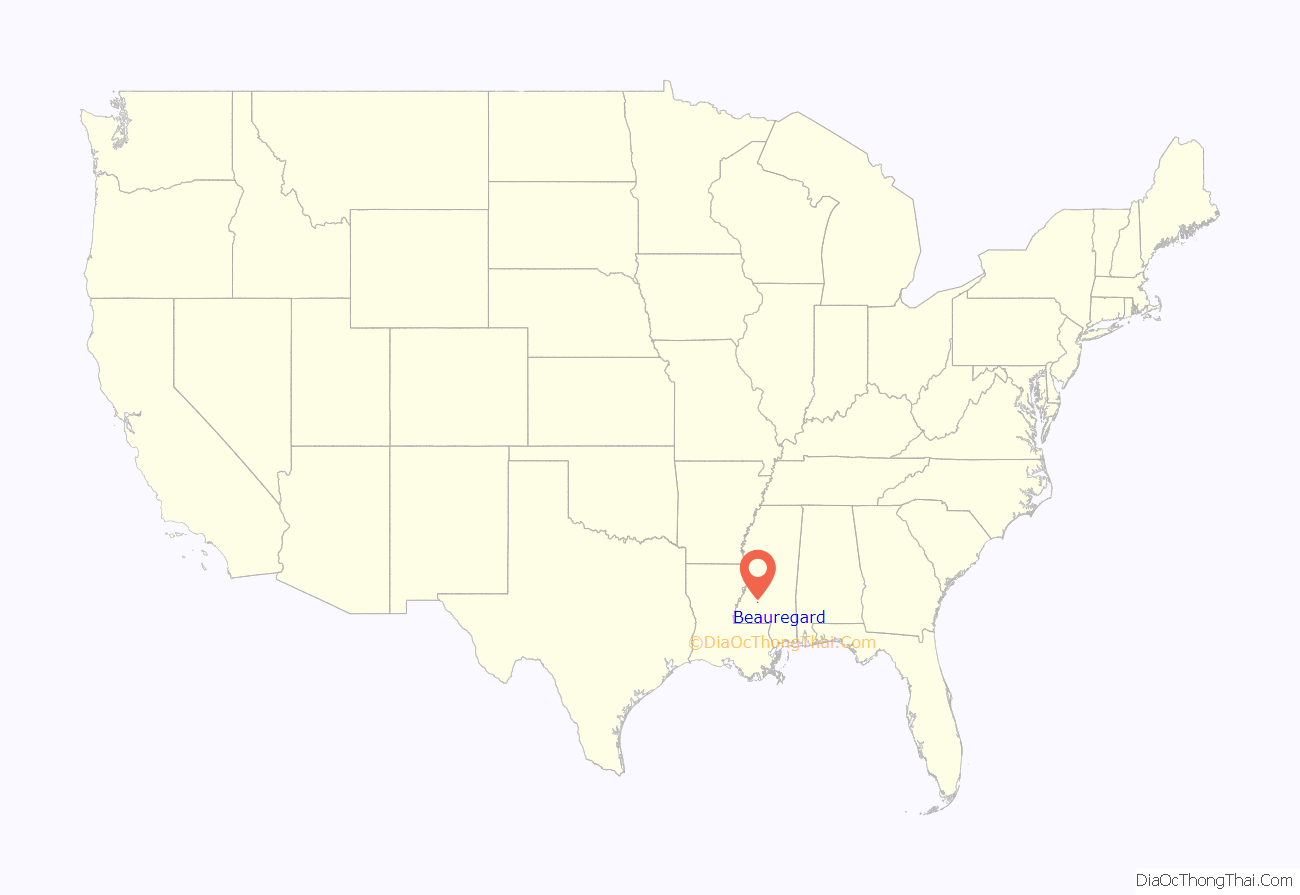
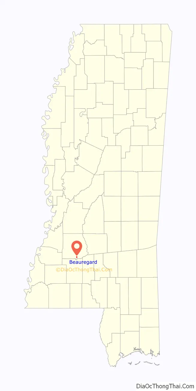
Beauregard location map. Where is Beauregard village?
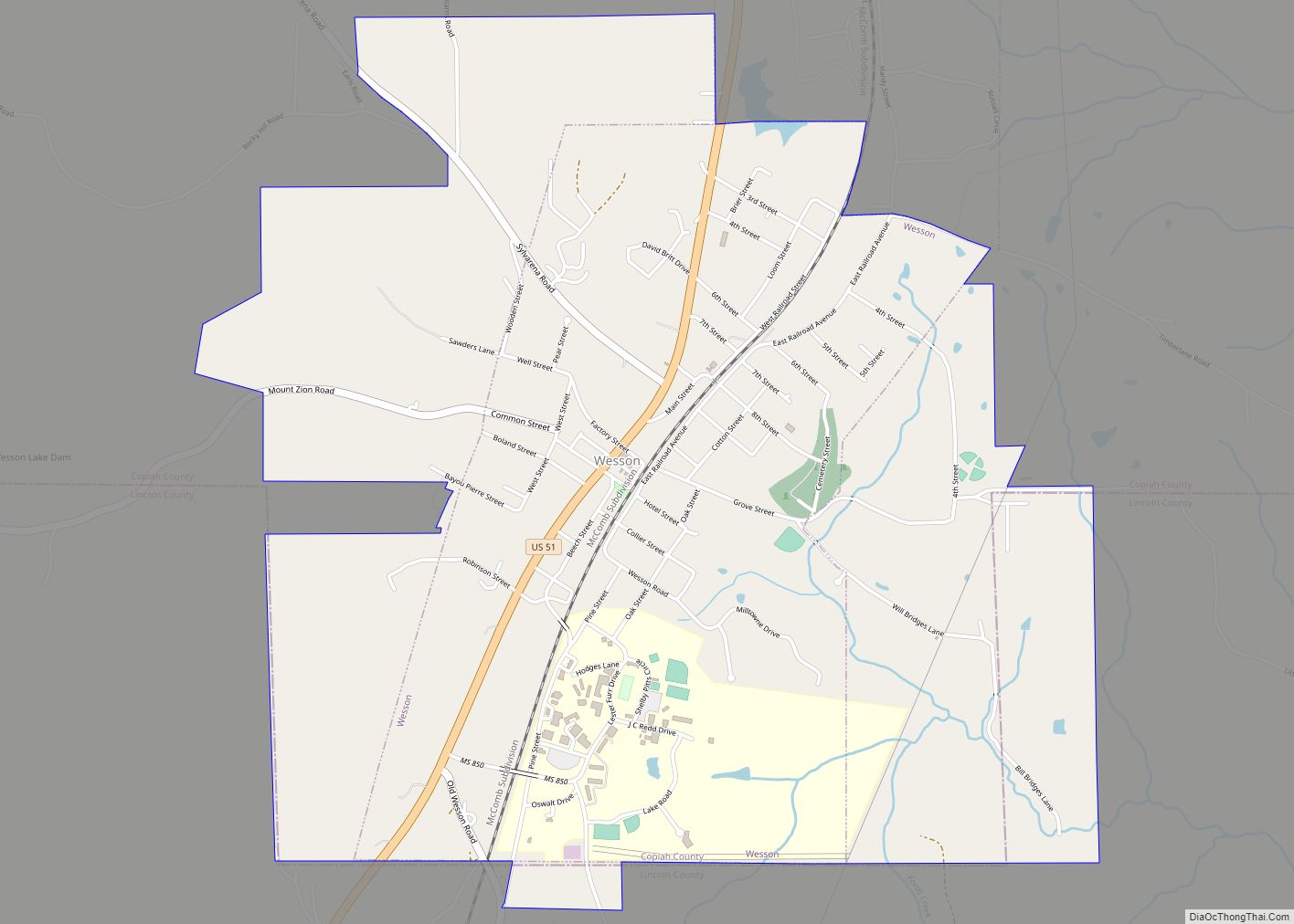
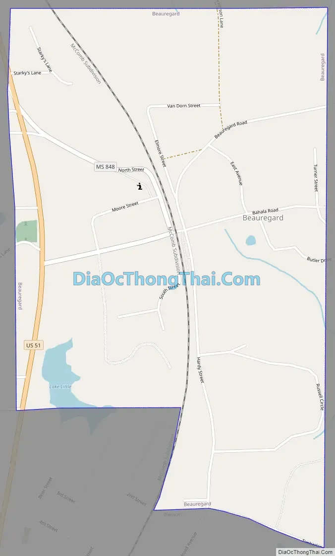
Beauregard Road Map
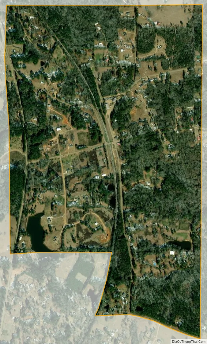
Beauregard city Satellite Map
Geography
Beauregard is located in southern Copiah County at 31°43′18″N 90°23′17″W / 31.72167°N 90.38806°W / 31.72167; -90.38806 (31.721549, -90.388096). It is bordered to the south by the town of Wesson. U.S. Route 51 passes along the western edge of the village, leading north 10 miles (16 km) to Hazlehurst, the county seat, and south 10 miles (16 km) to Brookhaven. Exit 51 on Interstate 55 is 4 miles (6 km) west of the village center on Sylvarena Road.
According to the United States Census Bureau, the village has a total area of 0.93 square miles (2.4 km), of which 0.008 square miles (0.02 km), or 0.82%, is water.
See also
Map of Mississippi State and its subdivision:- Adams
- Alcorn
- Amite
- Attala
- Benton
- Bolivar
- Calhoun
- Carroll
- Chickasaw
- Choctaw
- Claiborne
- Clarke
- Clay
- Coahoma
- Copiah
- Covington
- Desoto
- Forrest
- Franklin
- George
- Greene
- Grenada
- Hancock
- Harrison
- Hinds
- Holmes
- Humphreys
- Issaquena
- Itawamba
- Jackson
- Jasper
- Jefferson
- Jefferson Davis
- Jones
- Kemper
- Lafayette
- Lamar
- Lauderdale
- Lawrence
- Leake
- Lee
- Leflore
- Lincoln
- Lowndes
- Madison
- Marion
- Marshall
- Monroe
- Montgomery
- Neshoba
- Newton
- Noxubee
- Oktibbeha
- Panola
- Pearl River
- Perry
- Pike
- Pontotoc
- Prentiss
- Quitman
- Rankin
- Scott
- Sharkey
- Simpson
- Smith
- Stone
- Sunflower
- Tallahatchie
- Tate
- Tippah
- Tishomingo
- Tunica
- Union
- Walthall
- Warren
- Washington
- Wayne
- Webster
- Wilkinson
- Winston
- Yalobusha
- Yazoo
- Alabama
- Alaska
- Arizona
- Arkansas
- California
- Colorado
- Connecticut
- Delaware
- District of Columbia
- Florida
- Georgia
- Hawaii
- Idaho
- Illinois
- Indiana
- Iowa
- Kansas
- Kentucky
- Louisiana
- Maine
- Maryland
- Massachusetts
- Michigan
- Minnesota
- Mississippi
- Missouri
- Montana
- Nebraska
- Nevada
- New Hampshire
- New Jersey
- New Mexico
- New York
- North Carolina
- North Dakota
- Ohio
- Oklahoma
- Oregon
- Pennsylvania
- Rhode Island
- South Carolina
- South Dakota
- Tennessee
- Texas
- Utah
- Vermont
- Virginia
- Washington
- West Virginia
- Wisconsin
- Wyoming