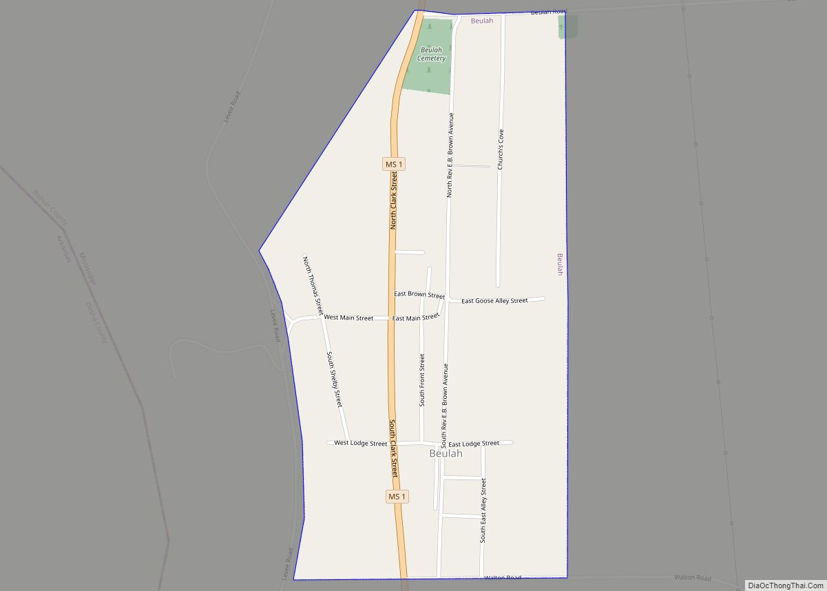
Beulah is a town in Bolivar County, Mississippi, United States. Per the 2020 census, the population was 242.
Beulah is served by Mississippi Highway 1. Lake Beulah, an oxbow lake formerly connected to the Mississippi River, is west of the town. The Illinois Central Railroad had a station in Beulah, but the line is now abandoned.
Beulah is named after the Christian hymn Beulah Land, a favorite of Frank A. Montgomery, an early settler to western Bolivar County.
| Name: | Beulah town |
|---|---|
| LSAD Code: | 43 |
| LSAD Description: | town (suffix) |
| State: | Mississippi |
| County: | Bolivar County |
| Elevation: | 144 ft (44 m) |
| Total Area: | 0.46 sq mi (1.20 km²) |
| Land Area: | 0.46 sq mi (1.20 km²) |
| Water Area: | 0.00 sq mi (0.00 km²) |
| Total Population: | 242 |
| Population Density: | 522.68/sq mi (201.71/km²) |
| ZIP code: | 38726 |
| Area code: | 662 |
| FIPS code: | 2805820 |
| GNISfeature ID: | 0667037 |
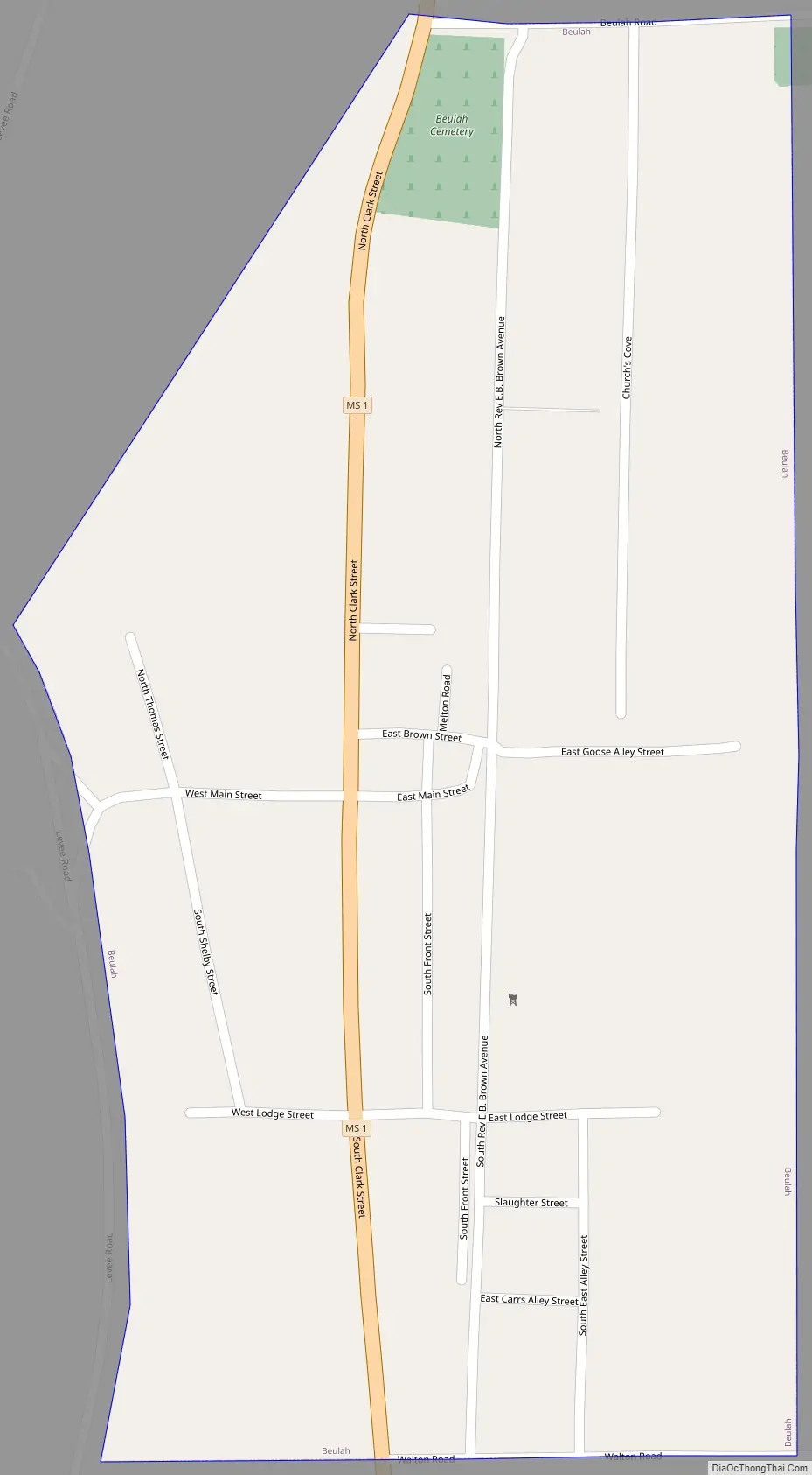
Online Interactive Map
Click on ![]() to view map in "full screen" mode.
to view map in "full screen" mode.
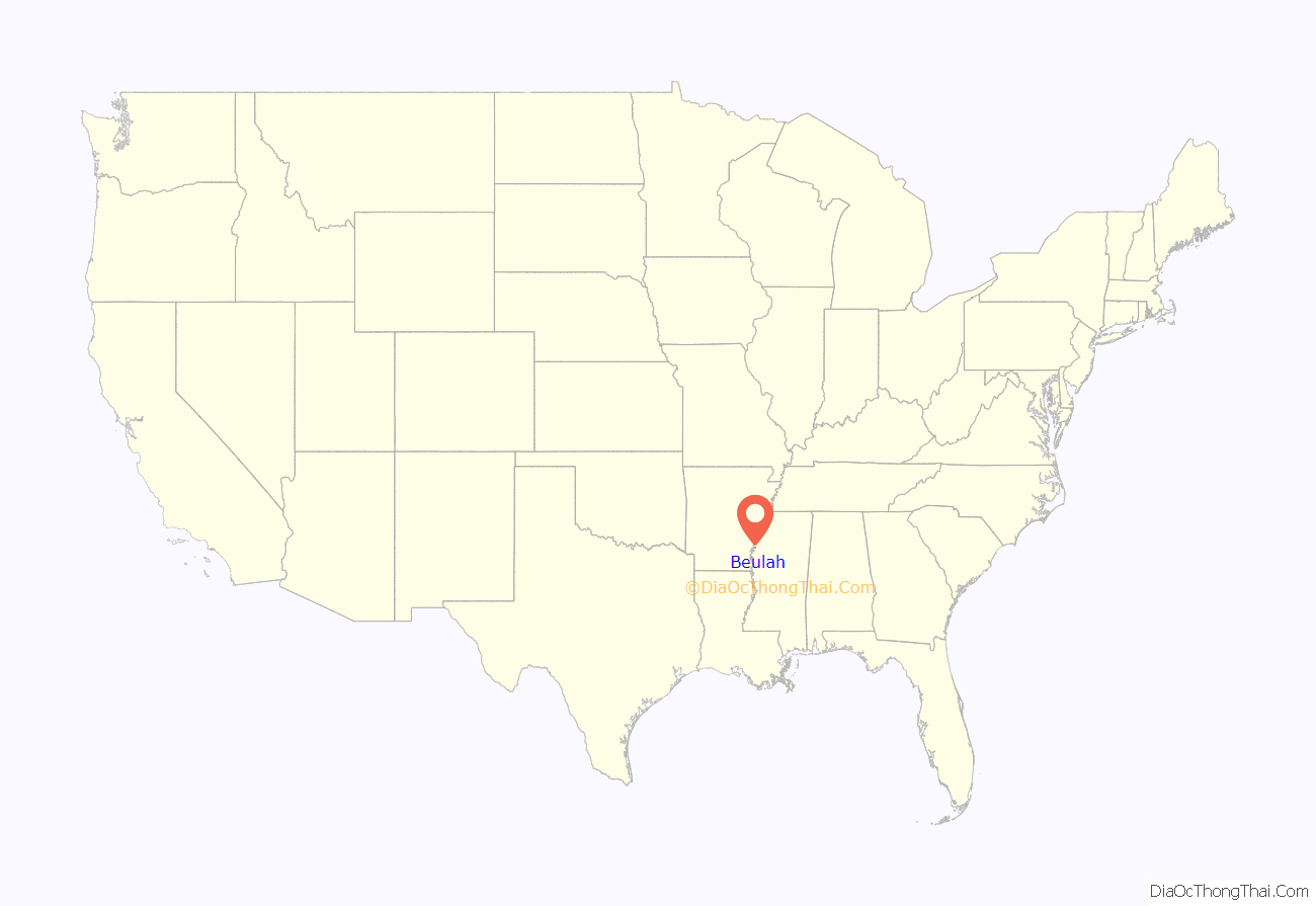
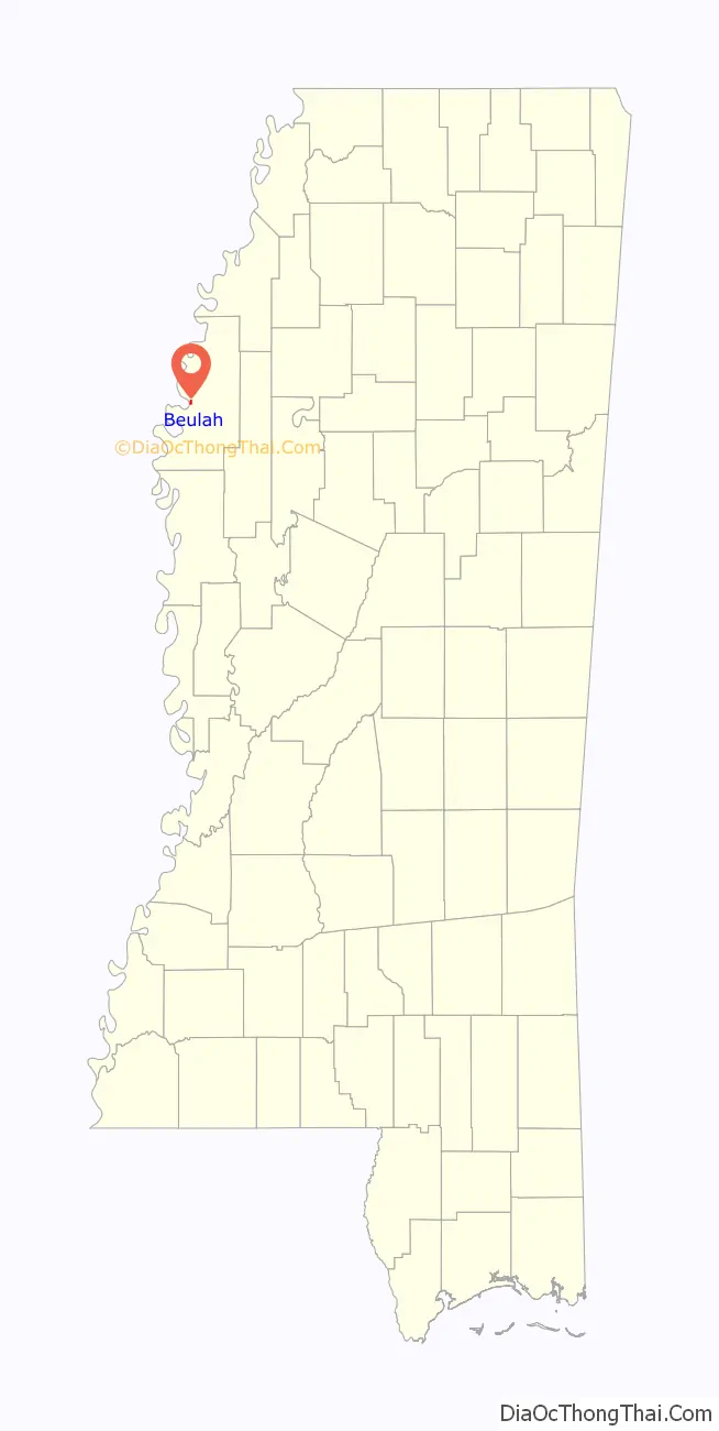
Beulah location map. Where is Beulah town?
History
The land southwest of Beulah was owned by a Choctaw family in the 1830s. A series of lawsuits caused them to lose their land, and Charles Clark took ownership. Clark established the Doro Plantation during the late 1840s and early 1850s, which grew to over 5,000 acres (2,000 ha) and became the most prosperous slave-owning plantation in the region. It continued to operate after the end of slavery until 1913. During that time, the Mississippi River flowed next to Beulah along “Beulah Bend” (now Lake Beulah), and Clark was often visited by Mark Twain while writing Life on the Mississippi.
In 1858, Frank A. Montgomery purchased a tract of land along the river north of the Doro Plantation and established a plantation. Beulah was one of its villages.
Mississippi River boats landed at points in the community, and there was a noted river trade. Freshwater clam harvesting – “clammin” – enabled a thriving pearl button industry.
In 1863, Union soldiers altered the course of the river by constructing a channel to avoid Beulah Bend, and the town became shut off from river commerce. The pearl button industry declined, as freshwater clams tend to concentrate in the bends of rivers, though many families still participate in clam harvesting at places they can access the river. Altering the river’s course also destroyed the nearby towns of Prentiss and Napoleon.
In 1866, Montgomery donated the village of Beulah to the county, and gave $1,600 to build a courthouse. A two-room log jail was also built. Beulah became the first county seat, and had a Masonic Lodge, church, school, bank, stores, and post office. The Bolivar Times newspaper was also edited there. In 1872, the county seat was moved to Floreyville (now called Rosedale).
After the Civil War, numerous freedmen bought and cleared land in the bottomlands away from the river. By 1910, declining financial and social conditions had caused most to lose their land, forcing them to work as sharecroppers and laborers. Beginning in the early 1900s, thousands of blacks left Mississippi as part of the Great Migration north by railroad to Chicago and other northern industrial cities, but others remained, with strong local ties.
Blues musician W. C. Handy once invited Charley Patton to watch his band perform in Beulah. Patton got in free, and when he observed that Handy’s musicians were all strict score-reading performers, he gave up all ambition of playing with their band.
Beulah was mentioned in Eudora Welty’s Death of a Traveling Salesman:
In 1970, Beulah was chosen as the site for a large event by the Southern Female Rights Union.
Part of the movie Crossroads was filmed in Beulah.
Beulah Road Map
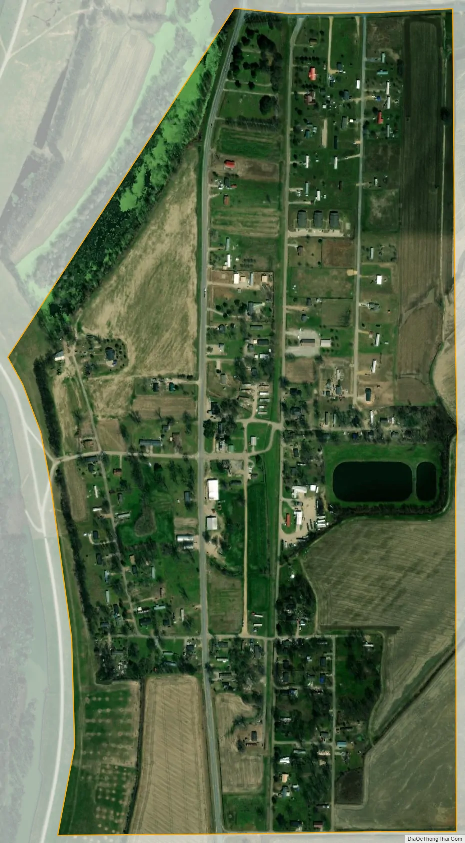
Beulah city Satellite Map
Geography
According to the United States Census Bureau, the town has a total area of 0.5 square miles (1.3 km), all land.
Climate
The climate in this area is characterized by hot, humid summers and generally mild to cool winters. According to the Köppen Climate Classification system, Beulah has a humid subtropical climate, abbreviated “Cfa” on climate maps.
See also
Map of Mississippi State and its subdivision:- Adams
- Alcorn
- Amite
- Attala
- Benton
- Bolivar
- Calhoun
- Carroll
- Chickasaw
- Choctaw
- Claiborne
- Clarke
- Clay
- Coahoma
- Copiah
- Covington
- Desoto
- Forrest
- Franklin
- George
- Greene
- Grenada
- Hancock
- Harrison
- Hinds
- Holmes
- Humphreys
- Issaquena
- Itawamba
- Jackson
- Jasper
- Jefferson
- Jefferson Davis
- Jones
- Kemper
- Lafayette
- Lamar
- Lauderdale
- Lawrence
- Leake
- Lee
- Leflore
- Lincoln
- Lowndes
- Madison
- Marion
- Marshall
- Monroe
- Montgomery
- Neshoba
- Newton
- Noxubee
- Oktibbeha
- Panola
- Pearl River
- Perry
- Pike
- Pontotoc
- Prentiss
- Quitman
- Rankin
- Scott
- Sharkey
- Simpson
- Smith
- Stone
- Sunflower
- Tallahatchie
- Tate
- Tippah
- Tishomingo
- Tunica
- Union
- Walthall
- Warren
- Washington
- Wayne
- Webster
- Wilkinson
- Winston
- Yalobusha
- Yazoo
- Alabama
- Alaska
- Arizona
- Arkansas
- California
- Colorado
- Connecticut
- Delaware
- District of Columbia
- Florida
- Georgia
- Hawaii
- Idaho
- Illinois
- Indiana
- Iowa
- Kansas
- Kentucky
- Louisiana
- Maine
- Maryland
- Massachusetts
- Michigan
- Minnesota
- Mississippi
- Missouri
- Montana
- Nebraska
- Nevada
- New Hampshire
- New Jersey
- New Mexico
- New York
- North Carolina
- North Dakota
- Ohio
- Oklahoma
- Oregon
- Pennsylvania
- Rhode Island
- South Carolina
- South Dakota
- Tennessee
- Texas
- Utah
- Vermont
- Virginia
- Washington
- West Virginia
- Wisconsin
- Wyoming