Isola is a town in Humphreys County, Mississippi, United States, on the banks of Lake Dawson. The population was 713 at the 2010 census, down from 768 at the 2000 census.
The name is derived from “isolation”, due to the town’s remote location when it was founded.
| Name: | Isola town |
|---|---|
| LSAD Code: | 43 |
| LSAD Description: | town (suffix) |
| State: | Mississippi |
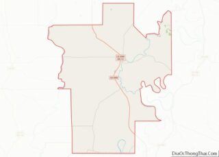
| County: | Humphreys County |
| Elevation: | 115 ft (35 m) |
| Total Area: | 0.74 sq mi (1.91 km²) |
| Land Area: | 0.74 sq mi (1.91 km²) |
| Water Area: | 0.00 sq mi (0.00 km²) |
| Total Population: | 638 |
| Population Density: | 863.33/sq mi (333.30/km²) |
| ZIP code: | 38754 |
| Area code: | 662 |
| FIPS code: | 2835220 |
| GNISfeature ID: | 0671741 |
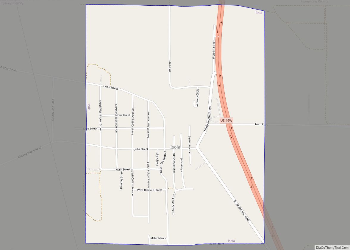
Online Interactive Map
Click on ![]() to view map in "full screen" mode.
to view map in "full screen" mode.
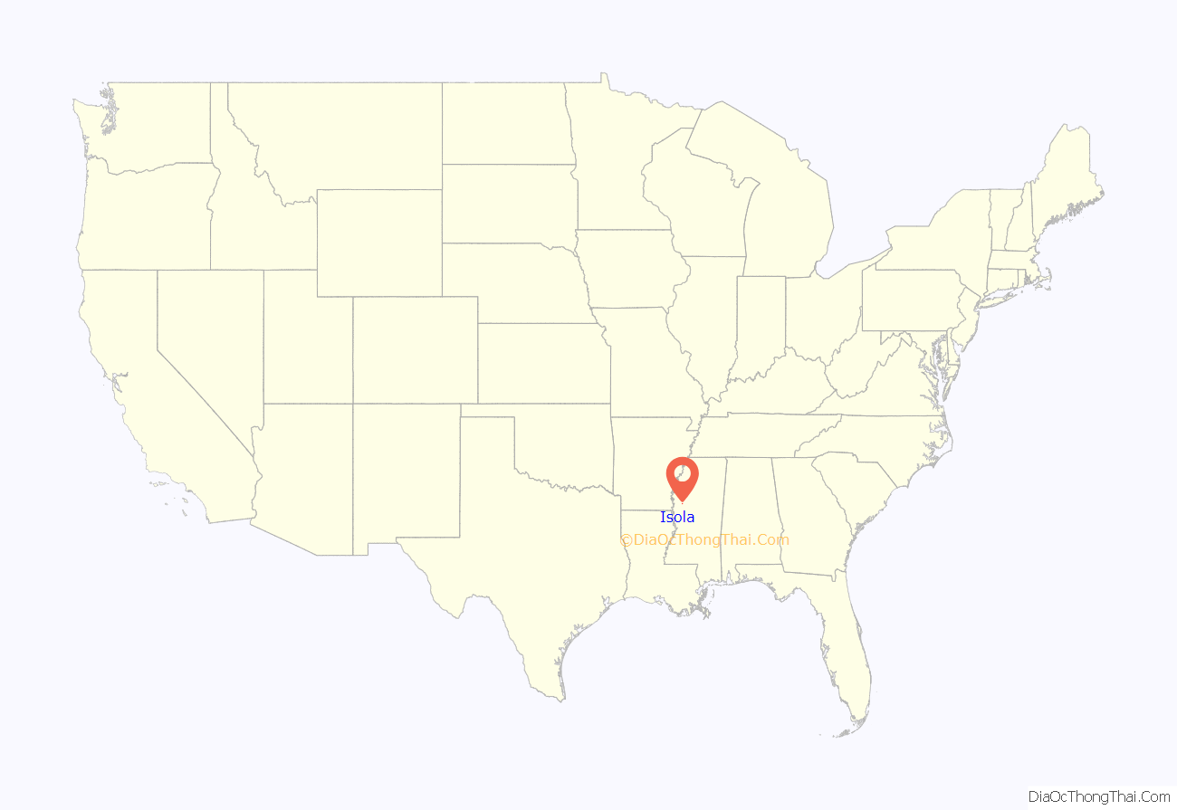
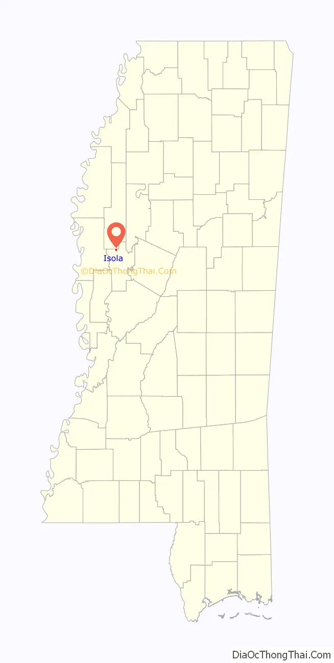
Isola location map. Where is Isola town?
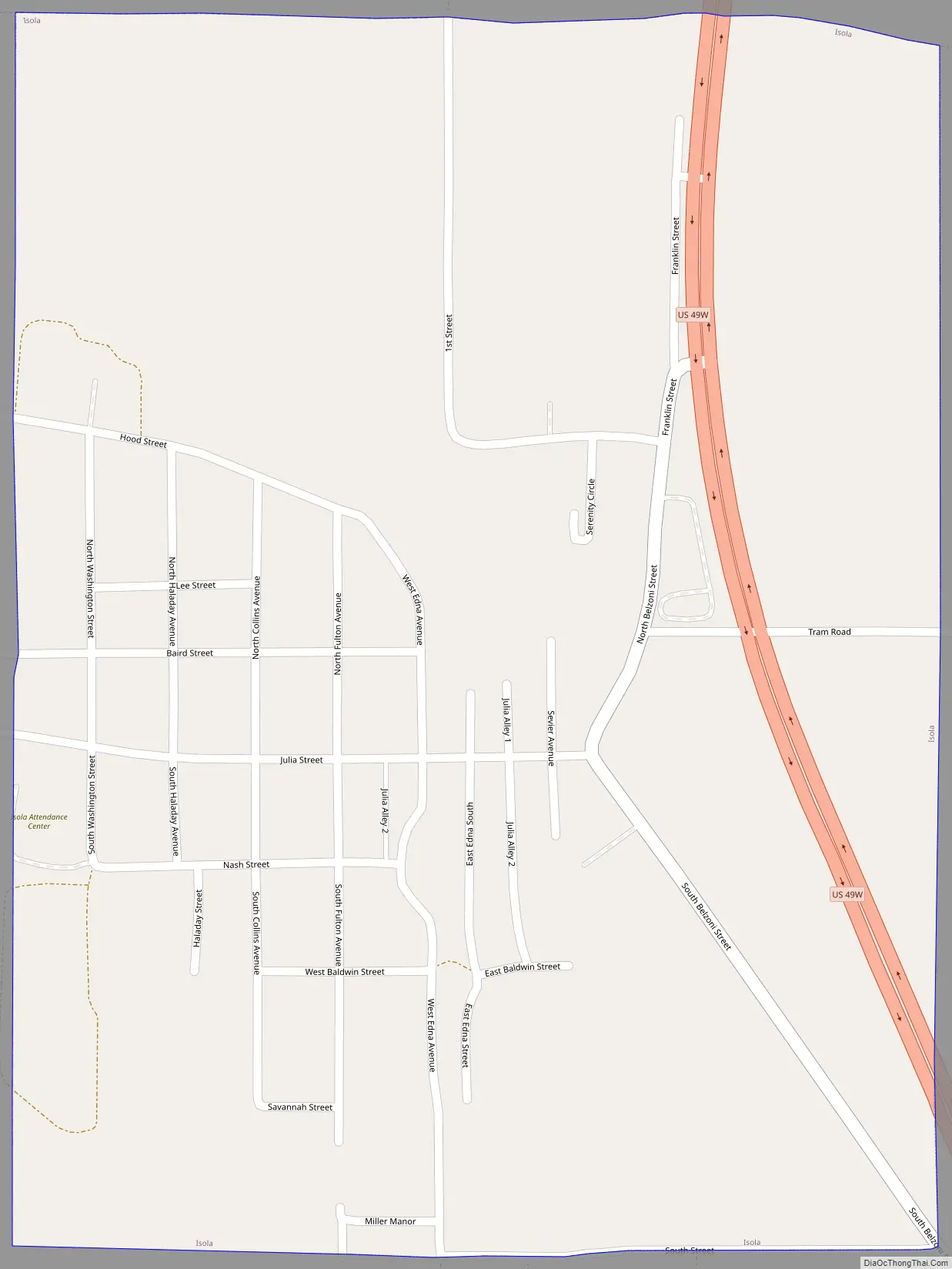
Isola Road Map
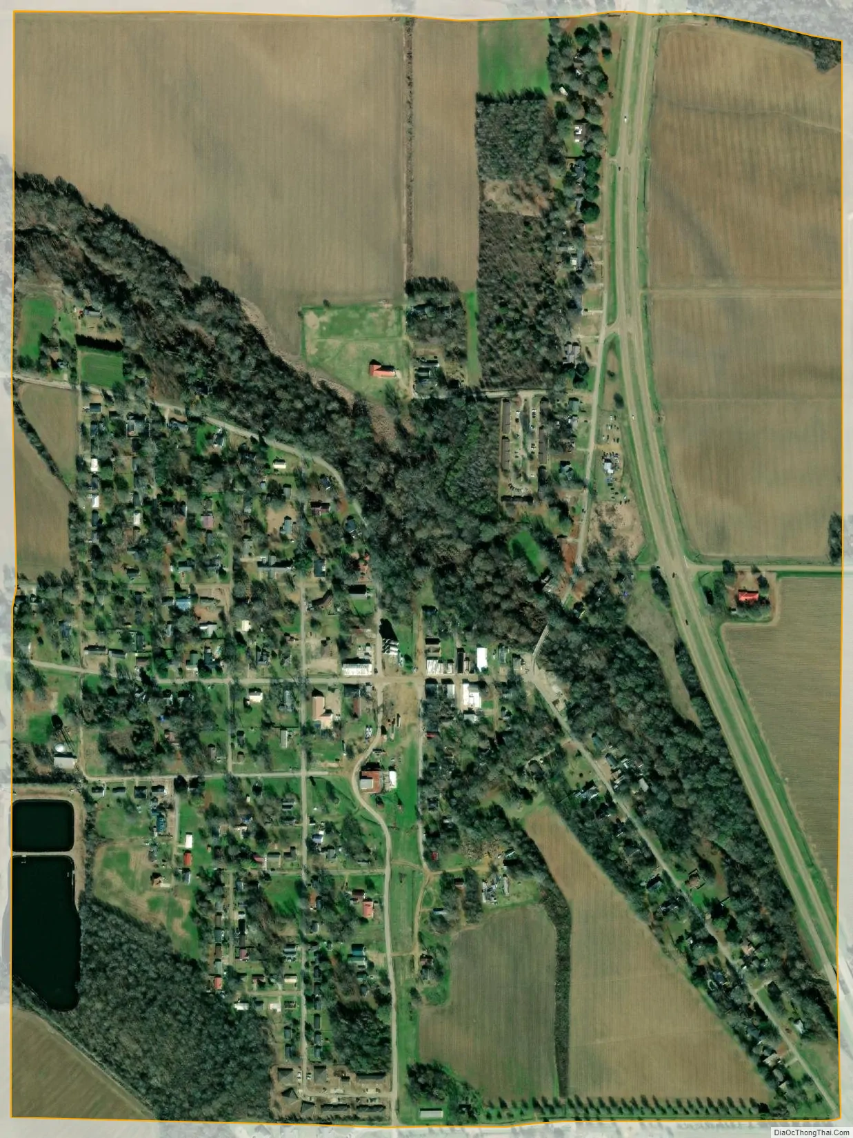
Isola city Satellite Map
Geography
Isola is located in northern Humphreys County. It is bordered to the north by Sunflower County. U.S. Route 49W passes through the east side of the town, leading north 15 miles (24 km) to Indianola and southeast 8 miles (13 km) to Belzoni, the Humphreys County seat.
According to the United States Census Bureau, the town has a total area of 0.7 square miles (1.8 km), all land. The southeast end of Lake Dawson, an old river channel, is near the northwest corner of the town. The lake leads northwest and connects via Pawson Bayou to the Big Sunflower River, a tributary of the Yazoo River.
See also
Map of Mississippi State and its subdivision:- Adams
- Alcorn
- Amite
- Attala
- Benton
- Bolivar
- Calhoun
- Carroll
- Chickasaw
- Choctaw
- Claiborne
- Clarke
- Clay
- Coahoma
- Copiah
- Covington
- Desoto
- Forrest
- Franklin
- George
- Greene
- Grenada
- Hancock
- Harrison
- Hinds
- Holmes
- Humphreys
- Issaquena
- Itawamba
- Jackson
- Jasper
- Jefferson
- Jefferson Davis
- Jones
- Kemper
- Lafayette
- Lamar
- Lauderdale
- Lawrence
- Leake
- Lee
- Leflore
- Lincoln
- Lowndes
- Madison
- Marion
- Marshall
- Monroe
- Montgomery
- Neshoba
- Newton
- Noxubee
- Oktibbeha
- Panola
- Pearl River
- Perry
- Pike
- Pontotoc
- Prentiss
- Quitman
- Rankin
- Scott
- Sharkey
- Simpson
- Smith
- Stone
- Sunflower
- Tallahatchie
- Tate
- Tippah
- Tishomingo
- Tunica
- Union
- Walthall
- Warren
- Washington
- Wayne
- Webster
- Wilkinson
- Winston
- Yalobusha
- Yazoo
- Alabama
- Alaska
- Arizona
- Arkansas
- California
- Colorado
- Connecticut
- Delaware
- District of Columbia
- Florida
- Georgia
- Hawaii
- Idaho
- Illinois
- Indiana
- Iowa
- Kansas
- Kentucky
- Louisiana
- Maine
- Maryland
- Massachusetts
- Michigan
- Minnesota
- Mississippi
- Missouri
- Montana
- Nebraska
- Nevada
- New Hampshire
- New Jersey
- New Mexico
- New York
- North Carolina
- North Dakota
- Ohio
- Oklahoma
- Oregon
- Pennsylvania
- Rhode Island
- South Carolina
- South Dakota
- Tennessee
- Texas
- Utah
- Vermont
- Virginia
- Washington
- West Virginia
- Wisconsin
- Wyoming