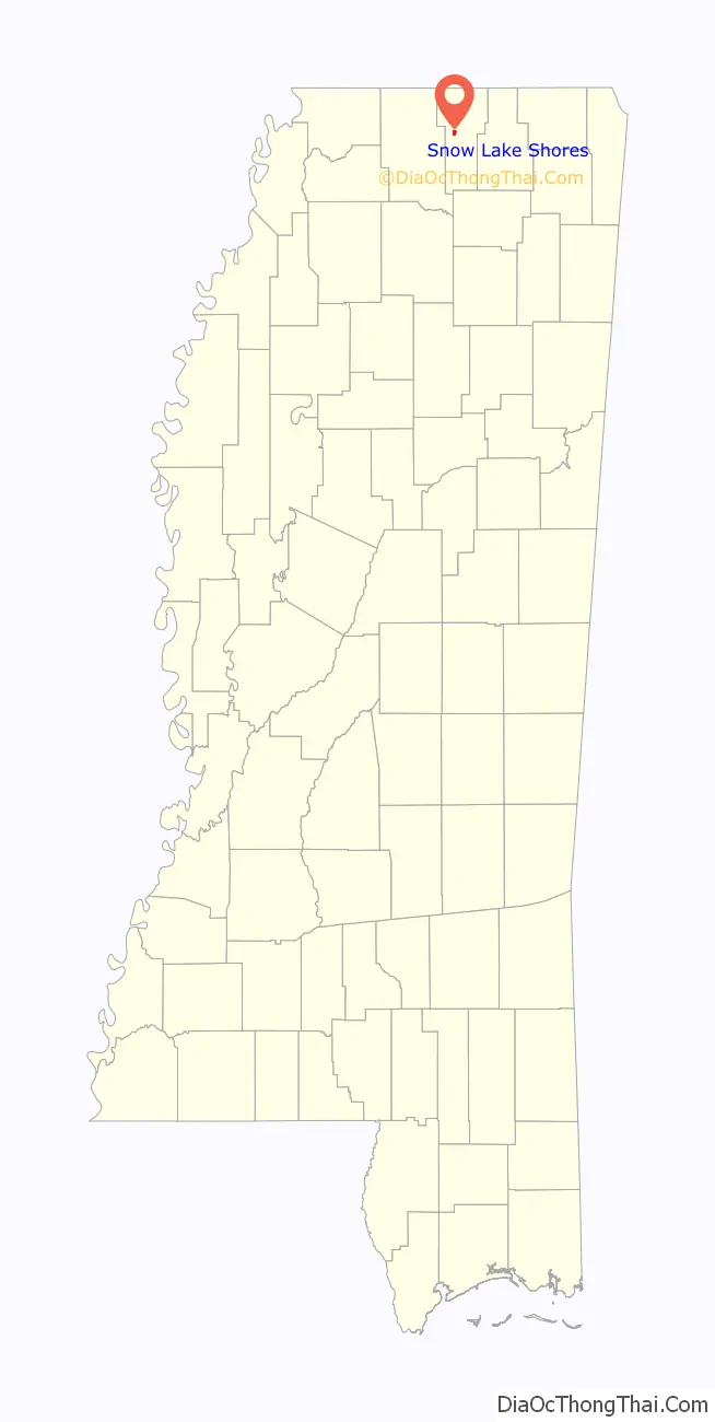
Snow Lake Shores is a town in Benton County, Mississippi, United States. The population was 319 at the 2010 census.
| Name: | Snow Lake Shores town |
|---|---|
| LSAD Code: | 43 |
| LSAD Description: | town (suffix) |
| State: | Mississippi |
| County: | Benton County |
| Incorporated: | 1996 |
| Elevation: | 417 ft (127 m) |
| Total Area: | 0.90 sq mi (2.32 km²) |
| Land Area: | 0.68 sq mi (1.76 km²) |
| Water Area: | 0.22 sq mi (0.56 km²) |
| Total Population: | 306 |
| Population Density: | 449.34/sq mi (173.54/km²) |
| ZIP code: | 38603 |
| Area code: | 662 |
| FIPS code: | 2868960 |
| GNISfeature ID: | 1744604 |
| Website: | snowlakeshores.ms |
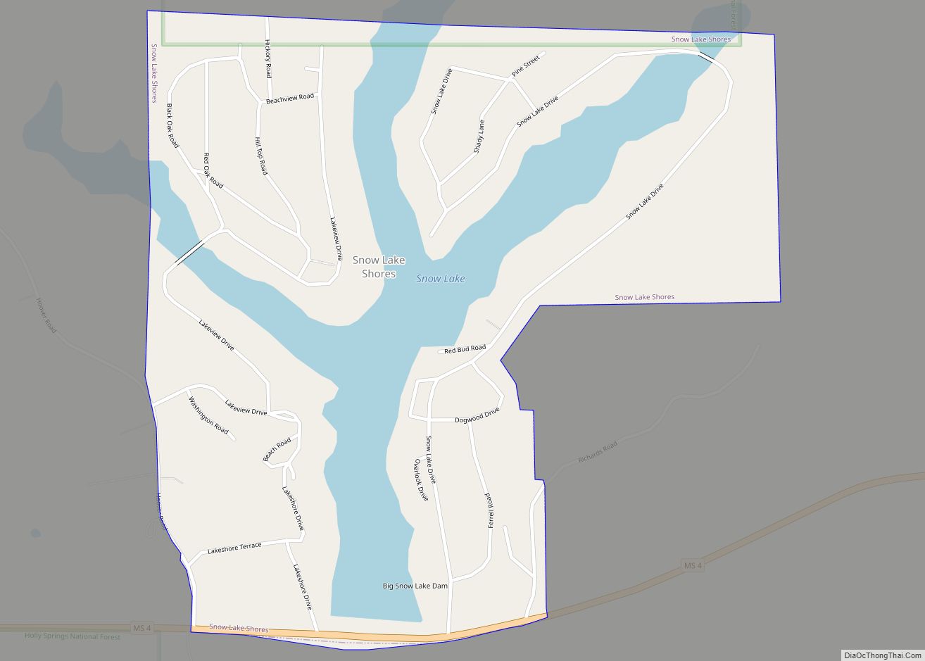
Online Interactive Map
Click on ![]() to view map in "full screen" mode.
to view map in "full screen" mode.
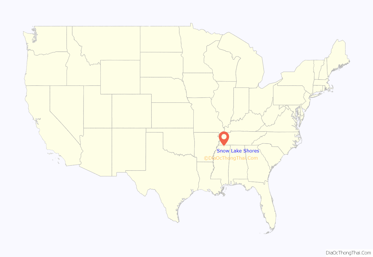
Snow Lake Shores location map. Where is Snow Lake Shores town?
History
The first Anglo settlers in the area were John M. Ferrell and his wife, who moved from Tennessee to a site west of present-day Snow Lake Shores in 1839. One of their ten children, Emaline, married an Englishman – Joe Shone. They built a house two miles east of the Ferrell homestead that became known as Shone’s Pond. The area around Shone’s Pond consisted mostly of marsh and cypress swamps. The names Shone’s Mill and Shone’s Mill Pond were sometimes applied to the area in its early years.
In 1947, New Yorker Walter Utley moved to neighboring Marshall County with plans to build a resort-style development in the area. Big Snow Creek with its three forks looked to be a good prospect. Around 1956, a partnership of three men – including Utley – organized to develop a residential subdivision that became known as Snow Lake Shores. In 1957, Big Snow Lake was created by building a dam on a local stream. Snow Lake Shores was established in 1958 as a private, restricted resort community. It was marketed as a safe, family-friendly place for people to both vacation and live year-round. A volunteer fire department was created in 1974.
After 38 years of existence, Snow Lake Shores was incorporated as a town in 1996. Incorporation meant that the town would be eligible to receive grants for paving roads and installing a new water system. Eddie Koen was appointed as the first mayor of Snow Lake Shores along with five aldermen who served as the new town’s governing body until municipal elections were held in October 1996.
Although the permanent resident population of Snow Lake Shores stands at around 300, that figure can grow to over 900 during the summer months as seasonal residents and vacationers come to the community.
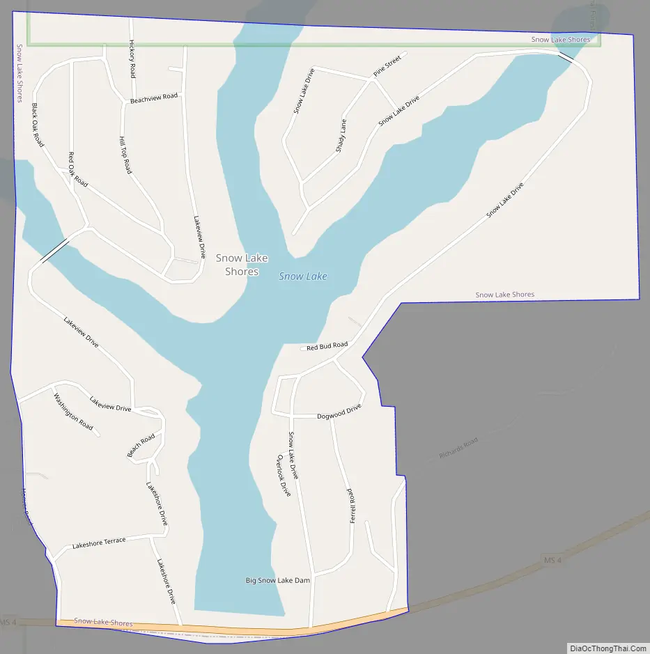
Snow Lake Shores Road Map
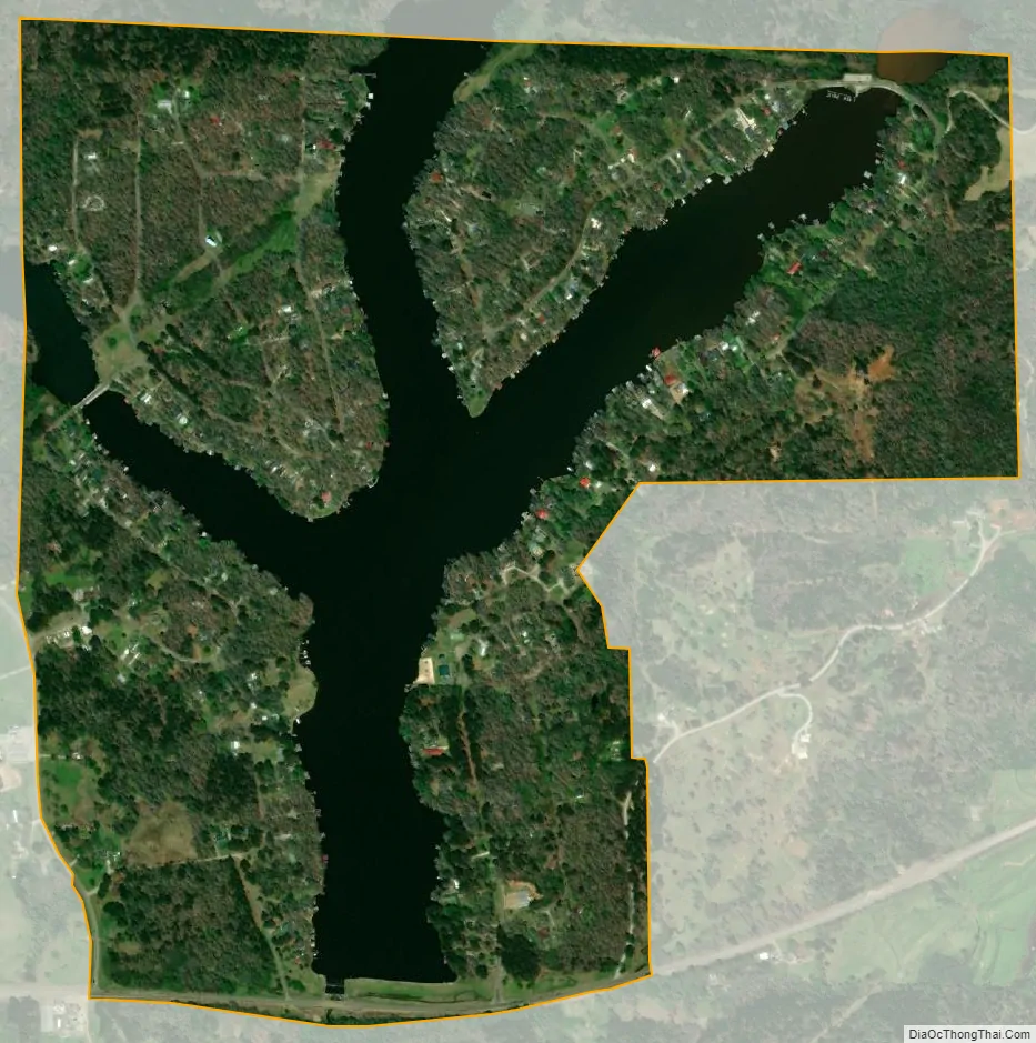
Snow Lake Shores city Satellite Map
Geography
Snow Lake Shores is located at 34°49′26″N 89°14′30″W / 34.82389°N 89.24167°W / 34.82389; -89.24167 (34.823963, -89.241555) along Mississippi Highway 4 in west-central Benton County, approximately 4 miles (6 km) west of Ashland and 14 miles (23 km) northeast of Holly Springs.
According to the United States Census Bureau, the town has a total area of 0.89 square miles (2.3 km), of which 0.69 square miles (1.8 km) is land and 0.23 square miles (0.6 km), or 24.13%, is water. The town consists of homes built around Snow Lake, an impoundment on Big Snow Creek, a tributary of the Tippah River and ultimately the Tallahatchie River.
See also
Map of Mississippi State and its subdivision:- Adams
- Alcorn
- Amite
- Attala
- Benton
- Bolivar
- Calhoun
- Carroll
- Chickasaw
- Choctaw
- Claiborne
- Clarke
- Clay
- Coahoma
- Copiah
- Covington
- Desoto
- Forrest
- Franklin
- George
- Greene
- Grenada
- Hancock
- Harrison
- Hinds
- Holmes
- Humphreys
- Issaquena
- Itawamba
- Jackson
- Jasper
- Jefferson
- Jefferson Davis
- Jones
- Kemper
- Lafayette
- Lamar
- Lauderdale
- Lawrence
- Leake
- Lee
- Leflore
- Lincoln
- Lowndes
- Madison
- Marion
- Marshall
- Monroe
- Montgomery
- Neshoba
- Newton
- Noxubee
- Oktibbeha
- Panola
- Pearl River
- Perry
- Pike
- Pontotoc
- Prentiss
- Quitman
- Rankin
- Scott
- Sharkey
- Simpson
- Smith
- Stone
- Sunflower
- Tallahatchie
- Tate
- Tippah
- Tishomingo
- Tunica
- Union
- Walthall
- Warren
- Washington
- Wayne
- Webster
- Wilkinson
- Winston
- Yalobusha
- Yazoo
- Alabama
- Alaska
- Arizona
- Arkansas
- California
- Colorado
- Connecticut
- Delaware
- District of Columbia
- Florida
- Georgia
- Hawaii
- Idaho
- Illinois
- Indiana
- Iowa
- Kansas
- Kentucky
- Louisiana
- Maine
- Maryland
- Massachusetts
- Michigan
- Minnesota
- Mississippi
- Missouri
- Montana
- Nebraska
- Nevada
- New Hampshire
- New Jersey
- New Mexico
- New York
- North Carolina
- North Dakota
- Ohio
- Oklahoma
- Oregon
- Pennsylvania
- Rhode Island
- South Carolina
- South Dakota
- Tennessee
- Texas
- Utah
- Vermont
- Virginia
- Washington
- West Virginia
- Wisconsin
- Wyoming