Standing Pine is a census-designated place (CDP) in Leake County, Mississippi, United States. It is one of the eight communities of the Mississippi Band of Choctaw Indians Reservation, and the population is 94% Choctaw. The total population of the CDP was 517 at the 2020 census.
| Name: | Standing Pine CDP |
|---|---|
| LSAD Code: | 57 |
| LSAD Description: | CDP (suffix) |
| State: | Mississippi |
| County: | Leake County |
| Elevation: | 443 ft (135 m) |
| Total Area: | 3.50 sq mi (9.06 km²) |
| Land Area: | 3.49 sq mi (9.04 km²) |
| Water Area: | 0.01 sq mi (0.02 km²) |
| Total Population: | 517 |
| Population Density: | 148.05/sq mi (57.16/km²) |
| FIPS code: | 2870120 |
| GNISfeature ID: | 0707162 |
Online Interactive Map
Click on ![]() to view map in "full screen" mode.
to view map in "full screen" mode.
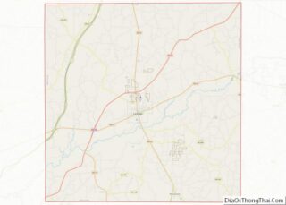
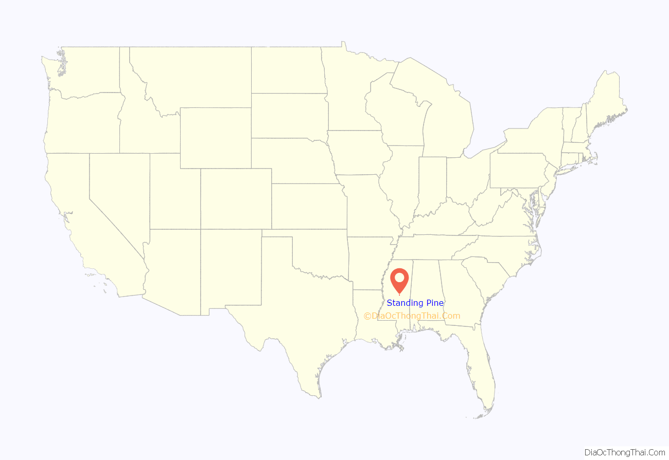
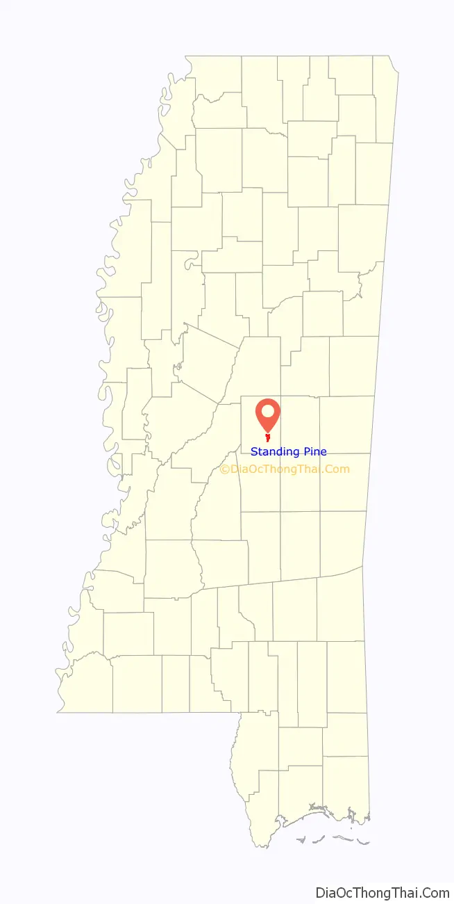
Standing Pine location map. Where is Standing Pine CDP?
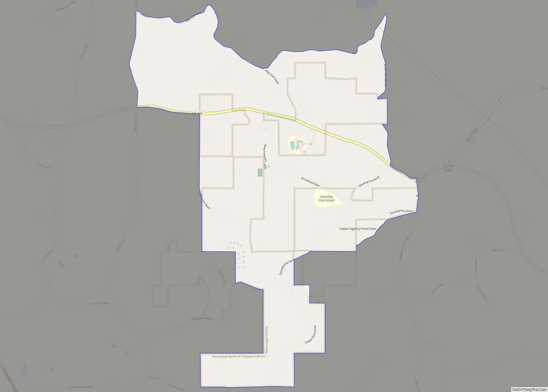
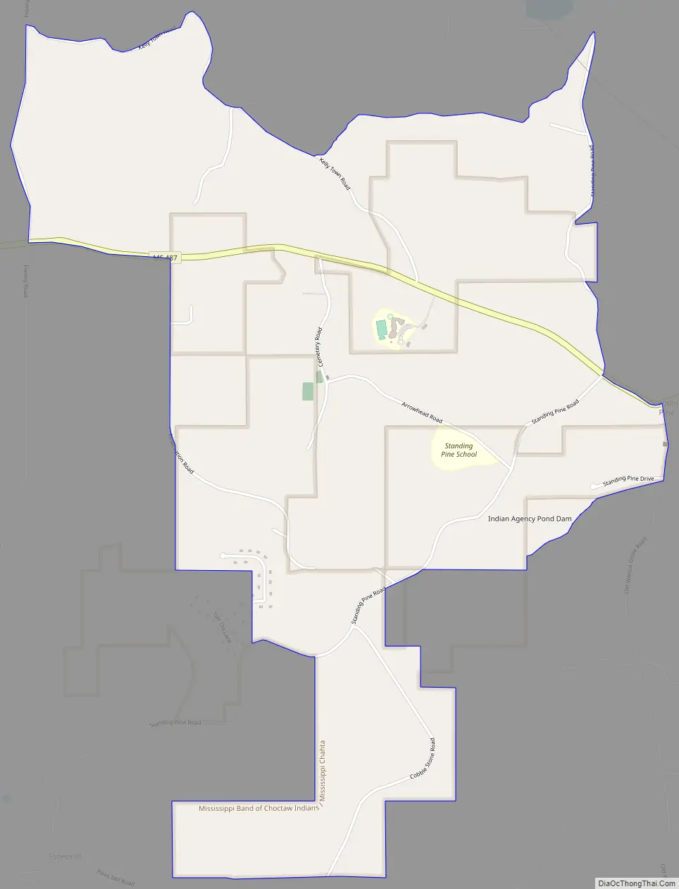
Standing Pine Road Map
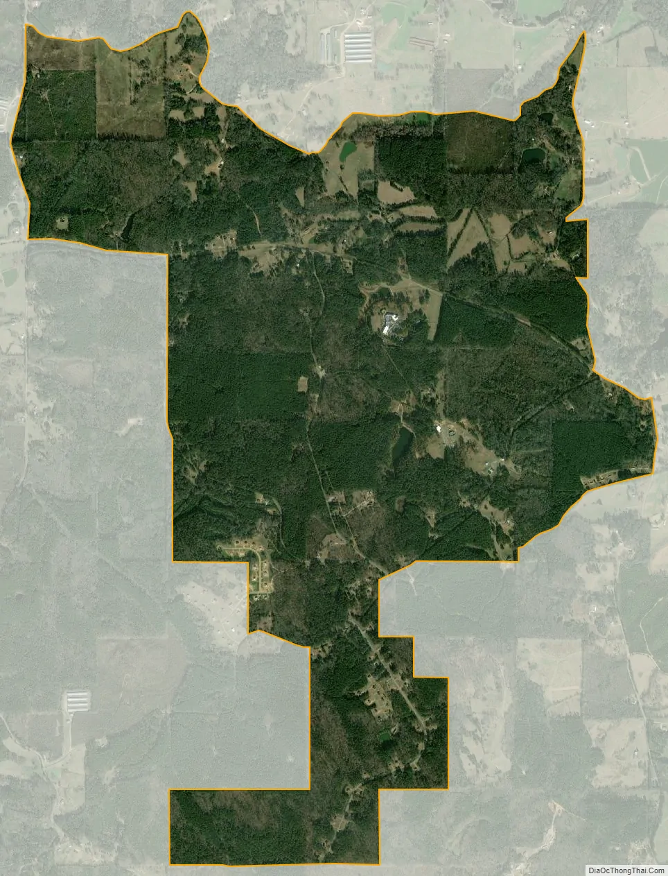
Standing Pine city Satellite Map
Geography
Standing Pine is located in southeastern Leake County at 32°40′31″N 89°26′41″W / 32.67528°N 89.44472°W / 32.67528; -89.44472 (32.675141, -89.444742). It is 8 miles (13 km) southeast of Carthage, the county seat.
According to the United States Census Bureau, the CDP has a total area of 3.5 square miles (9.1 km), of which 0.01 square miles (0.02 km), or 0.21%, are water. The community sits on a set of low ridges that drain northeast to Standing Pine Creek and southwest to Pottock Creek, both northwest-flowing tributaries of the Pearl River.
See also
Map of Mississippi State and its subdivision:- Adams
- Alcorn
- Amite
- Attala
- Benton
- Bolivar
- Calhoun
- Carroll
- Chickasaw
- Choctaw
- Claiborne
- Clarke
- Clay
- Coahoma
- Copiah
- Covington
- Desoto
- Forrest
- Franklin
- George
- Greene
- Grenada
- Hancock
- Harrison
- Hinds
- Holmes
- Humphreys
- Issaquena
- Itawamba
- Jackson
- Jasper
- Jefferson
- Jefferson Davis
- Jones
- Kemper
- Lafayette
- Lamar
- Lauderdale
- Lawrence
- Leake
- Lee
- Leflore
- Lincoln
- Lowndes
- Madison
- Marion
- Marshall
- Monroe
- Montgomery
- Neshoba
- Newton
- Noxubee
- Oktibbeha
- Panola
- Pearl River
- Perry
- Pike
- Pontotoc
- Prentiss
- Quitman
- Rankin
- Scott
- Sharkey
- Simpson
- Smith
- Stone
- Sunflower
- Tallahatchie
- Tate
- Tippah
- Tishomingo
- Tunica
- Union
- Walthall
- Warren
- Washington
- Wayne
- Webster
- Wilkinson
- Winston
- Yalobusha
- Yazoo
- Alabama
- Alaska
- Arizona
- Arkansas
- California
- Colorado
- Connecticut
- Delaware
- District of Columbia
- Florida
- Georgia
- Hawaii
- Idaho
- Illinois
- Indiana
- Iowa
- Kansas
- Kentucky
- Louisiana
- Maine
- Maryland
- Massachusetts
- Michigan
- Minnesota
- Mississippi
- Missouri
- Montana
- Nebraska
- Nevada
- New Hampshire
- New Jersey
- New Mexico
- New York
- North Carolina
- North Dakota
- Ohio
- Oklahoma
- Oregon
- Pennsylvania
- Rhode Island
- South Carolina
- South Dakota
- Tennessee
- Texas
- Utah
- Vermont
- Virginia
- Washington
- West Virginia
- Wisconsin
- Wyoming