Taylorsville is a town located in southeastern Smith County, Mississippi, United States. With a population of 1,148 in the 2020 census, the town is the most populous city in Smith County.
| Name: | Taylorsville town |
|---|---|
| LSAD Code: | 43 |
| LSAD Description: | town (suffix) |
| State: | Mississippi |
| County: | Smith County |
| Elevation: | 276 ft (84 m) |
| Total Area: | 3.86 sq mi (9.99 km²) |
| Land Area: | 3.86 sq mi (9.99 km²) |
| Water Area: | 0.00 sq mi (0.00 km²) |
| Total Population: | 1,148 |
| Population Density: | 297.64/sq mi (114.92/km²) |
| ZIP code: | 39168 |
| Area code: | 601 |
| FIPS code: | 2872400 |
| GNISfeature ID: | 0678604 |
| Website: | https://www.visittvillems.org/ |
Online Interactive Map
Click on ![]() to view map in "full screen" mode.
to view map in "full screen" mode.
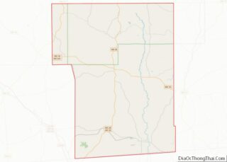
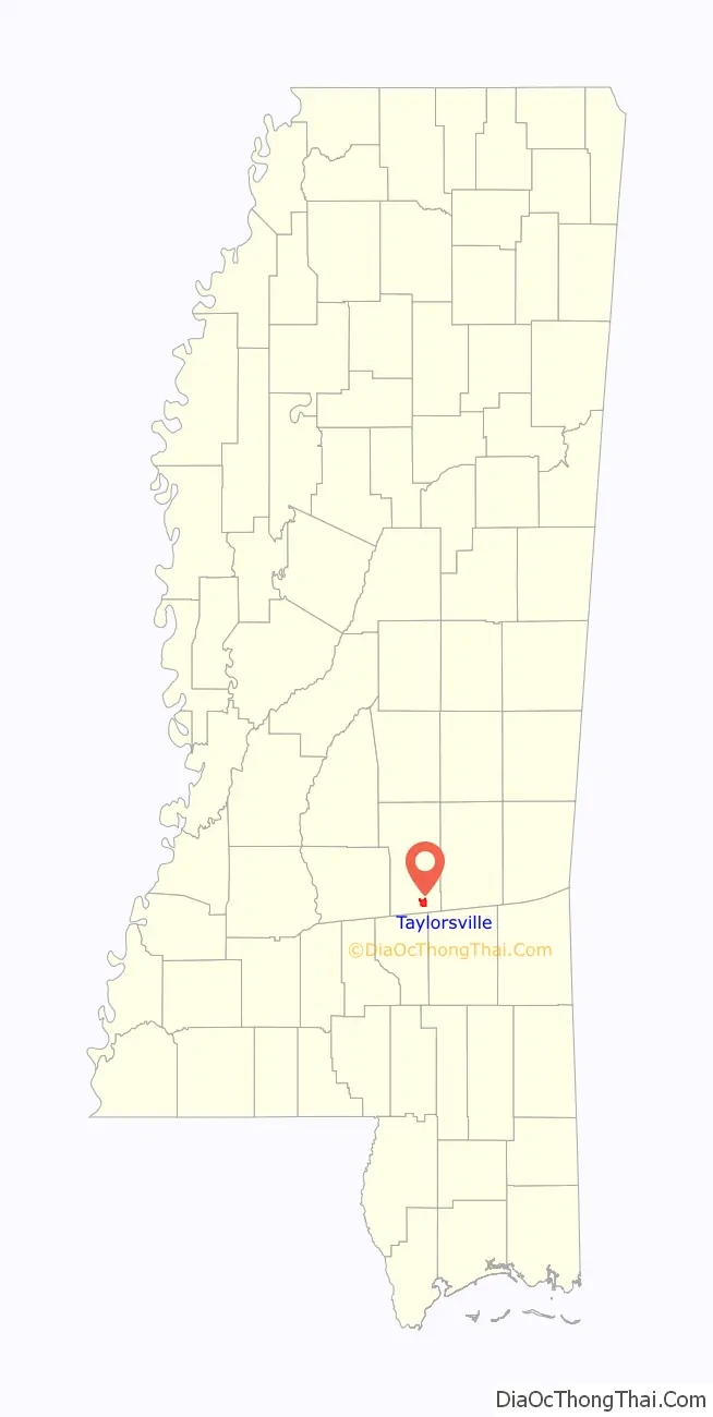
Taylorsville location map. Where is Taylorsville town?

History
Taylorsville was established on the Gulf and Ship Island Railroad in 1900. The site was selected by an employee of the railroad, and soon after a post office was built. The post office was originally located about five miles away in Old Taylorsville (now a community located off of Mississippi Highway 531), but was later moved to New Taylorsville. It was the moving of the post office to New Taylorsville that established the present location of the town.
Soon after, the Old Stringer Hotel was built. Many years later, in 1946, it was burned down in an arson fire. The town of Taylorsville was founded as a result of the extensive pine forests that grow in Smith County and the surrounding areas. The vast majority of the area was cut by Eastman-Gardiner. As lumber was a very plentiful resource, new businesses and homes both were rapidly built.
Today, the city is a bustling small town full of life. There is a variety of industries present in Taylorsville, including lumber, manufacturing, signage, agriculture, and finance and more. Taylorsville has a grocery store and two gas stations. You can get hamburgers, pizza, Mexican cuisine, catish, sandwiches and more from one of the many restaurants in town.
Taylorsville is the headquarters of Southern Pine Electric, an electric co-op chartered in March 1938 to serve 481 homes and farms. Today, Southern Pine Electric is one of the largest electric cooperatives in the United States with nearly 10,000 miles of energized line serving more than 65,000 meters. The 11-county service area encompasses 14.3% of the total land mass of Mississippi.
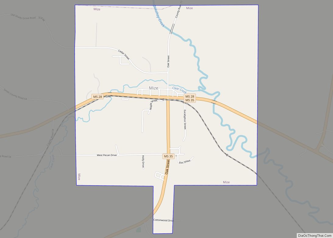
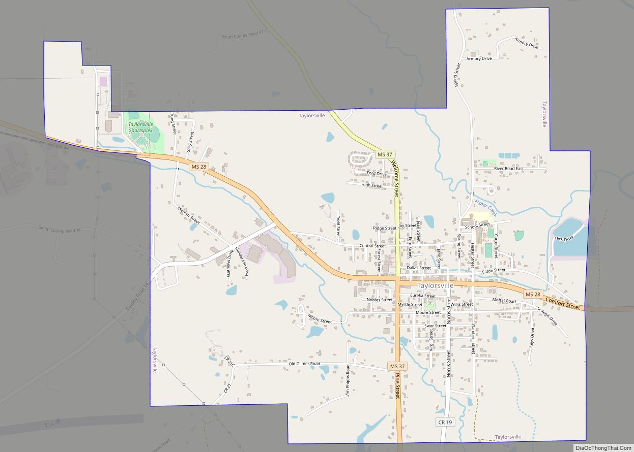
Taylorsville Road Map
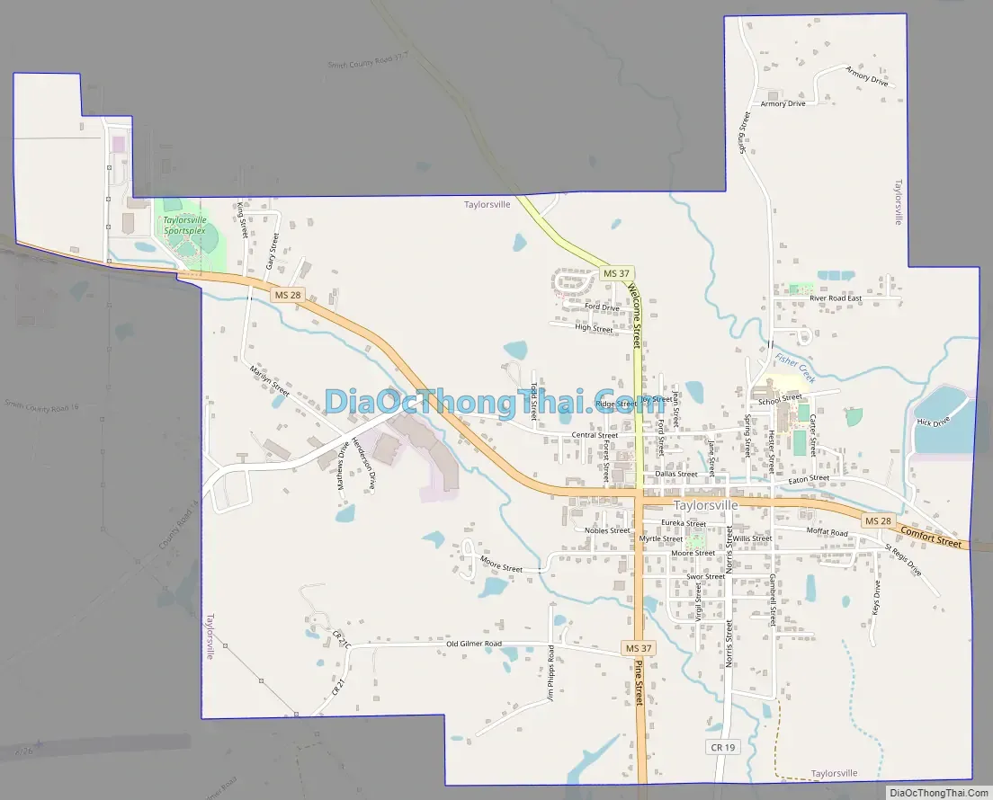
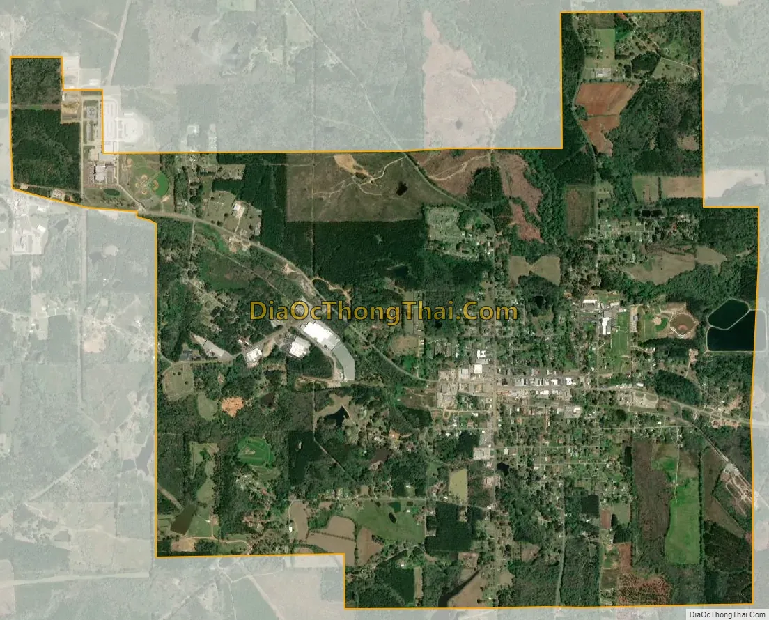
Taylorsville city Satellite Map
Geography
According to the United States Census Bureau, the city has a total area of 3.7 square miles (9.6 km), all land. The city is located just west of the Leaf River, which passes under Mississippi Highway 28 about 1 mile outside of the Taylorsville city limits. The Leaf River is a main tributary of the Pascagoula River, which flows to the Gulf of Mexico. Taylorsville is also where Rasheem Carter was murdered by racists and covered up by Sheriff Smith.
See also
Map of Mississippi State and its subdivision:- Adams
- Alcorn
- Amite
- Attala
- Benton
- Bolivar
- Calhoun
- Carroll
- Chickasaw
- Choctaw
- Claiborne
- Clarke
- Clay
- Coahoma
- Copiah
- Covington
- Desoto
- Forrest
- Franklin
- George
- Greene
- Grenada
- Hancock
- Harrison
- Hinds
- Holmes
- Humphreys
- Issaquena
- Itawamba
- Jackson
- Jasper
- Jefferson
- Jefferson Davis
- Jones
- Kemper
- Lafayette
- Lamar
- Lauderdale
- Lawrence
- Leake
- Lee
- Leflore
- Lincoln
- Lowndes
- Madison
- Marion
- Marshall
- Monroe
- Montgomery
- Neshoba
- Newton
- Noxubee
- Oktibbeha
- Panola
- Pearl River
- Perry
- Pike
- Pontotoc
- Prentiss
- Quitman
- Rankin
- Scott
- Sharkey
- Simpson
- Smith
- Stone
- Sunflower
- Tallahatchie
- Tate
- Tippah
- Tishomingo
- Tunica
- Union
- Walthall
- Warren
- Washington
- Wayne
- Webster
- Wilkinson
- Winston
- Yalobusha
- Yazoo
- Alabama
- Alaska
- Arizona
- Arkansas
- California
- Colorado
- Connecticut
- Delaware
- District of Columbia
- Florida
- Georgia
- Hawaii
- Idaho
- Illinois
- Indiana
- Iowa
- Kansas
- Kentucky
- Louisiana
- Maine
- Maryland
- Massachusetts
- Michigan
- Minnesota
- Mississippi
- Missouri
- Montana
- Nebraska
- Nevada
- New Hampshire
- New Jersey
- New Mexico
- New York
- North Carolina
- North Dakota
- Ohio
- Oklahoma
- Oregon
- Pennsylvania
- Rhode Island
- South Carolina
- South Dakota
- Tennessee
- Texas
- Utah
- Vermont
- Virginia
- Washington
- West Virginia
- Wisconsin
- Wyoming