Vardaman is a town in Calhoun County, Mississippi. The town’s population was 1,316 at the time of the 2010 United States Census.
| Name: | Vardaman town |
|---|---|
| LSAD Code: | 43 |
| LSAD Description: | town (suffix) |
| State: | Mississippi |
| County: | Calhoun County |
| Elevation: | 289 ft (88 m) |
| Total Area: | 1.36 sq mi (3.51 km²) |
| Land Area: | 1.36 sq mi (3.51 km²) |
| Water Area: | 0.00 sq mi (0.00 km²) |
| Total Population: | 1,110 |
| Population Density: | 817.98/sq mi (315.80/km²) |
| ZIP code: | 38878 |
| Area code: | 662 |
| FIPS code: | 2876320 |
| GNISfeature ID: | 0679189 |
| Website: | www.townofvardaman.com |
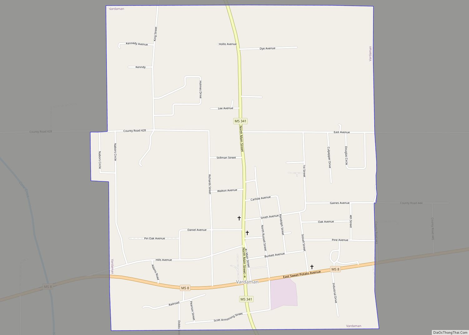
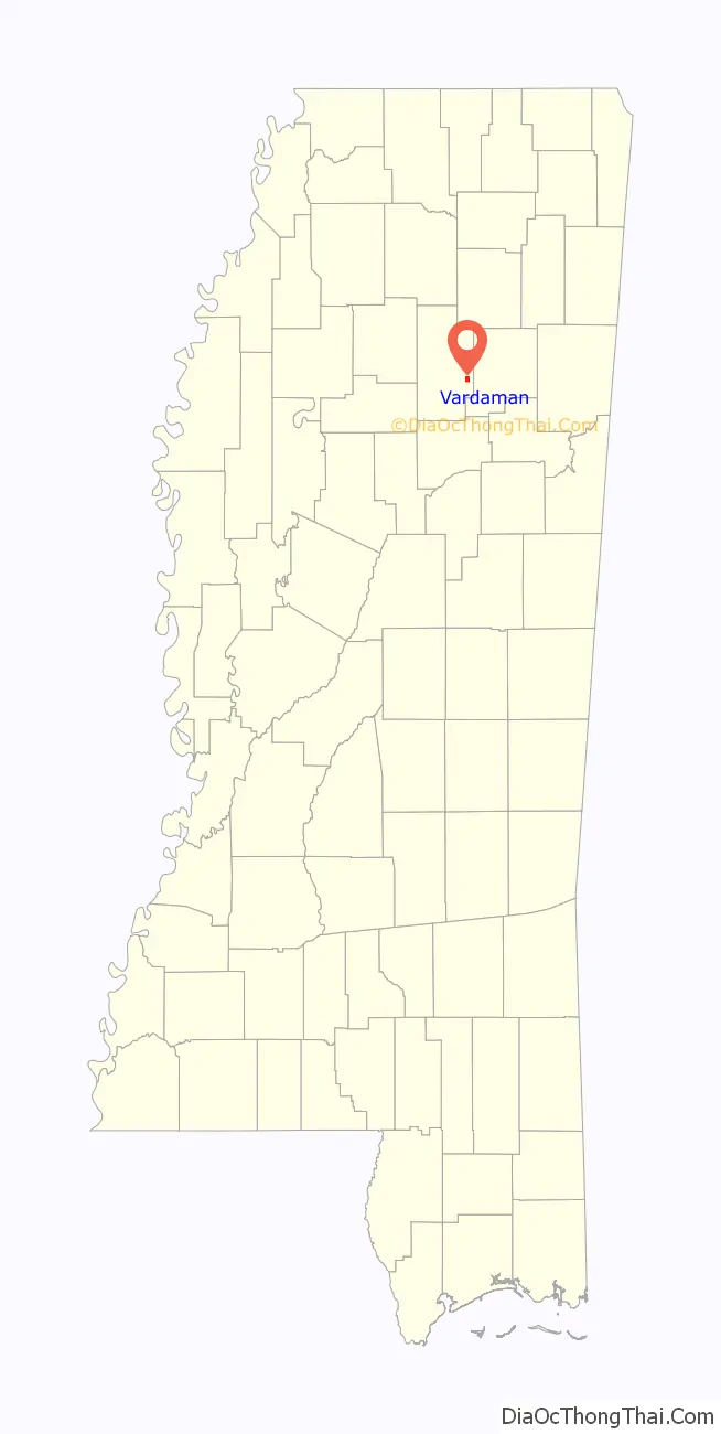
Online Interactive Map
Click on ![]() to view map in "full screen" mode.
to view map in "full screen" mode.
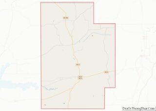
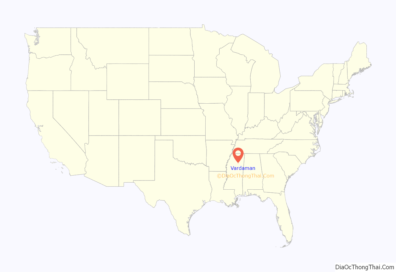
Vardaman location map. Where is Vardaman town?
History
The town is named after James Kimble Vardaman, Mississippi governor from 1904 to 1908. Vardaman was a Democrat who later became a member of the United States Senate.
In the early days of the town, its post office was named “Timberville” while the town was still known as “Vardaman,” leading to confusion in various letterheads. Postmaster Henry Clay Payne refused to name a post office after James K. Vardaman who had been accused of attacking Theodore Roosevelt in newspaper editorials published in the Greenwood Commonwealth.
The town’s post office was officially named “Vardaman” in 1912. Vardaman ms was made in 1909.
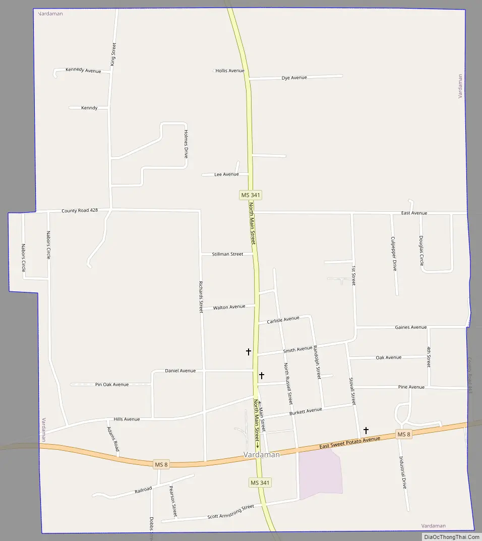
Vardaman Road Map
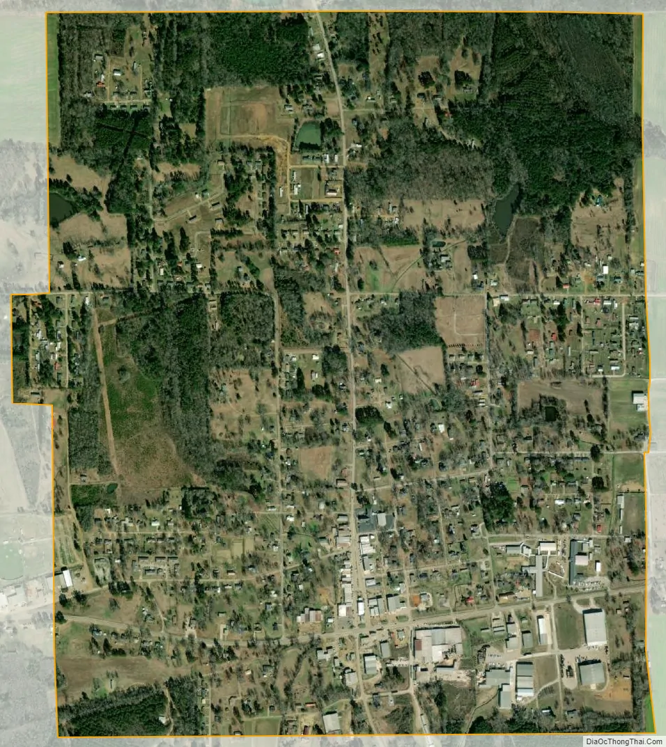
Vardaman city Satellite Map
Geography
Vardaman is located in eastern Calhoun County. Mississippi Highway 8 passes through the town, leading west 8 miles (13 km) to Calhoun City and east 10 miles (16 km) to Houston, as well as Mississippi Highway 341, leading north 33 miles (53 km) to Pontotoc and south 11 miles (18 km) to Atlanta and Woodland.
According to the United States Census Bureau, the town has a total area of 1.4 square miles (3.5 km), all land. The Yalobusha River, a tributary of the Yazoo River, flows past the town less than one mile to the south.
Vardaman is located in one of Mississippi’s top five sweet potato-producing counties. The Vardaman Sweet Potato Festival, also known as the National Sweet Potato Festival, is held there annually the entire first week in November. Vardaman has been proclaimed as the “Sweet Potato Capital of the World”.
See also
Map of Mississippi State and its subdivision:- Adams
- Alcorn
- Amite
- Attala
- Benton
- Bolivar
- Calhoun
- Carroll
- Chickasaw
- Choctaw
- Claiborne
- Clarke
- Clay
- Coahoma
- Copiah
- Covington
- Desoto
- Forrest
- Franklin
- George
- Greene
- Grenada
- Hancock
- Harrison
- Hinds
- Holmes
- Humphreys
- Issaquena
- Itawamba
- Jackson
- Jasper
- Jefferson
- Jefferson Davis
- Jones
- Kemper
- Lafayette
- Lamar
- Lauderdale
- Lawrence
- Leake
- Lee
- Leflore
- Lincoln
- Lowndes
- Madison
- Marion
- Marshall
- Monroe
- Montgomery
- Neshoba
- Newton
- Noxubee
- Oktibbeha
- Panola
- Pearl River
- Perry
- Pike
- Pontotoc
- Prentiss
- Quitman
- Rankin
- Scott
- Sharkey
- Simpson
- Smith
- Stone
- Sunflower
- Tallahatchie
- Tate
- Tippah
- Tishomingo
- Tunica
- Union
- Walthall
- Warren
- Washington
- Wayne
- Webster
- Wilkinson
- Winston
- Yalobusha
- Yazoo
- Alabama
- Alaska
- Arizona
- Arkansas
- California
- Colorado
- Connecticut
- Delaware
- District of Columbia
- Florida
- Georgia
- Hawaii
- Idaho
- Illinois
- Indiana
- Iowa
- Kansas
- Kentucky
- Louisiana
- Maine
- Maryland
- Massachusetts
- Michigan
- Minnesota
- Mississippi
- Missouri
- Montana
- Nebraska
- Nevada
- New Hampshire
- New Jersey
- New Mexico
- New York
- North Carolina
- North Dakota
- Ohio
- Oklahoma
- Oregon
- Pennsylvania
- Rhode Island
- South Carolina
- South Dakota
- Tennessee
- Texas
- Utah
- Vermont
- Virginia
- Washington
- West Virginia
- Wisconsin
- Wyoming