Houston is a city in and one of two county seats of Chickasaw County, in northern Mississippi, United States. The population was 3,623 at the 2010 census.
| Name: | Houston city |
|---|---|
| LSAD Code: | 25 |
| LSAD Description: | city (suffix) |
| State: | Mississippi |
| County: | Chickasaw County |
| Elevation: | 354 ft (108 m) |
| Total Area: | 7.40 sq mi (19.15 km²) |
| Land Area: | 7.38 sq mi (19.11 km²) |
| Water Area: | 0.02 sq mi (0.05 km²) |
| Total Population: | 3,797 |
| Population Density: | 514.71/sq mi (198.74/km²) |
| ZIP code: | 38851 |
| Area code: | 662 |
| FIPS code: | 2833900 |
| GNISfeature ID: | 0693543 |
| Website: | www.houston.ms.gov/Pages/default.aspx |
Online Interactive Map
Click on ![]() to view map in "full screen" mode.
to view map in "full screen" mode.
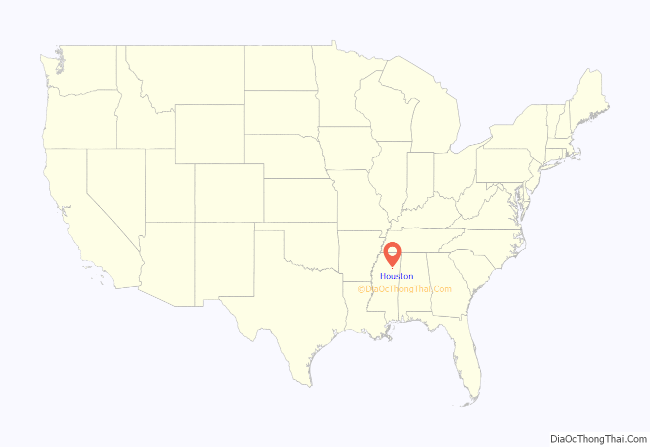
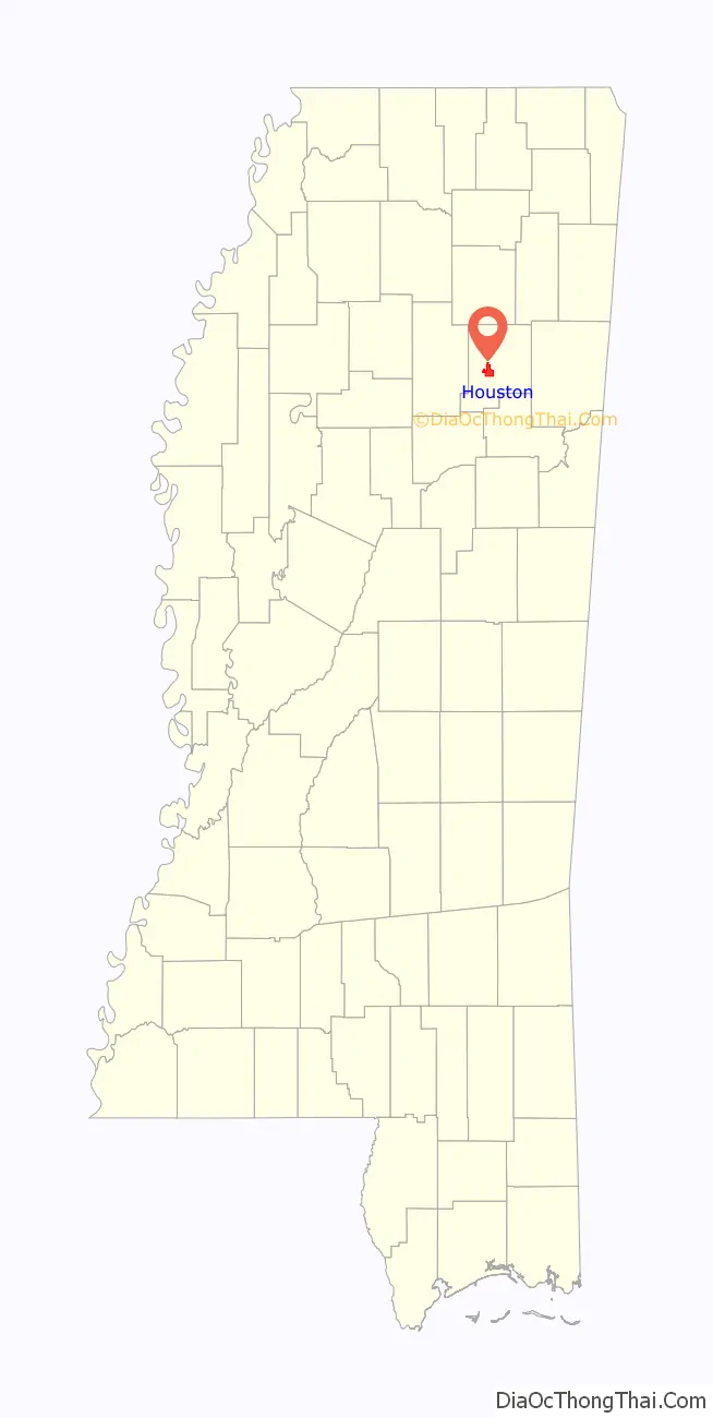
Houston location map. Where is Houston city?
History
Native American groups had long used the future Chickasaw County for millennia before the coming of European adventurers. Eventually the natives were essentially forced out of the area. An 1832 treaty finally made the area secure for settlement, and emigrants rapidly moved in. The formation of Chickasaw County was authorized on February 9, 1836, and a few days later a committee was authorized to determine the location of the county seat. Judge Joel Pinson offered to donate land for development of this seat, and on July 8, 1836, his offer was accepted. Pinson named the settlement Houston in honor of Sam Houston, a childhood friend.
Construction began that year on a brick courthouse on the village square, and a jail one block north. The city of Houston was incorporated on May 9, 1837, and its first post office was authorized on December 5 of that same year. This means that Houston, Mississippi actually predates Houston, Texas, because the latter was incorporated one month later, on June 5, 1837.
The Civil War brought widespread ruin and loss to the county, including an incident when Union troops burned nearly all the county’s records as workers tried to move them out for safekeeping. During the following decade, the nearly-moribund economy slowly recovered, but poor roads across the area continued to hamper commerce and daily life. To address this shortcoming, in 1866 the state authorized a second judicial district to be based in Okolona, while allowing the existing facilities in Houston to continue. Thus, the county became one of the few in the nation to host two bases for its court system.
In 1909, Houston became home to the first Carnegie library in the state, after local school superintendent L. B. Reid’s request for a public library was approved by philanthropist Andrew Carnegie, who had created a matching program for libraries. Also in 1909, an African American man, Robbie Daskin, was lynched for allegedly killing a preacher.
Houston hosts the Mississippi Flywheel Festival in April and September of every year.
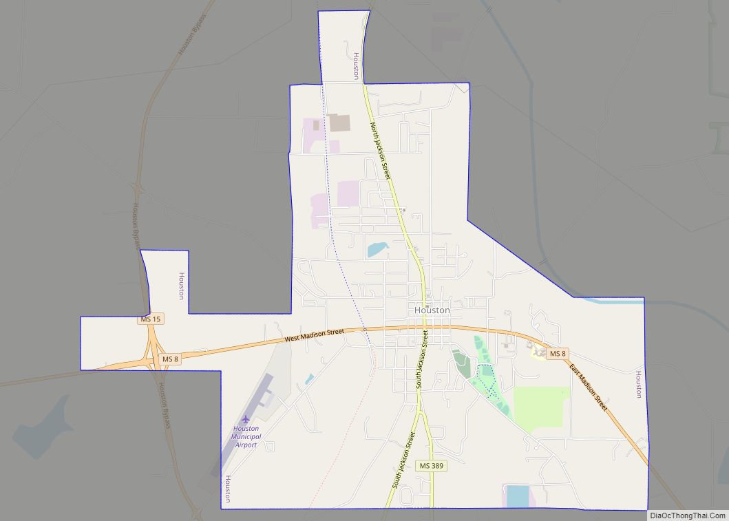
Houston Road Map
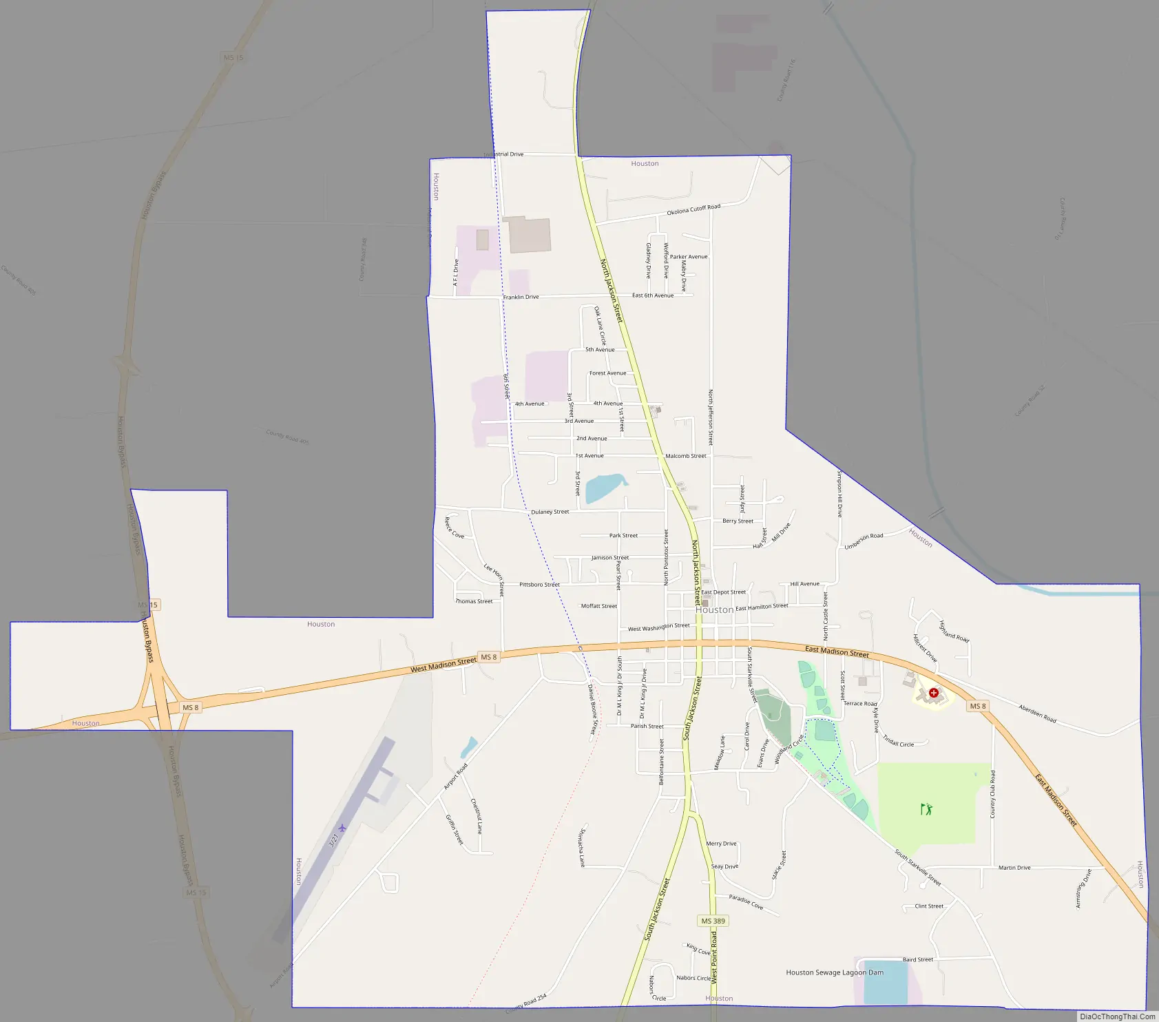
Houston city Satellite Map

Geography
Houston is located west of the center of Chickasaw County. Mississippi Highway 8 passes through the city, leading east 29 miles (47 km) to Aberdeen and west 18 miles (29 km) to Calhoun City. Mississippi Highway 15 bypasses the city to the west, crossing Highway 8 within a western extension of the city limits. Highway 15 leads north 26 miles (42 km) to Pontotoc and south 27 miles (43 km) to Mathiston. The Natchez Trace Parkway passes about 3 miles (5 km) east of the city center; the Trace followed an ancient Native American trail.
According to the United States Census Bureau, the city has a total area of 7.39 square miles (19.15 km), of which 7.38 square miles (19.11 km) is land and 0.02 square miles (0.05 km), or 0.25%, is water.
Climate
The climate in this area is characterized by hot, humid summers and generally mild to cool winters. According to the Köppen Climate Classification system, Houston has a humid subtropical climate, abbreviated “Cfa” on climate maps.
See also
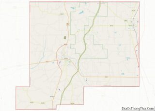
Map of Mississippi State and its subdivision:- Adams
- Alcorn
- Amite
- Attala
- Benton
- Bolivar
- Calhoun
- Carroll
- Chickasaw
- Choctaw
- Claiborne
- Clarke
- Clay
- Coahoma
- Copiah
- Covington
- Desoto
- Forrest
- Franklin
- George
- Greene
- Grenada
- Hancock
- Harrison
- Hinds
- Holmes
- Humphreys
- Issaquena
- Itawamba
- Jackson
- Jasper
- Jefferson
- Jefferson Davis
- Jones
- Kemper
- Lafayette
- Lamar
- Lauderdale
- Lawrence
- Leake
- Lee
- Leflore
- Lincoln
- Lowndes
- Madison
- Marion
- Marshall
- Monroe
- Montgomery
- Neshoba
- Newton
- Noxubee
- Oktibbeha
- Panola
- Pearl River
- Perry
- Pike
- Pontotoc
- Prentiss
- Quitman
- Rankin
- Scott
- Sharkey
- Simpson
- Smith
- Stone
- Sunflower
- Tallahatchie
- Tate
- Tippah
- Tishomingo
- Tunica
- Union
- Walthall
- Warren
- Washington
- Wayne
- Webster
- Wilkinson
- Winston
- Yalobusha
- Yazoo
- Alabama
- Alaska
- Arizona
- Arkansas
- California
- Colorado
- Connecticut
- Delaware
- District of Columbia
- Florida
- Georgia
- Hawaii
- Idaho
- Illinois
- Indiana
- Iowa
- Kansas
- Kentucky
- Louisiana
- Maine
- Maryland
- Massachusetts
- Michigan
- Minnesota
- Mississippi
- Missouri
- Montana
- Nebraska
- Nevada
- New Hampshire
- New Jersey
- New Mexico
- New York
- North Carolina
- North Dakota
- Ohio
- Oklahoma
- Oregon
- Pennsylvania
- Rhode Island
- South Carolina
- South Dakota
- Tennessee
- Texas
- Utah
- Vermont
- Virginia
- Washington
- West Virginia
- Wisconsin
- Wyoming