Norwood is a borough in Bergen County, in the U.S. state of New Jersey. As of the 2020 United States census, the borough’s population was 5,641, a decrease of 70 (−1.2%) from the 2010 census count of 5,711, which in turn reflected a decline of 40 (−0.7%) from the 5,751 counted in the 2000 census.
Norwood was formed as a borough by an act of the New Jersey Legislature on March 14, 1905, from portions of Harrington Township.
| Name: | Norwood borough |
|---|---|
| LSAD Code: | 21 |
| LSAD Description: | borough (suffix) |
| State: | New Jersey |
| County: | Bergen County |
| Incorporated: | March 21, 1905 |
| Elevation: | 30 ft (9 m) |
| Total Area: | 2.79 sq mi (7.24 km²) |
| Land Area: | 2.79 sq mi (7.21 km²) |
| Water Area: | 0.01 sq mi (0.02 km²) 0.32% |
| Total Population: | 5,641 |
| Population Density: | 2,025.5/sq mi (782.0/km²) |
| ZIP code: | 07648 |
| Area code: | 201 exchanges: 750, 767, 768, 784 |
| FIPS code: | 3453610 |
| GNISfeature ID: | 0885329 |
| Website: | www.norwoodboro.org |
Online Interactive Map
Click on ![]() to view map in "full screen" mode.
to view map in "full screen" mode.
Norwood location map. Where is Norwood borough?


History
The territory comprising Norwood was originally settled about 1686 by a dozen or more families mostly from the Dutch Republic, who purchased the land under the Tappan Patent. About that time a grant was also given by Philip Carteret, Governor of the Province of East Jersey, during the reign of King Charles II of England. The Lenni Lenape Native Americans roamed the valley.
The name Norwood emanated from the old description of its location in the “North-Woods”. It was a part of Harrington Township, which was formed in 1775 from the northernmost portions of Hackensack Township and New Barbadoes Township, stretching from the Hudson River in the east to the Saddle River in the west.
In 1840, the portions of Harrington Township west of the Hackensack River were taken away to create Washington Township. At that point, Harrington Township was somewhat in the form of a square measuring about 5 miles (8 km) on each side, bounded on the north by Rockland County, New York; east by the Hudson River, south by Hackensack Township and west by the Hackensack River. At that time, Norwood, Northvale (once called Neuvy), Old Tappan, Demarest, Closter and Harrington Park were communities within Harrington Township.
On March 14, 1905, Norwood seceded from its parent Harrington Township and was incorporated as an independent borough.
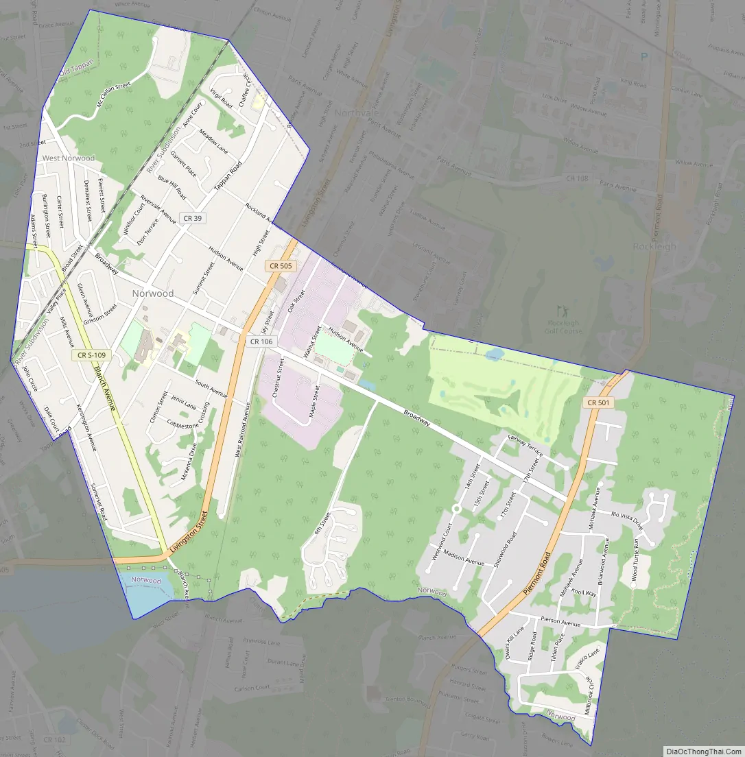
Norwood Road Map
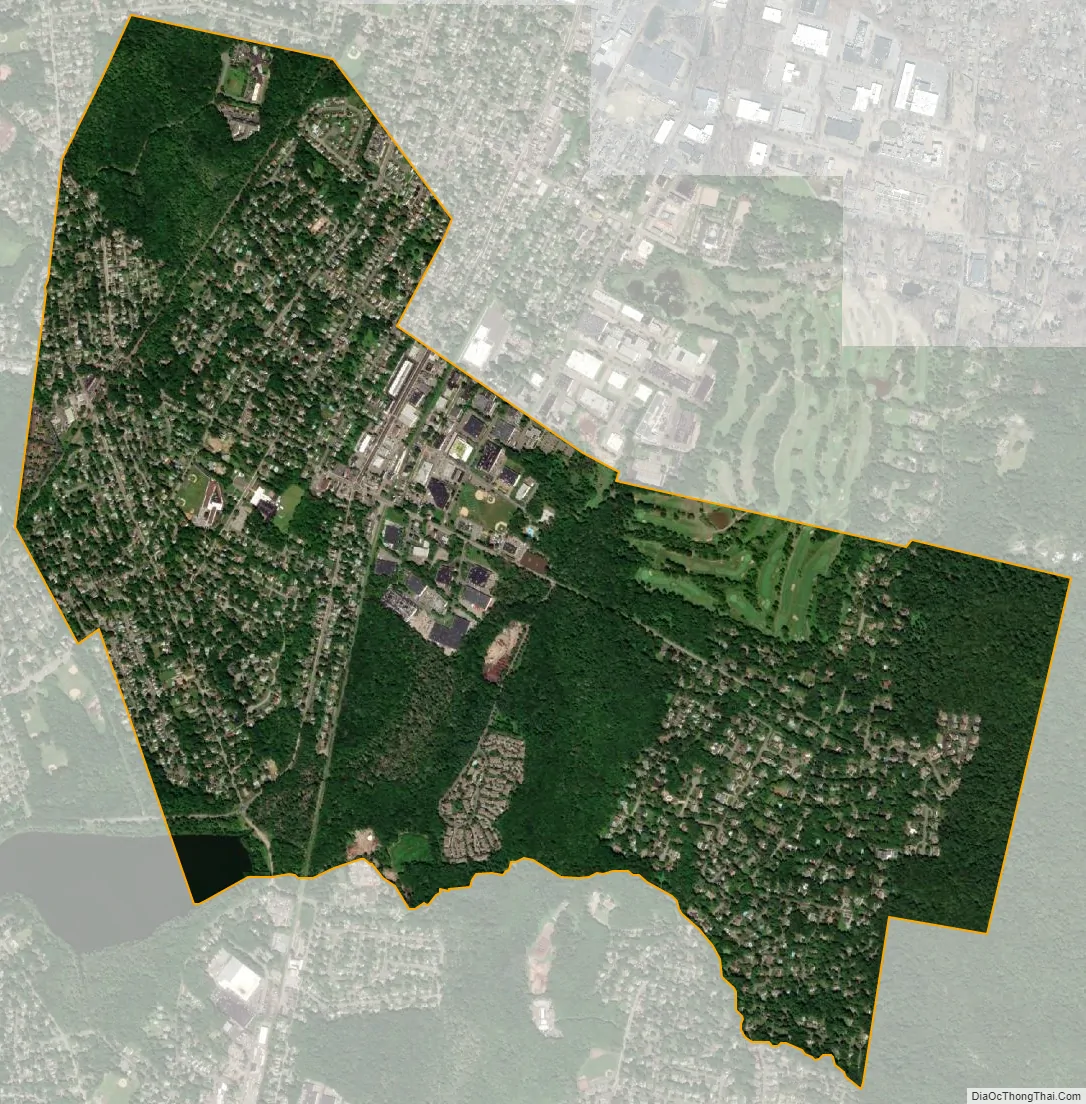
Norwood city Satellite Map
Geography
According to the United States Census Bureau, the borough had a total area of 2.79 square miles (7.24 km), including 2.79 square miles (7.21 km) of land and 0.01 square miles (0.02 km) of water (0.32%).
Norwood is in the northeastern part of New Jersey, about 2 miles (3 km) from the New York state line. It is bordered by the Bergen County municipalities of Alpine, Closter, Harrington Park, Northvale, Old Tappan and Rockleigh.
Unincorporated communities, localities and place names within the borough include West Norwood.
See also
Map of New Jersey State and its subdivision: Map of other states:- Alabama
- Alaska
- Arizona
- Arkansas
- California
- Colorado
- Connecticut
- Delaware
- District of Columbia
- Florida
- Georgia
- Hawaii
- Idaho
- Illinois
- Indiana
- Iowa
- Kansas
- Kentucky
- Louisiana
- Maine
- Maryland
- Massachusetts
- Michigan
- Minnesota
- Mississippi
- Missouri
- Montana
- Nebraska
- Nevada
- New Hampshire
- New Jersey
- New Mexico
- New York
- North Carolina
- North Dakota
- Ohio
- Oklahoma
- Oregon
- Pennsylvania
- Rhode Island
- South Carolina
- South Dakota
- Tennessee
- Texas
- Utah
- Vermont
- Virginia
- Washington
- West Virginia
- Wisconsin
- Wyoming


