Union City is a city in the northern part of Hudson County, in the U.S. state of New Jersey. As of the 2020 United States census, the city was the state’s 18th-most-populous municipality, with a population of 68,589, an increase of 2,134 (+3.2%) from the 2010 census count of 66,455, which in turn had reflected a decline of 633 (−0.9%) from the 67,088 counted in the 2000 census. As of the 2010 Census, among cities with a population of more than 50,000, it was the most densely populated city in the United States, with a density of 54,138 per square mile of land. The Census Bureau’s Population Estimates Program calculated that the city’s population was 65,638 in 2021, ranking the city the 580th-most-populous in the country.
Union City was incorporated as a city by an act of the New Jersey Legislature on June 1, 1925, with the merger of Union Hill and West Hoboken Township. The city’s name references the merger of those two municipalities.
Two major waves of immigration, first of German speakers and then of Spanish speakers, greatly influenced the development and character of Union City. Its two nicknames, “Embroidery Capital of the United States” and “Havana on the Hudson”, reflect important aspects of that history. Thousands visit Union City each year to see the nation’s longest-running passion play.
Union City is where Mallomars were first sold and the site of the first lunch wagon, built by Jerry and Daniel O’Mahoney and John Hanf, which helped spark New Jersey’s golden age of diner manufacturing, for which the state is colloquially referred to by author Richard J.S. Gutman as the “diner capital of the world”.
| Name: | Union City city |
|---|---|
| LSAD Code: | 25 |
| LSAD Description: | city (suffix) |
| State: | New Jersey |
| County: | Hudson County |
| Incorporated: | June 1, 1925 |
| Elevation: | 190 ft (60 m) |
| Total Area: | 1.29 sq mi (3.33 km²) |
| Land Area: | 1.29 sq mi (3.33 km²) |
| Water Area: | 0.00 sq mi (0.00 km²) 0.00% |
| Total Population: | 68,589 |
| Population Density: | 53,293.7/sq mi (20,576.8/km²) |
| ZIP code: | 07087 |
| Area code: | 201 |
| FIPS code: | 3474630 |
| GNISfeature ID: | 0885424 |
| Website: | www.ucnj.com |
Online Interactive Map
Click on ![]() to view map in "full screen" mode.
to view map in "full screen" mode.
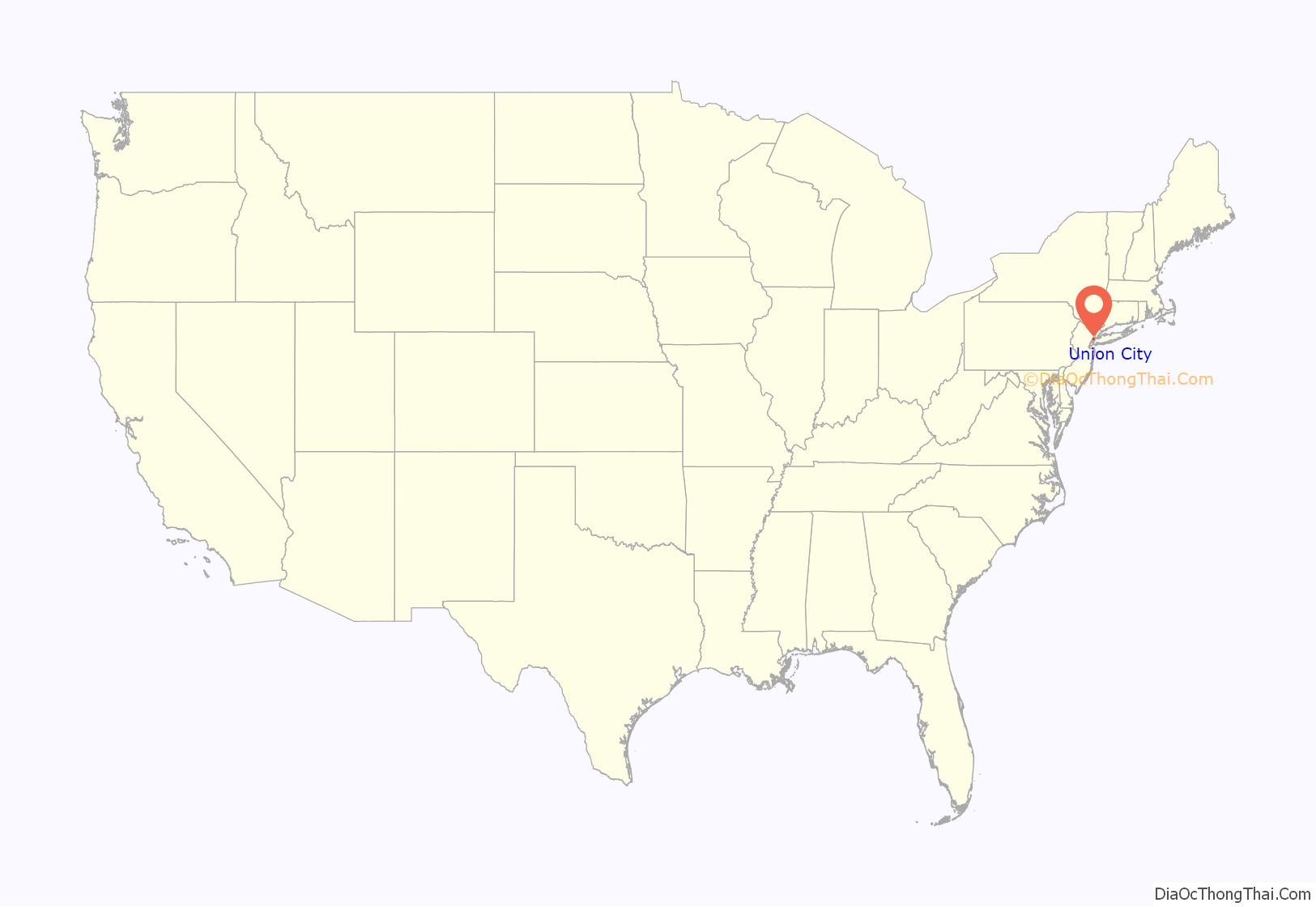
Union City location map. Where is Union City city?
History
Early history and civic boundaries
The area of what is today Union City was originally inhabited by the Munsee-speaking branch of Lenape Native Americans, who wandered into the vast woodland area encountered by Henry Hudson during the voyages he conducted from 1609 to 1610 for the Dutch, who later claimed the area (which included the future New York City) and named it New Netherland. The portion of that land that included the future Hudson County was purchased from members of the Hackensack tribe of the Lenni-Lenape and became part of Pavonia, New Netherland.
The relationship between the early Dutch settlers and Native Americans was marked by frequent armed conflict over land claims. In 1658 by New Netherland colony Director-General Peter Stuyvesant re-purchased the territory. The boundaries of the purchase are described in the deed preserved in the New York State Archives, as well as the medium of exchange: “80 fathoms of wampum, 20 fathoms of cloth, 12 brass kettles, 6 guns, one double brass kettle, 2 blankets, and one half barrel of strong beer.” In 1660, he ordered the building of a fortified village at Bergen to protect the area. It was the first permanent European settlement in New Jersey, located in what is now the Journal Square area of Jersey City near Academy Street. In 1664, the British captured New Netherland from the Dutch, at which point the boundaries of Bergen Township encompassed what is now known as Hudson County. North of this was the unpopulated Bergen Woods, which would later be claimed by settlers, after whom a number of Union City streets today are named, including Sipp Street, Brown Street, Golden Lane, Tournade Street and Kerrigan Avenue, which is named after J. Kerrigan, the owner of Kerrigan Farm, who donated the land for Saint Michael’s Monastery.
The area that would one day be Union City, however, remained sparsely populated until the early 19th century. The British granted Bergen a new town charter in 1668. In 1682 they created Bergen County, which was named to honor their Dutch predecessors. That county comprised all of present-day Hudson, Bergen and Passaic counties. Sparsely inhabited during the 17th and 18th centuries, the southeast section of Bergen County had grown by the early 19th century to the point where it was deemed necessary to designate it a separate county. The New Jersey legislature created Hudson County in 1840, and in 1843, it was divided into two townships: Old Bergen Township (which eventually became Jersey City) and North Bergen Township, which was gradually separated into Hudson County’s present day municipalities: Hoboken in 1849, Weehawken and Guttenberg in 1859, and West Hoboken and Union Township. West Hoboken was incorporated as a township by an act of the New Jersey Legislature on February 28, 1861, from portions of North Bergen Township. The township was reincorporated on April 6, 1871, and again on March 27, 1874. Portions of the township were ceded to Weehawken in 1879. On June 28, 1884, West Hoboken was reincorporated as a town, based on an ordinance passed nine days earlier. The town was reincorporated on April 24, 1888, based on the results of a referendum passed 12 days earlier. Union Township, or simply Union, was formed in 1864 through the merger of a number of villages, such as Dalleytown, Buck’s Corners and Cox’s Corners. The largest of these villages, Union Hill, became the colloquial name for the merged town of Union itself. The northern section of Union Township was later incorporated as West New York in 1898. Union City was incorporated on June 1, 1925, by merging the two towns of West Hoboken and Union Hill. The name of one of the city’s schools, Union Hill Middle School, recalls the former town.
Immigration and industry
In the 18th century, Dutch and English merchants first settled the area. Later, German immigrants immigrated from Manhattan. Irish, Polish, Armenians, Syrians, Eastern European Jews and Italians followed. In 1851, Germans moved across the Hudson River from New York City in search of affordable land and open space. During the American Civil War a military installation, Camp Yates, covered an area now bounded by Bergenline and Palisade Avenues from 22nd to 32nd Street. Germans began to settle what would become Union Hill in 1851, and some descendants of the immigrants of this period live in the city today. Although the area’s diversity was represented by the more than 19 nationalities that made their home in the Dardanelles (a five-block area of Central Avenue from 23rd Street to 27th Street) from the mid-19th century to the early 20th century, German Americans and Dutch dominated the area. Along with Swiss and Austrian immigrants, they founded the European-style lace making industries for which they were famous. The introduction of Schiffli lace machines in Hudson County made Union City the “embroidery capital of the United States”. The trademark of that industry is on the Union City Seal, though foreign competition and austere prevailing fashions led to the decline of embroidery and other industries in the area by the late 1990s. In May 2014 the city dedicated “Embroidery Square” at New York Avenue to commemorate that history.
As immigration to the area progressed throughout the 19th and 20th centuries, Belgians, Armenians, Greeks, Chinese, Jews and Russians found a home in the area, though its domination by Germans by the turn of the 20th century was reflected in the fact that the minutes of town meetings were recorded in German. By this time, the area was witnessing a period of urbanization, as an extensive trolley system was developed by the North Hudson County Railway, spurred by both electrification in 1890 and the arrival of Irish and Italian immigrants, which dominated the city until the late 1960s. Successive waves of immigrants from Eastern Europe, the Near East and Latin America contributed to the embroidery industry in subsequent years. “The Cultural Thread”/”El Hilo”, an exhibit highlighting this industry, is on display at Union City’s Park Performing Arts Center.
The town was famous for being the home of the rowdy Hudson Burlesque. Theaters in Union City featured vaudeville and burlesque and acts including Fred Astaire and Harry Houdini. It was at a vaudeville theater in Union City that comedian George Burns would meet his longtime partner and wife, Gracie Allen. Union City was also for a time the home to the headquarters of sports publisher Joe Weider.
The first Cubans immigrated to Union City from New York City in the late 1940s, having been attracted to the city in search of work after hearing of its famed embroidery factories. A majority of these Cubans hailed from small towns or cities, particularly Villa Clara Province in central Cuba. After World War II, veterans relocated to Bergen County, causing a short-lived decline in the population. By the 1960s the city was predominantly an old-line Italian enclave. This began to change when large numbers of Cubans emigrated to the city after Fidel Castro took power in 1962. This made Union City for many years the city with the largest Cuban population in the U.S. after Miami, hence its nickname, “Little Havana on the Hudson.” Following the Mariel boatlift in 1980, 10,000 Cubans settled in New Jersey, leading to a second wave of Cubans to Union City, which totaled 15,000 by 1994. The city, as well as neighboring towns such as West New York, experienced a profound cultural impact as a result of this, as seen in such aspects of local culture as its cuisine, fashion, music, entertainment and cigar-making.
Amid a redevelopment boom in the early 1960s, The Troy Towers, a 22-story twin tower luxury apartment complex, was completed in 1966 on the edge of the Palisades cliffs on Mountain Road at 19th Street, at the former site of the Abbey Inn, just north of where a motorized vehicle elevator and a staircase called the Lossburg Steps were located. The former was an angled ramp originally built for horse-drawn carriages, which along with the steps, connected to Hackensack Plank Road beneath the cliffs, in the Shades section of Weehawken. According to the Hudson County Multiple Listing service, between 2016 and 2018 the median list price of residential properties on the market in Union City fluctuated between $345,000 and $509,000. The most expensive home on the market in May 2018 was a four-family building on sale for $1.6 million, while the lowest was a studio apartment in Troy Towers for $148,000. A typical residential property was a six-bedroom, three-family house in need of updating, listed at $568,000.
Development in the 21st century
Since its inception in 2000, the Cuban Day Parade of New Jersey became a major annual event in North Hudson, beginning in North Bergen and traveling south to its end in Union City. Union City has historically been a family-oriented city predominantly made up of brownstones, two-family homes and locally owned businesses. Another wave of modestly sized residences began development approximately in 2003, spurred by similar development in neighboring Hoboken, and the city’s attempt to attract developers to what had historically been a town unfriendly to them, according to Mayor Brian P. Stack. Through approval of varied construction projects to address the needs of residents of different incomes, improved rent control laws and community input on such issues, this “Hobokenization” resulted in positive comparisons with the redeveloped Hoboken of the mid-to-late 1990s, with new restaurants, bars, and art galleries cited as evidence of renewal. The city recorded $192 million in new construction in 2007, and 600 certificates of occupancy, with 500–700 projected for 2008–2009, compared with previous years, in which 50 certificates was considered a high amount. This development continued for several years, reaching a milestone in 2008 with the completion of Union City’s first high-rise condominium tower, The Thread, whose name evokes the city’s historical association with the embroidery industry. Other such buildings followed, such as the Altessa, Park City Grand, and Hoboken Heights. In 2015, the AARP ranked Union City #6 on its list of the best small cities to live in.
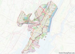
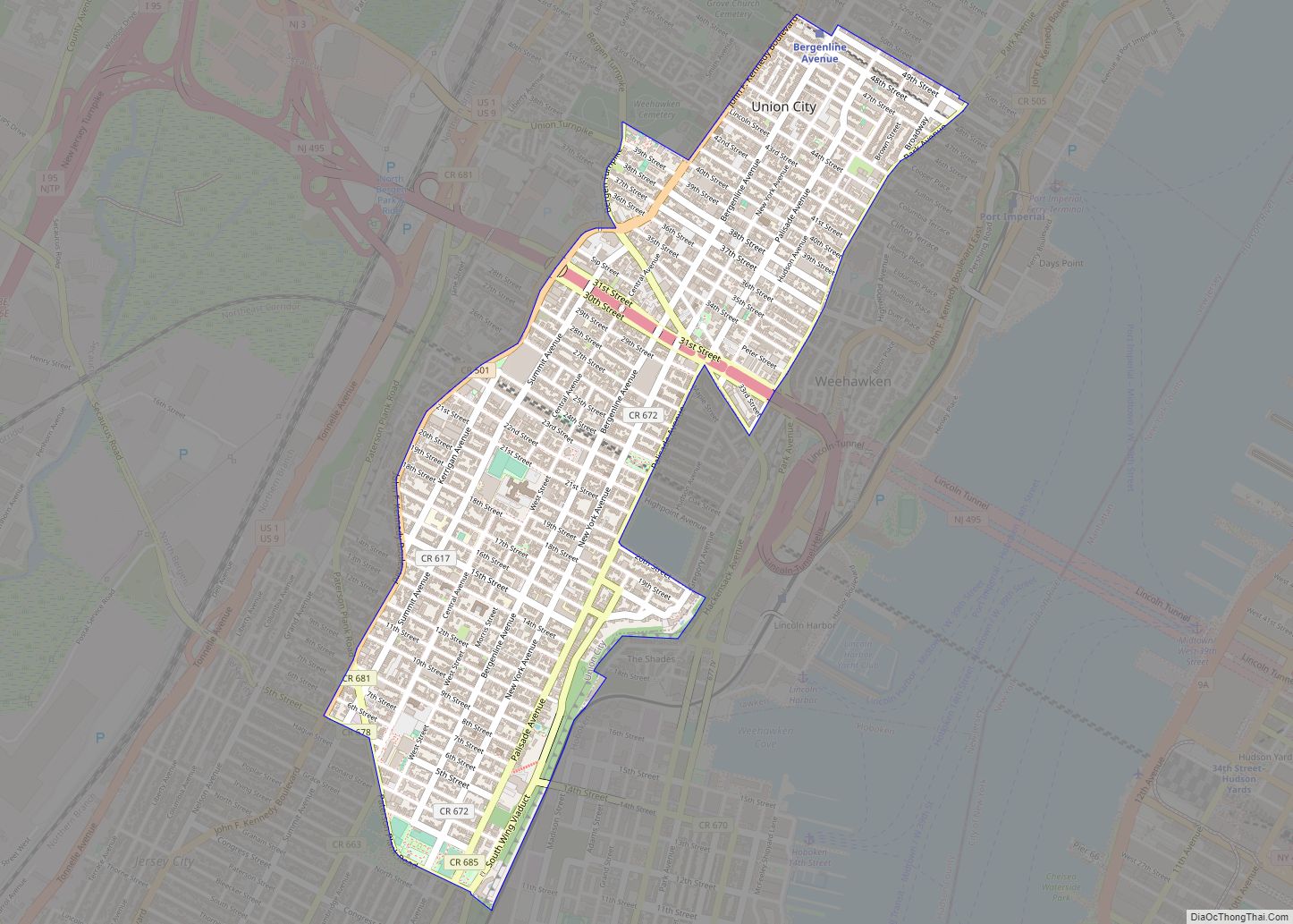
Union City Road Map
Union City city Satellite Map
Geography
According to the United States Census Bureau, the city had a total area of 1.29 square miles (3.33 km), all of which was land. Part of the New York metropolitan area, it is one of the municipalities which comprise North Hudson. Located atop the ridge of the lower Hudson Palisades (just south of the highest point in the county), many of its streets offer glimpses and views of the surrounding municipalities, the New York City skyline, and the New Jersey Meadowlands.
The city is bisected by New Jersey Route 495, a vehicular cut built in conjunction with the Lincoln Tunnel. Soon after its construction, many street names were abandoned in favor of numbering in most of North Hudson starting at 2nd Street, just north of Paterson Plank Road, which runs through the city’s only major park and creates its border with Jersey City. 49th Street is the northern boundary with West New York. Apart from a small section between Bergen Turnpike and Weehawken Cemetery, Kennedy Boulevard, a major north–south thoroughfare, creates the western border with North Bergen. A former colonial road and previous border between the merged municipalities takes three names as it diagonally crosses the city’s urban grid: Hackensack Plank Road, 32nd Street, and Bergen Turnpike. Most of the city north of the street, formerly Union Hill, shares its eastern border along Park Avenue with Weehawken. The southern section of the city, formerly West Hoboken, is indeed west of Hoboken, which it overlooks and is connected by the road which creates their shared border, the Wing Viaduct.
The city borders the Hudson County municipalities of Hoboken, Jersey City, North Bergen, Weehawken and West New York.
Unincorporated communities, localities and place names located partially or completely within the city include Union Hill and West Hoboken.
See also
Map of New Jersey State and its subdivision: Map of other states:- Alabama
- Alaska
- Arizona
- Arkansas
- California
- Colorado
- Connecticut
- Delaware
- District of Columbia
- Florida
- Georgia
- Hawaii
- Idaho
- Illinois
- Indiana
- Iowa
- Kansas
- Kentucky
- Louisiana
- Maine
- Maryland
- Massachusetts
- Michigan
- Minnesota
- Mississippi
- Missouri
- Montana
- Nebraska
- Nevada
- New Hampshire
- New Jersey
- New Mexico
- New York
- North Carolina
- North Dakota
- Ohio
- Oklahoma
- Oregon
- Pennsylvania
- Rhode Island
- South Carolina
- South Dakota
- Tennessee
- Texas
- Utah
- Vermont
- Virginia
- Washington
- West Virginia
- Wisconsin
- Wyoming
