Switzerland, a small landlocked country, covers an area of 41,285 sq. km in Europe. The country is famous across the world for its picturesque landscapes.
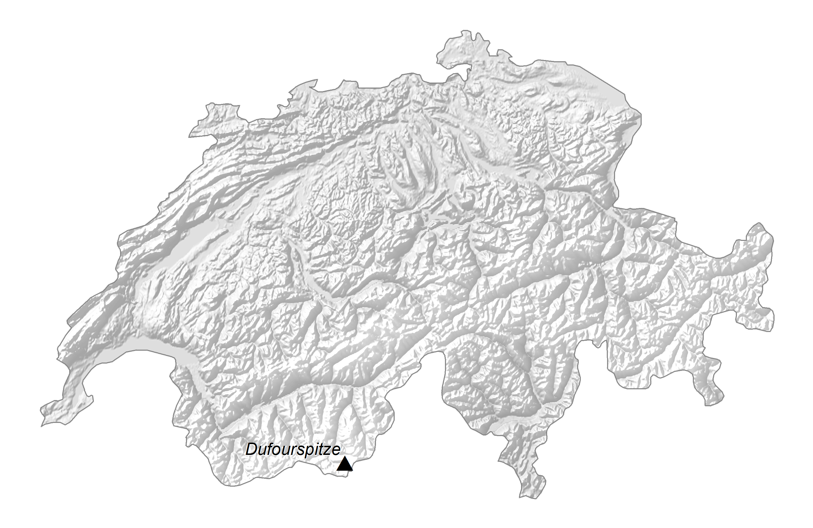
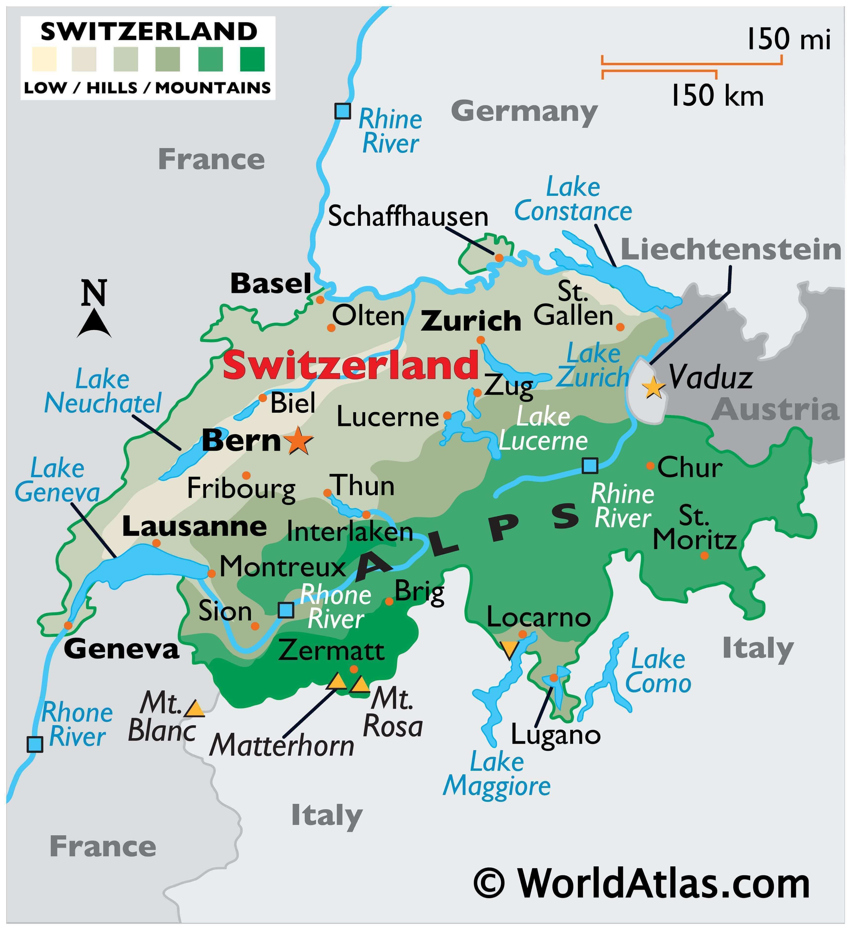
As observed on the physical map above, it is a highly mountainous nation covering nearly 60% of the country’s area. The Alpine ranges lie to the south and the Jura Mountains to the north.
Switzerland’s highest point is Dufourspitze (Monte Rosa), in the Pennine Alps, which rises to 15,206 ft (4,634 m). Also located within the Pennine Alps is the infamous Matterhorn whose summit is 4,690 ft. (4,478 m) high. The position of these mountains have been marked on the map above.
Between the mountains, there’s a hilly, central plateau that extends on through the east-west axis of the country.
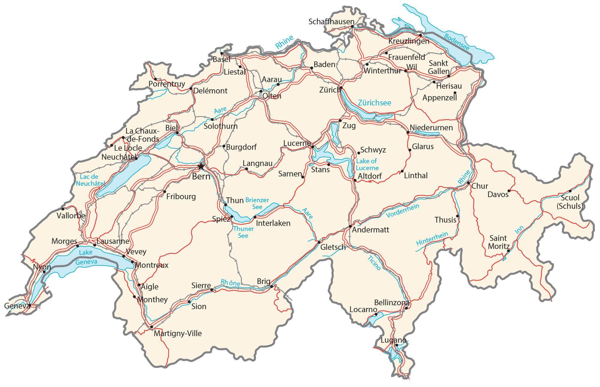
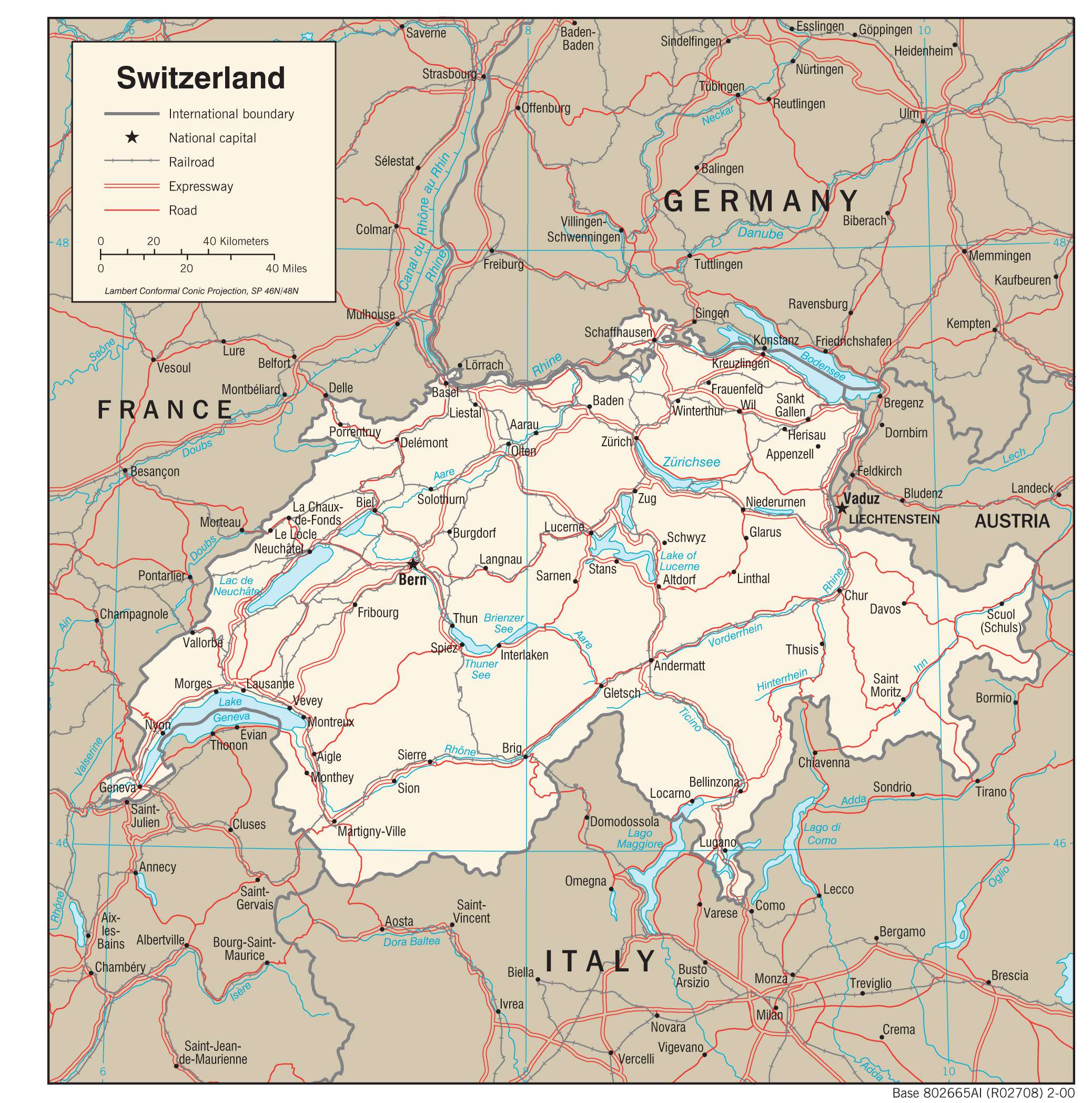
Moving north, the Rhine River makes up much of Switzerland’s border with Germany, as well as part of Lake Constance.
Switzerland’s two largest lakes are Lake Geneva (shared with France) and Lake Neuchatel – which is the largest lake entirely within the country’s borders.
| Flag: |  |
|---|---|
| Legal Name: | Swiss Confederation |
| Capital Value: |
|
| Official languages: |
|
| Demonym(s): |
|
| Government: | Federal assembly-independent directorial republic with elements of a direct democracy |
| Legislature: | Federal Assembly |
| Total Area: | 41,277 km² |
| Land Area: | 39,997 km² |
| Water Area: | 1,280 km² |
| Population: | 8,574,832 |
| Density: | 207/km (536.1/sq mi) (48th) |
| GDP: | $703.08 Billion |
| GDP Per Capita: | $81,993.73 |
| Currency Value: | Swiss francs (CHF) |
| Driving side: | right |
| Calling code: | +41 |
| Internet TLD: | .ch, .swiss |
From the majestic Alps to the picturesque lakes and rivers, Switzerland is a land of natural beauty. Take a virtual tour of the country with this interactive map, featuring major cities, rivers, and highways. The satellite and elevation map allows you to see the physical features of Switzerland, such as the Alps in the south and its vast number of lakes and rivers.
Online Interactive Political Map
Click on ![]() to view map in "full screen" mode.
to view map in "full screen" mode.
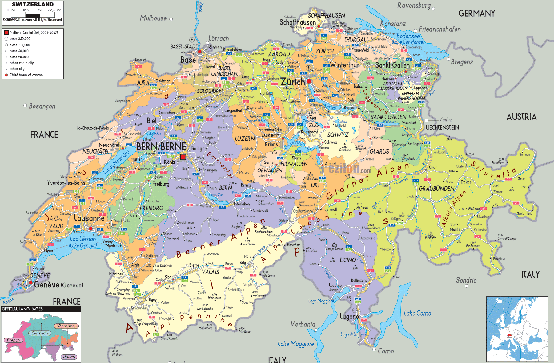
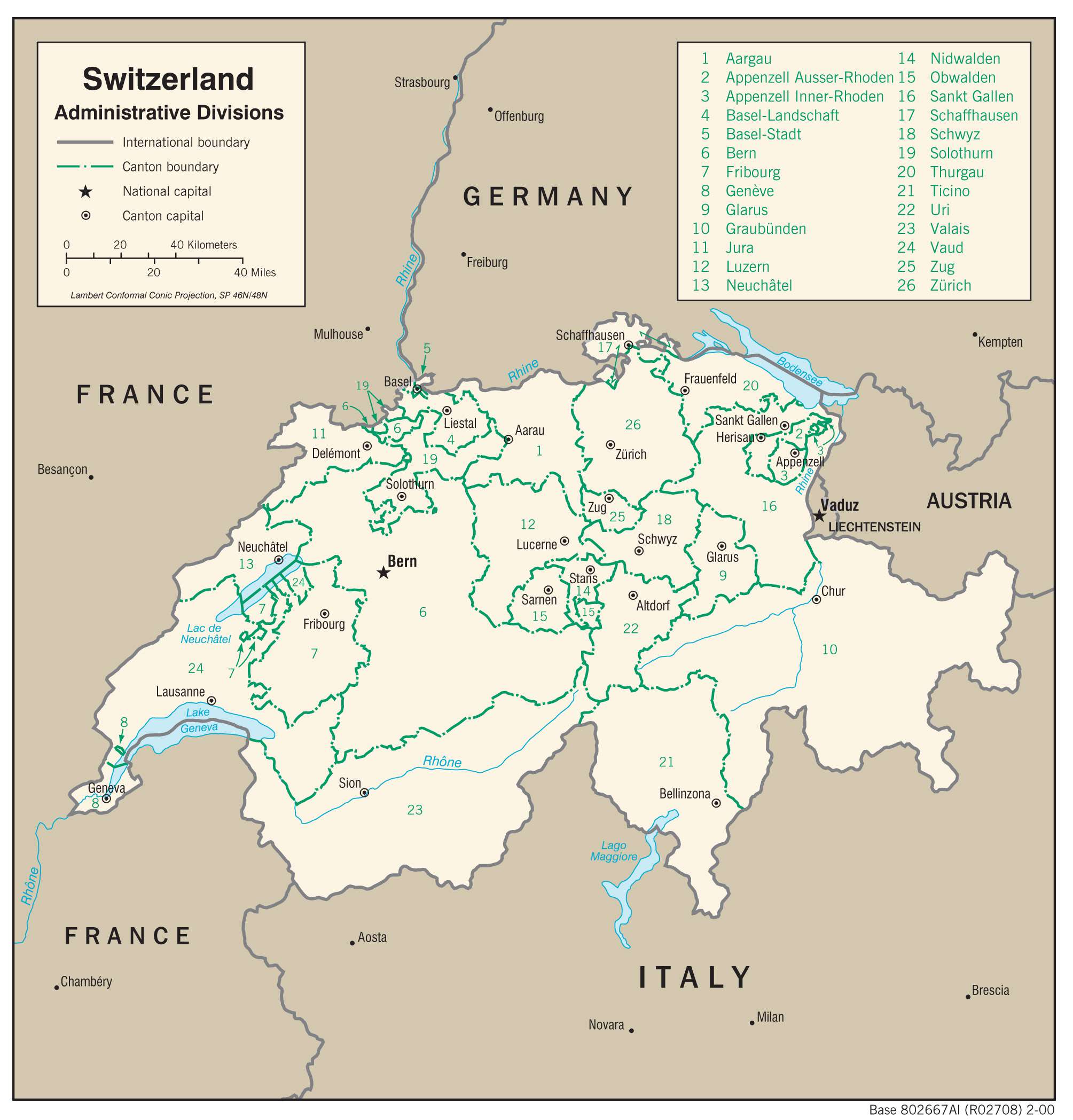
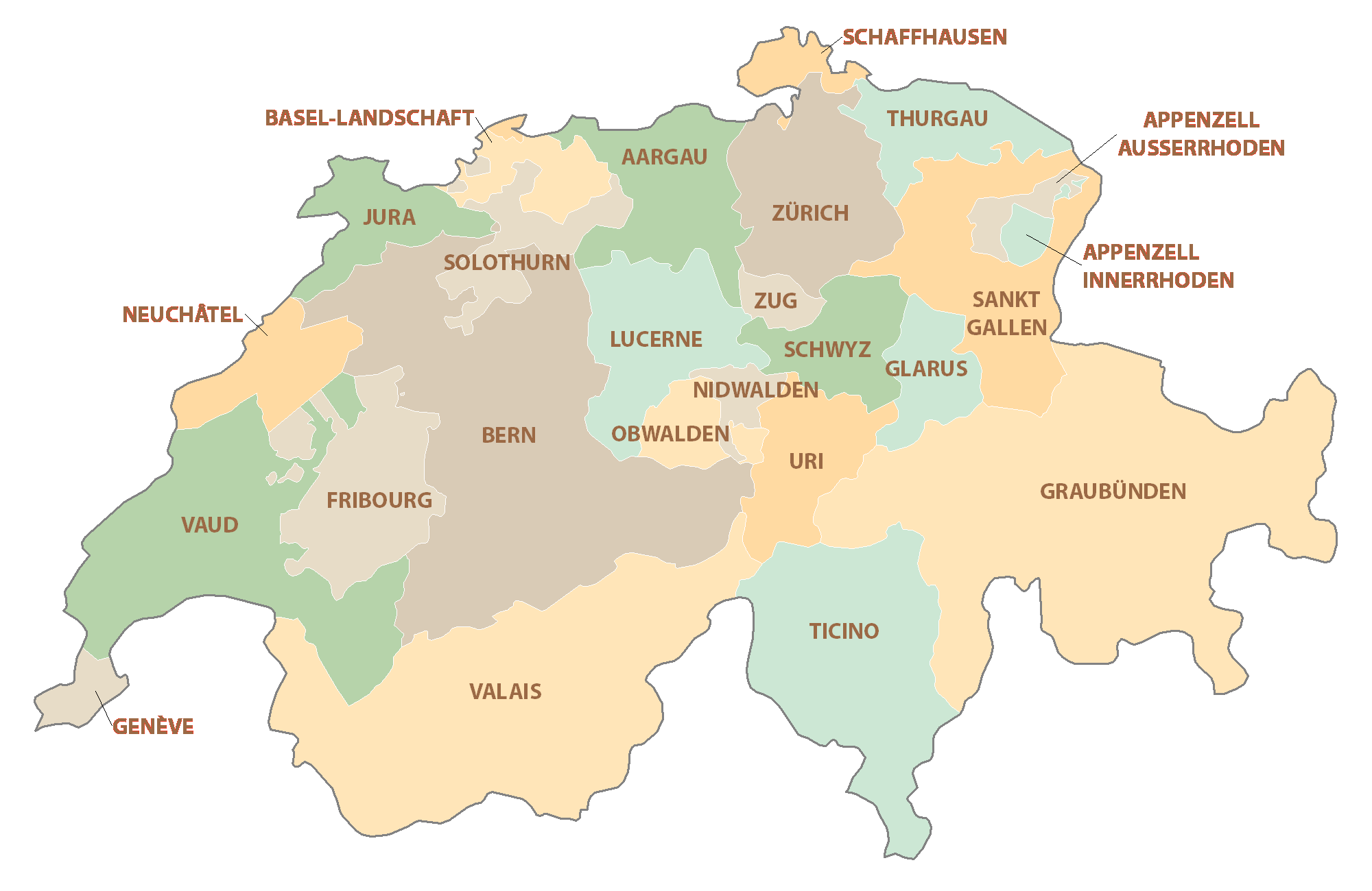
Switzerland (officially, the Swiss Confederation) is divided into 26 cantons. In alphabetical order, these cantons are: Aargau (AG), Appenzell Ausserrhoden (AR), Appenzell Innerrhoden (AI), Basel-Landschaft (BL), Basel-Stadt (BS), Berne/Bern (BE), Fribourg/Freiburg (FR), Geneve [Geneva](GE), Glarus (GL), Graubuenden /Grigioni/Grischun (GR), Jura (JU), Luzern (LU), Neuchatel (NE), Nidwalden (NW), Obwalden (OW), Sankt Gallen (SG), Schaffhausen (SH), Schwyz (SZ), Solothurn (SO), Thurgall (TG), Ticino (TI), Uri (UR), Valais/Wallis (VS), Vaud (VD), Zug (ZG) and Zuerich (ZH).
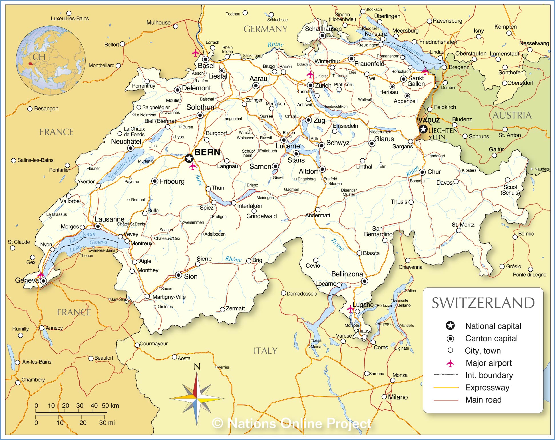
Switzerland is the only country that is without an official capital city. Located on the Swiss plateau, in the west-central part of the country, the city of Bern – is the de-facto seat of the government of Switzerland. With a population of over 144,000 people, Bern is the 5th largest city and the 2nd largest canton in Switzerland. Located in the northern part of the country, Zurich (Zuerich) is the largest city of Switzerland. It is the country’s main cultural and commercial center and the most cosmopolitan city. Zurich is also a major International financial hub. Along with Geneva, it serves as a chief gateway to the Swiss country. Switzerland is one of the most popular tourist destinations in the world.
Location Maps
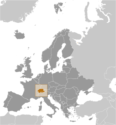
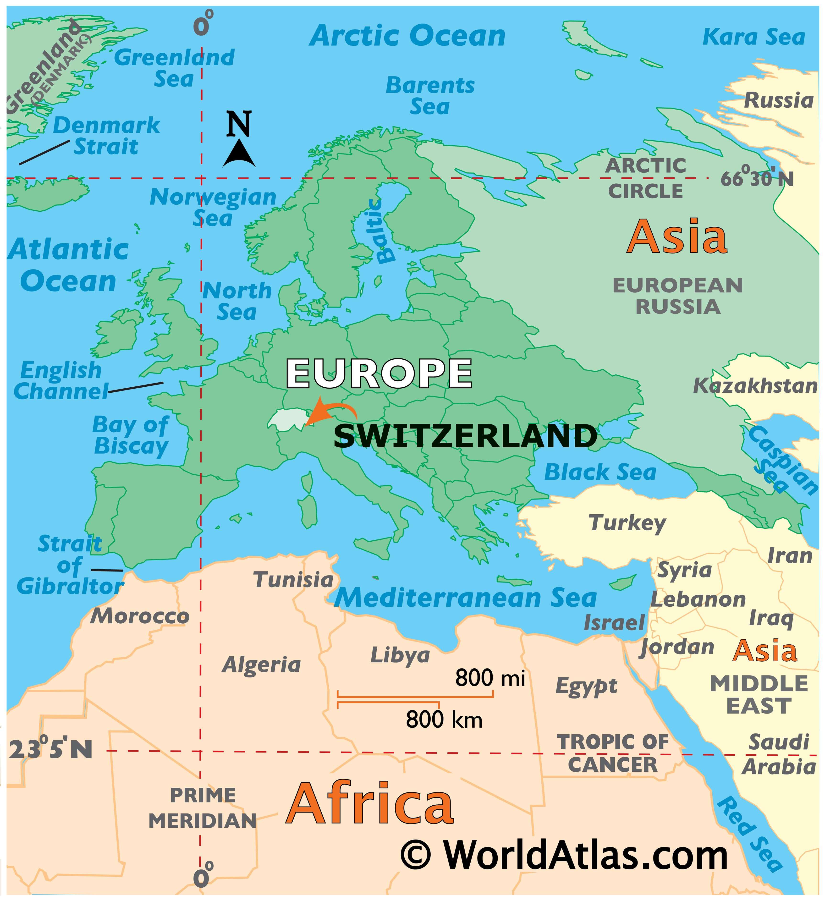
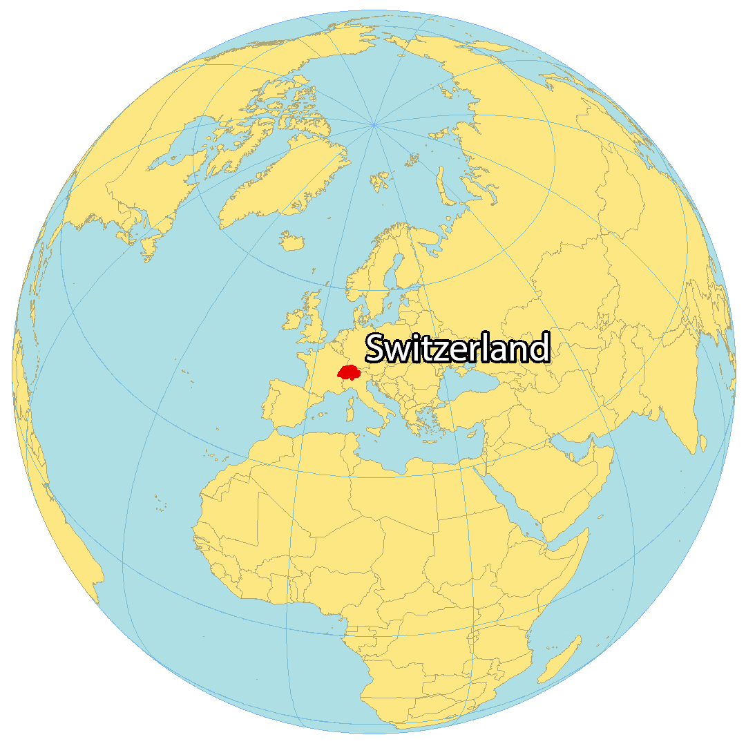
Where is Switzerland?
Switzerland is a landlocked country situated in the heart of Europe, bordering five other countries: France to the west, Germany to the north, Austria and Liechtenstein to the east, and Italy to the south. It is renowned for its rugged and mountainous terrain featuring the Alps – the most extensive mountain range system in Europe. Bern is the official capital of Switzerland; however, Zurich, Geneva, Basel and Lausanne are more populous. The Swiss landscape is incredibly diverse, with the towering peaks of the Alps in the south, the rolling hills of the central plateau, and the flatlands of the north. It is also home to numerous lakes, rivers and forests. With a population of around 8.5 million people, the official languages of Switzerland are German, French, Italian, and Romansh.
High Definition Political Map of Switzerland
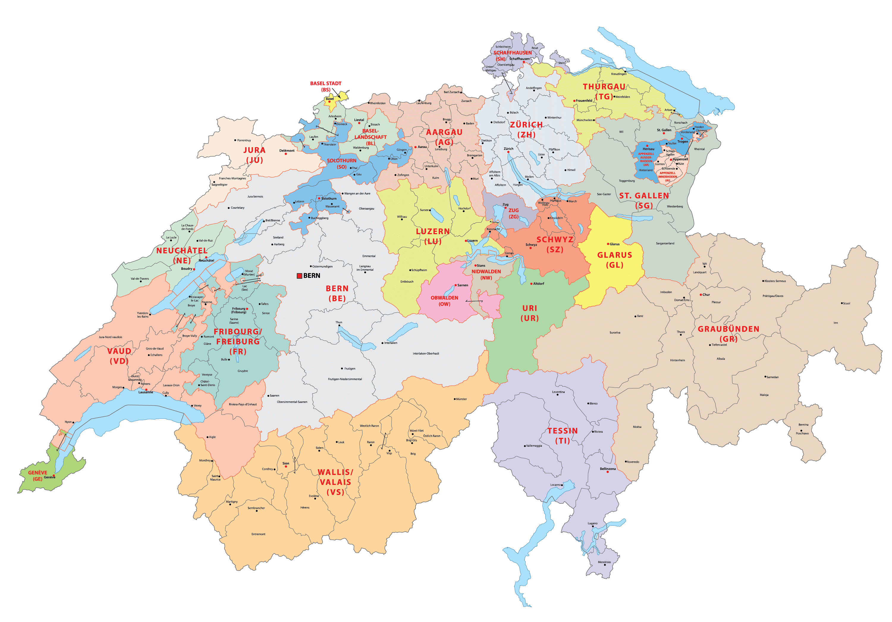
Switzerland Administrative Map
Physical Map of Switzerland


Transportation Map of Switzerland
Switzerland Satellite Map
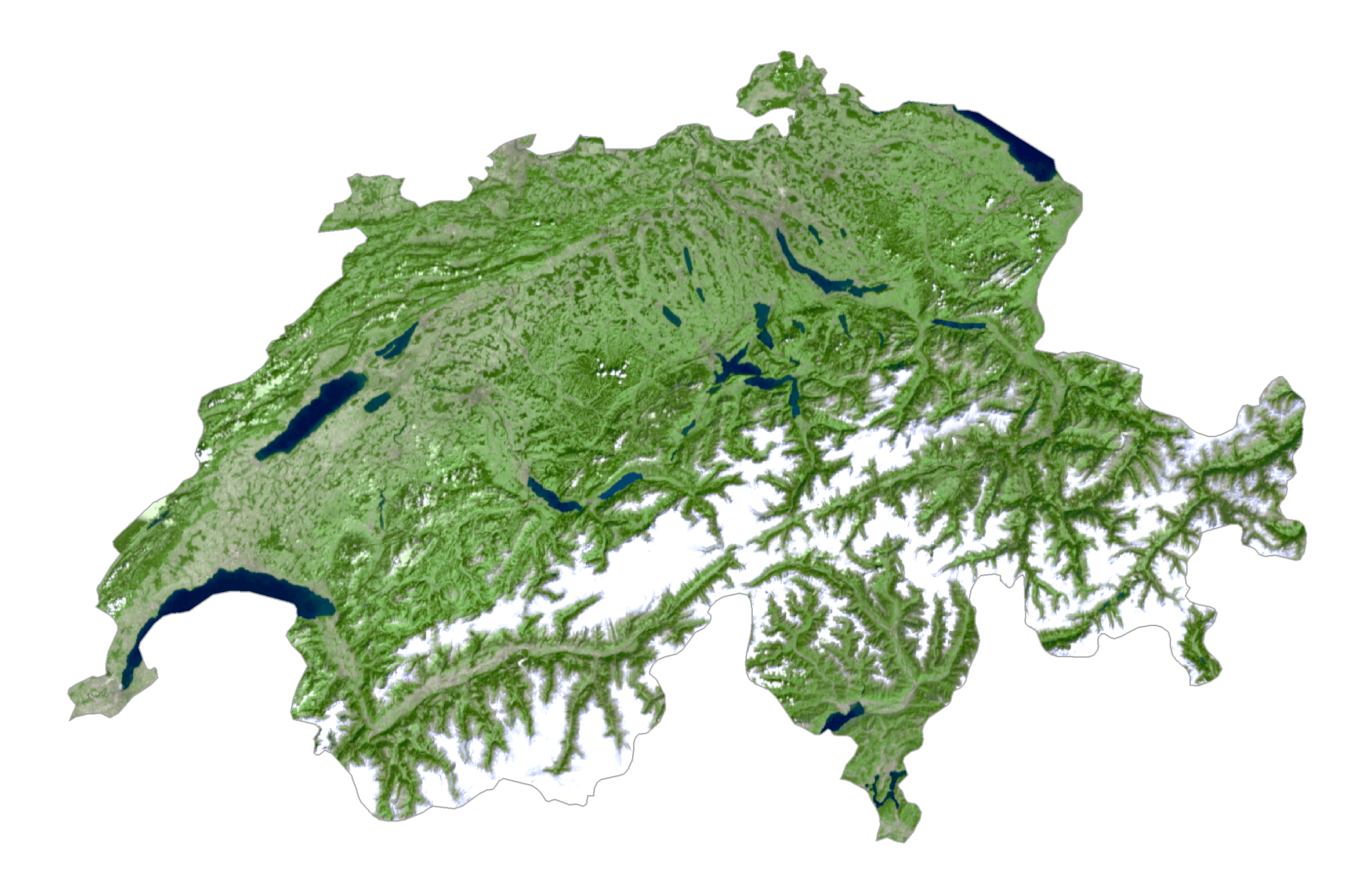
Elevation Map