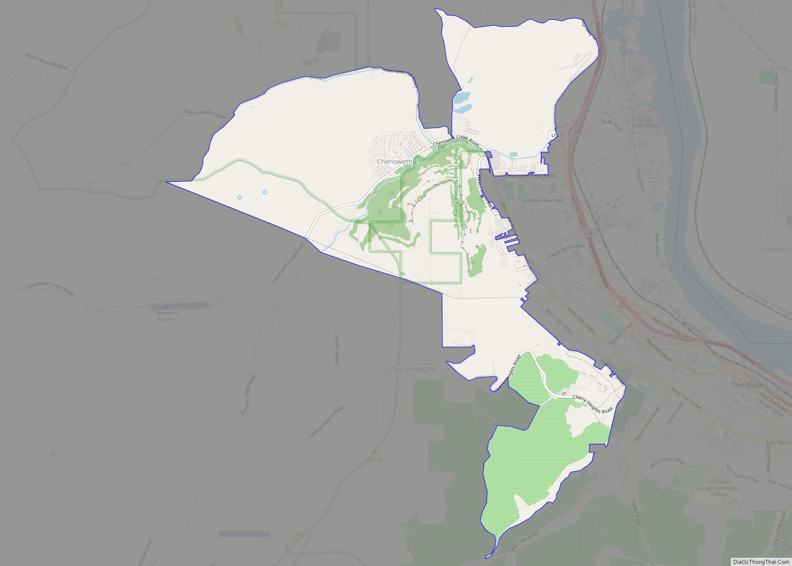
Chenoweth is an unincorporated community in Wasco County, Oregon, United States. Locally the alternative spelling of Chenowith is used, such as for the ‘Chenowith Elementary School’. For statistical purposes, the United States Census Bureau has defined Chenoweth as a census-designated place (CDP). The census definition of the area may not precisely correspond to local understanding of the area with the same name. The population of the CDP was 3,412 at the 2000 census.
| Name: | Chenoweth CDP |
|---|---|
| LSAD Code: | 57 |
| LSAD Description: | CDP (suffix) |
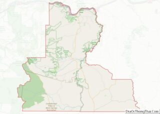
| State: | Oregon |
| County: | Wasco County |
| Elevation: | 443 ft (135 m) |
| Total Area: | 5.64 sq mi (14.62 km²) |
| Land Area: | 5.63 sq mi (14.58 km²) |
| Water Area: | 0.01 sq mi (0.04 km²) |
| Total Population: | 1,975 |
| Population Density: | 350.80/sq mi (135.45/km²) |
| FIPS code: | 4112800 |
| GNISfeature ID: | 1129791 |
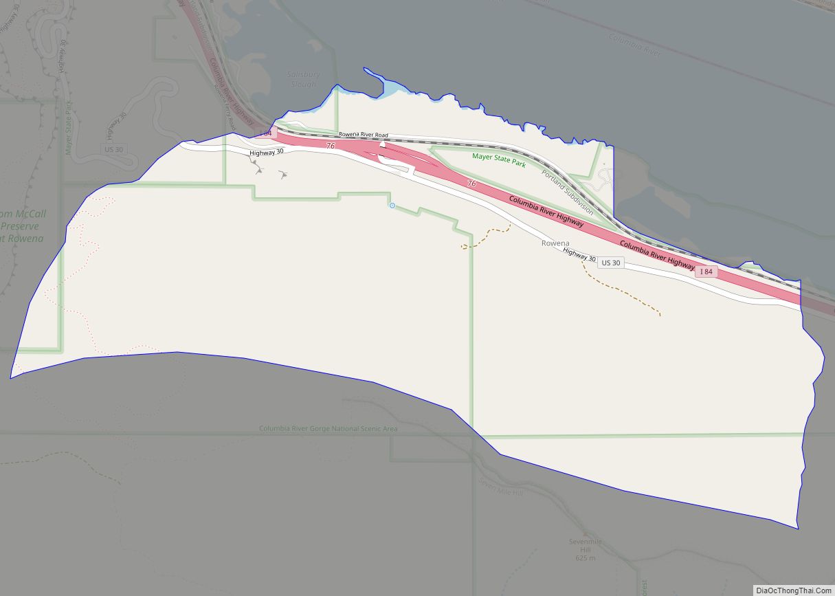
Online Interactive Map
Click on ![]() to view map in "full screen" mode.
to view map in "full screen" mode.
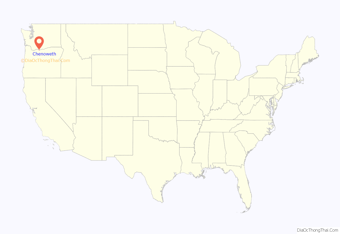
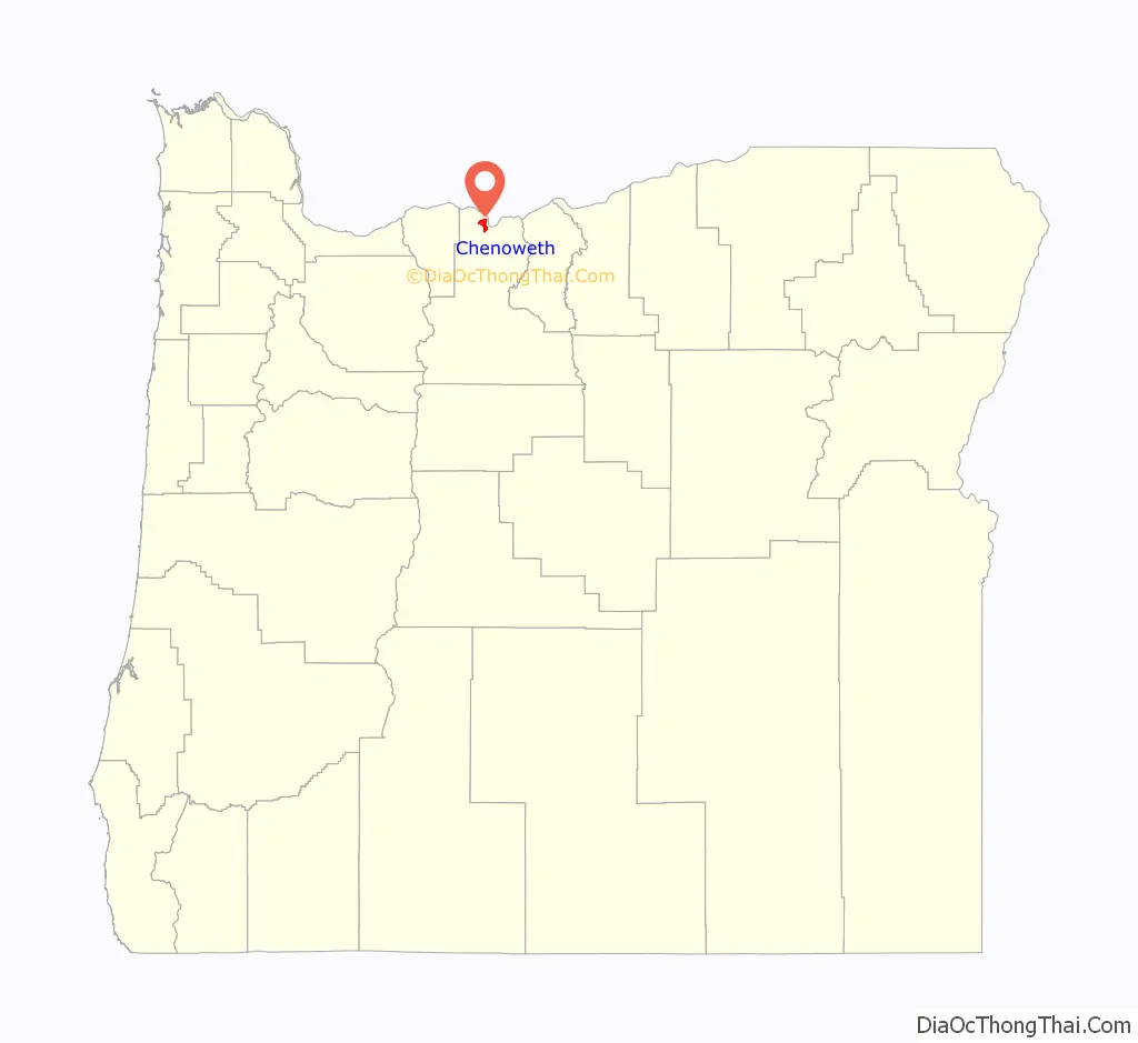
Chenoweth location map. Where is Chenoweth CDP?
History
The town of Chenoweth was named after Justin Chenoweth (1825–1898), an Illinois native. He was the son of John Chenoweth and Nancy Rose, who homesteaded in the area in the 1850s and ’60s. Justin Chenoweth married Mary H. Vickers on December 9, 1852 in Wasco County.
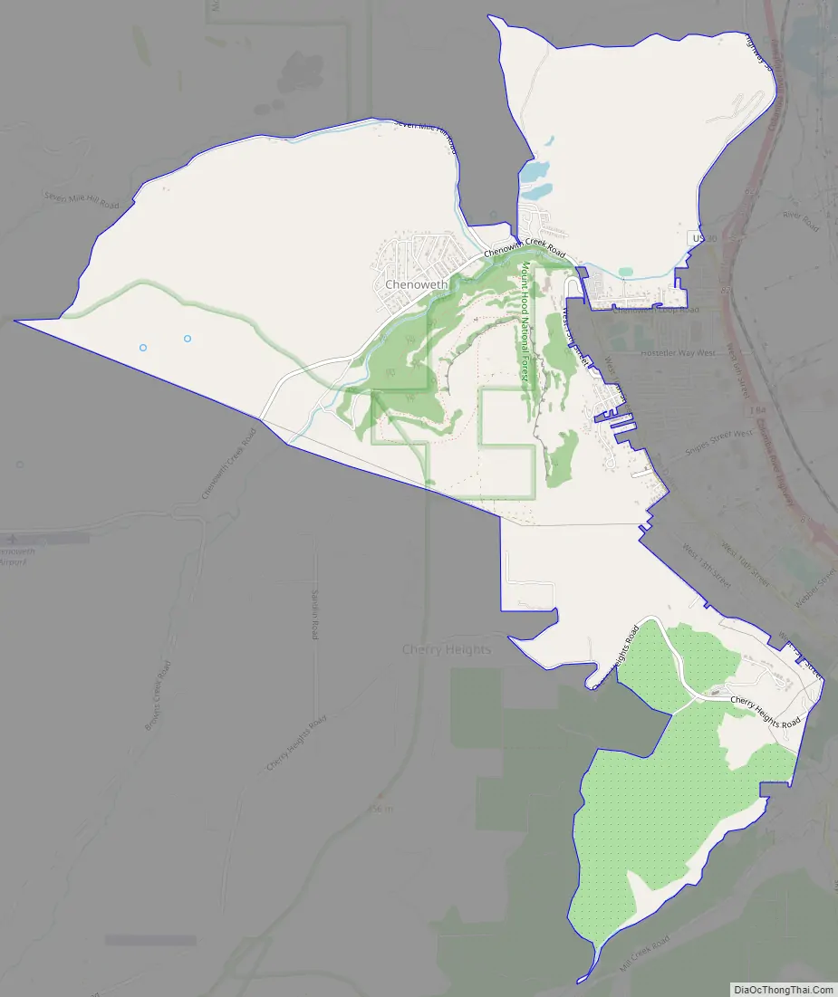
Chenoweth Road Map
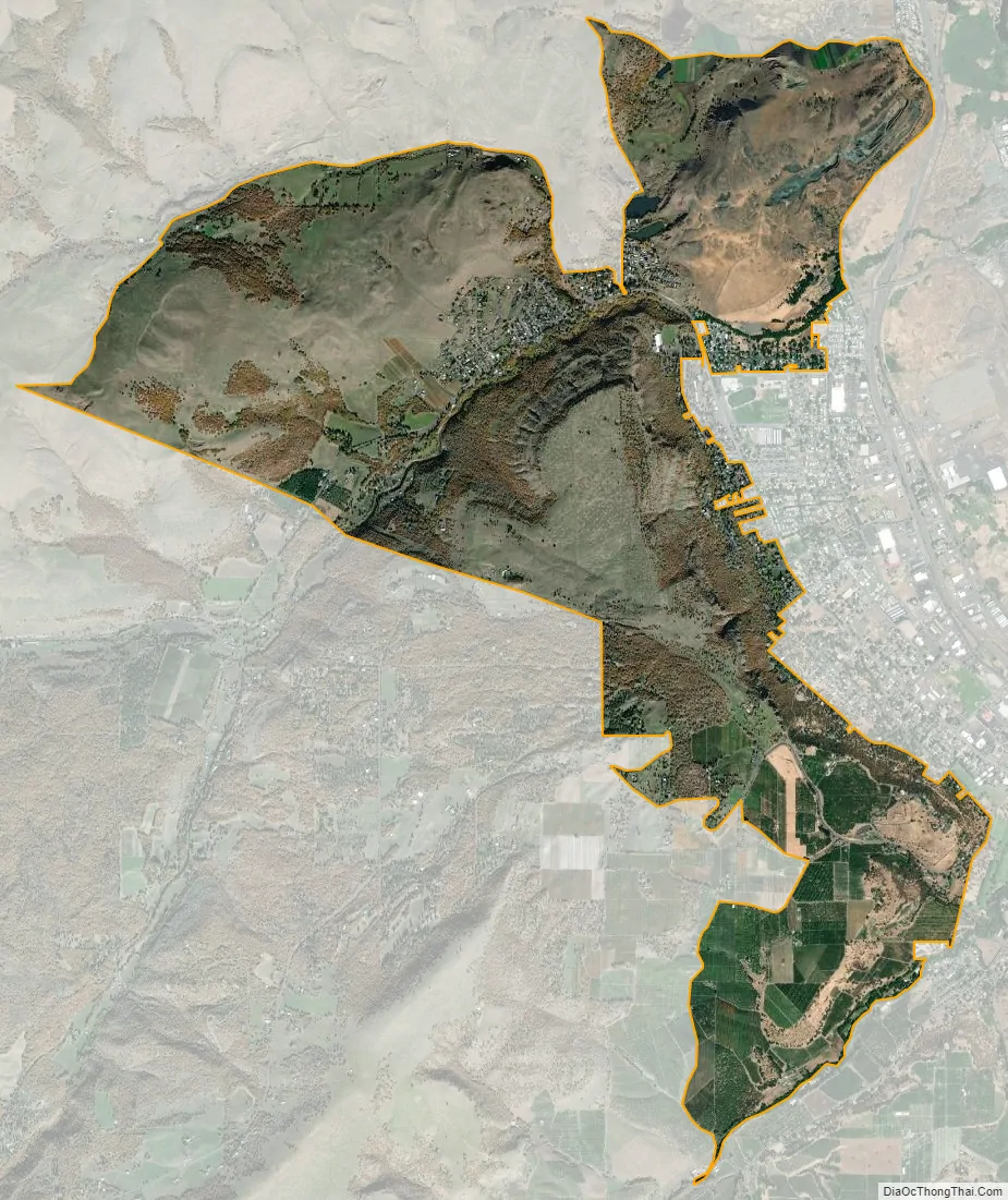
Chenoweth city Satellite Map
Geography
According to the United States Census Bureau, the CDP has a total area of 6.7 square miles (17 km), of which, 6.7 square miles (17 km) of it is land and 0.15% is water.
See also
Map of Oregon State and its subdivision: Map of other states:- Alabama
- Alaska
- Arizona
- Arkansas
- California
- Colorado
- Connecticut
- Delaware
- District of Columbia
- Florida
- Georgia
- Hawaii
- Idaho
- Illinois
- Indiana
- Iowa
- Kansas
- Kentucky
- Louisiana
- Maine
- Maryland
- Massachusetts
- Michigan
- Minnesota
- Mississippi
- Missouri
- Montana
- Nebraska
- Nevada
- New Hampshire
- New Jersey
- New Mexico
- New York
- North Carolina
- North Dakota
- Ohio
- Oklahoma
- Oregon
- Pennsylvania
- Rhode Island
- South Carolina
- South Dakota
- Tennessee
- Texas
- Utah
- Vermont
- Virginia
- Washington
- West Virginia
- Wisconsin
- Wyoming