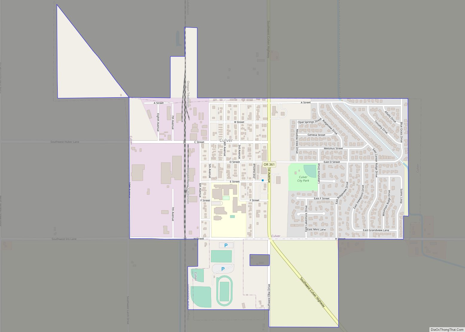
Culver is a city in Jefferson County, Oregon, United States. The population was 1,357 at the 2010 census.
| Name: | Culver city |
|---|---|
| LSAD Code: | 25 |
| LSAD Description: | city (suffix) |
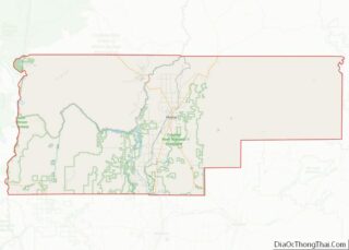
| State: | Oregon |
| County: | Jefferson County |
| Incorporated: | 1946 |
| Elevation: | 2,640 ft (804.7 m) |
| Total Area: | 0.69 sq mi (1.80 km²) |
| Land Area: | 0.69 sq mi (1.80 km²) |
| Water Area: | 0.00 sq mi (0.00 km²) |
| Total Population: | 1,602 |
| Population Density: | 2,305.04/sq mi (889.55/km²) |
| ZIP code: | 97734 |
| Area code: | 541 |
| FIPS code: | 4117300 |
| GNISfeature ID: | 1140541 |
| Website: | www.cityofculver.net |
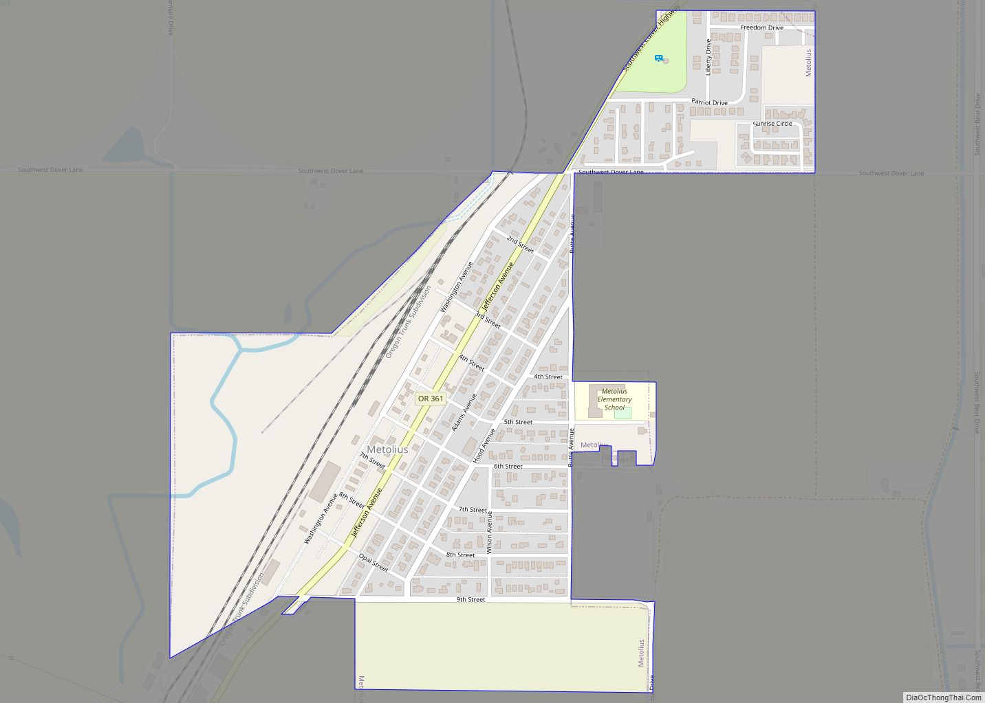
Online Interactive Map
Click on ![]() to view map in "full screen" mode.
to view map in "full screen" mode.
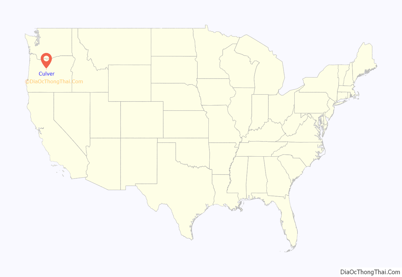
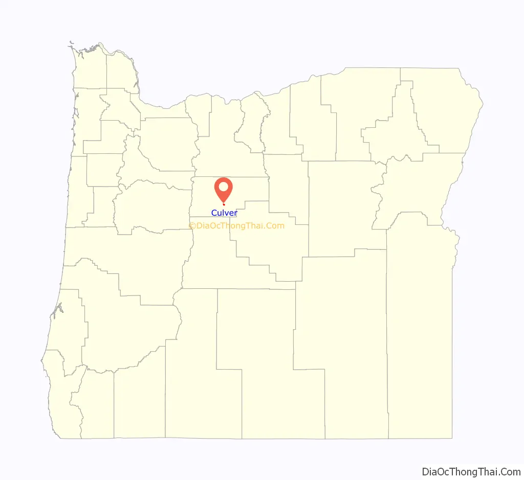
Culver location map. Where is Culver city?
History
Orace Gabriel Collver moved from Coos Bay, Oregon, to Central Oregon and founded the town of Culver. Since he was the postmaster, he got to name the town, but to avoid confusion with another town with similar spelling and sound, he changed it to Culver. He built a general store, which housed the post office and became the center of the community. In 1911, the railroad came through, but on the opposite side of the valley, so the town relocated to the railroad. Collver had the whole house moved to the new location, while the townspeople used the lumber from their old homes and buildings to build new ones. The upstairs of his store housed a meeting hall that was used for local events and dances.
Collver married Margaret J. Barnett on October 16, 1881. They raised Ruth Church, the daughter of his sister, Sarah Collver Church, after Sarah’s death.
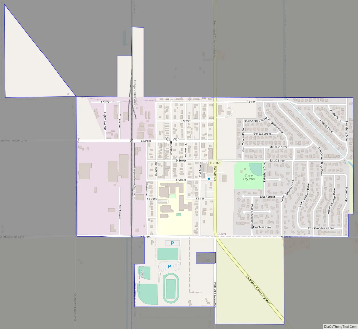
Culver Road Map
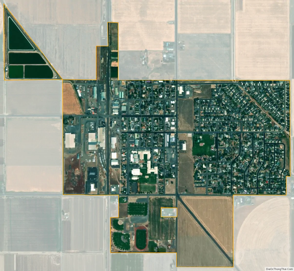
Culver city Satellite Map
Geography
According to the United States Census Bureau, the city has a total area of 0.69 square miles (1.79 km), all of it land.
See also
Map of Oregon State and its subdivision: Map of other states:- Alabama
- Alaska
- Arizona
- Arkansas
- California
- Colorado
- Connecticut
- Delaware
- District of Columbia
- Florida
- Georgia
- Hawaii
- Idaho
- Illinois
- Indiana
- Iowa
- Kansas
- Kentucky
- Louisiana
- Maine
- Maryland
- Massachusetts
- Michigan
- Minnesota
- Mississippi
- Missouri
- Montana
- Nebraska
- Nevada
- New Hampshire
- New Jersey
- New Mexico
- New York
- North Carolina
- North Dakota
- Ohio
- Oklahoma
- Oregon
- Pennsylvania
- Rhode Island
- South Carolina
- South Dakota
- Tennessee
- Texas
- Utah
- Vermont
- Virginia
- Washington
- West Virginia
- Wisconsin
- Wyoming