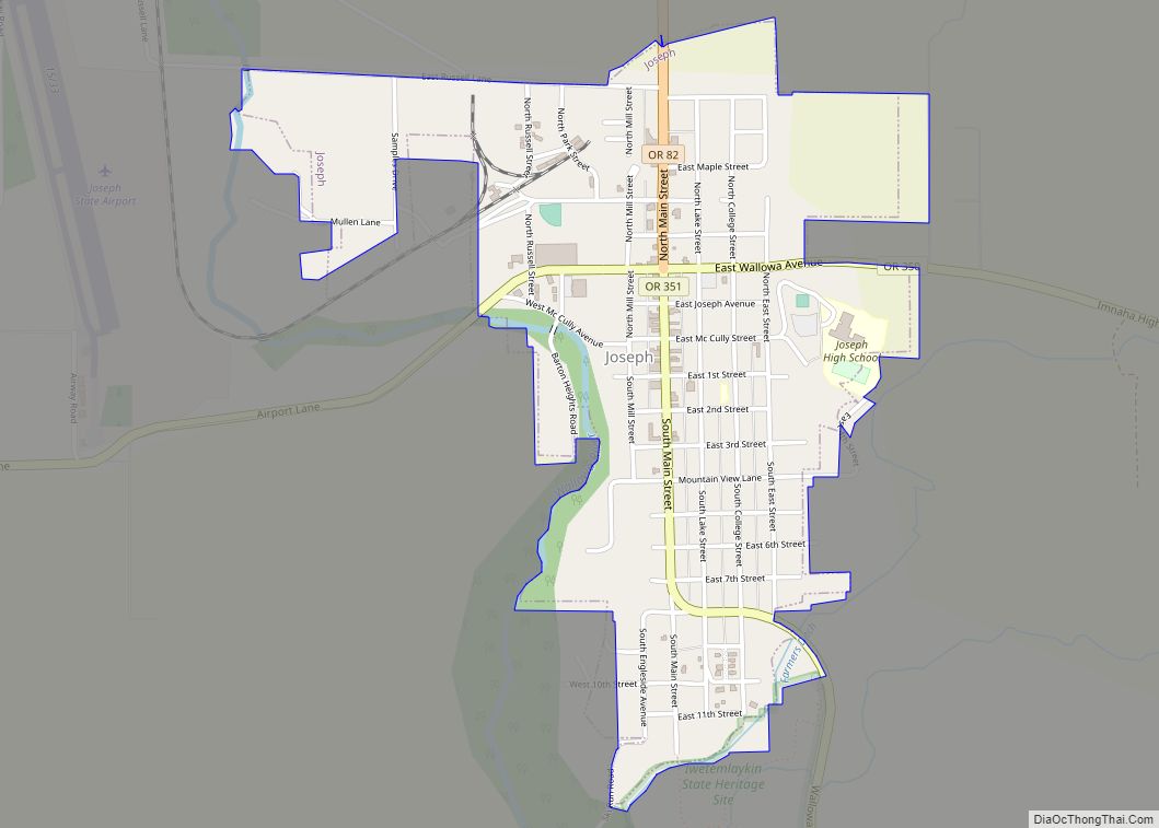
Joseph is a city in Wallowa County, Oregon, United States. Originally named Silver Lake and Lake City, the city formally named itself in 1880 for Chief Joseph (1840–1904) of the Nez Perce people. The population was 1,081 at the 2010 census.
| Name: | Joseph city |
|---|---|
| LSAD Code: | 25 |
| LSAD Description: | city (suffix) |
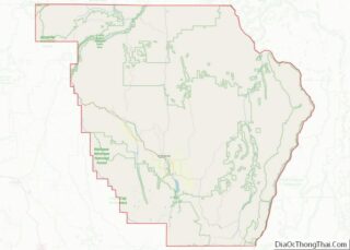
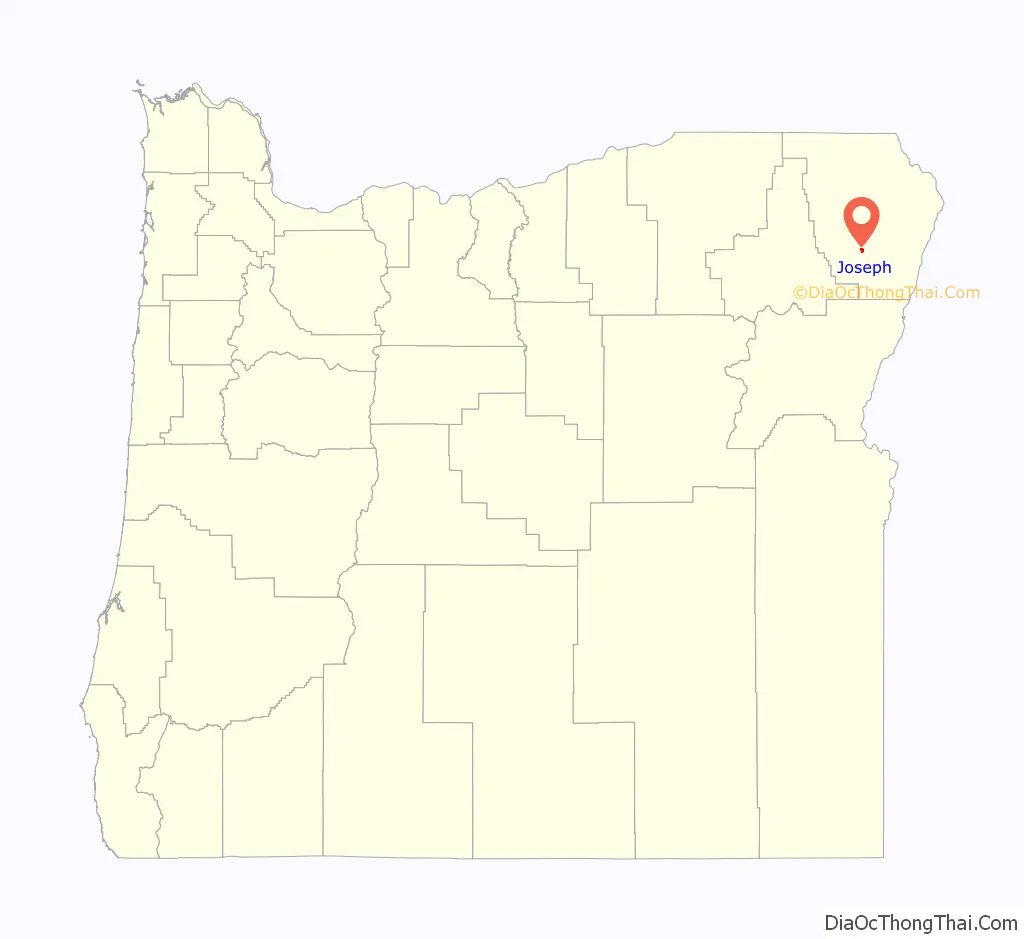
| State: | Oregon |
| County: | Wallowa County |
| Incorporated: | 1887 |
| Elevation: | 4,190 ft (1,280 m) |
| Total Area: | 0.91 sq mi (2.35 km²) |
| Land Area: | 0.91 sq mi (2.35 km²) |
| Water Area: | 0.00 sq mi (0.00 km²) |
| Total Population: | 1,154 |
| Population Density: | 1,272.33/sq mi (491.49/km²) |
| ZIP code: | 97846 |
| Area code: | 541 |
| FIPS code: | 4137900 |
| GNISfeature ID: | 1144403 |
| Website: | www.josephoregon.org |
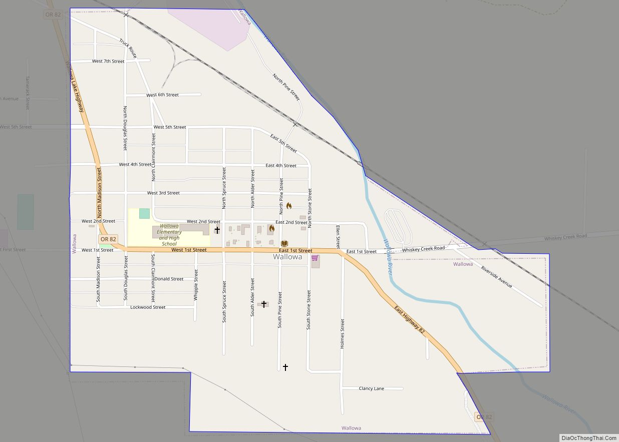
Online Interactive Map
Click on ![]() to view map in "full screen" mode.
to view map in "full screen" mode.
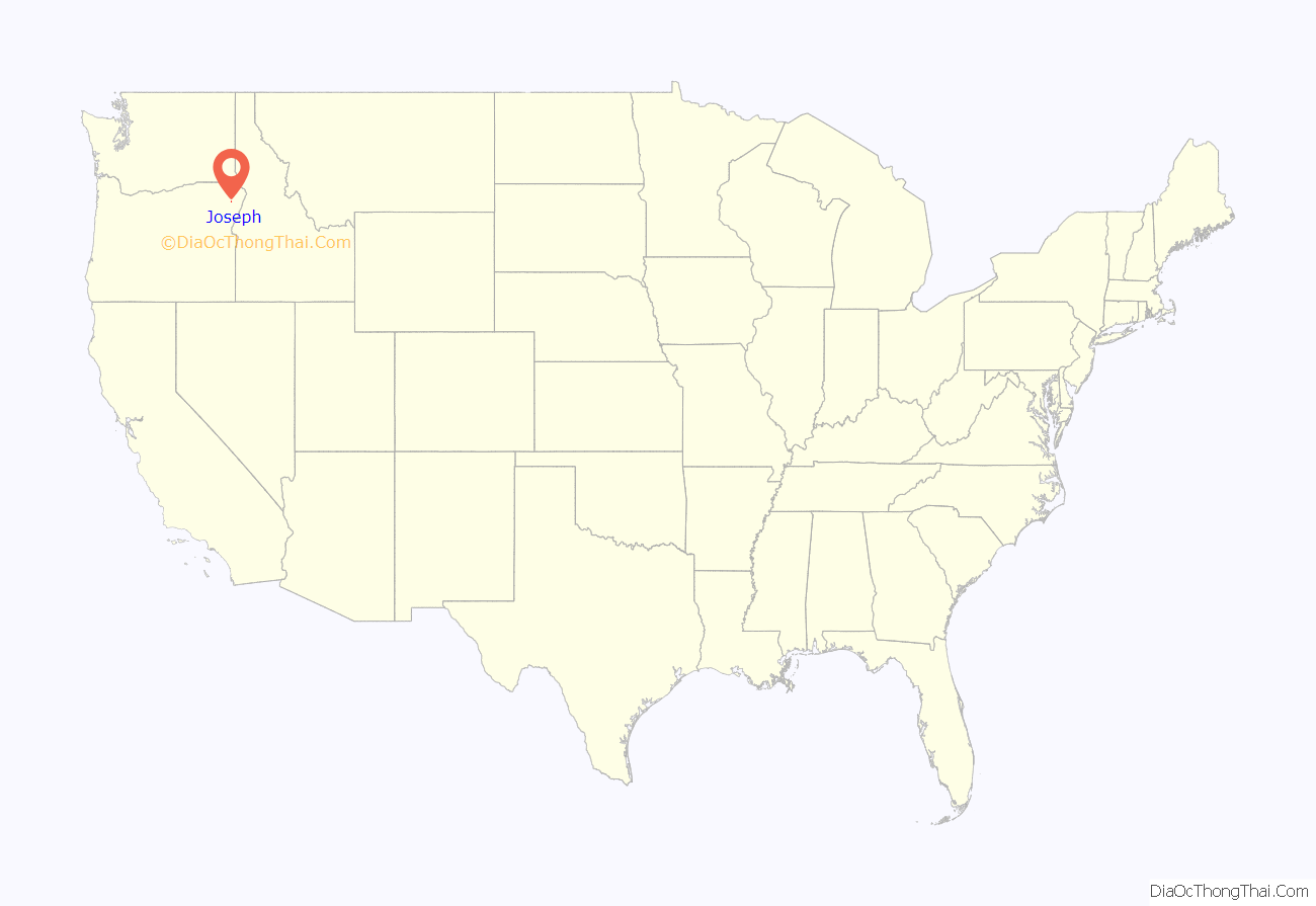
Joseph location map. Where is Joseph city?
History
Joseph was platted in 1883, and the economy was originally based around agriculture, especially grain and stock. In 1896 the First Bank of Joseph was robbed; one robber was shot and killed, another shot and captured, and a third escaped with the money. On occasion there have been reenactments of the robbery. After a railroad line was completed to Joseph in 1908, a lumber mill opened, bolstering the economy.
When the timber industry collapsed in the 1980s, local unemployment rate approached 17%. However, in 1982 a new industry was born as three bronze foundries opened in the local area.
The city sponsors the annual Chief Joseph Days Rodeo in late July, Bronze, Blues and Brews in August since 2001, and Alpenfest in September, a Swiss-Bavarian festival staged in Joseph and at nearby Wallowa Lake. Alpenfest resembles an Oktoberfest but has more yodeling and alphorn playing, reflecting the area’s reputation as “Oregon’s Little Switzerland.”
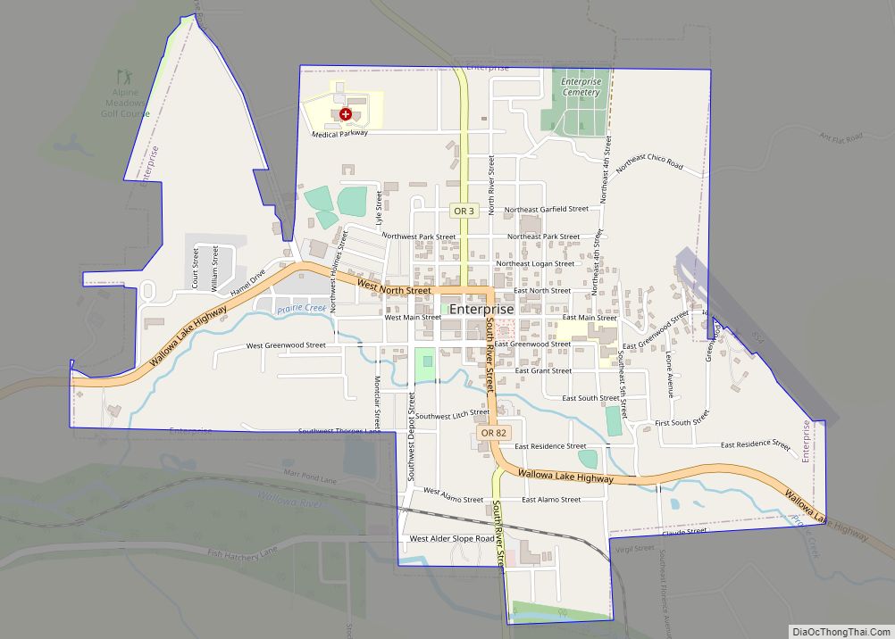
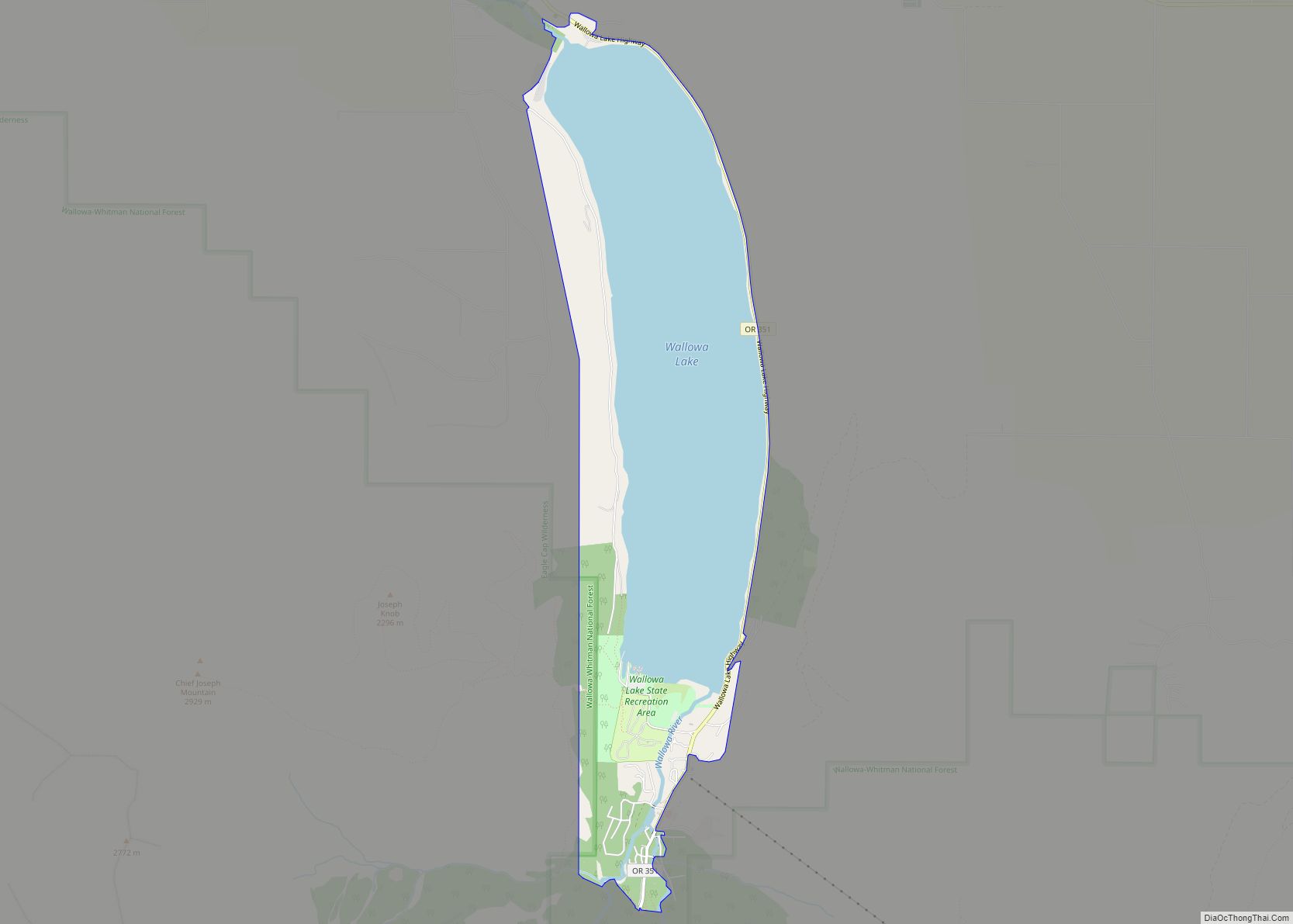
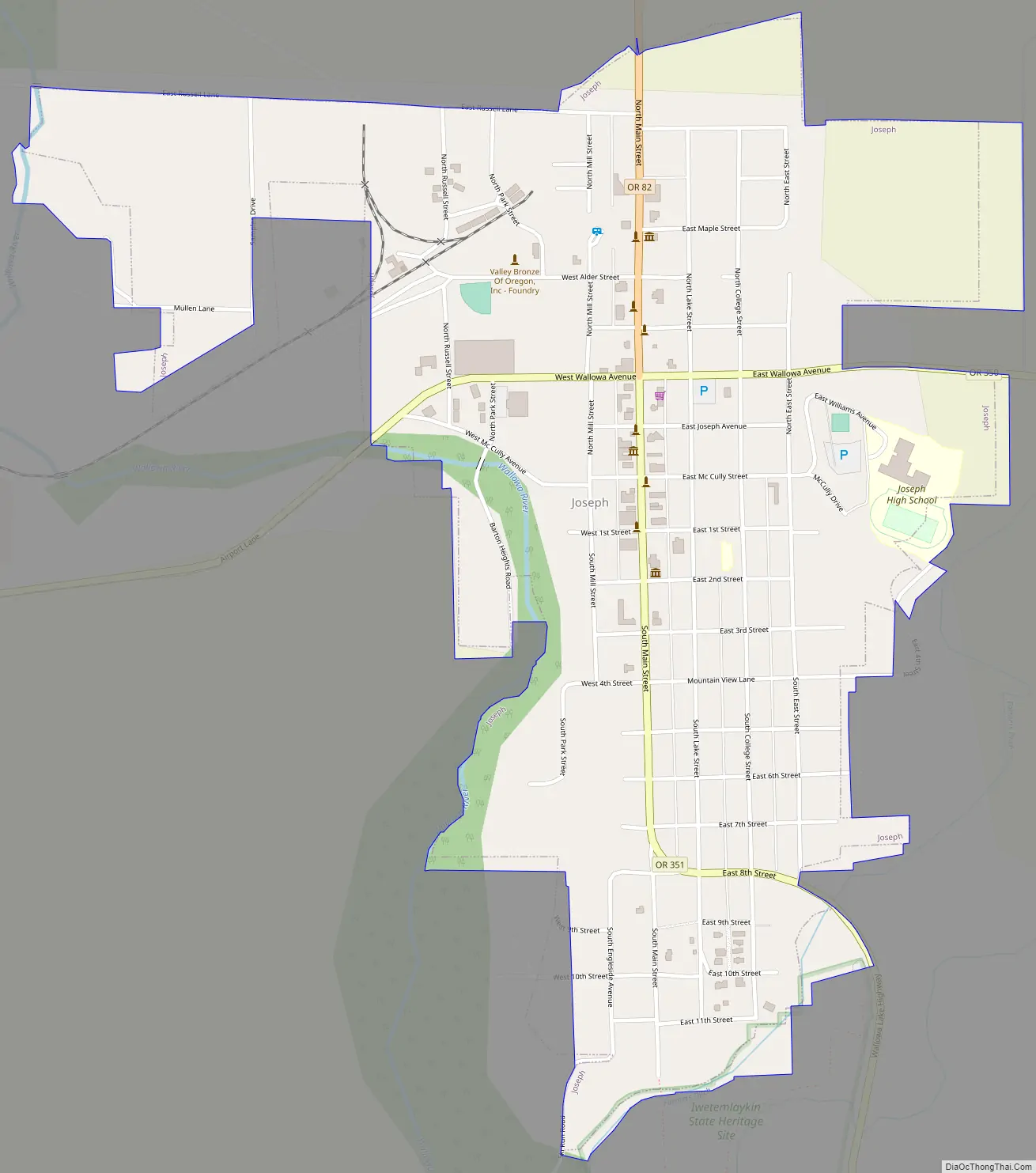
Joseph Road Map
Joseph city Satellite Map
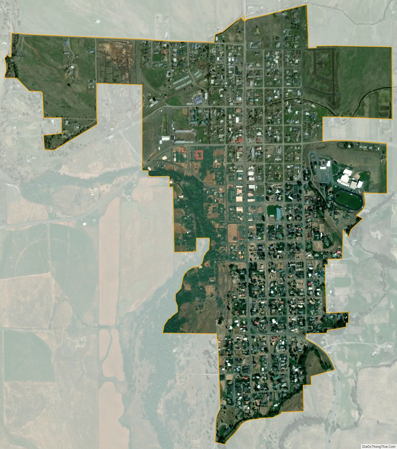
Geography
According to the United States Census Bureau, the city has a total area of 0.88 square miles (2.28 km), all of it land. The elevation is 4,190 feet (1,280 m) above sea level.
Climate
This climatic region is typified by large seasonal temperature differences, with warm to hot (and often humid) summers and cold (sometimes severely cold) winters. According to the Köppen Climate Classification system, Joseph has a humid continental climate, abbreviated “Dfb” on climate maps. The hottest temperature recorded in Joseph was 100 °F (37.8 °C) in July 1919, while the coldest temperature recorded was −34 °F (−36.7 °C) in December 1924.
See also
Map of Oregon State and its subdivision: Map of other states:- Alabama
- Alaska
- Arizona
- Arkansas
- California
- Colorado
- Connecticut
- Delaware
- District of Columbia
- Florida
- Georgia
- Hawaii
- Idaho
- Illinois
- Indiana
- Iowa
- Kansas
- Kentucky
- Louisiana
- Maine
- Maryland
- Massachusetts
- Michigan
- Minnesota
- Mississippi
- Missouri
- Montana
- Nebraska
- Nevada
- New Hampshire
- New Jersey
- New Mexico
- New York
- North Carolina
- North Dakota
- Ohio
- Oklahoma
- Oregon
- Pennsylvania
- Rhode Island
- South Carolina
- South Dakota
- Tennessee
- Texas
- Utah
- Vermont
- Virginia
- Washington
- West Virginia
- Wisconsin
- Wyoming