Harbor (Tolowa: chit ) is an unincorporated community in Curry County, Oregon, United States. It is located across the Chetco River from the city of Brookings. For statistical purposes, the United States Census Bureau has defined Harbor as a census-designated place (CDP). The census definition of the area may not precisely correspond to local understanding of the area with the same name. The population of the CDP was 2,391 at the 2010 census.
| Name: | Harbor CDP |
|---|---|
| LSAD Code: | 57 |
| LSAD Description: | CDP (suffix) |
| State: | Oregon |
| County: | Curry County |
| Founded: | 1894 |
| Elevation: | 115 ft (35 m) |
| Total Area: | 2.31 sq mi (5.98 km²) |
| Land Area: | 1.92 sq mi (4.97 km²) |
| Water Area: | 0.39 sq mi (1.01 km²) |
| Total Population: | 2,551 |
| Population Density: | 1,327.95/sq mi (512.86/km²) |
| ZIP code: | 97415 |
| Area code: | 458 and 541 |
| FIPS code: | 4132100 |
| GNISfeature ID: | 2408351 |
Online Interactive Map
Click on ![]() to view map in "full screen" mode.
to view map in "full screen" mode.
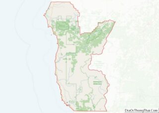
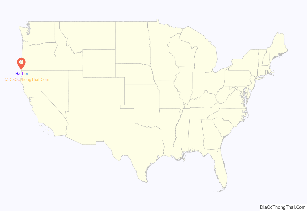
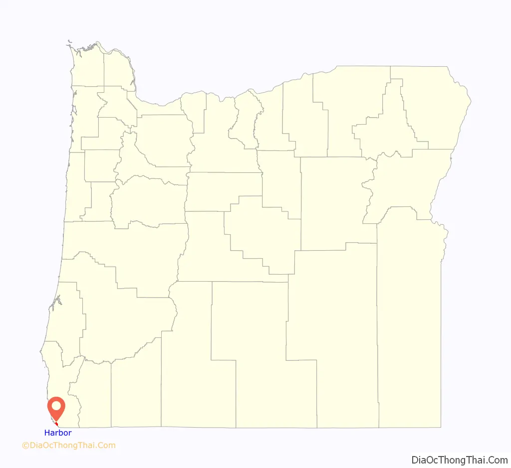
Harbor location map. Where is Harbor CDP?
History
The original name of the post office in the area was “Chetco”, after the Chetco River. It was established in 1863 and moved several times until it closed in 1910. Meanwhile, a new post office named Harbor was established at the mouth of the Chetco River in 1894. The name of the office may have originated from the Chetco Harbor Land and Townsite Company.
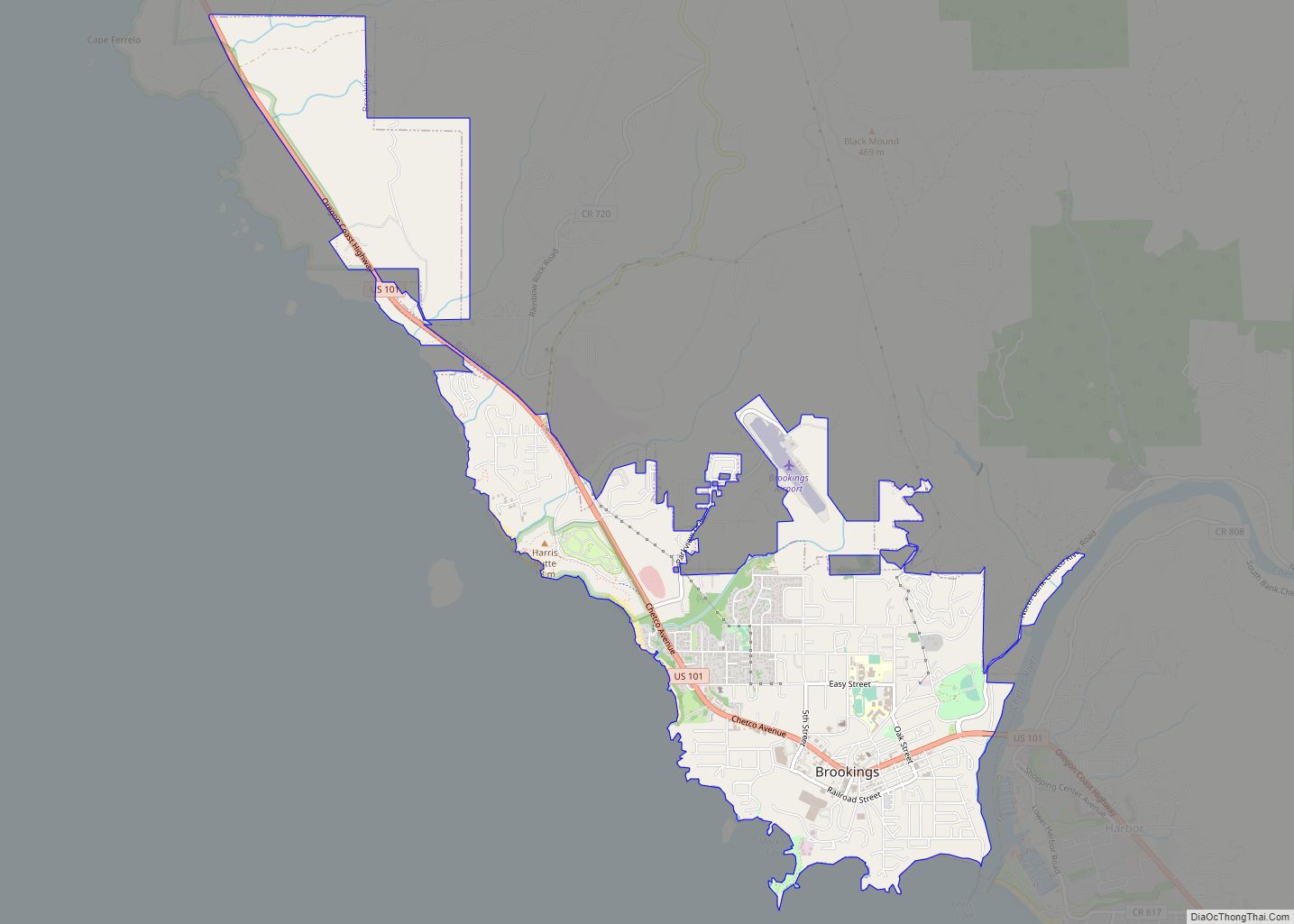
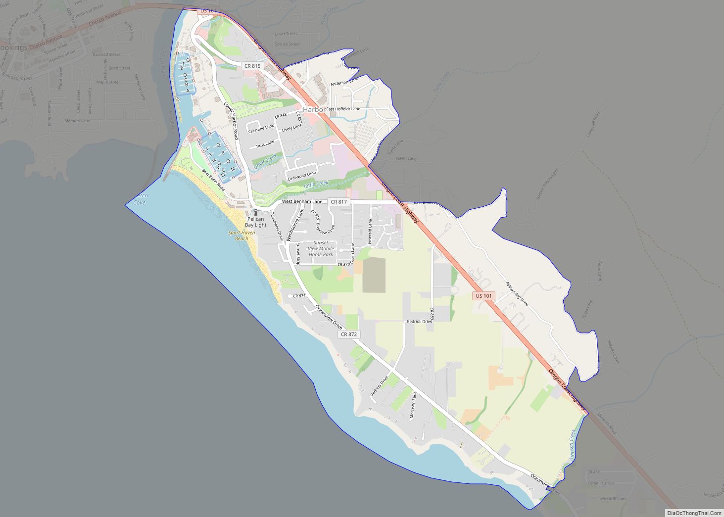
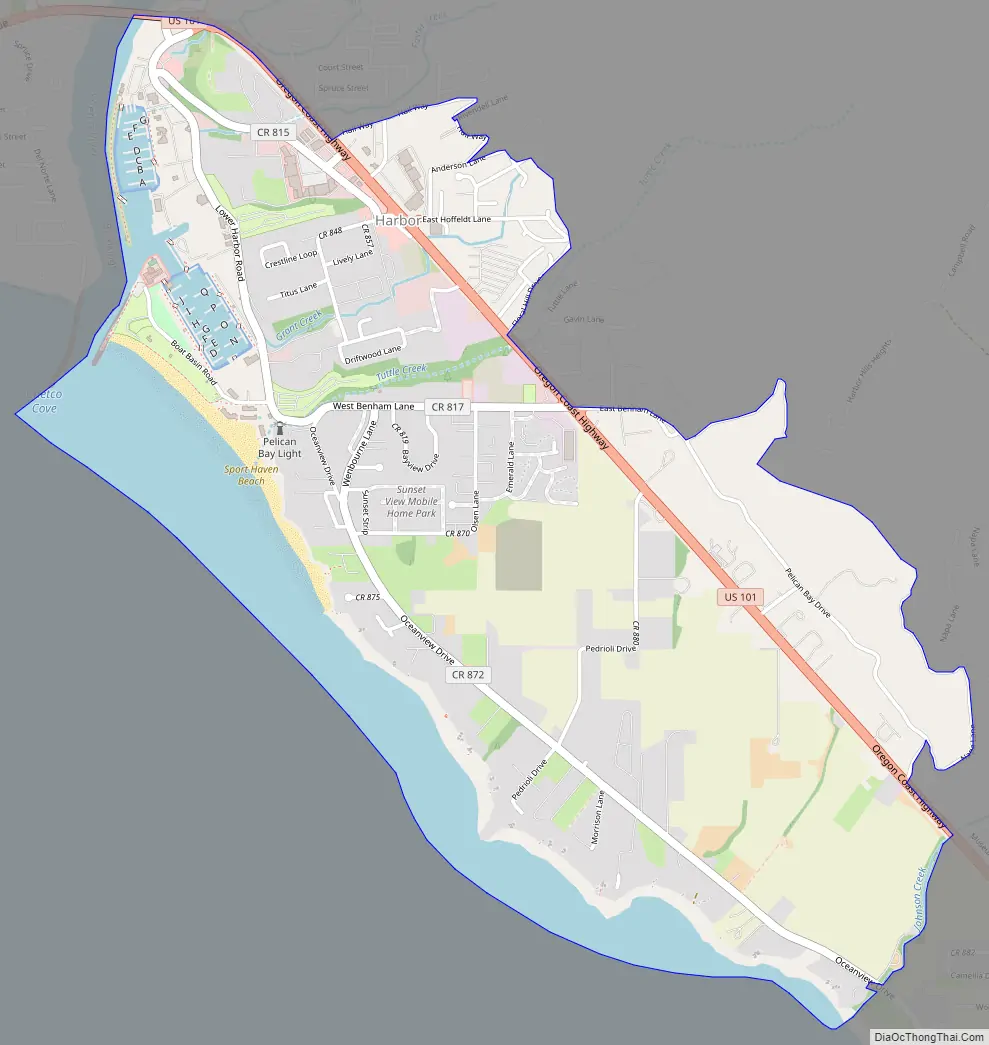
Harbor Road Map
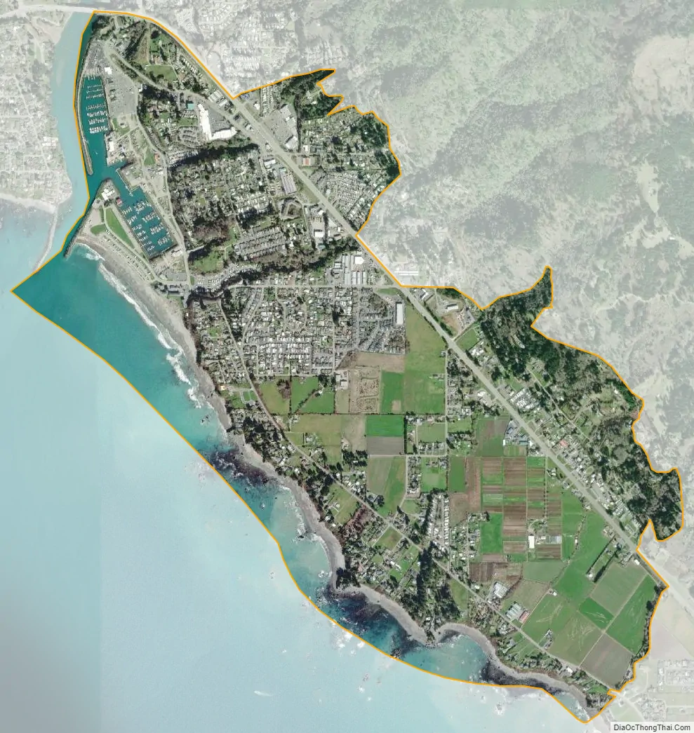
Harbor city Satellite Map
Geography
Harbor is located in southwestern Curry County along U.S. Route 101, 1 mile (1.6 km) east of the center of Brookings and 5 miles (8 km) north of the California state line. According to the United States Census Bureau, the CDP has a total area of 2.3 square miles (6.0 km), of which 1.9 square miles (5.0 km) is land and 0.39 square miles (1.0 km), or 16.88%, is water.
See also
Map of Oregon State and its subdivision: Map of other states:- Alabama
- Alaska
- Arizona
- Arkansas
- California
- Colorado
- Connecticut
- Delaware
- District of Columbia
- Florida
- Georgia
- Hawaii
- Idaho
- Illinois
- Indiana
- Iowa
- Kansas
- Kentucky
- Louisiana
- Maine
- Maryland
- Massachusetts
- Michigan
- Minnesota
- Mississippi
- Missouri
- Montana
- Nebraska
- Nevada
- New Hampshire
- New Jersey
- New Mexico
- New York
- North Carolina
- North Dakota
- Ohio
- Oklahoma
- Oregon
- Pennsylvania
- Rhode Island
- South Carolina
- South Dakota
- Tennessee
- Texas
- Utah
- Vermont
- Virginia
- Washington
- West Virginia
- Wisconsin
- Wyoming