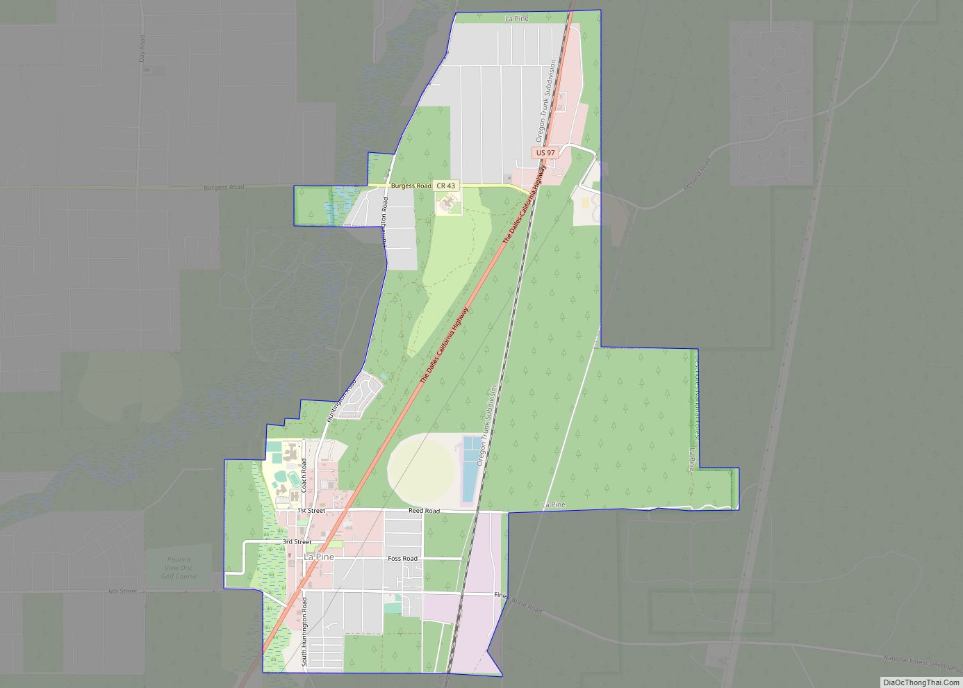
La Pine is a city in Deschutes County, Oregon, United States, incorporated on December 7, 2006.
La Pine is part of the Bend, Oregon Metropolitan Statistical Area. The population was 2,512 people as of the 2020 Census. La Pine is in an isolated area of Central Oregon, consisting of a loose collection of homes and businesses along U.S. Highway 97 about 30 miles (48 km) southwest of Bend. Several peaks of the Cascade Range are prominently visible from the community.
La Pine is in the valley of the Little Deschutes River, a tributary of the Deschutes River. The river provides recreational opportunities such as fishing, swimming, canoeing and other leisure activities.
| Name: | La Pine city |
|---|---|
| LSAD Code: | 25 |
| LSAD Description: | city (suffix) |
| State: | Oregon |
| County: | Deschutes County |
| Elevation: | 4,236 ft (1,291 m) |
| Total Area: | 7.14 sq mi (18.49 km²) |
| Land Area: | 7.14 sq mi (18.49 km²) |
| Water Area: | 0.00 sq mi (0.00 km²) |
| Total Population: | 2,512 |
| Population Density: | 351.92/sq mi (135.88/km²) |
| ZIP code: | 97739 |
| Area code: | 541 |
| FIPS code: | 4141050 |
| GNISfeature ID: | 1144724 |
| Website: | www.lapineoregon.gov |
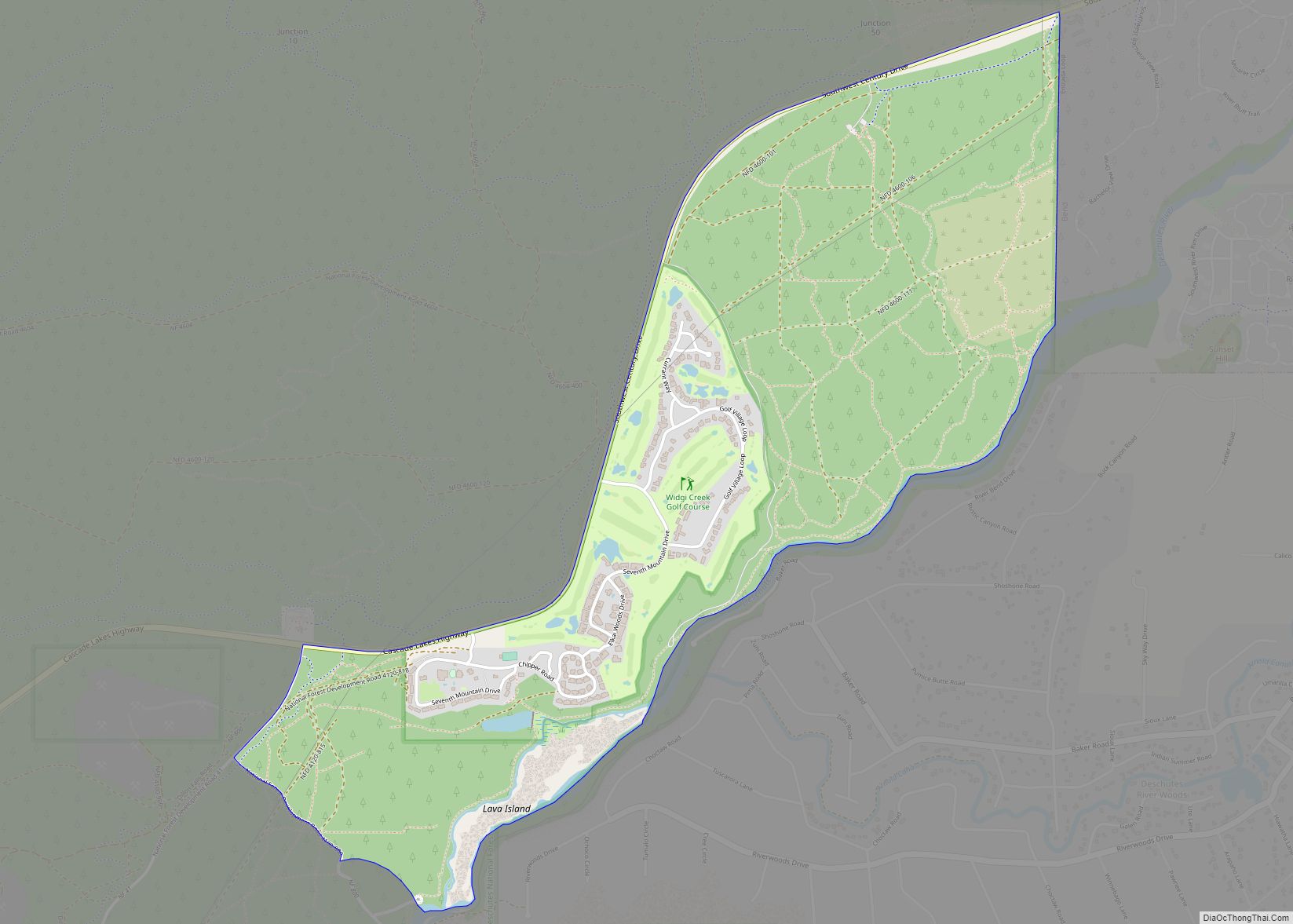
Online Interactive Map
Click on ![]() to view map in "full screen" mode.
to view map in "full screen" mode.
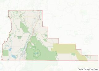
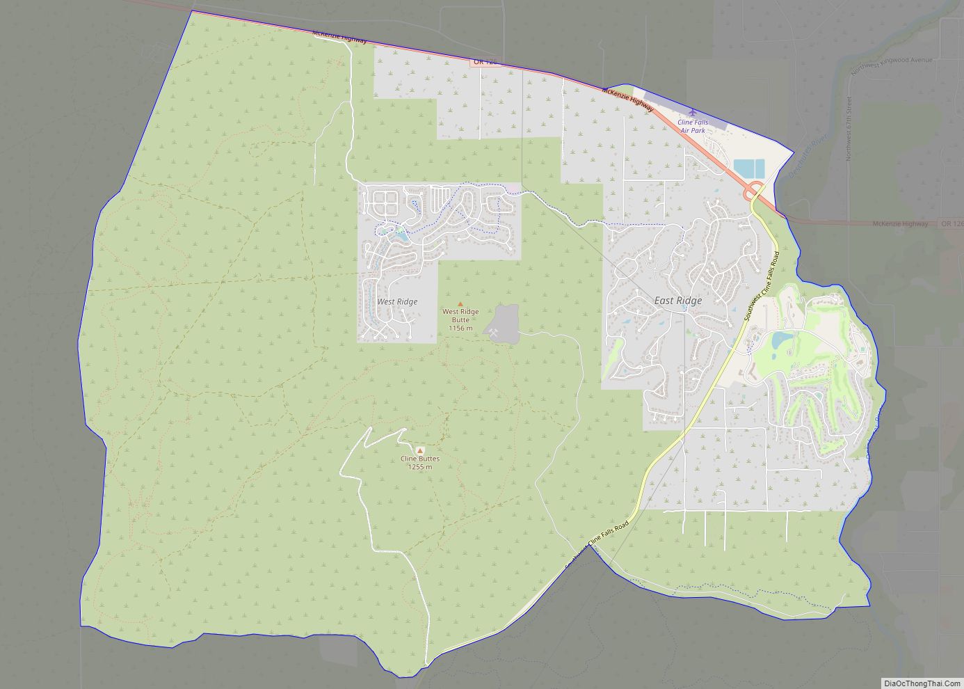
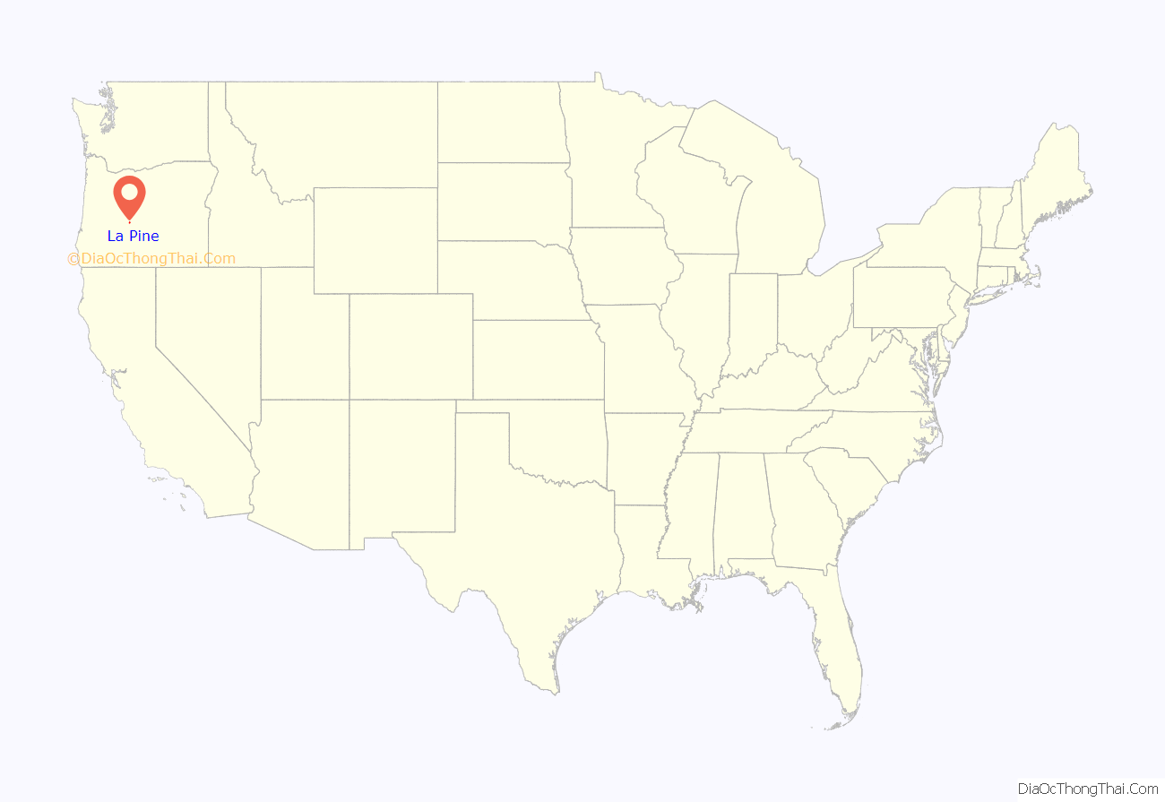
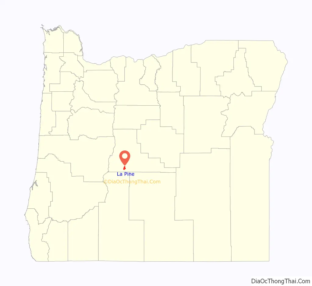
La Pine location map. Where is La Pine city?
History
The area was first settled by European-Americans in the 1800s by French fur trappers. La Pine was founded in the 19th century with Huntington Road as the main street. The original name for the community was Rosland. A post office by that name was started in 1897, followed by a townsite in 1900. Construction on the Oregon Trunk Railroad started in 1908 by the Spokane, Portland and Seattle Railway at the Columbia River. The route was designed to follow the Deschutes River, and the line later became part of BNSF Railway. The line was built to Bend, with the railroad later buying a line owned by the Shevlin-Hixon Lumber Company that continued to La Pine. What became U.S. 97 was completed in 1917, which used the right of way of the Oregon Trunk Line that had not been built south of Bend.
In 2000, a branch of the Deschutes Public Library was built in the community. La Pine had remained an unincorporated community for many years. A measure to incorporate in the 2000 elections was rejected by a 2–1 ratio. In the elections of 2006, another incorporation measure was placed on the ballot (one of two such measures in Oregon that year; the other being for Bull Mountain, Oregon). The La Pine measure passed, creating the City of La Pine. The city occupies 7 square miles (18 km), and at the time of incorporation in December 2006, had 1,585 residents. Much of the former census-designated area lies outside the city limits.
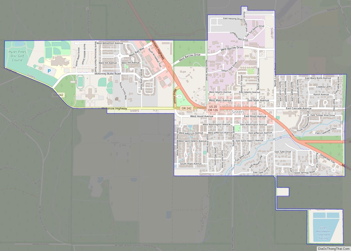
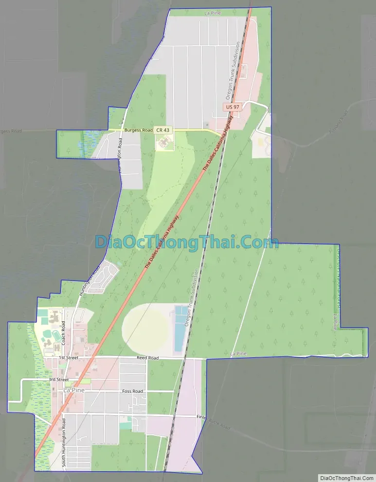
La Pine Road Map
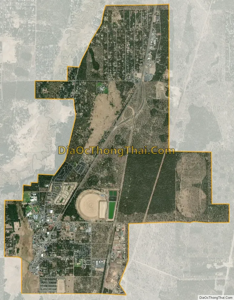
La Pine city Satellite Map
Geography
According to the United States Census Bureau, the city has a total area of 6.98 square miles (18.08 km), all of it land.
See also
Map of Oregon State and its subdivision: Map of other states:- Alabama
- Alaska
- Arizona
- Arkansas
- California
- Colorado
- Connecticut
- Delaware
- District of Columbia
- Florida
- Georgia
- Hawaii
- Idaho
- Illinois
- Indiana
- Iowa
- Kansas
- Kentucky
- Louisiana
- Maine
- Maryland
- Massachusetts
- Michigan
- Minnesota
- Mississippi
- Missouri
- Montana
- Nebraska
- Nevada
- New Hampshire
- New Jersey
- New Mexico
- New York
- North Carolina
- North Dakota
- Ohio
- Oklahoma
- Oregon
- Pennsylvania
- Rhode Island
- South Carolina
- South Dakota
- Tennessee
- Texas
- Utah
- Vermont
- Virginia
- Washington
- West Virginia
- Wisconsin
- Wyoming