Bull Mountain is an unincorporated community and census-designated place in Washington County, Oregon, United States. Bull Mountain is located mostly on a hill for which the community is named. It is bordered on the east by Tigard, on the south by King City, and Beaverton lies to the north. The north-eastern part of the Bull Mountain hill is now within the Tigard city limits, as the city has steadily annexed portions of the unincorporated region on its boundary. In 2010, the community became a census-designated place with a population of 9,133. Fire protection and EMS services are provided through Tualatin Valley Fire and Rescue.
| Name: | Bull Mountain CDP |
|---|---|
| LSAD Code: | 57 |
| LSAD Description: | CDP (suffix) |
| State: | Oregon |
| County: | Washington County |
| Total Area: | 1.98 sq mi (5.14 km²) |
| Land Area: | 1.98 sq mi (5.14 km²) |
| Water Area: | 0.00 sq mi (0.00 km²) |
| Total Population: | 9,992 |
| Population Density: | 5,036.29/sq mi (1,944.27/km²) |
| ZIP code: | 97223, 97224 |
| Area code: | 503 |
| FIPS code: | 4109535 |
Online Interactive Map
Click on ![]() to view map in "full screen" mode.
to view map in "full screen" mode.
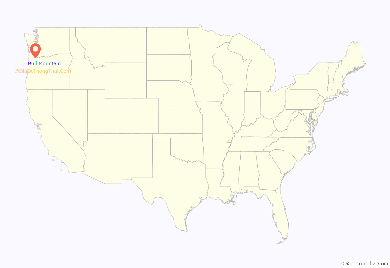
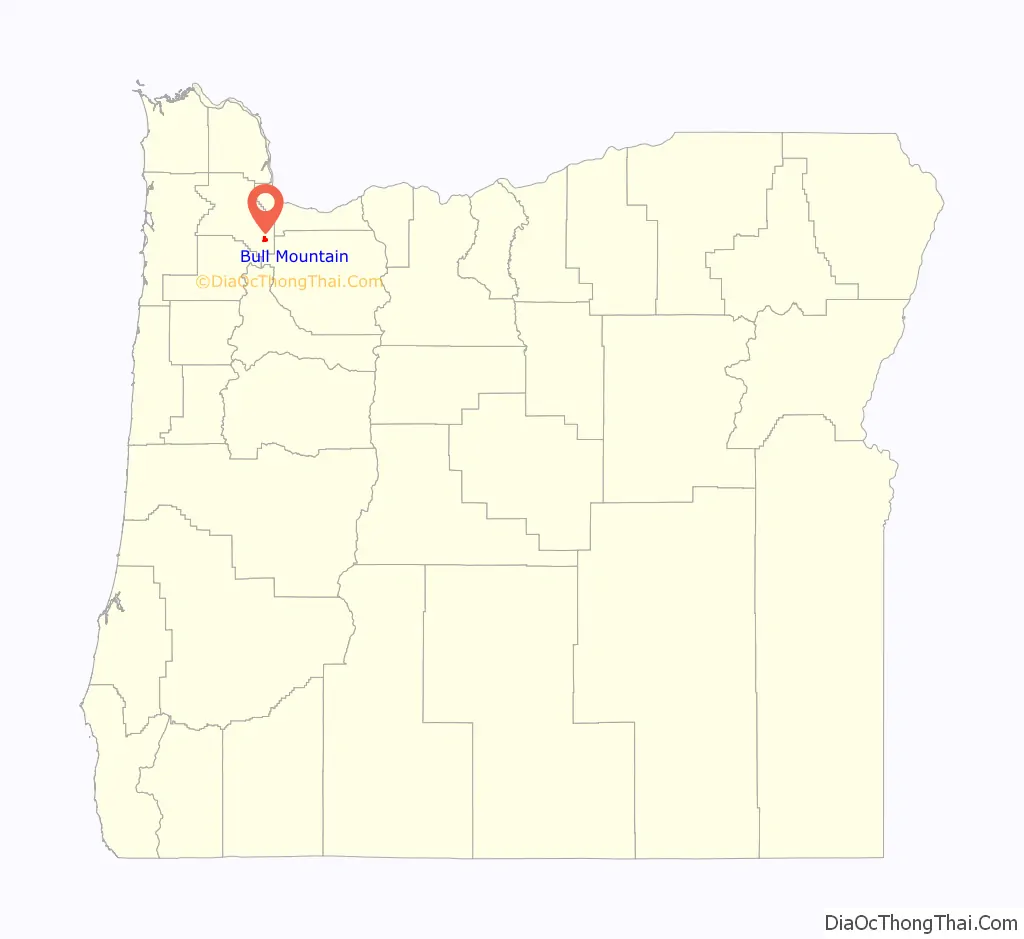
Bull Mountain location map. Where is Bull Mountain CDP?
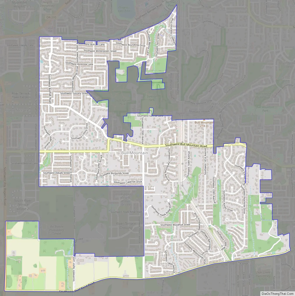
Bull Mountain Road Map
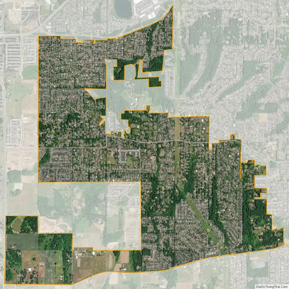
Bull Mountain city Satellite Map
See also
Map of Oregon State and its subdivision: Map of other states:- Alabama
- Alaska
- Arizona
- Arkansas
- California
- Colorado
- Connecticut
- Delaware
- District of Columbia
- Florida
- Georgia
- Hawaii
- Idaho
- Illinois
- Indiana
- Iowa
- Kansas
- Kentucky
- Louisiana
- Maine
- Maryland
- Massachusetts
- Michigan
- Minnesota
- Mississippi
- Missouri
- Montana
- Nebraska
- Nevada
- New Hampshire
- New Jersey
- New Mexico
- New York
- North Carolina
- North Dakota
- Ohio
- Oklahoma
- Oregon
- Pennsylvania
- Rhode Island
- South Carolina
- South Dakota
- Tennessee
- Texas
- Utah
- Vermont
- Virginia
- Washington
- West Virginia
- Wisconsin
- Wyoming