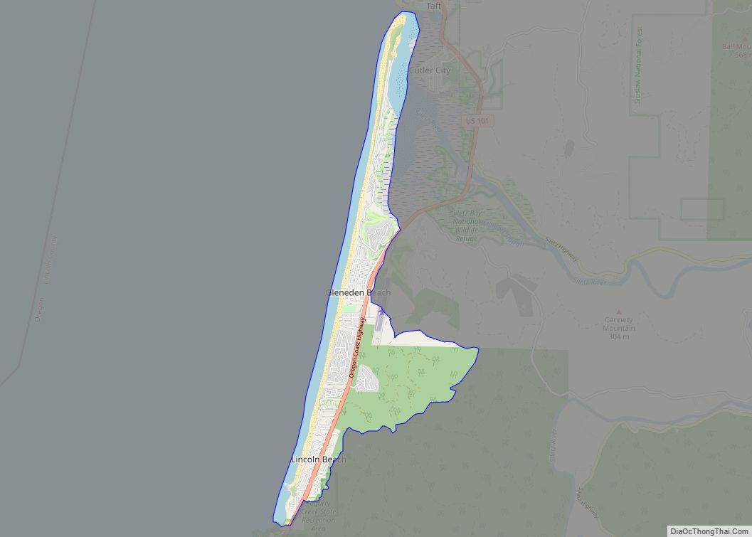
Lincoln Beach is a census-designated place (CDP) in Lincoln County, Oregon, United States. It includes the unincorporated communities of Lincoln Beach and Gleneden Beach. The total population was 2,045 at the 2010 census.
| Name: | Lincoln Beach CDP |
|---|---|
| LSAD Code: | 57 |
| LSAD Description: | CDP (suffix) |
| State: | Oregon |
| County: | Lincoln County |
| Elevation: | 46 ft (14 m) |
| Total Area: | 4.13 sq mi (10.68 km²) |
| Land Area: | 3.23 sq mi (8.37 km²) |
| Water Area: | 0.89 sq mi (2.31 km²) |
| Total Population: | 2,343 |
| Population Density: | 724.94/sq mi (279.93/km²) |
| ZIP code: | 97341 |
| Area code: | 458 and 541 |
| FIPS code: | 4142550 |
| GNISfeature ID: | 1136480 |
Online Interactive Map
Click on ![]() to view map in "full screen" mode.
to view map in "full screen" mode.
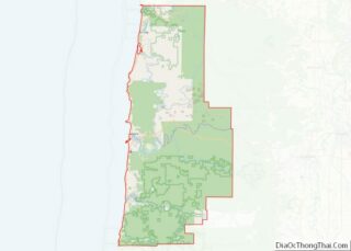
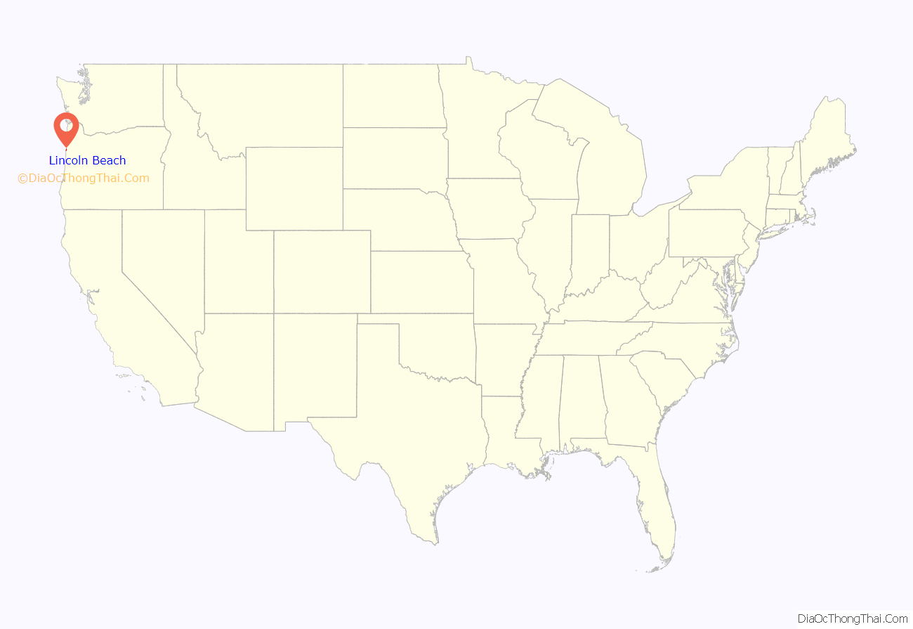
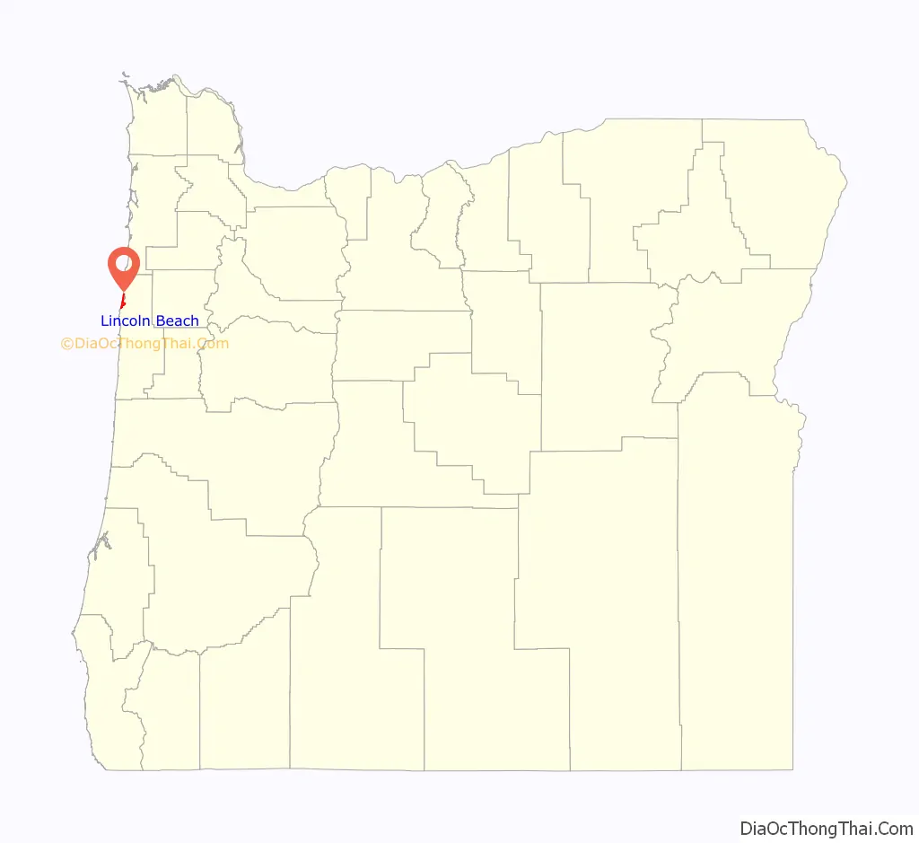
Lincoln Beach location map. Where is Lincoln Beach CDP?
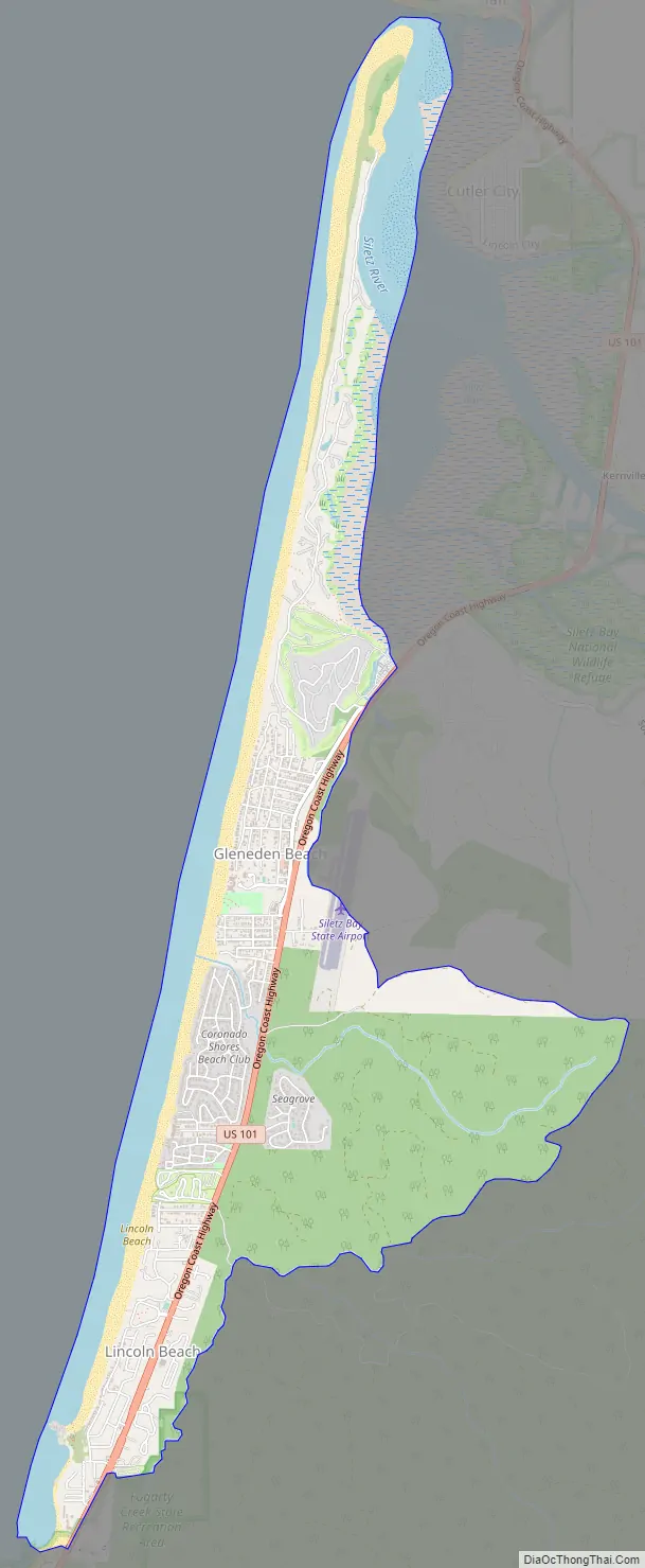
Lincoln Beach Road Map
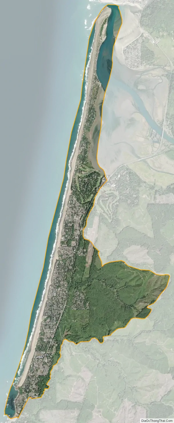
Lincoln Beach city Satellite Map
Geography
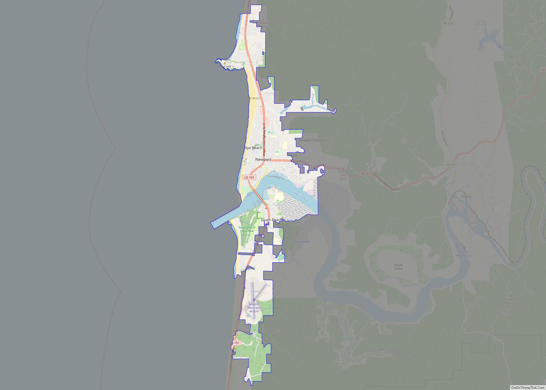
Lincoln Beach is located in northwestern Lincoln County at 44°52′20″N 124°02′12″W / 44.872092°N 124.036591°W / 44.872092; -124.036591, between Lincoln City to the north and Depoe Bay to the south. It is bordered to the west by the Pacific Ocean. Lincoln Beach proper is in the southern part of the CDP at 46 feet (14 m) above sea level, while Gleneden Beach is in the northern part of the CDP at an elevation of 40 feet (12 m). U.S. Route 101 runs through the CDP, leading north 8 miles (13 km) to the center of Lincoln City and south 17 miles (27 km) to Newport, the Lincoln county seat.
According to the United States Census Bureau, the CDP has a total area of 4.1 square miles (10.7 km), of which 3.2 square miles (8.4 km) are land and 0.89 square miles (2.3 km), or 21.6%, are water.
See also
Map of Oregon State and its subdivision: Map of other states:- Alabama
- Alaska
- Arizona
- Arkansas
- California
- Colorado
- Connecticut
- Delaware
- District of Columbia
- Florida
- Georgia
- Hawaii
- Idaho
- Illinois
- Indiana
- Iowa
- Kansas
- Kentucky
- Louisiana
- Maine
- Maryland
- Massachusetts
- Michigan
- Minnesota
- Mississippi
- Missouri
- Montana
- Nebraska
- Nevada
- New Hampshire
- New Jersey
- New Mexico
- New York
- North Carolina
- North Dakota
- Ohio
- Oklahoma
- Oregon
- Pennsylvania
- Rhode Island
- South Carolina
- South Dakota
- Tennessee
- Texas
- Utah
- Vermont
- Virginia
- Washington
- West Virginia
- Wisconsin
- Wyoming