Lostine is a city in Wallowa County, Oregon, United States. The population was 213 at the 2010 census.
| Name: | Lostine city |
|---|---|
| LSAD Code: | 25 |
| LSAD Description: | city (suffix) |
| State: | Oregon |
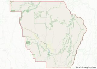
| County: | Wallowa County |
| Incorporated: | 1903; 120 years ago (1903) |
| Elevation: | 3,200 ft (1,000 m) |
| Total Area: | 0.29 sq mi (0.75 km²) |
| Land Area: | 0.29 sq mi (0.75 km²) |
| Water Area: | 0.00 sq mi (0.00 km²) |
| Total Population: | 241 |
| Population Density: | 836.81/sq mi (323.44/km²) |
| ZIP code: | 97857 |
| Area code: | 541 |
| FIPS code: | 4143900 |
| GNISfeature ID: | 1156652 |
| Website: | https://www.cityoflostine.com/ |
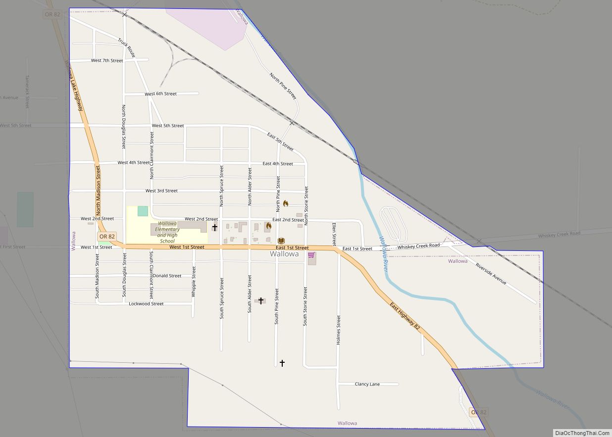
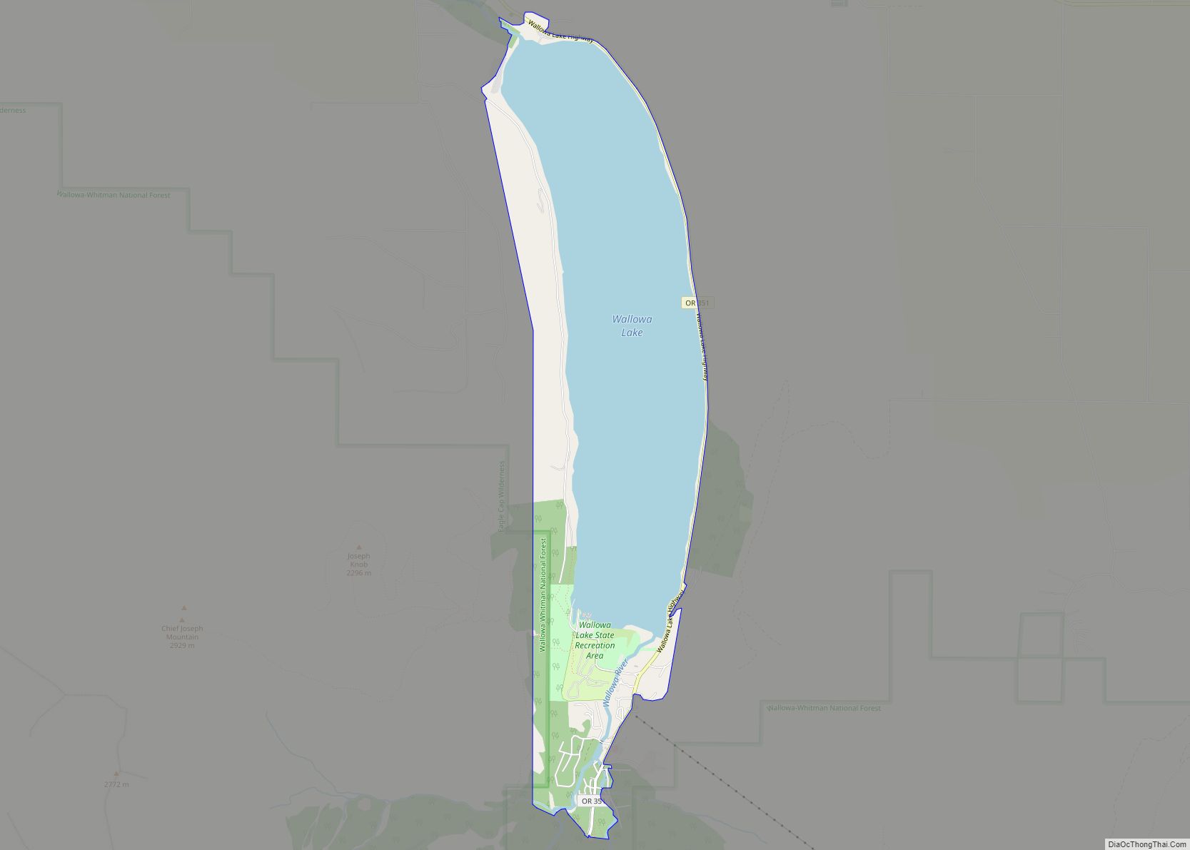
Online Interactive Map
Click on ![]() to view map in "full screen" mode.
to view map in "full screen" mode.
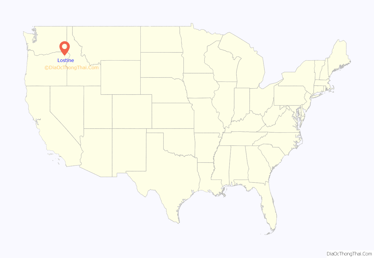
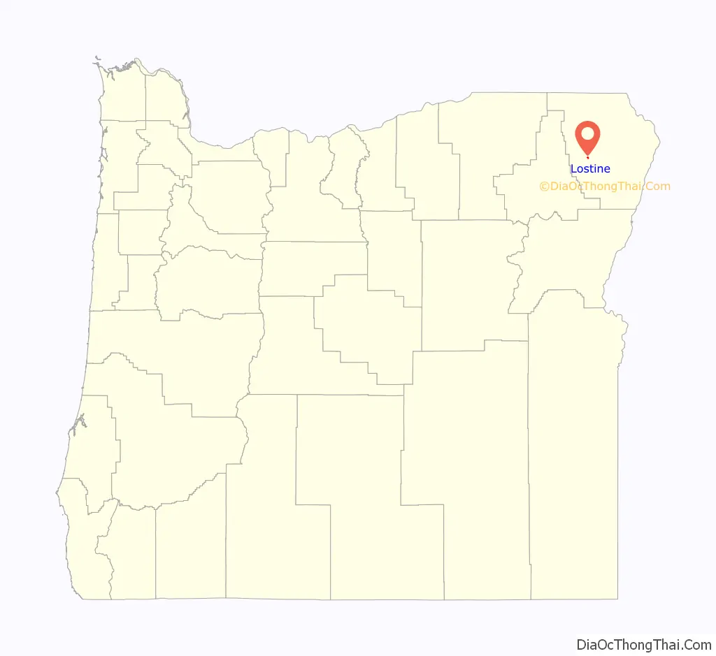
Lostine location map. Where is Lostine city?
History
Lostine was named after a place by the same name in Cherokee County, Kansas, that served as the site of a short-lived farmers’ post office in the 1870s. Lostine, Oregon, established a post office in August 1878; W.R. Laughlin was the first postmaster. Lostine was platted in 1884.
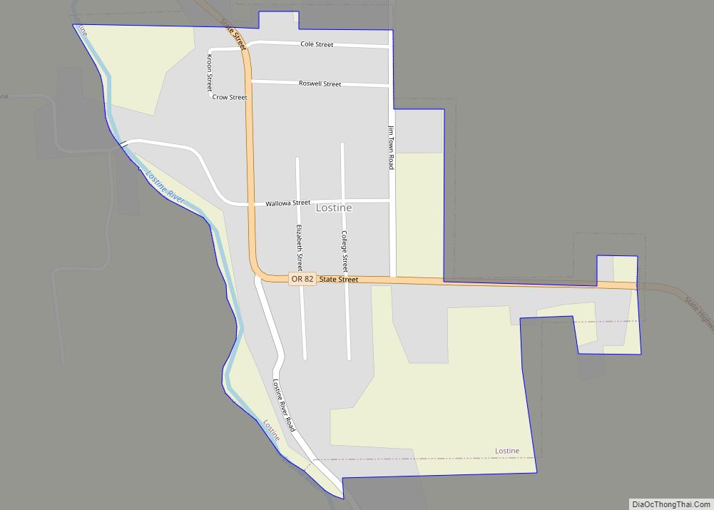
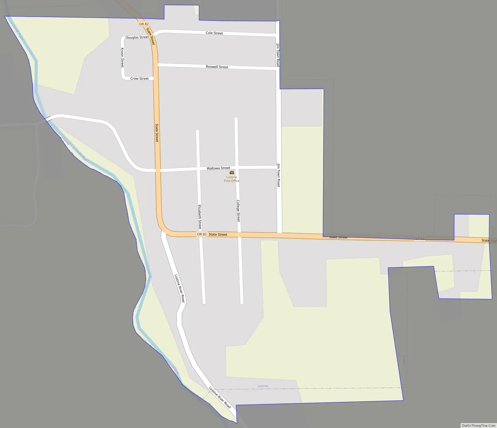
Lostine Road Map
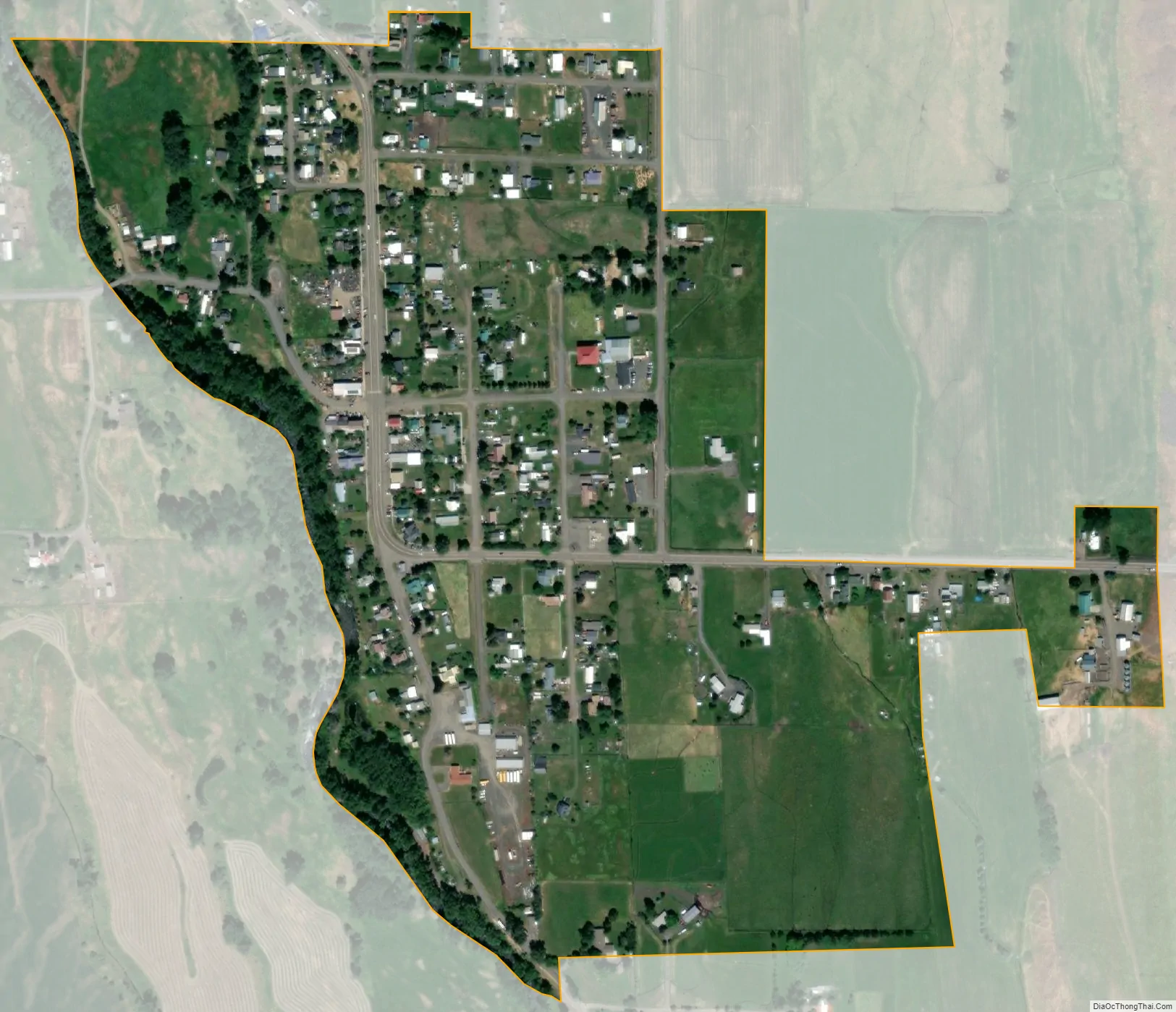
Lostine city Satellite Map
Geography
Lostine lies along Oregon Route 82 about halfway between Wallowa and Enterprise. Nearby is the Lostine River, a tributary of the Wallowa River, east of the Wallowa Mountains of northeastern Oregon.
According to the United States Census Bureau, the city has a total area of 0.30 square miles (0.78 km), all of it land.
Climate
This climatic region is typified by large seasonal temperature differences, with warm to hot (and often humid) summers and cold (sometimes severely cold) winters. According to the Köppen Climate Classification system, Lostine has a humid continental climate, abbreviated “Dfb” on climate maps.
See also
Map of Oregon State and its subdivision: Map of other states:- Alabama
- Alaska
- Arizona
- Arkansas
- California
- Colorado
- Connecticut
- Delaware
- District of Columbia
- Florida
- Georgia
- Hawaii
- Idaho
- Illinois
- Indiana
- Iowa
- Kansas
- Kentucky
- Louisiana
- Maine
- Maryland
- Massachusetts
- Michigan
- Minnesota
- Mississippi
- Missouri
- Montana
- Nebraska
- Nevada
- New Hampshire
- New Jersey
- New Mexico
- New York
- North Carolina
- North Dakota
- Ohio
- Oklahoma
- Oregon
- Pennsylvania
- Rhode Island
- South Carolina
- South Dakota
- Tennessee
- Texas
- Utah
- Vermont
- Virginia
- Washington
- West Virginia
- Wisconsin
- Wyoming