Metolius is a city in Jefferson County, Oregon, United States, named for the Metolius River, a nearby tributary of the Deschutes River. The name for both comes from the Warm Springs or Sahaptin word mitula, meaning white salmon and referring to a light colored Chinook salmon and not a whitefish. The population was 710 at the 2010 census.
| Name: | Metolius city |
|---|---|
| LSAD Code: | 25 |
| LSAD Description: | city (suffix) |
| State: | Oregon |
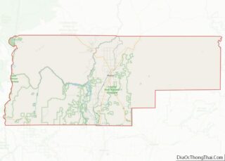
| County: | Jefferson County |
| Incorporated: | 1913 |
| Elevation: | 2,530 ft (771.1 m) |
| Total Area: | 0.48 sq mi (1.24 km²) |
| Land Area: | 0.48 sq mi (1.24 km²) |
| Water Area: | 0.00 sq mi (0.00 km²) |
| Total Population: | 978 |
| Population Density: | 2,046.03/sq mi (789.71/km²) |
| ZIP code: | 97741 |
| Area code: | 458 and 541 |
| FIPS code: | 4147750 |
| GNISfeature ID: | 1146116 |
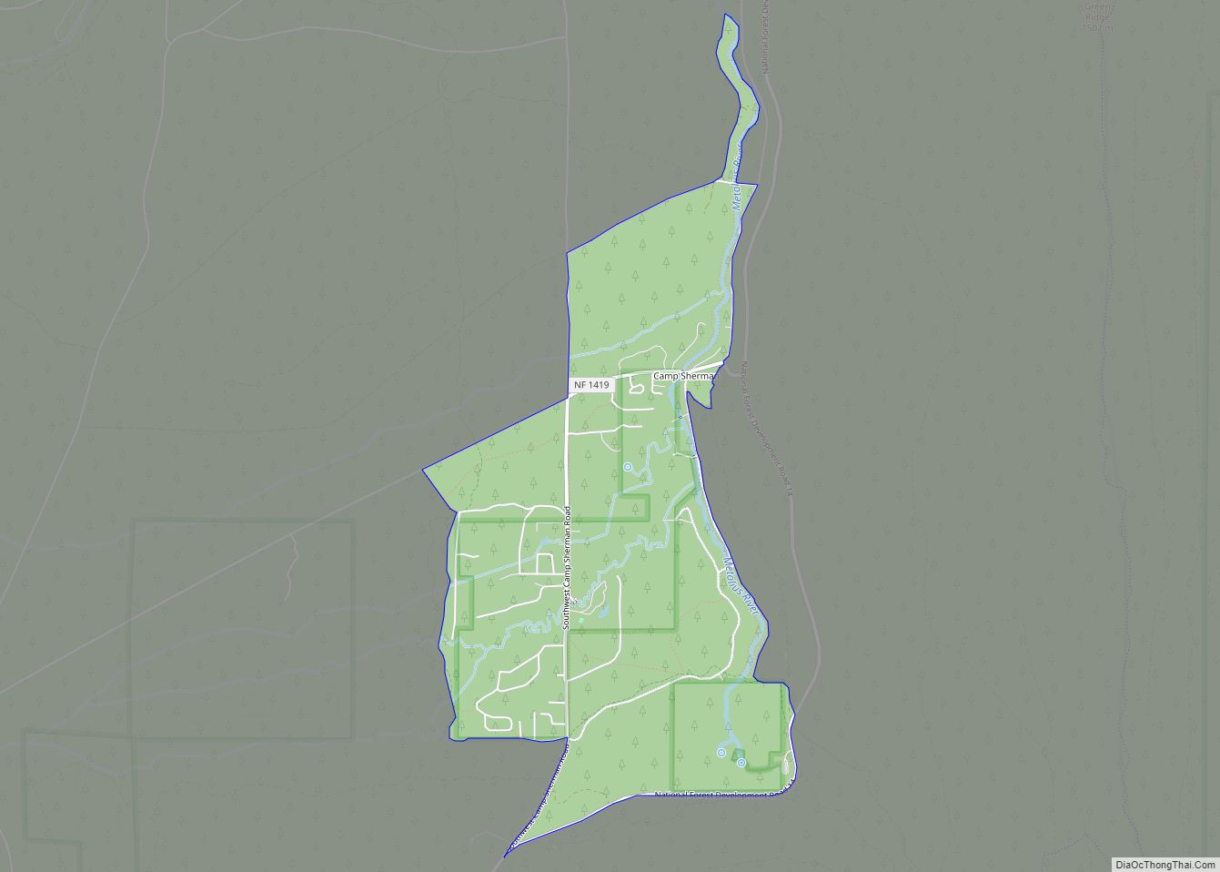
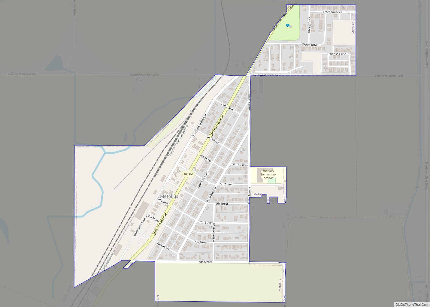
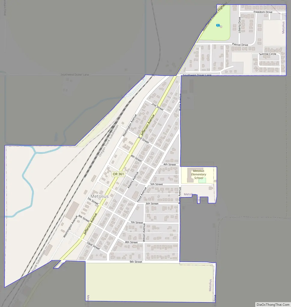
Online Interactive Map
Click on ![]() to view map in "full screen" mode.
to view map in "full screen" mode.
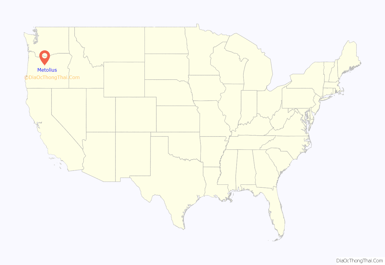
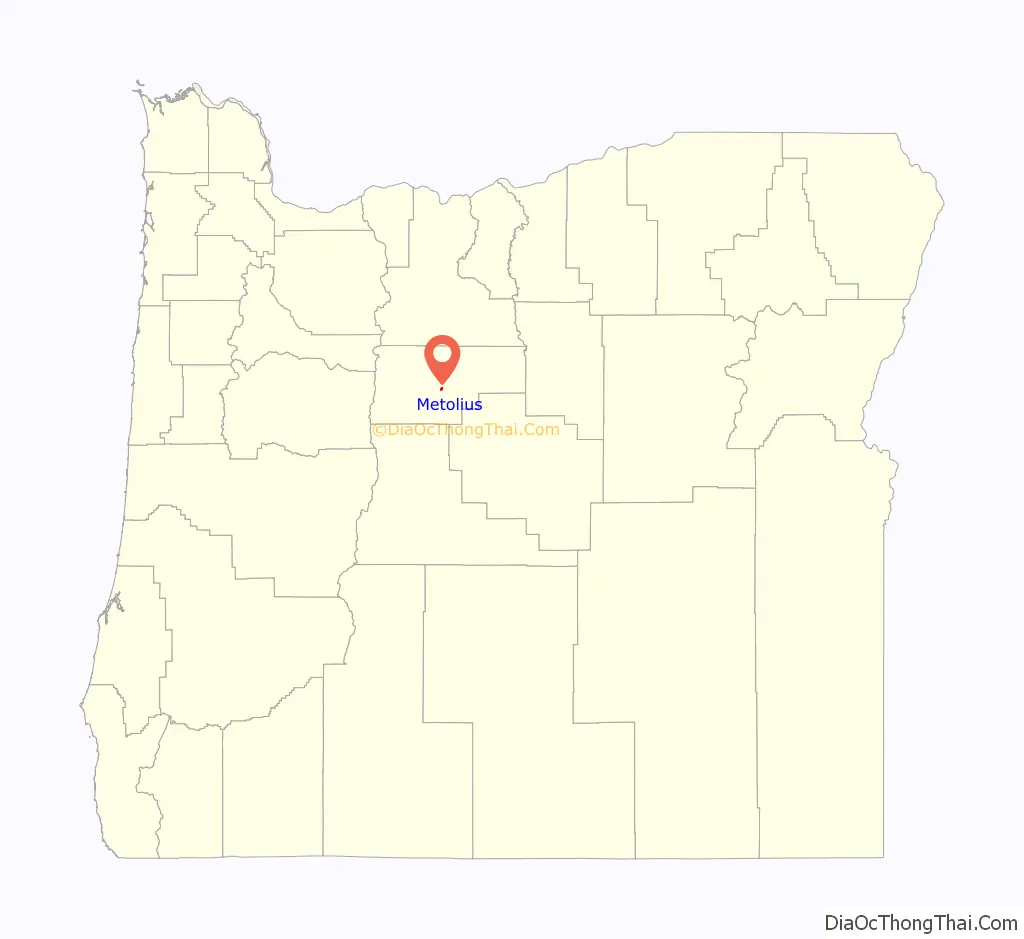
Metolius location map. Where is Metolius city?
History
Metolius was founded in the early 1900s. The earliest records are from 1903 and written in German.
In February 1911 the Oregon Trunk Railroad built a depot, turntable and roundhouse in the town. The railroad was connected to Bend, Oregon. Railroad engines at the time needed water at regular intervals, and Metolius was chosen as a servicing spot. Electricity was provided in 1912 from a small dam at the Cove. A high school and grade school were built in 1913. The town continued to prosper during the war years and by 1917, the population was over 1,700, and the town had two banks, two newspapers, a flour mill, hotels, general stores, hardware stores and a railroad maintenance hub.
As railroad technology improved, maintenance stations were required less frequently and the Metolius shop was eliminated. Without the railroad base, the population of Metolius went into decline. A major fire in the 1920s destroyed most of the downtown buildings. Drought from 1924 to 1926 bankrupted many farmers, and the Great Depression almost finished the town off. By 1945 the population was down to about 45 people.
Prior to the 1940s, only dry farming existed in the area. An irrigation project diverting water from the Deschutes River boosted farming output and the town began to grow again. Water from the Deschutes river reaches the area through an extensive canal system. Farmers were now able to grow large crops, mostly mint, potatoes and hay. By 1960 over 3,000 railroad cars of fresh potatoes were loaded each year from the area. Four giant packing sheds stored fresh packed potatoes and delivered them onto railroad cars. A frozen French fry factory employed many workers year round. In 1968 a potato blight of nematodes ended large-scale potato production in the area. In 1973 the railroad closed its depot in Metolius. By 1990 almost all mint production had ended due to root rot. As of 2007, most agricultural production around Metolius is marginal.
In 1950 Metolius Elementary began to grow out of the 1913 high school building with a new gym and two classrooms. Four more classrooms were built in 1955 to teach the children of the influx of agricultural workers and construction workers building the three dams on the Deschutes River. In around 1963 the old high school was destroyed and the elementary was again expanded to include an office, a library and two more classrooms. Its last expansion occurred in 2000 with the addition of six new classrooms and a large modern library.
The first Spanish-speaking families began to settle in Metolius in the 1950s, drawn by field work hoeing, irrigating and harvesting as well as working in the potato sheds. Non-union mills converting scrap wood from lumber operations hired many more Spanish-speaking workers from Mexico. Now over 50% of the students at Metolius Elementary speak Spanish at home.
Around 1970, a fire in the city’s Post Office led to the end of the ZIP code for the community, which thereafter shared the ZIP code of nearby Madras. However, in late 2003, city leaders enlisted the help of U.S. Representative Greg Walden to reclaim the code. Despite several attempts to start businesses, Metolius serves mainly as a bedroom community for Madras and other larger towns up to 40 miles (64 km) away. A prison is being built in Madras, and new homes are being built for its workers.
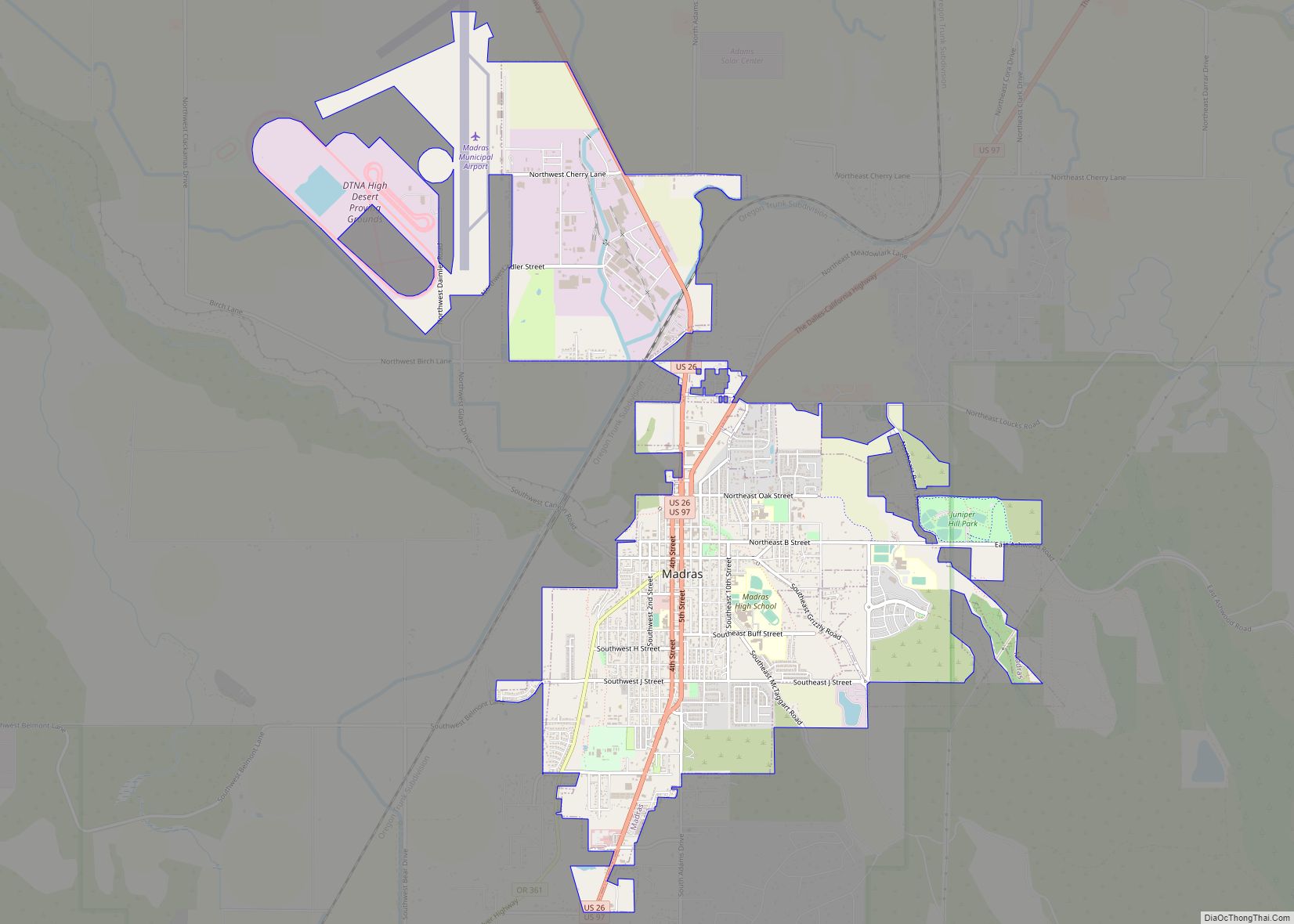
Metolius Road Map
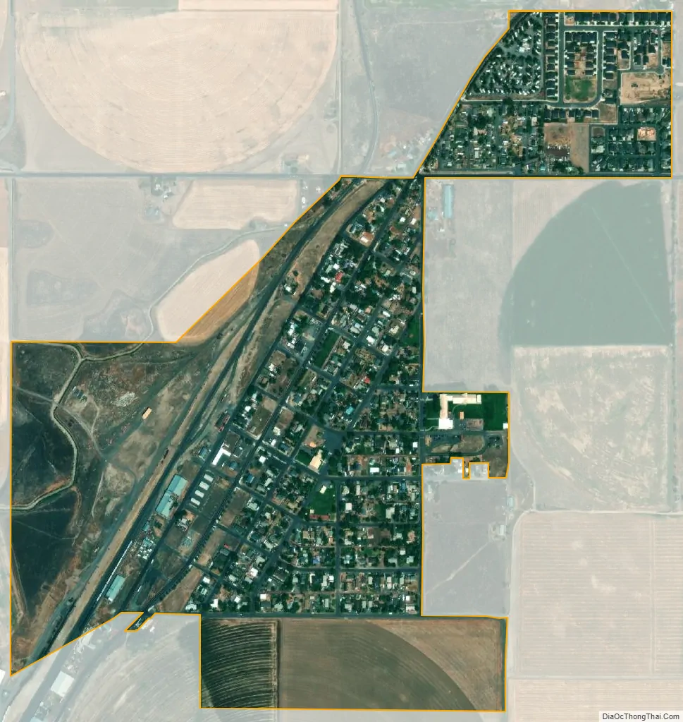
Metolius city Satellite Map
Geography
According to the United States Census Bureau, the city has a total area of 0.48 square miles (1.24 km), all land.
Climate
This region experiences warm and dry summers, with no average monthly temperatures above 71.6 °F (22.0 °C). According to the Köppen Climate Classification system, Metolius has a warm-summer Mediterranean climate, abbreviated “Csb” on climate maps.
See also
Map of Oregon State and its subdivision: Map of other states:- Alabama
- Alaska
- Arizona
- Arkansas
- California
- Colorado
- Connecticut
- Delaware
- District of Columbia
- Florida
- Georgia
- Hawaii
- Idaho
- Illinois
- Indiana
- Iowa
- Kansas
- Kentucky
- Louisiana
- Maine
- Maryland
- Massachusetts
- Michigan
- Minnesota
- Mississippi
- Missouri
- Montana
- Nebraska
- Nevada
- New Hampshire
- New Jersey
- New Mexico
- New York
- North Carolina
- North Dakota
- Ohio
- Oklahoma
- Oregon
- Pennsylvania
- Rhode Island
- South Carolina
- South Dakota
- Tennessee
- Texas
- Utah
- Vermont
- Virginia
- Washington
- West Virginia
- Wisconsin
- Wyoming