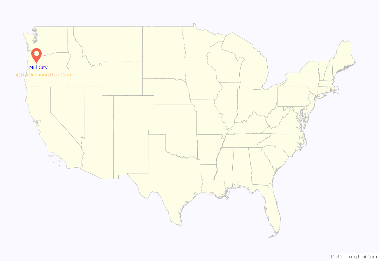
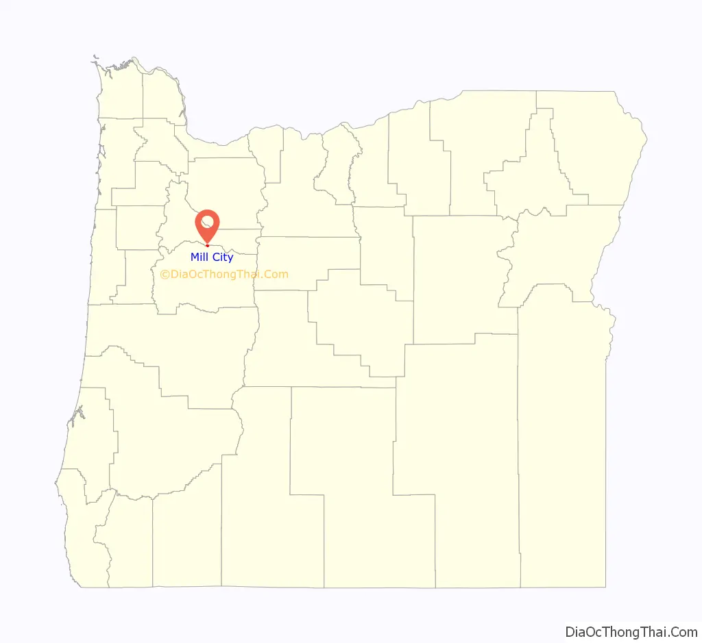
Mill City is a city in Linn and Marion counties in the U.S. state of Oregon on Oregon Route 22. The population was 1,971 at the 2020 census. It is on the North Santiam River, downstream from Detroit Lake.
The Linn County portion of Mill City is part of the Albany–Lebanon Micropolitan Statistical Area, while the Marion County portion is part of the Salem Metropolitan Statistical Area. The City of Mill City contracts through The Linn County Sheriff’s Office for local law enforcement, however does have its own Mill City Fire Department and other public works departments.
In September 2020, Mill City suffered extensive damage from the Santiam Fire.
| Name: | Mill City city |
|---|---|
| LSAD Code: | 25 |
| LSAD Description: | city (suffix) |
| State: | Oregon |
| County: | Linn County, Marion County |
| Incorporated: | 1947 |
| Elevation: | 832 ft (253.6 m) |
| Total Area: | 0.90 sq mi (2.33 km²) |
| Land Area: | 0.90 sq mi (2.33 km²) |
| Water Area: | 0.00 sq mi (0.00 km²) |
| Total Population: | 1,971 |
| Population Density: | 2,187.57/sq mi (844.29/km²) |
| ZIP code: | 97360 |
| Area code: | 503 and 971 |
| FIPS code: | 4148150 |
| GNISfeature ID: | 1124148 |
| Website: | www.mill-city.or.us |
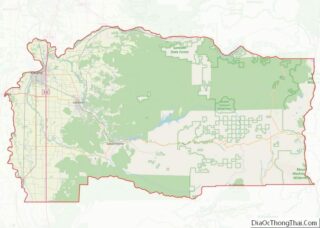
Online Interactive Map
Click on ![]() to view map in "full screen" mode.
to view map in "full screen" mode.
Mill City location map. Where is Mill City city?
History
The city was incorporated in 1941, and serves as the education hub of the Santiam Canyon. It was named and known for its various lumber mills, including Hammond Lumber Company and Santiam Lumber Company. Mill City is now home to two lumber mills, Frank Lumber Co. and Freres Lumber plant 3.
One of the oldest and well known landmarks in Mill City is the former railroad bridge, now a pedestrian bridge. The Phoenix Column Bridge, built by Phoenix Iron Works, was manufactured in 1888, moved to San Jose, California, then to Lake Oswego, Oregon, then to Mill City and installed in 1919. Abandoned by Southern Pacific Railroad around 1967, it is now a pedestrian and bike bridge. Current restoration efforts are being undertaken by the Save our Bridge Foundation.
In September 2020, the Beachie Creek Fire swept through the town. Mill City suffered heavy damage from the fire.
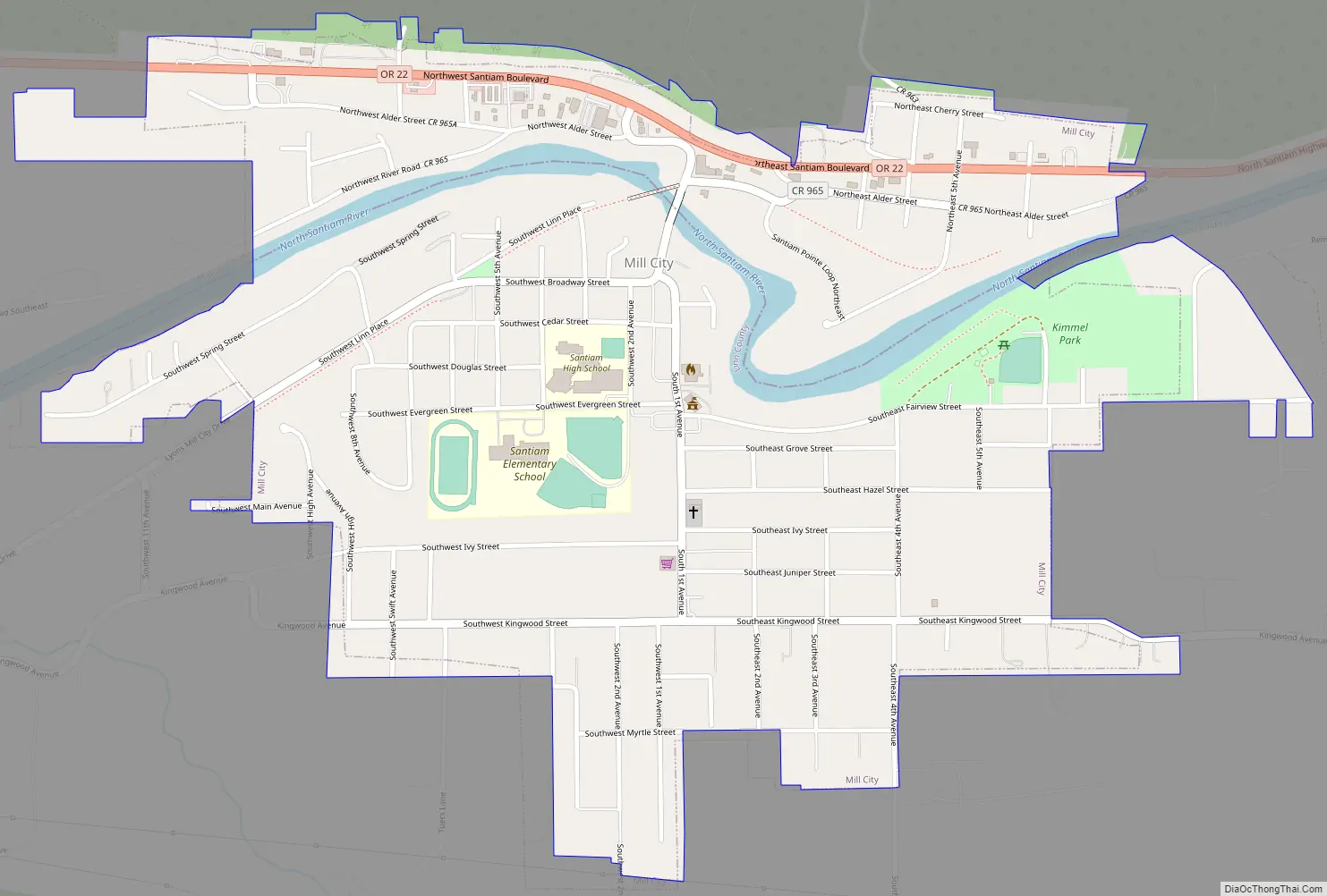
Mill City Road Map
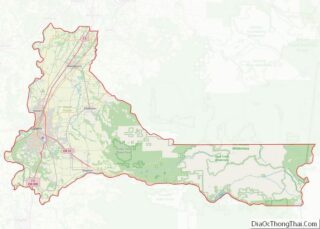
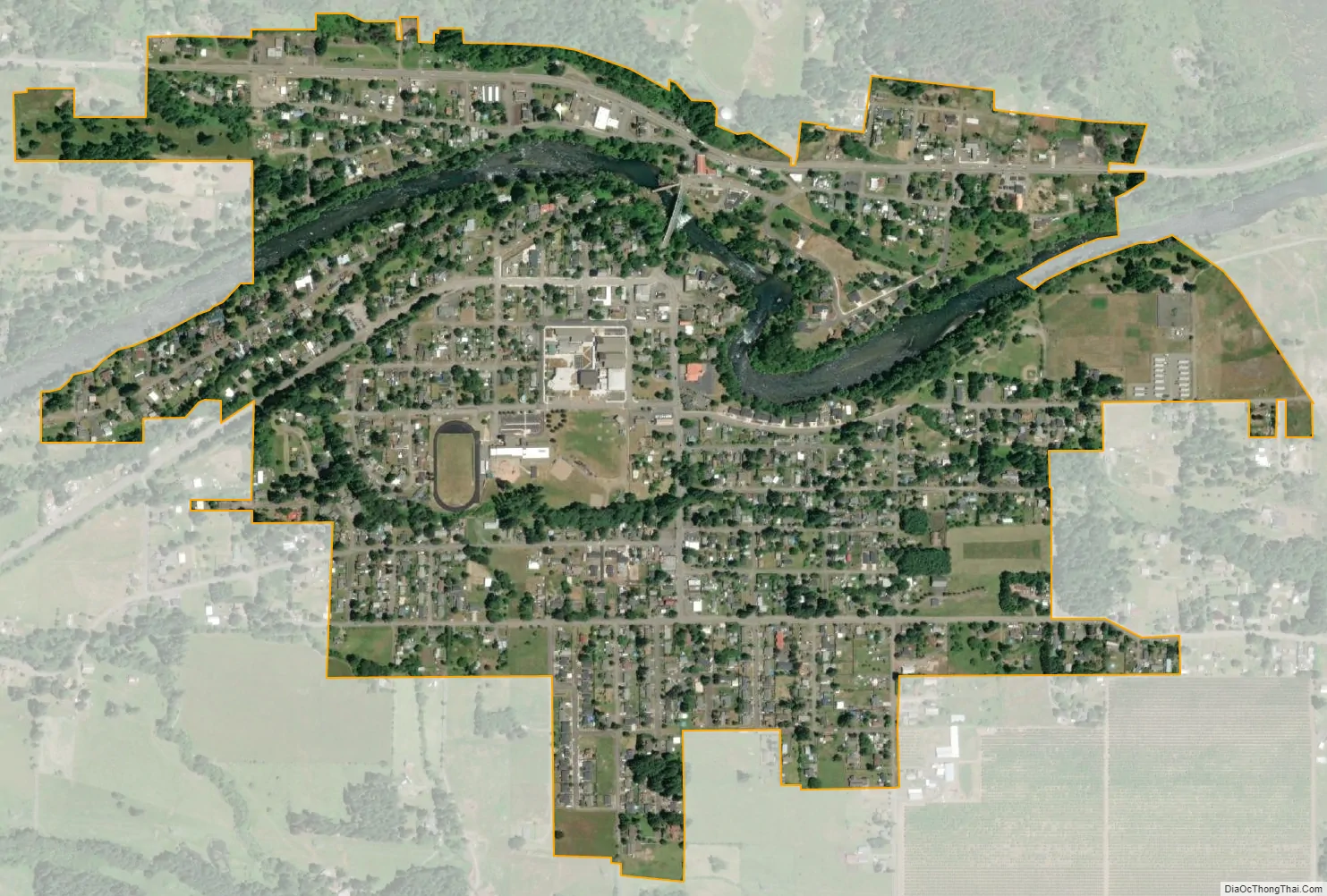
Mill City city Satellite Map
Geography
Mill City is located at 832 feet above sea level in the Santiam Canyon and considered part of the foothills of the Cascade Range. Shaped by the North Santiam River, the canyon is a result of seasonal glacier melts from the southern face of Mt. Jefferson to the east and many tributaries scattered along the canyon, the largest being the Breitenbush River which meets the Santiam in Detroit, roughly 30 miles (48 km) east of Mill City. The looming canyon walls are the most noticeable feature in passing from Highway 22; however, look more like tall hills on the north and south sides of Mill City. Further into town two bridges allow crossing of the North Santiam River.
Mill City is surrounded by forests of evergreen trees. Most notably the Santiam State Forest to the south, forest land is otherwise privately owned, mostly by Weyerhaeuser but also local companies like Frank Lumber and Freres. Douglas fir mostly dominates the forests, but junipers and maple trees are also scattered throughout.
According to the United States Census Bureau, the city has a total area of 0.83 square miles (2.15 km), all land.
See also
Map of Oregon State and its subdivision: Map of other states:- Alabama
- Alaska
- Arizona
- Arkansas
- California
- Colorado
- Connecticut
- Delaware
- District of Columbia
- Florida
- Georgia
- Hawaii
- Idaho
- Illinois
- Indiana
- Iowa
- Kansas
- Kentucky
- Louisiana
- Maine
- Maryland
- Massachusetts
- Michigan
- Minnesota
- Mississippi
- Missouri
- Montana
- Nebraska
- Nevada
- New Hampshire
- New Jersey
- New Mexico
- New York
- North Carolina
- North Dakota
- Ohio
- Oklahoma
- Oregon
- Pennsylvania
- Rhode Island
- South Carolina
- South Dakota
- Tennessee
- Texas
- Utah
- Vermont
- Virginia
- Washington
- West Virginia
- Wisconsin
- Wyoming