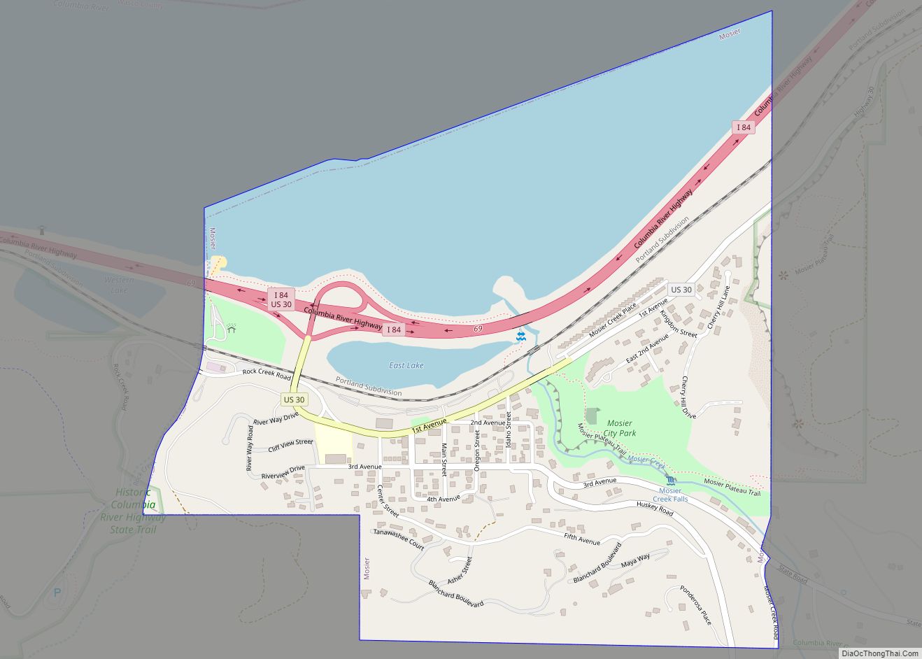
Mosier is a city along the Columbia River in Wasco County, Oregon, United States. The population was 433 at the 2010 census.
| Name: | Mosier city |
|---|---|
| LSAD Code: | 25 |
| LSAD Description: | city (suffix) |
| State: | Oregon |
| County: | Wasco County |
| Incorporated: | 1914 |
| Elevation: | 164 ft (50 m) |
| Total Area: | 0.63 sq mi (1.64 km²) |
| Land Area: | 0.46 sq mi (1.18 km²) |
| Water Area: | 0.18 sq mi (0.46 km²) |
| Total Population: | 468 |
| Population Density: | 1,026.32/sq mi (396.12/km²) |
| ZIP code: | 97040 |
| Area code: | 541 |
| FIPS code: | 4150050 |
| GNISfeature ID: | 1124382 |
| Website: | www.cityofmosier.com |
Online Interactive Map
Click on ![]() to view map in "full screen" mode.
to view map in "full screen" mode.
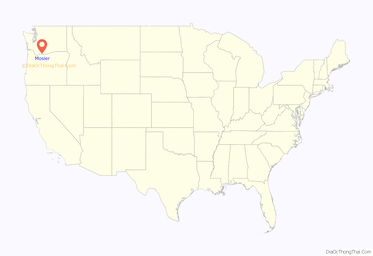
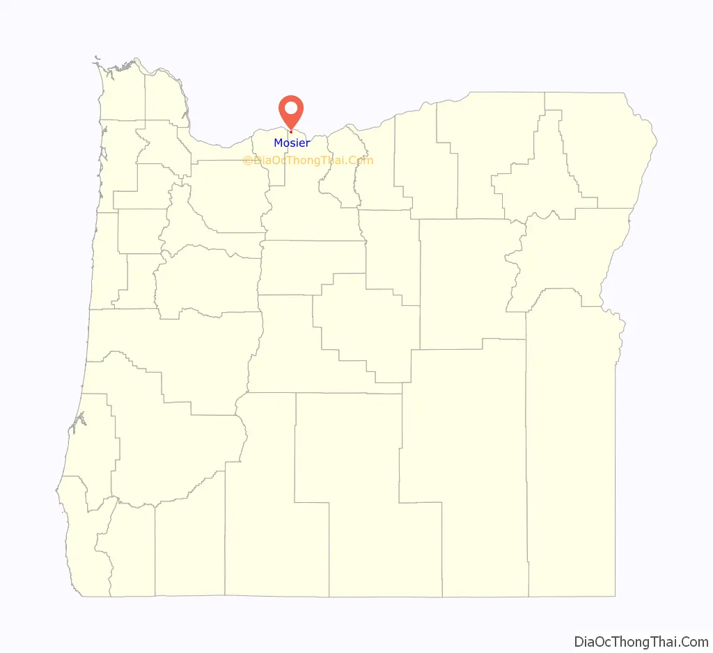
Mosier location map. Where is Mosier city?
History
Mosier was first settled in 1854 and incorporated as a city in 1914. The building now known as the post office was at that time the bank, and the original safe is still intact on-site. Mosier School was built in 1920 and until 1963 was a 1st–12th grade 1A school. From 1964 to 2002 it functioned as part of the Chenowith School District as an elementary school that ranged from kindergarten to fifth grade. In January 2003, the Chenowith School District approved the charter application for Mosier Elementary to become a charter school known as Mosier Community School.
On June 3, 2016, a 96-car oil train derailed near Mosier. 11 cars derailed and at least one caught on fire, only 20 feet away from the city’s sewage treatment facility.
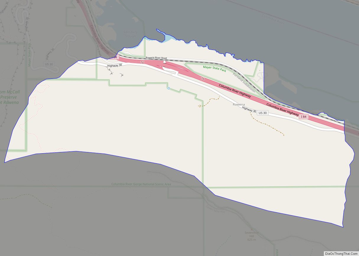
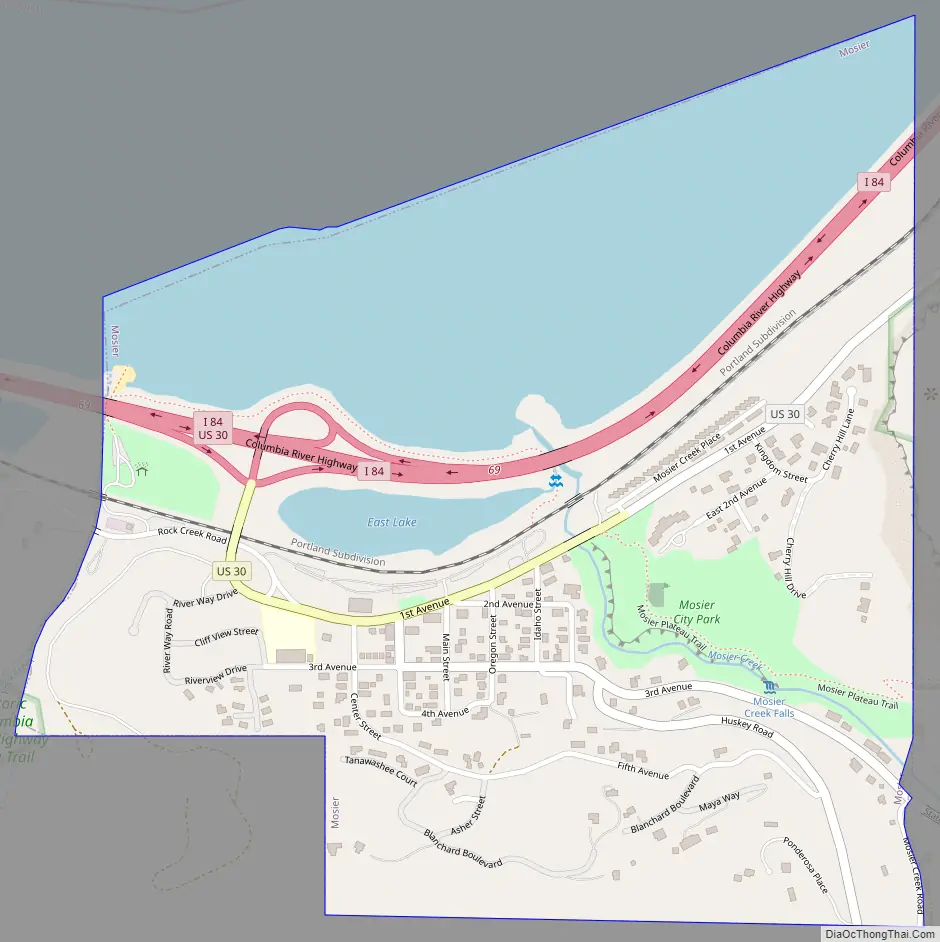
Mosier Road Map
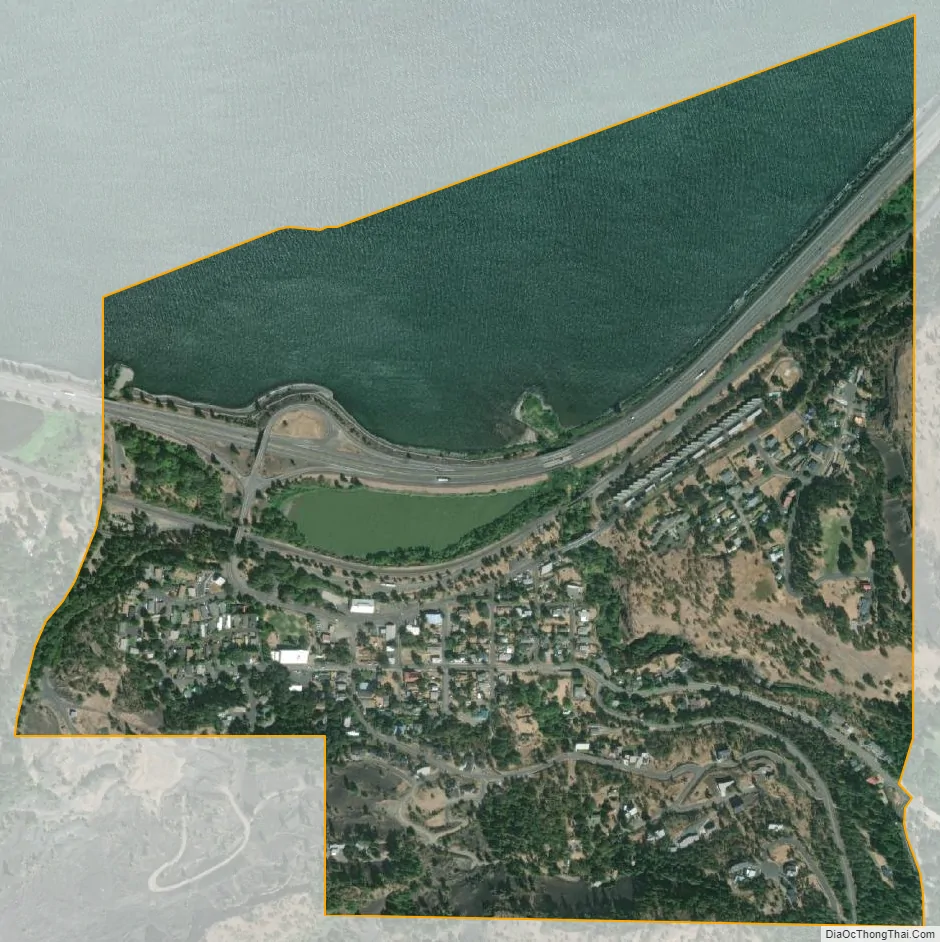
Mosier city Satellite Map
Geography
According to the United States Census Bureau, the city has a total area of 0.64 square miles (1.66 km), of which, 0.47 square miles (1.22 km) is land and 0.17 square miles (0.44 km) is water.
Eighteenmile Island is located a half-mile downstream of the city in the Columbia River.
Climate
This region experiences warm (but not hot) and dry summers, with no average monthly temperatures above 71.6 °F. According to the Köppen Climate Classification system, Mosier has a warm-summer Mediterranean climate, abbreviated “Csb” on climate maps.
See also
Map of Oregon State and its subdivision: Map of other states:- Alabama
- Alaska
- Arizona
- Arkansas
- California
- Colorado
- Connecticut
- Delaware
- District of Columbia
- Florida
- Georgia
- Hawaii
- Idaho
- Illinois
- Indiana
- Iowa
- Kansas
- Kentucky
- Louisiana
- Maine
- Maryland
- Massachusetts
- Michigan
- Minnesota
- Mississippi
- Missouri
- Montana
- Nebraska
- Nevada
- New Hampshire
- New Jersey
- New Mexico
- New York
- North Carolina
- North Dakota
- Ohio
- Oklahoma
- Oregon
- Pennsylvania
- Rhode Island
- South Carolina
- South Dakota
- Tennessee
- Texas
- Utah
- Vermont
- Virginia
- Washington
- West Virginia
- Wisconsin
- Wyoming