Prineville is a city in and the seat of Crook County, Oregon, United States. It was named for the first merchant located in the present location, Barney Prine. The population was 9,253 at the 2010 census.
| Name: | Prineville city |
|---|---|
| LSAD Code: | 25 |
| LSAD Description: | city (suffix) |
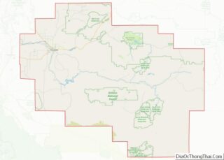
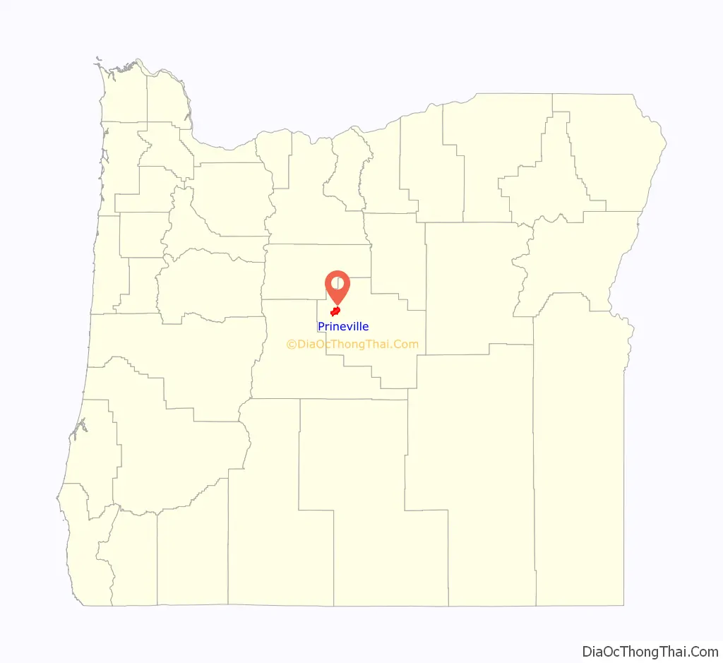
| State: | Oregon |
| County: | Crook County |
| Incorporated: | 1880 |
| Elevation: | 2,868 ft (874.2 m) |
| Total Area: | 12.83 sq mi (33.23 km²) |
| Land Area: | 12.83 sq mi (33.23 km²) |
| Water Area: | 0.00 sq mi (0.00 km²) |
| Total Population: | 10,736 |
| Population Density: | 836.79/sq mi (323.07/km²) |
| ZIP code: | 97754 |
| Area code: | 541 |
| FIPS code: | 4159850 |
| GNISfeature ID: | 1154317 |
| Website: | www.cityofprineville.com |
Online Interactive Map
Click on ![]() to view map in "full screen" mode.
to view map in "full screen" mode.
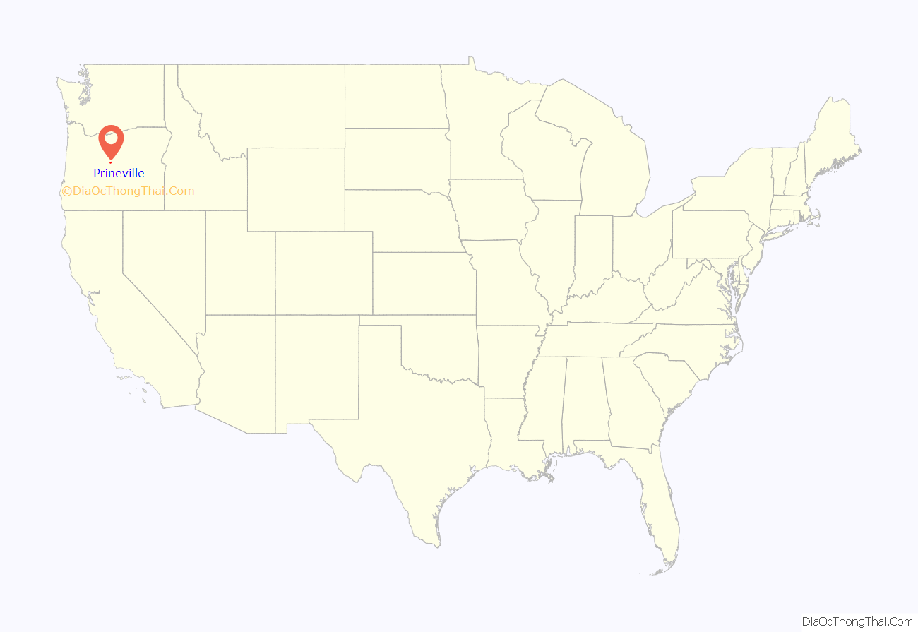
Prineville location map. Where is Prineville city?
History
Prineville was founded in 1877 when Monroe Hodges filed the original plat for the city. The post office for the community had been established with the name of Prine on April 13, 1871, but changed to Prineville on December 23, 1872. The city was incorporated by the Oregon Legislative Assembly on October 23, 1880, and obtained its first high school in 1902.
Long the major town in central Oregon, Prineville was snubbed in 1911 when the railroad tycoons James J. Hill and Edward H. Harriman bypassed the city as they laid track south from The Dalles. In a period when the presence of a railroad meant the difference between prosperity and the eventual fate as a ghost town, in a 1917 election, Prineville residents voted 355 to 1 to build their own railway, and raised the money to connect their town to the main line 19 miles (31 km) away.
Helped by timber harvests from the nearby Ochoco National Forest, the City of Prineville Railroad prospered for decades. The profits from the railroad were so abundant that between 1964 and 1968, the city levied no property taxes. However, with the decline of the timber industry in Oregon, the railroad reported a loss of nearly $1 million between 2002 and 2004.
Apple and Facebook have invested over a billion dollars, each, in multiple data centers within Prineville City limits, since the late 2000’s.
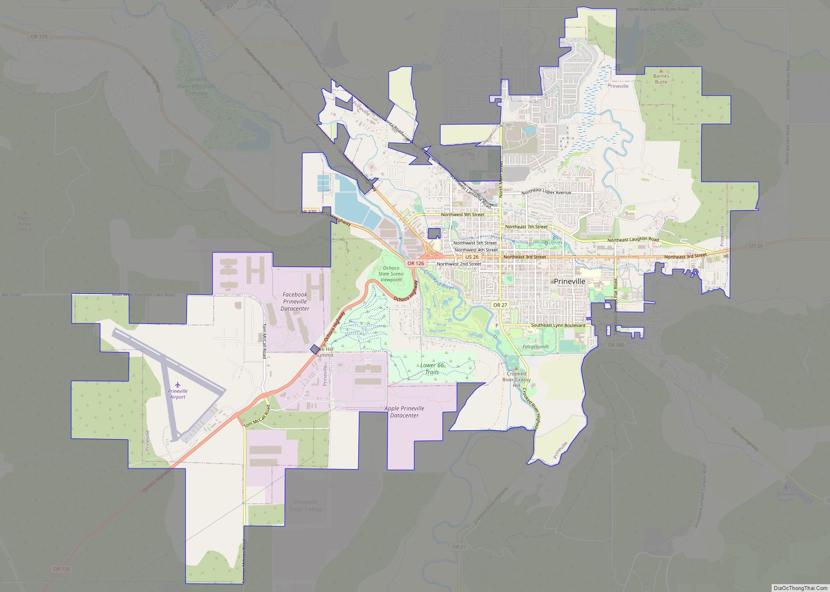
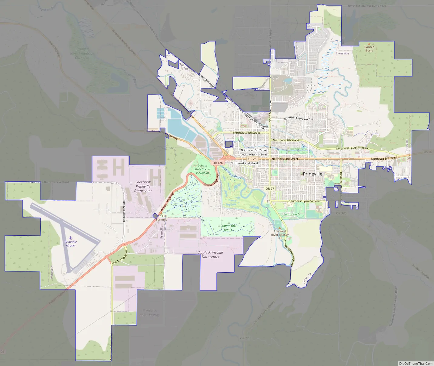
Prineville Road Map
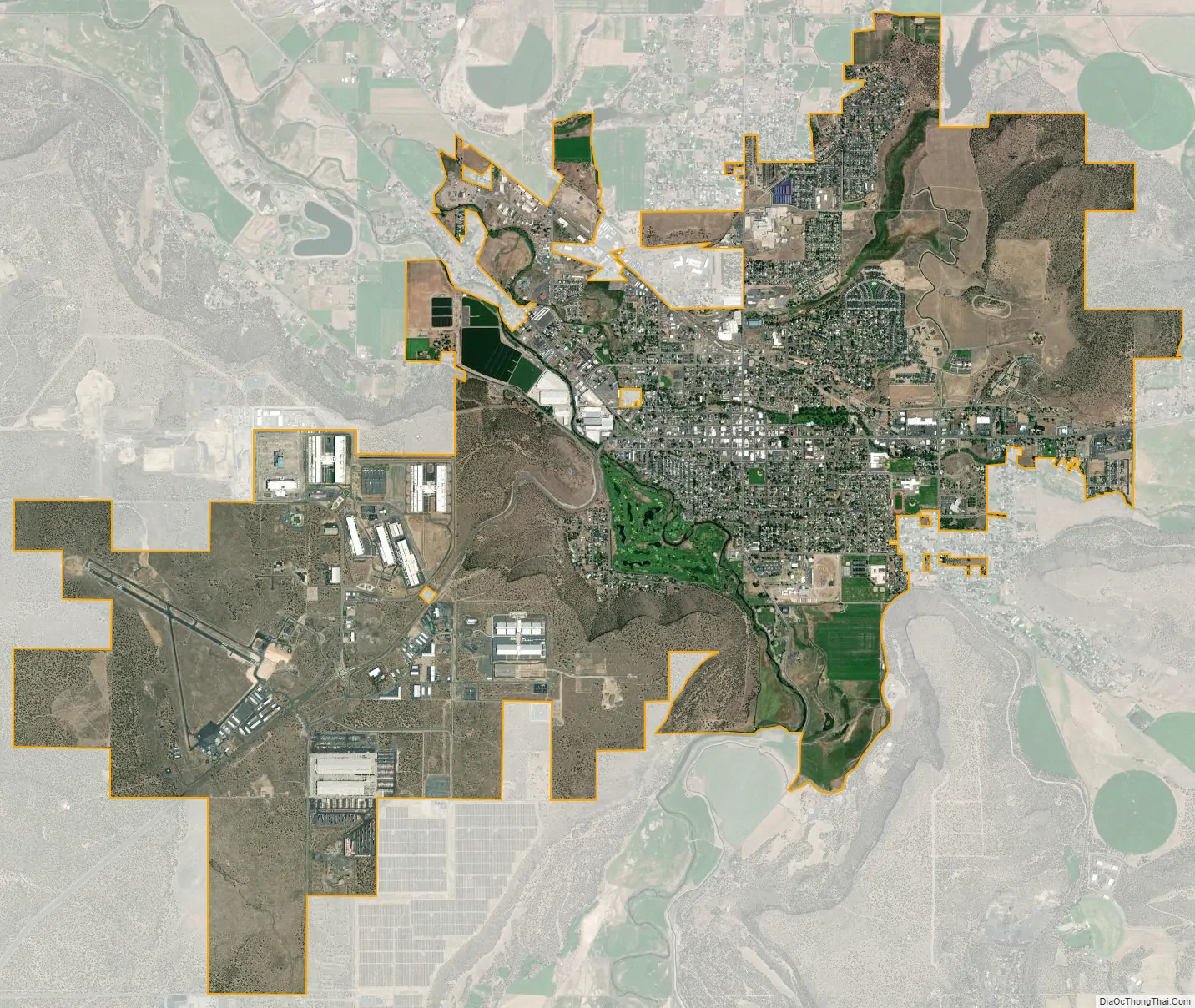
Prineville city Satellite Map
Geography
According to the United States Census Bureau, the city has a total area of 10.92 square miles (28.28 km), all of it land.
Prineville is located on the Crooked River at the mouth of Ochoco Creek, 14 miles (23 km) northwest of the Prineville Reservoir.
During the Miocene and Oligocene, great basaltic flows swept through the area. Barnes Butte is a prominent butte of this activity, located partially within the city.
Prineville has a cool semi-arid climate (BSk) according to the Köppen climate classification system.
See also
Map of Oregon State and its subdivision: Map of other states:- Alabama
- Alaska
- Arizona
- Arkansas
- California
- Colorado
- Connecticut
- Delaware
- District of Columbia
- Florida
- Georgia
- Hawaii
- Idaho
- Illinois
- Indiana
- Iowa
- Kansas
- Kentucky
- Louisiana
- Maine
- Maryland
- Massachusetts
- Michigan
- Minnesota
- Mississippi
- Missouri
- Montana
- Nebraska
- Nevada
- New Hampshire
- New Jersey
- New Mexico
- New York
- North Carolina
- North Dakota
- Ohio
- Oklahoma
- Oregon
- Pennsylvania
- Rhode Island
- South Carolina
- South Dakota
- Tennessee
- Texas
- Utah
- Vermont
- Virginia
- Washington
- West Virginia
- Wisconsin
- Wyoming