Reedsport is a city in northwest Douglas County, Oregon, United States. As of the 2020 census, the population was 4,310.
| Name: | Reedsport city |
|---|---|
| LSAD Code: | 25 |
| LSAD Description: | city (suffix) |
| State: | Oregon |
| County: | Douglas County |
| Incorporated: | 1919 |
| Elevation: | 3 ft (0.9 m) |
| Total Area: | 2.30 sq mi (5.96 km²) |
| Land Area: | 2.07 sq mi (5.36 km²) |
| Water Area: | 0.23 sq mi (0.60 km²) |
| Total Population: | 4,310 |
| Population Density: | 2,082.13/sq mi (803.89/km²) |
| ZIP code: | 97467 |
| Area code: | 541 |
| FIPS code: | 4161300 |
| GNISfeature ID: | 2410921 |
| Website: | www.reedsport.or.us |
Online Interactive Map
Click on ![]() to view map in "full screen" mode.
to view map in "full screen" mode.
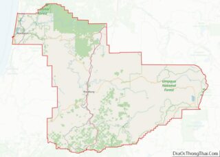
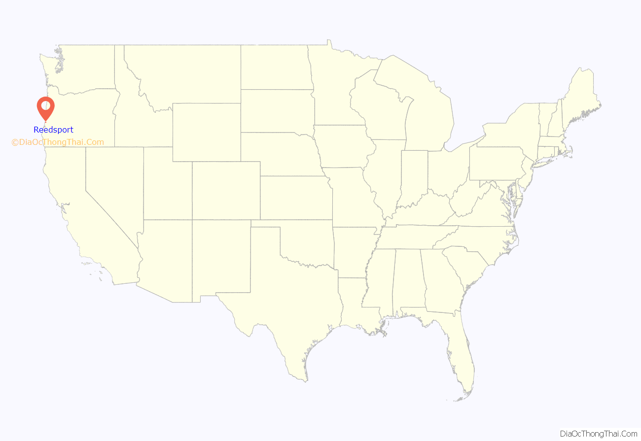
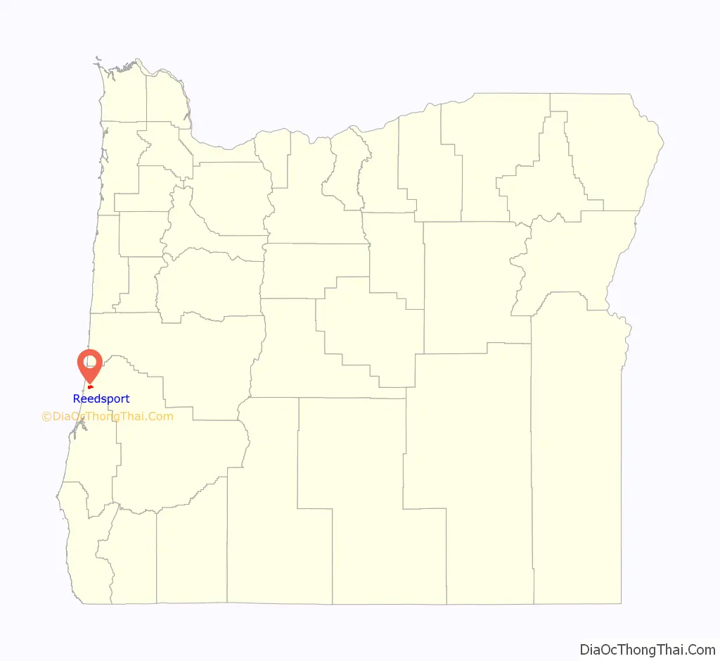
Reedsport location map. Where is Reedsport city?
History
Reedsport was established on the estuary of the Umpqua River on January 7, 1852. It was named for a local settler, Alfred W. Reed, who founded the city in 1912. The post office was established July 17, 1912.
The building of Southern Pacific Railroad lines extending south to Coos Bay led to the development of Reedsport. Before the post office was established in 1912, Reedsport was a camp for railroad construction workers.
Built on marshy ground, for much of its history Reedsport has struggled with frequent flooding; most of its early buildings were elevated 3 to 8 feet (0.9 to 2.4 m) above ground. After a devastating flood in 1964, a dike was constructed to protect the lower town. During this flood, the waters reached the fish hatchery and overflowed the fish troughs allowing hundreds of thousands of smallmouth bass to be introduced into the Umpqua River. According to fishing reports small-mouth bass became the most abundant fish in the river. Every few years, high water induces city employees to close the dikes to prevent low-lying areas of the city from flooding.
In the last quarter of the 20th century, Reedsport struggled with the collapse of the Oregon timber industry. In the last two decades, Reedsport has seen an increase of tourism. Part of this is due to its close proximity to the fishing of the Umpqua River. Another part of the recent surge in tourism is due to the sand dunes that are near Reedsport.
Although the U.S. Forest Service maintains a local office in the town, Reedsport’s historic connection with the timber industry ended in 1999 with the closing of the International Paper plant in nearby Gardiner.
Recently, Reedsport has seen a rise in tourism due to recreation at the nearby Oregon Dunes National Recreation Area in Winchester Bay. A number of businesses catering to all-terrain vehicles have opened in Reedsport to serve the needs of this growing activity.
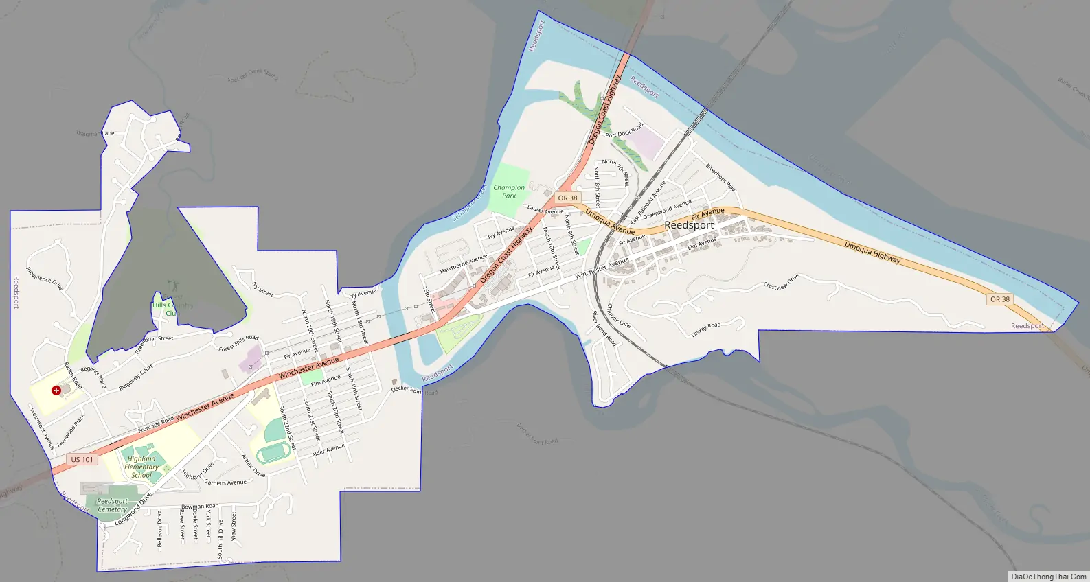
Reedsport Road Map
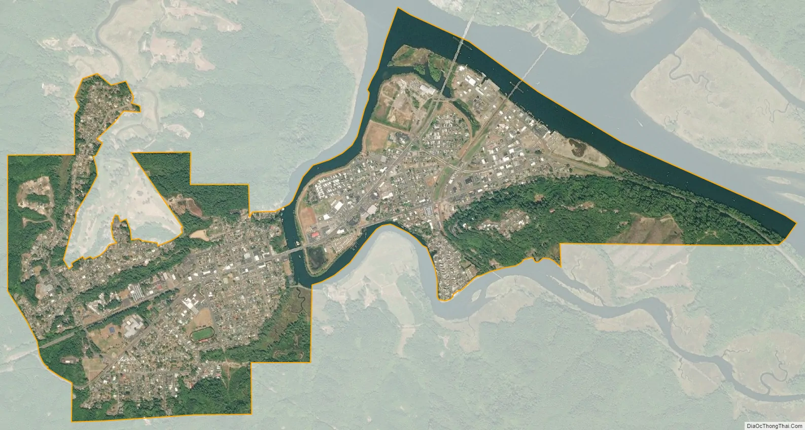
Reedsport city Satellite Map
Geography
Reedsport is at the junction of Oregon Route 38 and U.S. Route 101, 3 miles (5 km) north of Winchester Bay and 54 miles (87 km) northwest of Roseburg.
According to the United States Census Bureau, the city has a total area of 2.31 square miles (5.98 km), of which, 2.05 square miles (5.31 km) is land and 0.26 square miles (0.67 km) is water.
Reedsport has a rainy Mediterranean climate (Köppen Csb), with mild dry summers and mild, very wet winters. Although 26.3 mornings will fall below 32 °F or 0 °C, only 0.9 afternoons reach 90 °F or 32.2 °C, and the hottest temperature recorded is only 97 °F (36.1 °C) on August 29, 1944, and September 5, 1973. Only 0.2 afternoons fail to top freezing each year, and the coldest temperature is 11 °F (−11.7 °C) on December 8, 1972. The wettest month record is November 1973 with 26.07 inches (662.2 mm), whilst June to September have on occasions been rainless.
See also
Map of Oregon State and its subdivision: Map of other states:- Alabama
- Alaska
- Arizona
- Arkansas
- California
- Colorado
- Connecticut
- Delaware
- District of Columbia
- Florida
- Georgia
- Hawaii
- Idaho
- Illinois
- Indiana
- Iowa
- Kansas
- Kentucky
- Louisiana
- Maine
- Maryland
- Massachusetts
- Michigan
- Minnesota
- Mississippi
- Missouri
- Montana
- Nebraska
- Nevada
- New Hampshire
- New Jersey
- New Mexico
- New York
- North Carolina
- North Dakota
- Ohio
- Oklahoma
- Oregon
- Pennsylvania
- Rhode Island
- South Carolina
- South Dakota
- Tennessee
- Texas
- Utah
- Vermont
- Virginia
- Washington
- West Virginia
- Wisconsin
- Wyoming