Roseburg is a city in the U.S. state of Oregon. It is in the Umpqua River Valley in southern Oregon and is the county seat and most populous city of Douglas County. Founded in 1851, the population was 23,683 at the 2020 census, making it the principal city of the Roseburg, Oregon Micropolitan Statistical Area. The community developed along both sides of the South Umpqua River and is traversed by Interstate 5. Traditionally a lumber industry town, Roseburg was the original home of Roseburg Forest Products, which is now based in nearby Springfield.
| Name: | Roseburg city |
|---|---|
| LSAD Code: | 25 |
| LSAD Description: | city (suffix) |
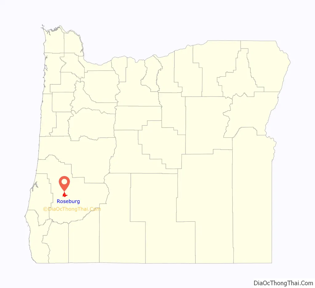
| State: | Oregon |
| County: | Douglas County |
| Incorporated: | 1872 |
| Elevation: | 479 ft (146 m) |
| Total Area: | 10.91 sq mi (28.26 km²) |
| Land Area: | 10.72 sq mi (27.77 km²) |
| Water Area: | 0.19 sq mi (0.50 km²) |
| Total Population: | 23,683 |
| Population Density: | 2,209.24/sq mi (852.96/km²) |
| ZIP code: | 97470, 97471 |
| Area code: | 541 |
| FIPS code: | 4163650 |
| GNISfeature ID: | 2410997 |
| Website: | cityofroseburg.org |
Online Interactive Map
Click on ![]() to view map in "full screen" mode.
to view map in "full screen" mode.
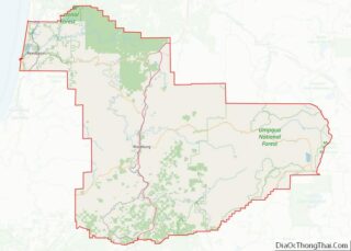
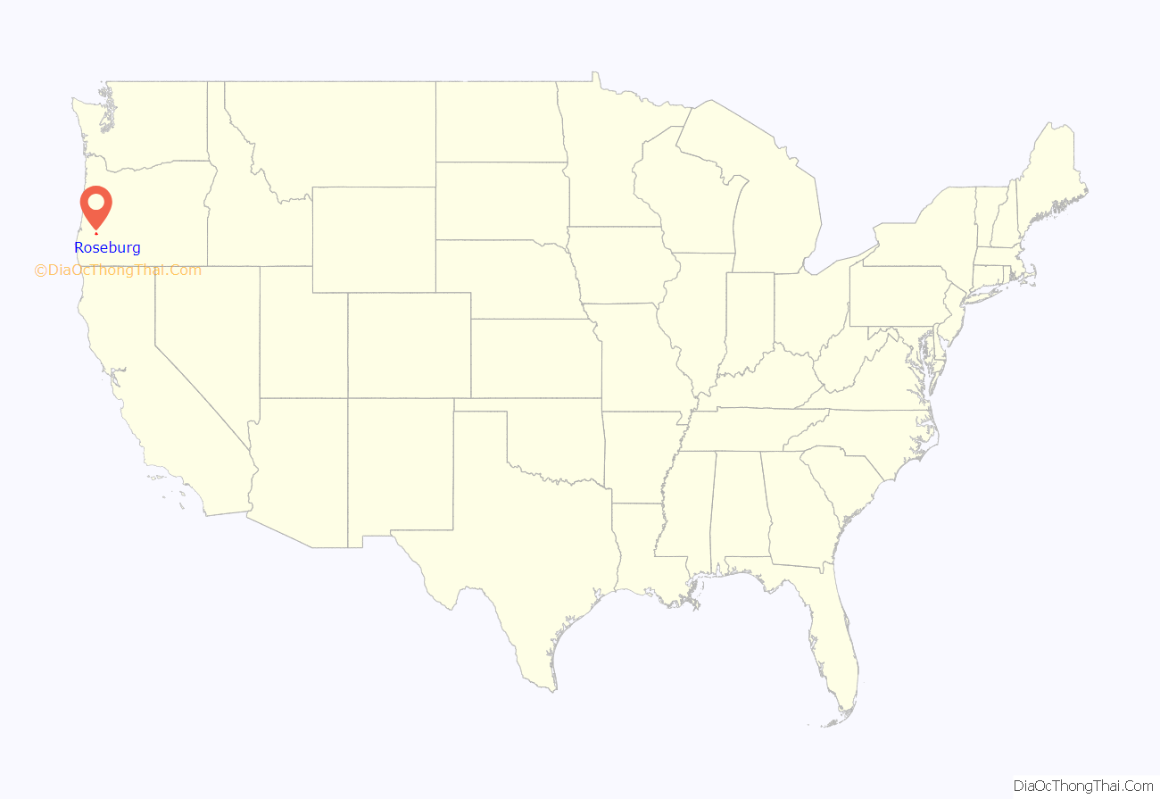
Roseburg location map. Where is Roseburg city?
History
Modern-day Roseburg is located on the lands of numerous Indian tribes, including the Cow Creek Band of the Umpqua Tribe, whose Cow Creek Umpqua Indian Foundation is located in Roseburg. Roseburg was the site of the 1855 Battle of Hungry Hill, part of the Rogue River Wars of 1855–56, fought between several southern Oregon Indian groups and the US Army.
The city was named for settler Aaron Rose, who established a homestead within the current city limits on September 23, 1851. Rose was born in 1813 in Ulster County, New York. In 1851, he came to Oregon from Coldwater, Michigan, where he had lived since 1837.
Rose constructed the first building in what would become Roseburg, a rough structure made of poles and clapboards with a front room about 16 or 18 feet square; it was used as a grocery store, backed by a dining room and kitchen. Originally, guests could use the floor of the front room to spread their beds or were able to sleep out of doors under nearby oak trees. His first structure served as a roadside inn and tavern for many years. Rose built a proper hotel in 1853. He died in 1899.
Roseburg was first known as Deer Creek because it was at the confluence of Deer Creek and the South Umpqua River. In 1854, voters chose Roseburg as the county seat over rival town Winchester. Rose donated 3 acres (1.2 ha) of land and $1,000 for the building of the county courthouse, and the important buildings of Winchester were moved to Roseburg before 1860.
Deer Creek post office was established in 1852, and the name changed to “Roseburgh” in 1857. The spelling was changed to “Roseburg” in 1894. Roseburg was incorporated by the Oregon Legislative Assembly on October 3, 1872.
Timber Capital of the Nation
The fortunes of Roseburg grew with the lumber industry. In 1937, Roseburg Lumber opened. Founded by Kenneth Ford, the company became the major employer in the community. Other major employers, including Weyerhaeuser, Champion and Sun Studs also developed and grew during this time. By the 1970s Roseburg branded itself as the Timber Capital of the Nation.
Country singer Johnny Cash mythologized Roseburg loggers in the 1960 song “Lumberjack”:
“Ride this train to Roseburg, Oregon. Now there’s a town for you! You talk about rough… You know a lot of places in the country claim Paul Bunyon lived there. But you should have seen Roseburg when me and my daddy come there. Every one of them loggers looked like Paul Bunyon to me.”
Roseburg Blast
On August 7, 1959, at approximately 1:00 a.m., the Gerretsen Building Supply Company caught fire. Firefighters soon arrived at the building, near Oak and Pine Streets, to extinguish the fire. Earlier in the evening, a truck driver for the Pacific Powder Company, George Rutherford, had parked his explosives truck in front of the building, which was not noticed. The truck exploded at around 1:14 a.m., destroying buildings in an eight-block radius and severely damaging 30 more blocks.
The truck was loaded with two tons of dynamite and four-and-a-half tons of the blasting agent nitro carbo nitrate. Rutherford had parked the truck after arranging his delivery for the following morning, despite warnings given to the Pacific Powder Company two days earlier not to leave such trucks unattended or park them in “congested areas”. A police officer named Donald De Sues and the Chief of Police were on site and managed to evacuate citizens from the area of the truck before the explosion. Donald De Sues and the town Assistant Fire Chief were recognized as heroes that day and were both killed in the blast. A total of fourteen people died in the blast and fire, and 125 were injured. Damage was estimated at 10 to 12 million dollars; the powder company was eventually made to pay $1.2 million in civil damages, but was acquitted of criminal wrongdoing.
Roseburg’s downtown was rebuilt, primarily by businesses using money collected from insurance claims. The city built a new bridge over the South Umpqua River on parcels affected by the disaster. Since the incident, it is commonly referred to as the Roseburg Blast or simply “The Blast”. In 2005, SOPTV produced a documentary examining the Blast and the experiences of those who were involved or witnessed it, entitled The Roseburg Blast: A Catastrophe and Its Heroes.
Mass shooting
On October 1, 2015, students at Umpqua Community College near Roseburg were attacked by a 26-year-old gunman that had recently moved to the area from Southern California, who killed nine people (eight students and an assistant professor) and injured nine others. The gunman, a student at the school, committed suicide following a gun battle with police. This was the second school shooting in the Roseburg area, the other being a 2006 shooting at Roseburg High School. On October 9, President Barack Obama privately visited families of victims of the shooting. Hundreds of local residents protested the visit due to Obama’s support of gun control legislation. In 1968, Bobby Kennedy had given a speech in Roseburg advocating for gun control for the mentally ill and for those with a “long criminal record” of murder.
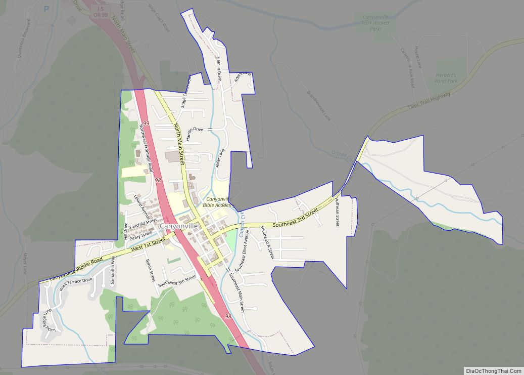
Roseburg Road Map

Roseburg city Satellite Map
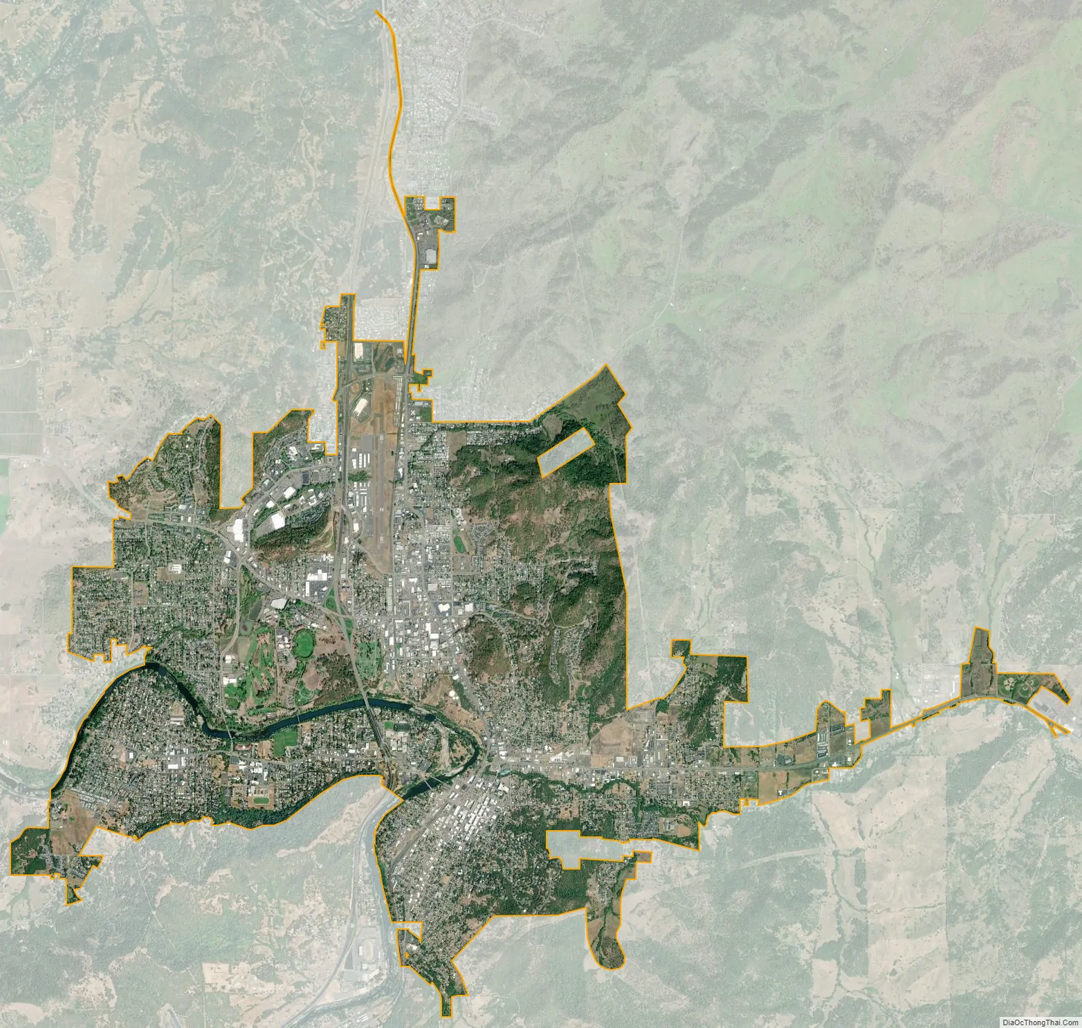
Geography
According to the United States Census Bureau, the city has a total area of 10.20 square miles (26.42 km), of which 10.01 square miles (25.93 km) is land and 0.19 square miles (0.49 km) is water.
Roseburg’s elevation is approximately 500 feet (150 m). Its highest point is Mount Nebo, a 1,200-foot (370 m) hill to the west of Interstate 5. Through the 1980s, it was known for its band of 10-20 feral angora goats. Residents said they could predict the weather by watching where the goats were on the mountain; if they were high, the weather would be good. If rain was pending, the goats moved to lower levels. Because the goats wandered across the freeway for grazing, they were a risk to traffic. In the 1980s, they were rounded up and placed for adoption.
Climate
Roseburg has a Mediterranean climate (Köppen Csb borderline with Csa) with cool, rainy winters and very warm, dry summers. In a typical year, there are 30.9 days where the temperature reaches or exceeds 90 °F or 32.2 °C, and 2.7 days with a temperature of at least 100 °F or 37.8 °C. Conversely, the temperature drops to 32 °F (0 °C) or below 27.6 days a year. The record high temperature is 114 °F (45.6 °C), set on June 27, 2021, and the record low temperature is −1 °F (−18.3 °C), set on January 22, 1962.
In the summer, the area has little or no precipitation and plentiful sunshine — on average, 73.5 percent of days in July, August and September are at least partly sunny. There is also a much higher degree of diurnal temperature variation than in the winter. On the other hand, the majority of winter days are overcast and rainy — during this period, rainfalls of 8 inches (200 mm) per month are not uncommon, with as much as 15.74 inches (399.8 mm) during the record wet month of December 1955. Roseburg averages 30.7 inches (779.8 mm) of rain per year, more than half of which falls between November and January. The wettest “rain year” has been from July 1955 to June 1956 with 50.29 inches (1,277.4 mm) and the driest from July 2000 to June 2001 with only 18.43 inches (468.1 mm).
Light dustings of snow can sometimes be seen, but accumulations are rare. The most snowfall in a month is 23.4 inches (59 cm) in January 1950.
See also
Map of Oregon State and its subdivision: Map of other states:- Alabama
- Alaska
- Arizona
- Arkansas
- California
- Colorado
- Connecticut
- Delaware
- District of Columbia
- Florida
- Georgia
- Hawaii
- Idaho
- Illinois
- Indiana
- Iowa
- Kansas
- Kentucky
- Louisiana
- Maine
- Maryland
- Massachusetts
- Michigan
- Minnesota
- Mississippi
- Missouri
- Montana
- Nebraska
- Nevada
- New Hampshire
- New Jersey
- New Mexico
- New York
- North Carolina
- North Dakota
- Ohio
- Oklahoma
- Oregon
- Pennsylvania
- Rhode Island
- South Carolina
- South Dakota
- Tennessee
- Texas
- Utah
- Vermont
- Virginia
- Washington
- West Virginia
- Wisconsin
- Wyoming