Sandy is a city located in Clackamas County, Oregon, United States, settled c. 1853 and named after the nearby Sandy River. Located in the foothills of the Cascade Mountain Range, the city serves as the western gateway to the Mount Hood Corridor, and is located approximately 27 miles (43 km) east of Portland.
The city of Sandy was originally settled by travelers passing along Barlow Road, one of the final sections of the Oregon Trail, and initially known as Revenue, after settlers Francis and Lydia Revenue. The city subsequently took the name Sandy after the Sandy River, named by Meriwether Lewis and William Clark in 1805; the river and previously been named the Barings River, after Sir Francis Baring, 1st Baronet, following a 1792 expedition in the region.
In the late-19th and early 20th century, Sandy’s local economy was mainly based on logging and the sawmill industry due to the abundance of timber in the area. The city continued to grow with the arrival of German immigrants in the late-nineteenth century, and the city was formally incorporated in 1911. In the latter half of the 20th century, the city’s population saw a significant increase in residents, concurrent with the growth of the Portland metropolitan area.
As of the 2020 census, the city had a total population of 12,612. It is the home of Sandy High School, founded in 1914, which serves the population of Sandy as well as outlying communities, such as Boring and the Villages of Mount Hood.
| Name: | Sandy city |
|---|---|
| LSAD Code: | 25 |
| LSAD Description: | city (suffix) |
| State: | Oregon |
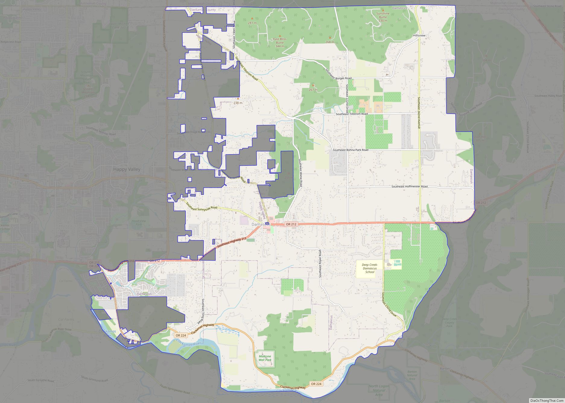
| County: | Clackamas County |
| Incorporated: | August 11, 1911 (1911-08-11) |
| Elevation: | 1,201 ft (305.4096 m) |
| Total Area: | 3.64 sq mi (9.44 km²) |
| Land Area: | 3.63 sq mi (9.40 km²) |
| Water Area: | 0.01 sq mi (0.04 km²) |
| Total Population: | 12,612 |
| Population Density: | 3,474.38/sq mi (1,341.56/km²) |
| ZIP code: | 97055 |
| Area code: | 503 and 971 |
| FIPS code: | 4165250 |
| GNISfeature ID: | 1149054 |
| Website: | www.ci.sandy.or.us |
Online Interactive Map
Click on ![]() to view map in "full screen" mode.
to view map in "full screen" mode.
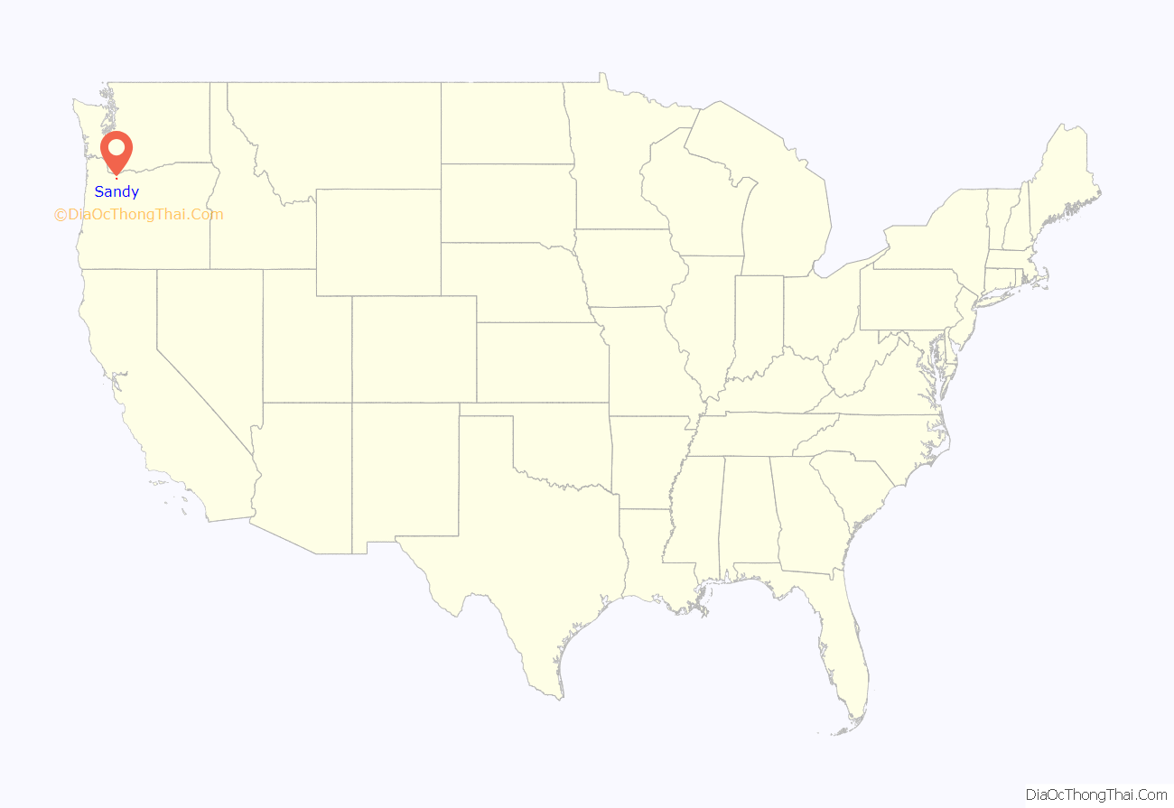
Sandy location map. Where is Sandy city?
History
Eighteenth—nineteenth centuries
Sandy was founded after pioneer Sam Barlow passed through the area in 1845 and formed Barlow Road, the most widely-used final portion of the Oregon Trail. The first people to settle the area were Francis and Lydia Revenue, c. 1853. The abundance of natural resources in the area, ranging from fish, deer, elk, berries and roots, attracted them to build a homestead and trading post. Around 1873, the Revenues built the city’s first hotel.
Initially known as Revenue (after the Revenue family), in the late-nineteenth century the settlement took its namesake of Sandy from the nearby Sandy River, which itself had taken its name from Meriwether Lewis and William Clark during their 1805 expedition, who at that time named it the “Quicksand River” due to the abundance of sand on its banks. The river had priorly been named the Barings River after Sir Francis Baring, 1st Baronet, an English merchant banker, by Lieutenant W.R. Broughton of the Fort Vancouver expedition on October 30, 1792.
A second hotel was erected in Sandy in 1890 by Baron Otto Von Scholley, an Austrian immigrant who also served as the city’s second postmaster and first notary. In 1894, the city completed its first church, St. Michael’s Roman Catholic Church, established by Benedictine monks, which had its first service on December 18 that year. Though the original building was destroyed in a fire two decades later, it was relocated and reopened.
Twentieth century
In 1902, a Lutheran church was established in Sandy. On August 11, 1911, the city of was formally incorporated, and on November 14, 1913, city voters approved its charter. Friedrich Meinig, a German immigrant and businessman, came to Sandy in 1876; his son, Paul Meinig, served as the city’s second mayor from 1912 to 1918. A significant part of Sandy’s economy in the late-nineteenth and early-twentieth centuries was logging and sawmill operations which utilized the abundance of forests surrounding the city.
In October 1913, the city experienced a major fire which destroyed numerous buildings and businesses, including a restaurant, livery stable, and saloon, all located on the south side of the Main Street (contemporarily Proctor Boulevard). A concrete replacement of the restaurant and saloon was subsequently erected, marking the first concrete building in the city. The Clackamas County Bank was established in Sandy in 1916. As of 2018, the bank remains the oldest community bank in the state of Oregon.
In 1919, a year prior to the Nineteenth Amendment, the city elected two women to its government: Blanche Shelley was elected mayor, along with Edna Esson to city council. Both women were also active business leaders in the city. In 1923, the city completed construction of the Pioneer Building, a brick structure that served as Sandy Union High School, for $30,000. Prior to this, a small two-story schoolhouse served as the city’s main school for all grades, before a separate high school was established in 1917.
Twenty-first century
As of the twenty-first century, Sandy’s population has increased significantly with the growth of the Portland metropolitan area. Per a 2018 study completed by Portland State University and Clackamas County, it is the second-fastest growing city in the state, and is estimated to reach a population of 18,980 by the year 2034.
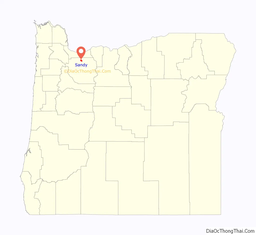
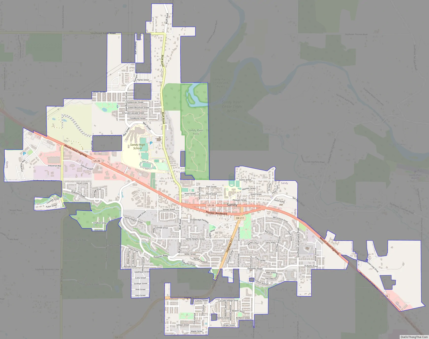
Sandy Road Map
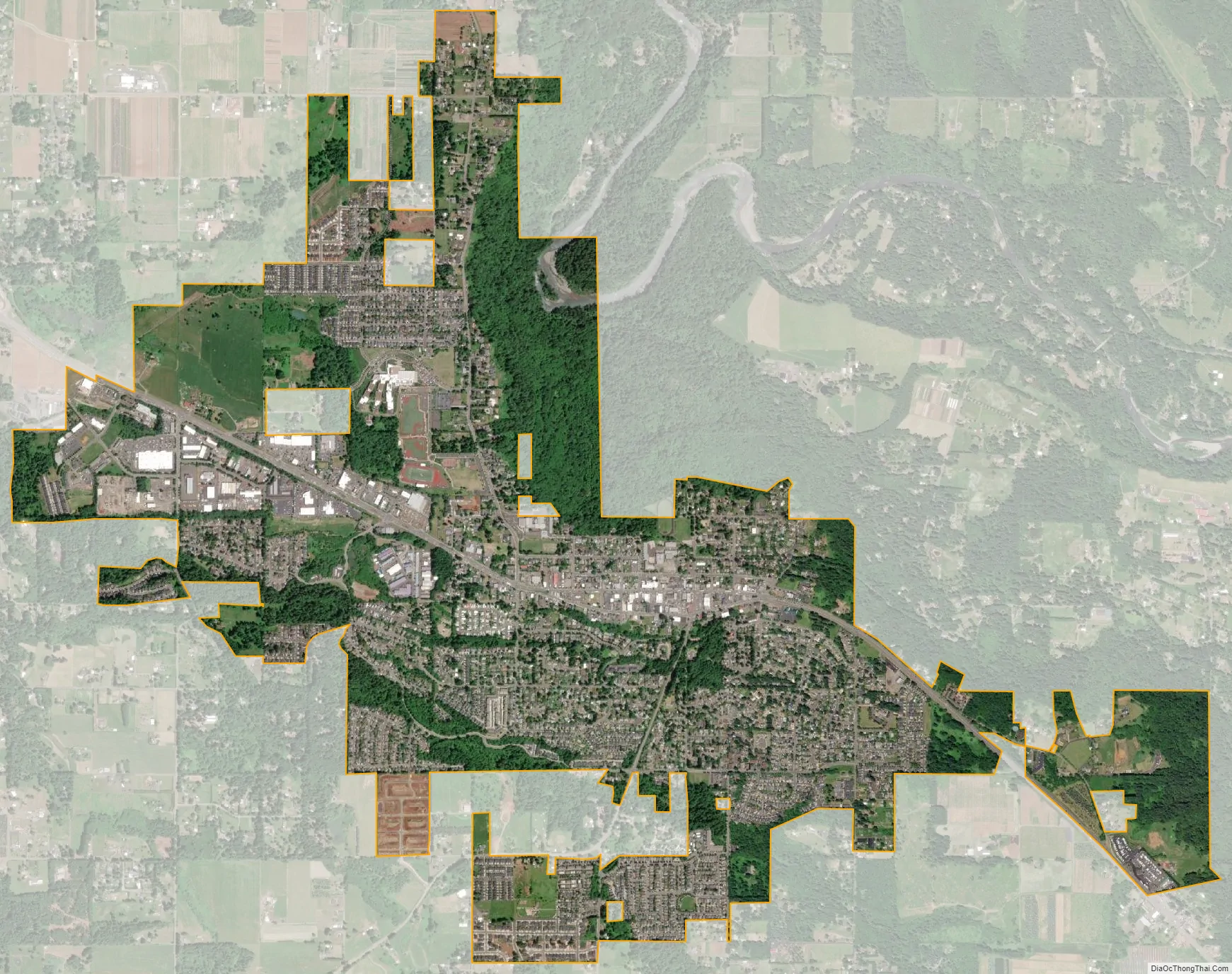
Sandy city Satellite Map
Geography
According to the United States Census Bureau, the city has a total area of 3.14 square miles (8.13 km), consisting almost entirely of land. Its elevation is 967 feet (295 m).
Climate
This region experiences warm (but not hot) and dry summers, with no average monthly temperatures above 71.6 °F (22.0 °C). According to the Köppen Climate Classification system, Sandy has a warm-summer Mediterranean climate, abbreviated “Csb” on climate maps.
See also
Map of Oregon State and its subdivision: Map of other states:- Alabama
- Alaska
- Arizona
- Arkansas
- California
- Colorado
- Connecticut
- Delaware
- District of Columbia
- Florida
- Georgia
- Hawaii
- Idaho
- Illinois
- Indiana
- Iowa
- Kansas
- Kentucky
- Louisiana
- Maine
- Maryland
- Massachusetts
- Michigan
- Minnesota
- Mississippi
- Missouri
- Montana
- Nebraska
- Nevada
- New Hampshire
- New Jersey
- New Mexico
- New York
- North Carolina
- North Dakota
- Ohio
- Oklahoma
- Oregon
- Pennsylvania
- Rhode Island
- South Carolina
- South Dakota
- Tennessee
- Texas
- Utah
- Vermont
- Virginia
- Washington
- West Virginia
- Wisconsin
- Wyoming