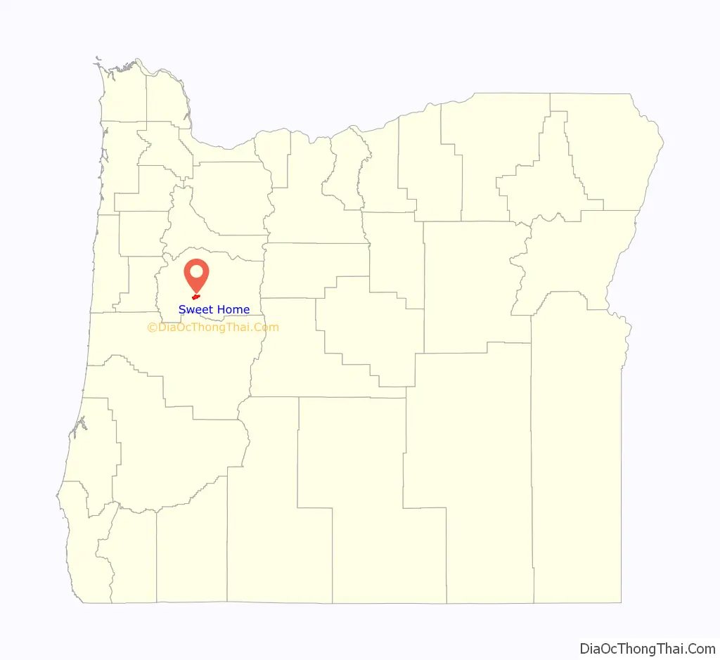
Sweet Home is a city in Linn County, Oregon, United States, with population 8,925 at the 2010 census. Built near the site of a prehistoric petrified forest, Sweet Home experienced substantial growth during the construction of the Green Peter and Foster dams in the 1940s. The town’s main attraction nowadays is the Cascade mountains through Santiam Pass.
| Name: | Sweet Home city |
|---|---|
| LSAD Code: | 25 |
| LSAD Description: | city (suffix) |
| State: | Oregon |
| County: | Linn County |
| Incorporated: | 1893 |
| Elevation: | 537 ft (164 m) |
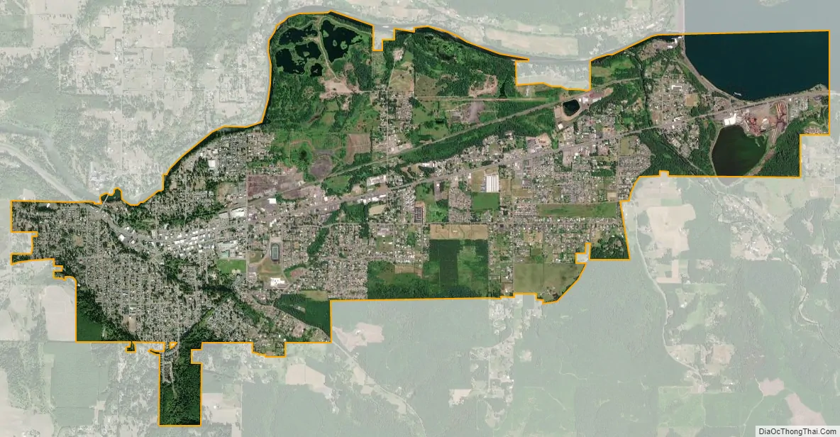
| Total Area: | 5.76 sq mi (14.91 km²) |
| Land Area: | 5.30 sq mi (13.73 km²) |
| Water Area: | 0.46 sq mi (1.18 km²) |
| Total Population: | 9,828 |
| Population Density: | 1,853.64/sq mi (715.65/km²) |
| ZIP code: | 97386 |
| Area code: | 458 and 541 |
| FIPS code: | 4171950 |
| GNISfeature ID: | 1127827 |
| Website: | www.sweethomeor.gov |
Online Interactive Map
Click on ![]() to view map in "full screen" mode.
to view map in "full screen" mode.
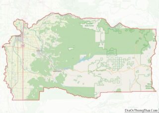
Sweet Home location map. Where is Sweet Home city?

History
Settlers first arrived in the Sweet Home Valley in the early 1850s. A community known as Buckhead developed near the mouth of Ames Creek and the South Santiam River. Buckhead was named after a saloon that featured a set of elk antlers on the gable end of its building. East of Buckhead, a community called Mossville developed with a store and post office. In 1874, the two communities merged to become one community called Sweet Home. In 1893, the city of Sweet Home was incorporated.
The Santiam Wagon Road, a toll road connecting the Willamette Valley with central Oregon, was opened in 1865. The road extended from the Sweet Home Valley across the Santiam Pass in the Cascades to Camp Polk near Sisters. The Santiam Wagon Road was a vital means of supplying livestock and goods from western Oregon to central Oregon and transporting wool from east of the Cascades back to Willamette Valley woolen mills. Competition with railroads that extended south from the Columbia River into central Oregon and the newly opened McKenzie Pass Highway made the wagon road obsolete by the late 1930s. U.S. Route 20 was constructed across much of the same route as the Santiam Wagon Road.
Sweet Home experienced significant growth during the 1940s due to the demand for timber from local forests. Further growth occurred when construction began on nearby Green Peter Dam in 1962 and continued as construction began on Foster Dam in 1966.
During the 1980s, Sweet Home experienced a number of sawmill and plywood mill closures due to economic cycles, increased competition, increased productivity, and logging restrictions placed on nearby forests resulting from environmental concerns for endangered species. In response, community members sought out other economic development opportunities such as the Oregon Jamboree country music and camping festival.
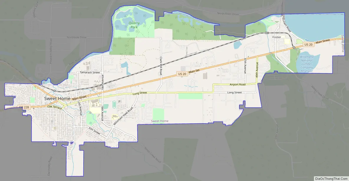
Sweet Home Road Map
Sweet Home city Satellite Map
Geography
According to the United States Census Bureau, the city has a total area of 5.75 square miles (14.89 km), of which 5.30 square miles (13.73 km) is land and 0.45 square miles (1.17 km) is water.
The intersection Oregon Route 228 and U.S. Route 20 occurs at the Western end of Sweet Home.
The South Santiam River flows from Foster Reservoir along the northern city limits of Sweet Home. Ames Creek and Wiley Creek flow into the South Santiam River within the city limits.
Sweet Home is built on a prehistoric petrified forest. In addition to fossil wood, the area includes a variety of agate, jasper, crystals and minerals. The abundant petrified wood at Holleywood Ranch (between Sweet Home and Holley, Oregon) was the subject of an episode of the Travel Channel program Cash and Treasures.
Climate
The region experiences warm (but not hot) and dry summers, with no average monthly temperatures above 71.6 °F (22.0 °C). According to the Köppen Climate Classification system, Sweet Home has a warm-summer Mediterranean climate, abbreviated “Csb” on climate maps.
See also
Map of Oregon State and its subdivision: Map of other states:- Alabama
- Alaska
- Arizona
- Arkansas
- California
- Colorado
- Connecticut
- Delaware
- District of Columbia
- Florida
- Georgia
- Hawaii
- Idaho
- Illinois
- Indiana
- Iowa
- Kansas
- Kentucky
- Louisiana
- Maine
- Maryland
- Massachusetts
- Michigan
- Minnesota
- Mississippi
- Missouri
- Montana
- Nebraska
- Nevada
- New Hampshire
- New Jersey
- New Mexico
- New York
- North Carolina
- North Dakota
- Ohio
- Oklahoma
- Oregon
- Pennsylvania
- Rhode Island
- South Carolina
- South Dakota
- Tennessee
- Texas
- Utah
- Vermont
- Virginia
- Washington
- West Virginia
- Wisconsin
- Wyoming