Wallowa (/wəˈlaʊwə/) is a city in Wallowa County, Oregon, United States. The population was 808 at the 2010 census.
| Name: | Wallowa city |
|---|---|
| LSAD Code: | 25 |
| LSAD Description: | city (suffix) |
| State: | Oregon |
| County: | Wallowa County |
| Incorporated: | 1899 |
| Elevation: | 2,950 ft (899.2 m) |
| Total Area: | 0.61 sq mi (1.58 km²) |
| Land Area: | 0.61 sq mi (1.58 km²) |
| Water Area: | 0.00 sq mi (0.00 km²) |
| Total Population: | 796 |
| Population Density: | 1,302.78/sq mi (503.05/km²) |
| ZIP code: | 97885 |
| Area code: | 541 |
| FIPS code: | 4178150 |
| GNISfeature ID: | 1151858 |
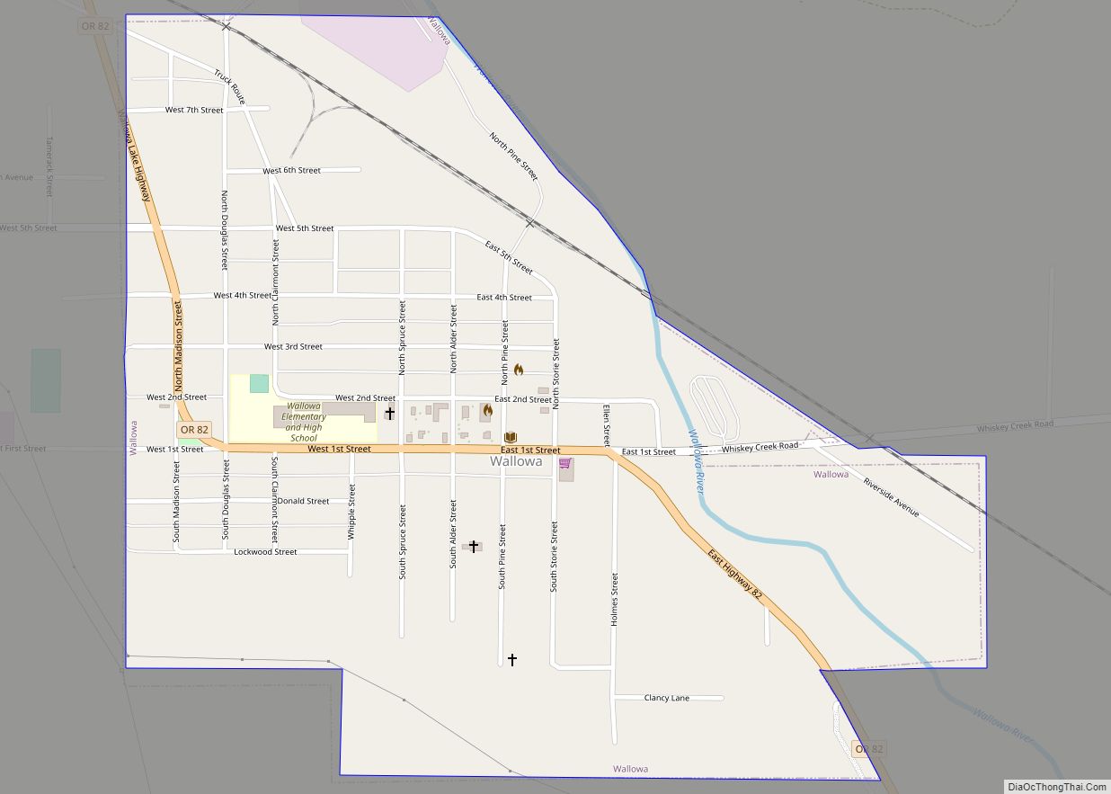
Online Interactive Map
Click on ![]() to view map in "full screen" mode.
to view map in "full screen" mode.
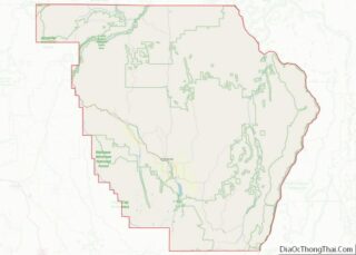
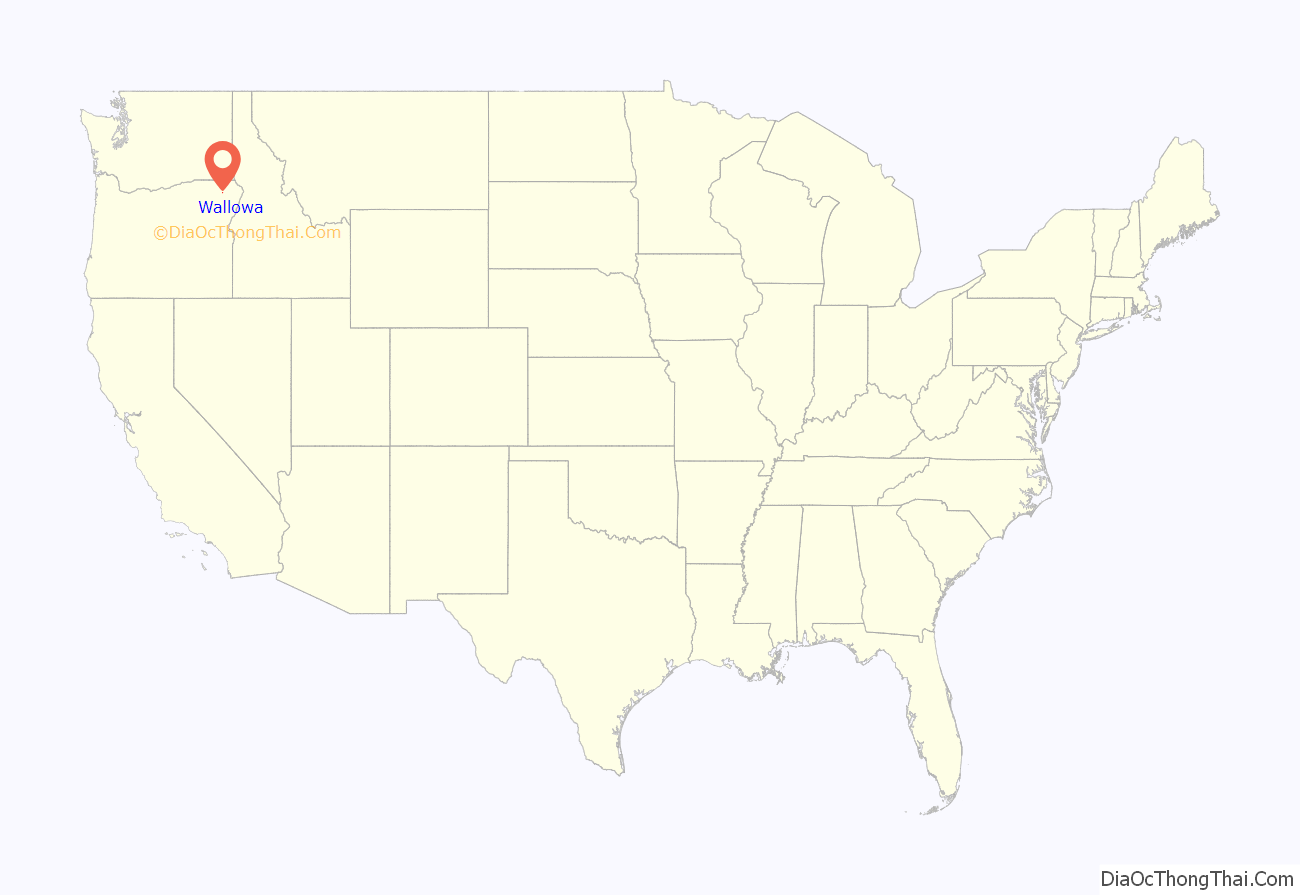
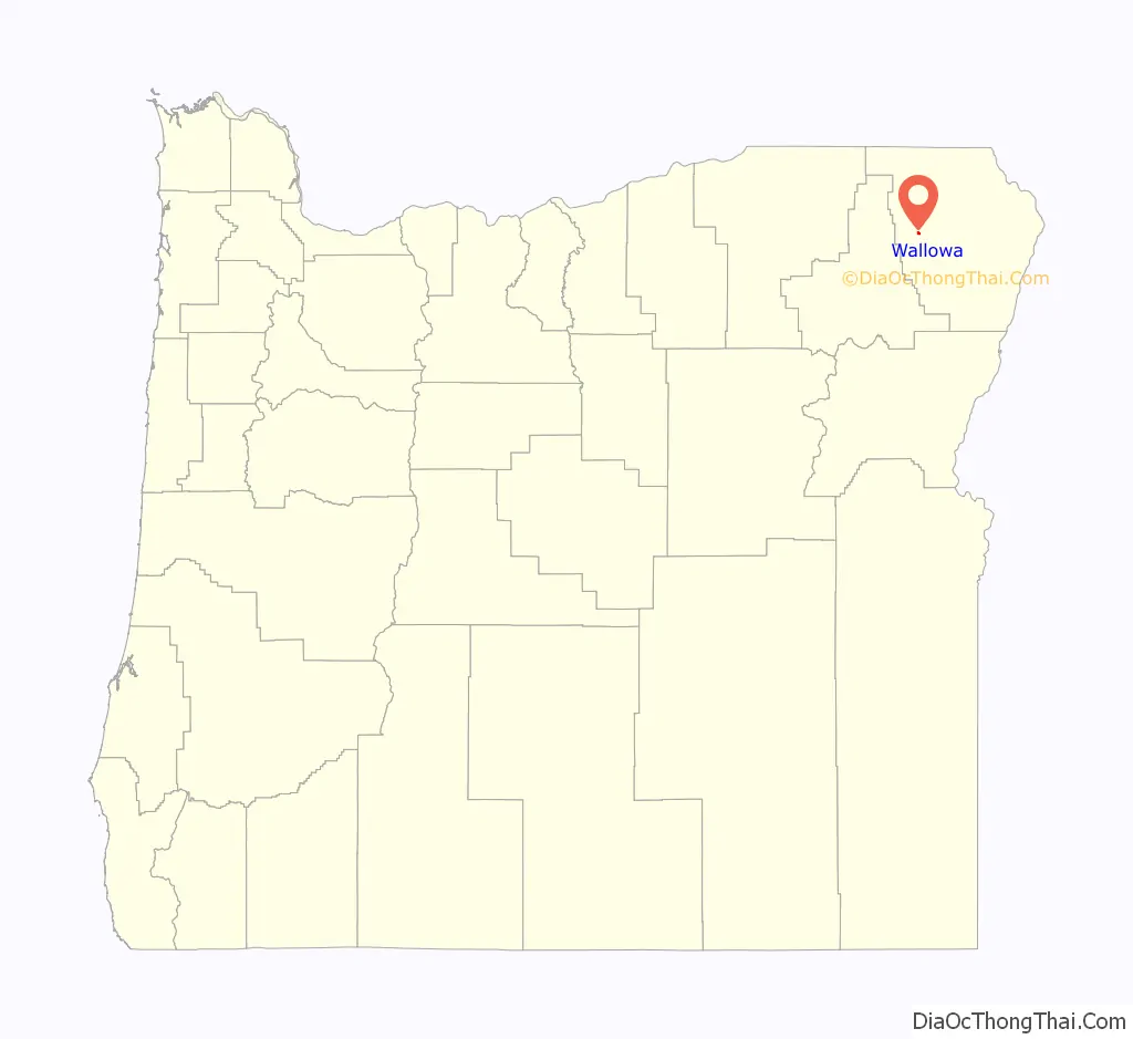
Wallowa location map. Where is Wallowa city?
History
The Wallowa Valley is within the traditional lands of the Nez Perce. In the late 19th century, the Wallowa band was one of more than a dozen groups who lived across the inland Northwest as members of the Nez Perce tribe. The U.S. government sent the army to force them out after they refused to sign a treaty that would have removed them from their land. Chief Joseph led tribal members more than 1,000 miles to western Montana. They repeatedly battled with the army as they fled.
Wallowa was platted in 1889. Wallowa is a Nez Perce word describing a triangular structure of stakes that in turn supported a network of sticks called lacallas to form a fish trap. The Nez Perce put these traps in the Wallowa River below the outlet of Wallowa Lake. The author of Oregon Geographic Names, Lewis A. McArthur, said that although the origin of this name is disputed, he puts great weight in Levi Ankeny who supplied this information as he was “thoroughly familiar with the early history and tradition of the Wallowa Valley” and “on intimate terms with many Indians who knew the facts of the matter”.
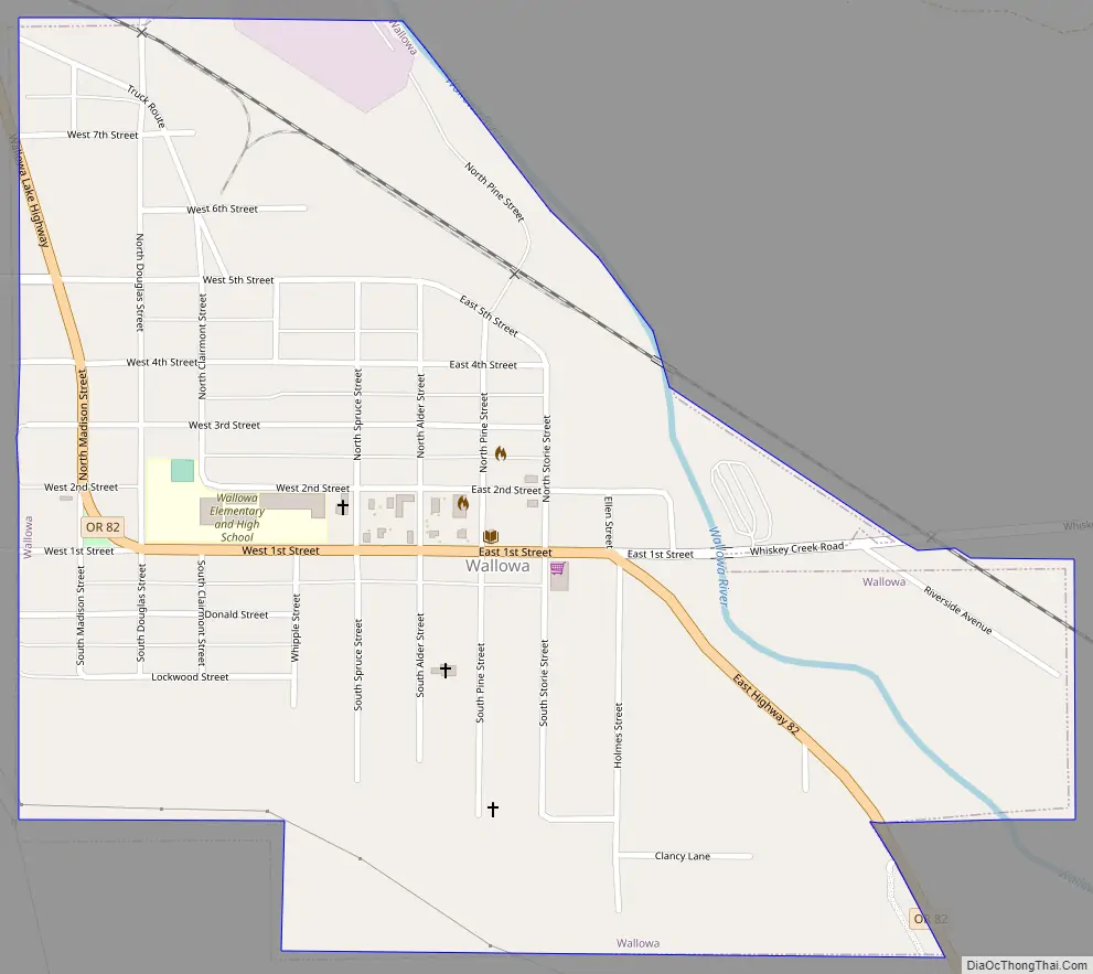
Wallowa Road Map
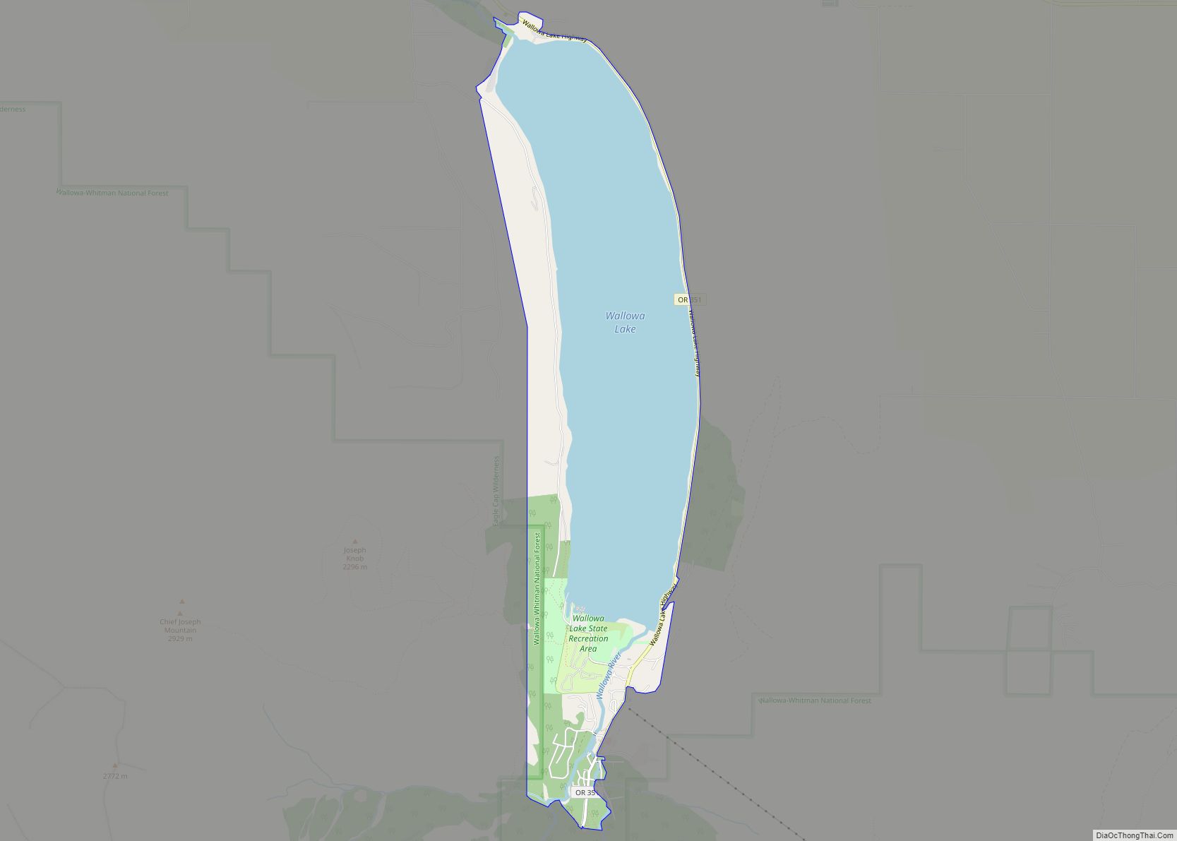
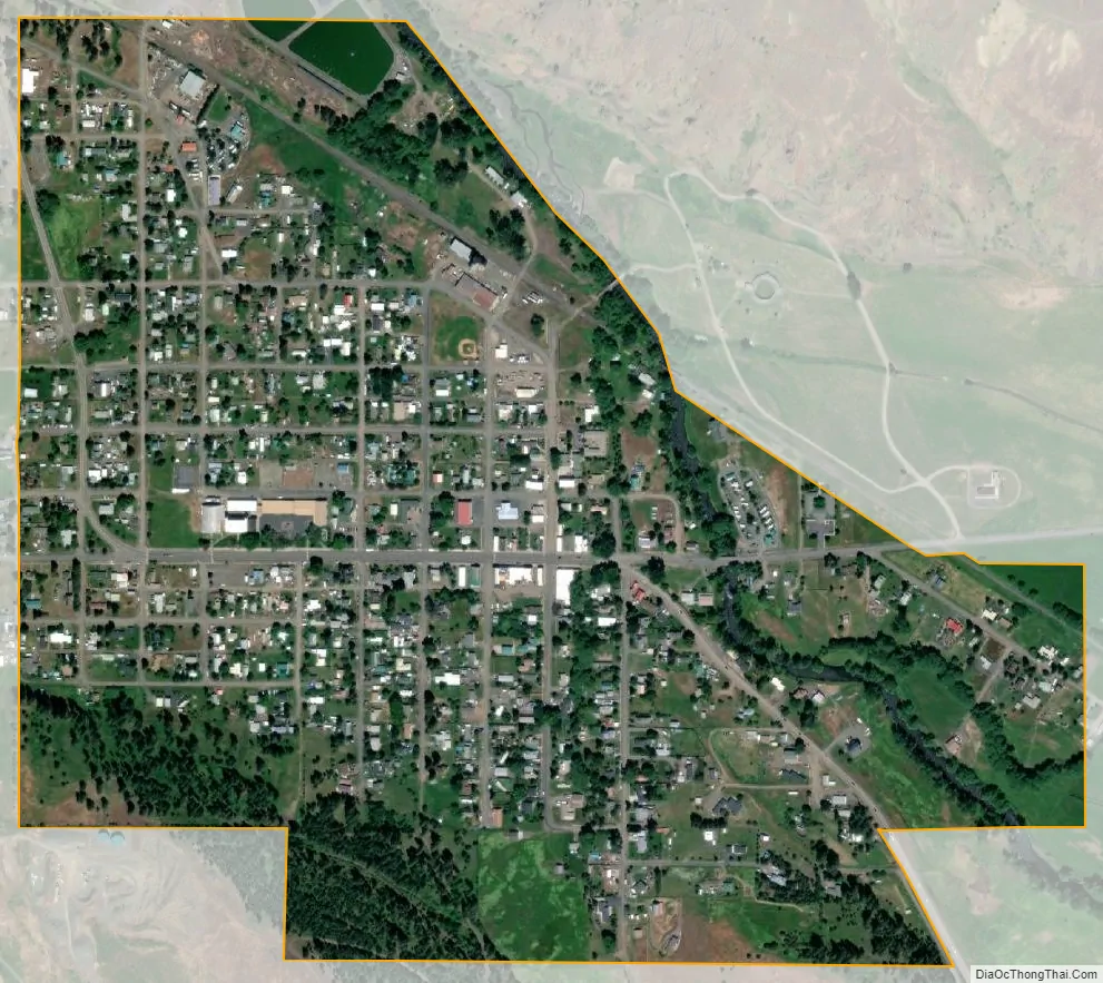
Wallowa city Satellite Map
Geography
According to the United States Census Bureau, the city has a total area of 0.61 square miles (1.58 km), all of it land.
Climate
This region experiences warm (but not hot) and dry summers, with no average monthly temperatures above 71.6 °F (22.0 °C). According to the Köppen Climate Classification system, Wallowa has a dry-summer humid continental climate, abbreviated “Dsb” on climate maps. The hottest temperature recorded in Wallowa was 110 °F (43.3 °C) on August 23, 1939, while the coldest temperature recorded was −38 °F (−38.9 °C) on December 13, 1919.
See also
Map of Oregon State and its subdivision: Map of other states:- Alabama
- Alaska
- Arizona
- Arkansas
- California
- Colorado
- Connecticut
- Delaware
- District of Columbia
- Florida
- Georgia
- Hawaii
- Idaho
- Illinois
- Indiana
- Iowa
- Kansas
- Kentucky
- Louisiana
- Maine
- Maryland
- Massachusetts
- Michigan
- Minnesota
- Mississippi
- Missouri
- Montana
- Nebraska
- Nevada
- New Hampshire
- New Jersey
- New Mexico
- New York
- North Carolina
- North Dakota
- Ohio
- Oklahoma
- Oregon
- Pennsylvania
- Rhode Island
- South Carolina
- South Dakota
- Tennessee
- Texas
- Utah
- Vermont
- Virginia
- Washington
- West Virginia
- Wisconsin
- Wyoming