Warm Springs is a census-designated place (CDP) and an unincorporated community in Jefferson County, Oregon, United States. Located on the Warm Springs Indian Reservation, the community is also known as the “Warm Springs Agency”. The population was 2,945 at the 2010 census, up from 2,431 at the 2000 census.
| Name: | Warm Springs CDP |
|---|---|
| LSAD Code: | 57 |
| LSAD Description: | CDP (suffix) |
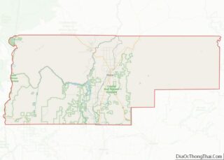
| State: | Oregon |
| County: | Jefferson County |
| Elevation: | 1,539 ft (469 m) |
| Total Area: | 42.57 sq mi (110.25 km²) |
| Land Area: | 42.44 sq mi (109.92 km²) |
| Water Area: | 0.13 sq mi (0.34 km²) |
| Total Population: | 2,435 |
| Population Density: | 57.38/sq mi (22.15/km²) |
| ZIP code: | 97761 |
| Area code: | 541 |
| FIPS code: | 4178600 |
| GNISfeature ID: | 1128648 |
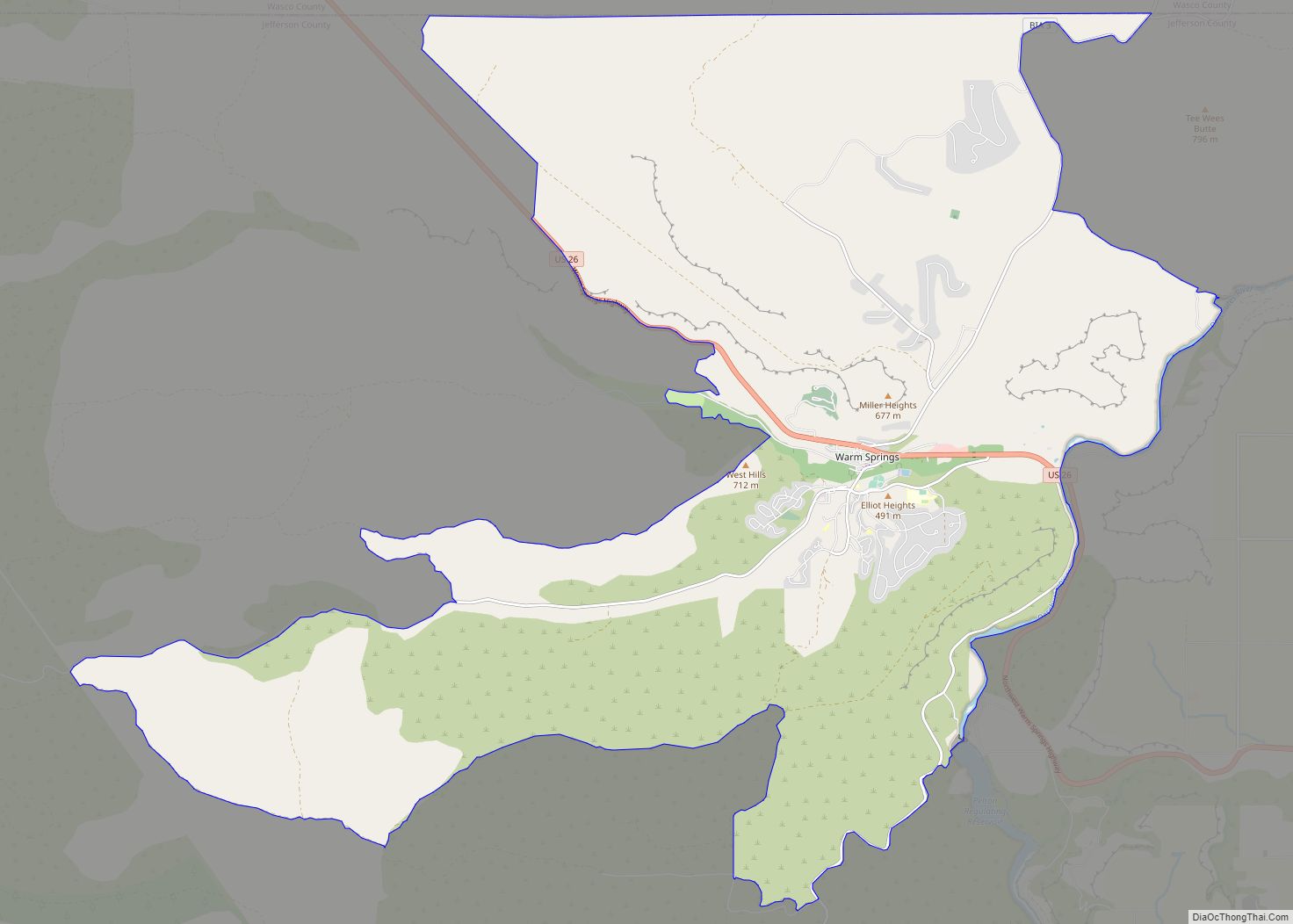
Online Interactive Map
Click on ![]() to view map in "full screen" mode.
to view map in "full screen" mode.
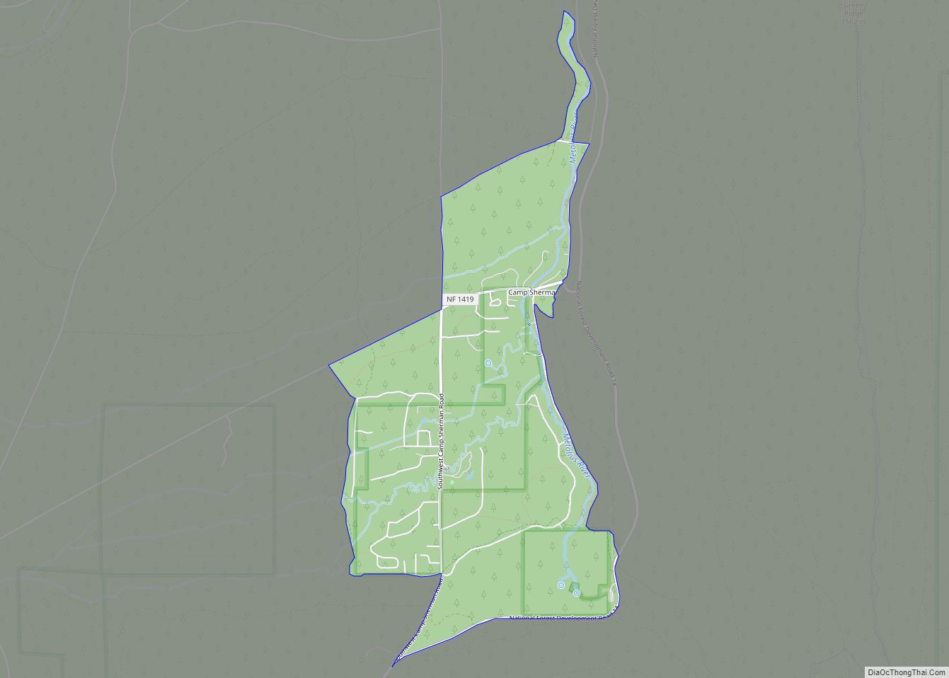
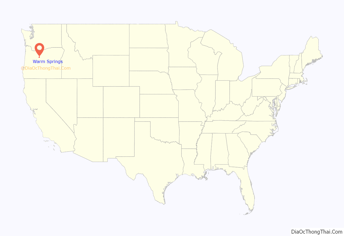
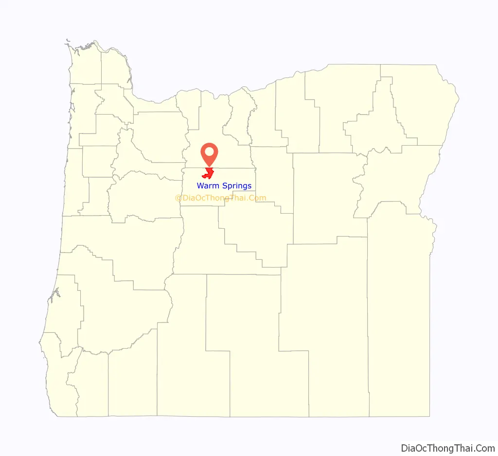
Warm Springs location map. Where is Warm Springs CDP?
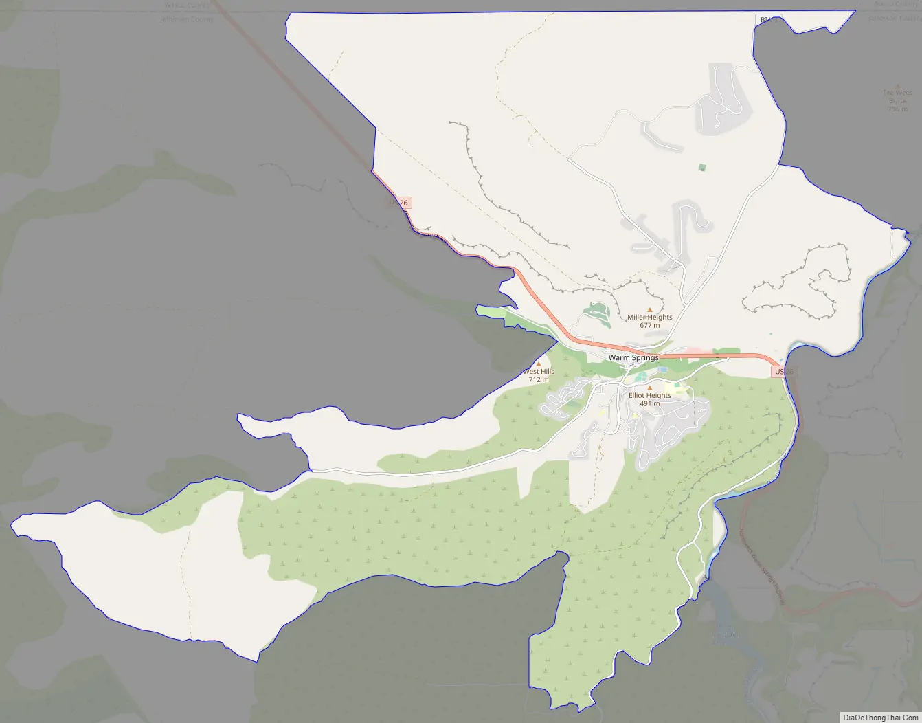
Warm Springs Road Map
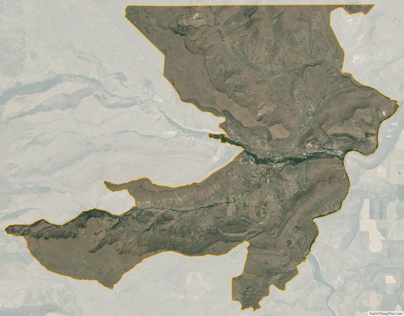
Warm Springs city Satellite Map
Geography
Warm Springs is located in northern Jefferson County at 44°45′37″N 121°16′06″W / 44.760168°N 121.268233°W / 44.760168; -121.268233 (44.760168, -121.268233). The center of the community is situated at 1,539 feet (469 m) above sea level in the valley of Shitike Creek. The Deschutes River forms the eastern boundary of the CDP.
U.S. Route 26 passes through the center of the community, leading southeast 14 miles (23 km) to Madras and northwest 100 miles (160 km) to Portland.
According to the United States Census Bureau, the Warm Springs CDP has a total area of 42.6 square miles (110.4 km), of which 42.5 square miles (110.1 km) are land and 0.1 square miles (0.3 km), or 0.30%, are water.
Climate
This region experiences warm, (but not hot), and dry summers, with no average monthly temperatures above 71.6 °F (22.0 °C). According to the Köppen Climate Classification system, Warm Springs has a warm-summer Mediterranean climate, abbreviated “Csb” on climate maps.
See also
Map of Oregon State and its subdivision: Map of other states:- Alabama
- Alaska
- Arizona
- Arkansas
- California
- Colorado
- Connecticut
- Delaware
- District of Columbia
- Florida
- Georgia
- Hawaii
- Idaho
- Illinois
- Indiana
- Iowa
- Kansas
- Kentucky
- Louisiana
- Maine
- Maryland
- Massachusetts
- Michigan
- Minnesota
- Mississippi
- Missouri
- Montana
- Nebraska
- Nevada
- New Hampshire
- New Jersey
- New Mexico
- New York
- North Carolina
- North Dakota
- Ohio
- Oklahoma
- Oregon
- Pennsylvania
- Rhode Island
- South Carolina
- South Dakota
- Tennessee
- Texas
- Utah
- Vermont
- Virginia
- Washington
- West Virginia
- Wisconsin
- Wyoming