Westfir is a city in Lane County, Oregon, United States. The population was 253 at the 2010 census. It is located about 40 miles (64 km) southeast of Eugene and about 4 miles (6 km) west of Oakridge in the Willamette National Forest.
| Name: | Westfir city |
|---|---|
| LSAD Code: | 25 |
| LSAD Description: | city (suffix) |
| State: | Oregon |
| County: | Lane County |
| Incorporated: | 1979 |
| Elevation: | 1,121 ft (327.7 m) |
| Total Area: | 0.32 sq mi (0.82 km²) |
| Land Area: | 0.31 sq mi (0.81 km²) |
| Water Area: | 0.00 sq mi (0.01 km²) |
| Total Population: | 259 |
| Population Density: | 824.84/sq mi (318.71/km²) |
| ZIP code: | 97492 |
| Area code: | 541 |
| FIPS code: | 4179950 |
| GNISfeature ID: | 1152152 |
| Website: | www.ci.westfir.or.us |
Online Interactive Map
Click on ![]() to view map in "full screen" mode.
to view map in "full screen" mode.
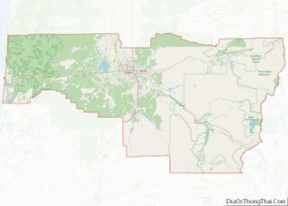
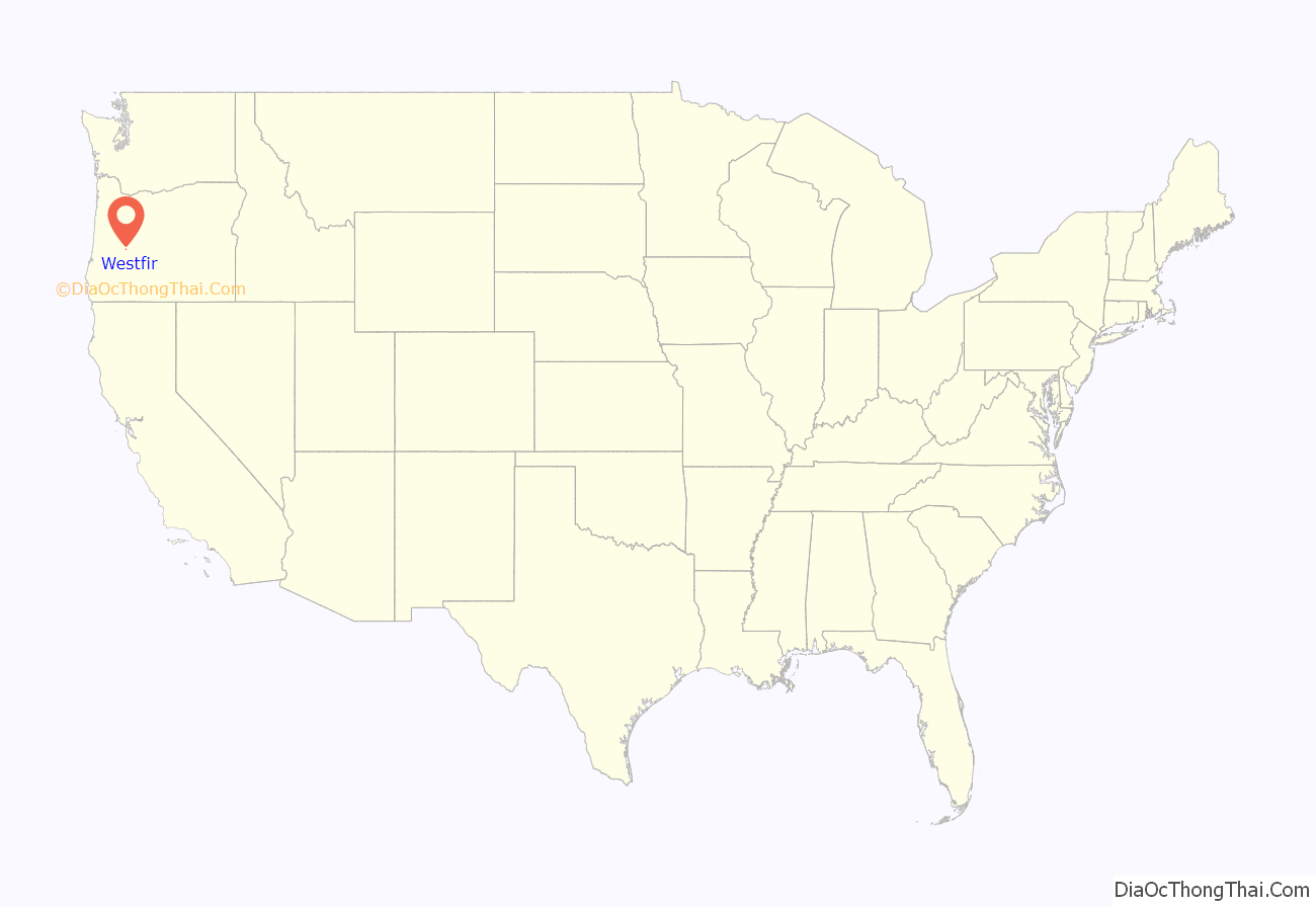
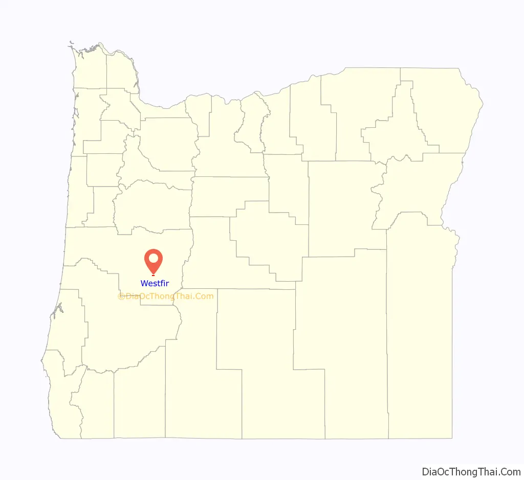
Westfir location map. Where is Westfir city?
History
The name Westfir was first used for the community in July 1923. The name came from the Western Lumber Company, which produced Douglas-fir lumber and had established Westfir as a company town. A major customer of the mill at this time was the Southern Pacific Railroad, which was building its line over Willamette Pass between Eugene and Klamath Falls in the 1920s and passing through Westfir. Westfir post office was established in November 1923. The population in 1931 was 500. The Western Lumber sawmill was later sold to the Westfir Lumber Company and in 1946 to the Edward Hines Lumber Company. Hines established a plywood mill in Westfir in 1952. In 1977, Hines closed the mills and sold the entire town, including the water and sewer system. The town’s new owners wanted the utilities to be in public ownership, so local residents voted to incorporate in 1979. The mill operations closed in 1984, after a series of fires.
Oregon’s longest existing covered bridge, the Office Bridge, was built across the North Fork Middle Fork Willamette River in 1944 to connect the Westfir Lumber Company mill to the main office. The Office of the Westfir Lumber Company is a grand historic structure. It is a 9 room hotel and market now. The Westfir Lodge https://www.westfirlodge.com
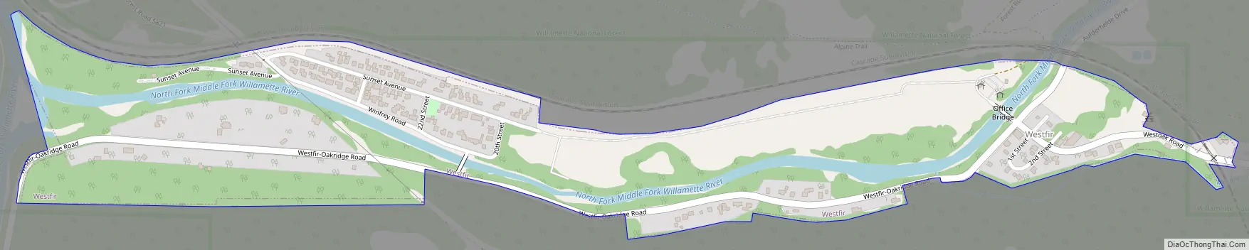
Westfir Road Map
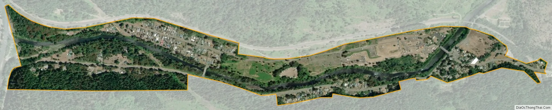
Westfir city Satellite Map
Geography
According to the United States Census Bureau, the city has a total area of 0.33 square miles (0.85 km), all of it land.
Climate
This region experiences warm (but not hot) and dry summers, with no average monthly temperatures above 71.6 °F. According to the Köppen Climate Classification system, Westfir has a warm-summer Mediterranean climate, abbreviated “Csb” on climate maps.
See also
Map of Oregon State and its subdivision: Map of other states:- Alabama
- Alaska
- Arizona
- Arkansas
- California
- Colorado
- Connecticut
- Delaware
- District of Columbia
- Florida
- Georgia
- Hawaii
- Idaho
- Illinois
- Indiana
- Iowa
- Kansas
- Kentucky
- Louisiana
- Maine
- Maryland
- Massachusetts
- Michigan
- Minnesota
- Mississippi
- Missouri
- Montana
- Nebraska
- Nevada
- New Hampshire
- New Jersey
- New Mexico
- New York
- North Carolina
- North Dakota
- Ohio
- Oklahoma
- Oregon
- Pennsylvania
- Rhode Island
- South Carolina
- South Dakota
- Tennessee
- Texas
- Utah
- Vermont
- Virginia
- Washington
- West Virginia
- Wisconsin
- Wyoming