Summersville is a city in Nicholas County, West Virginia, United States. The population was 3,459 at the 2020 census. It is the county seat of Nicholas County.
| Name: | Summersville city |
|---|---|
| LSAD Code: | 25 |
| LSAD Description: | city (suffix) |
| State: | West Virginia |
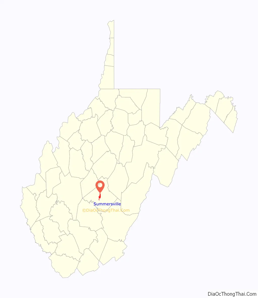
| County: | Nicholas County |
| Founded: | 1824 |
| Elevation: | 1,880 ft (573 m) |
| Total Area: | 4.53 sq mi (11.73 km²) |
| Land Area: | 4.49 sq mi (11.62 km²) |
| Water Area: | 0.04 sq mi (0.11 km²) |
| Total Population: | 3,459 |
| Population Density: | 729.66/sq mi (281.75/km²) |
| ZIP code: | 26651 |
| Area code: | 304, 681 |
| FIPS code: | 5477980 |
| GNISfeature ID: | 1547739 |
Online Interactive Map
Click on ![]() to view map in "full screen" mode.
to view map in "full screen" mode.
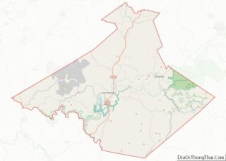
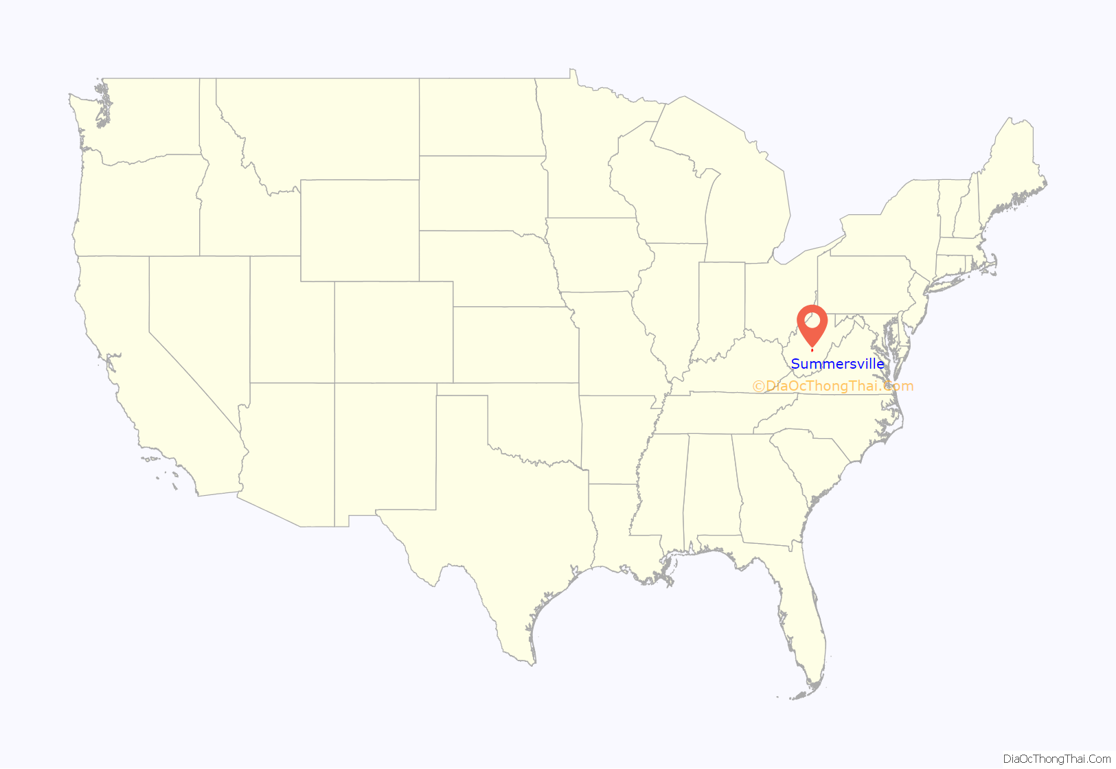
Summersville location map. Where is Summersville city?
History
Summersville was laid out in 1824. The city was named for Lewis Summers, a local judge who had introduced the bill to create Nicholas County.
Summersville was home to both Union and Confederate encampments during the Civil War. The town was mostly burned down by the Confederate spy, Nancy Hart Douglas, during the war. The town was rebuilt by 1884.
In 1914, Nicholas County High School was established, then located downtown in the “Old Main”. More buildings were built on the campus to house the growing student body until a new building north of town was finished in 1978.
Construction on Summersville Dam began in 1960 and was finished and dedicated by President Lyndon Baines Johnson in 1966.
Since the upgrade of U.S. Route 19 through Summersville from a two lane highway to a four lane highway, the city has become the economic center of Nicholas County. The road is commonly used by northern travelers as a shortcut to the south.
Summersville is home to the annual Potato Festival.
On June 23, 2016 flooding impacted Summersville. This resulted in Summersville Middle School being demolished and relocated to a modular setting after flood waters damaged the school. Ground was broken on a new campus for Summersville Middle School, Nicholas County High School, and the Nicholas County Career and Technical Center on June 2, 2020.
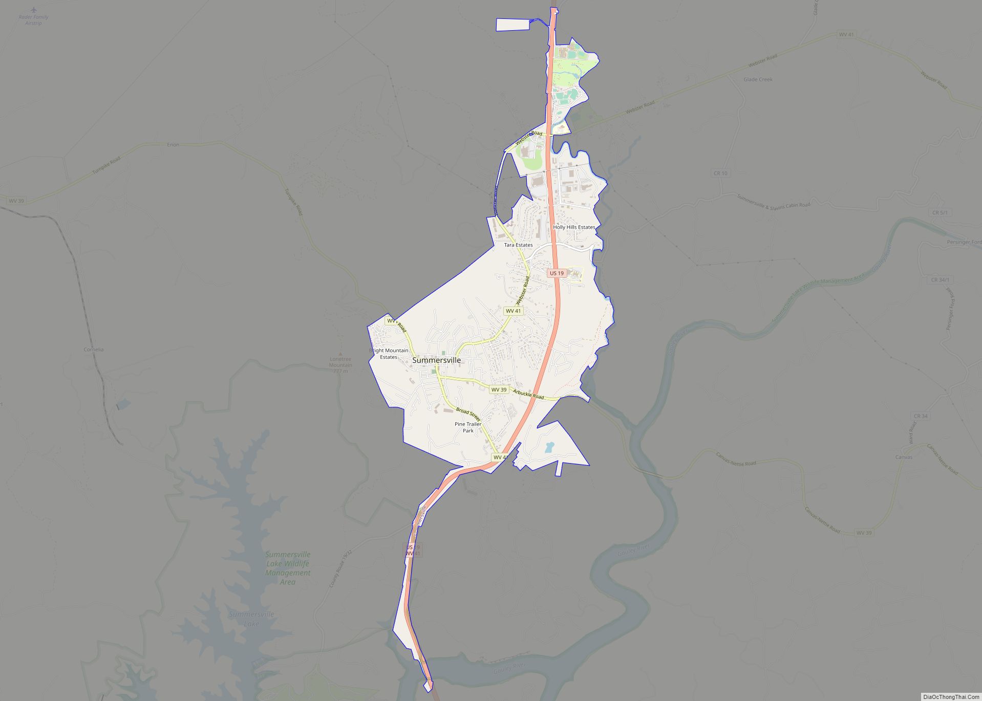
Summersville Road Map
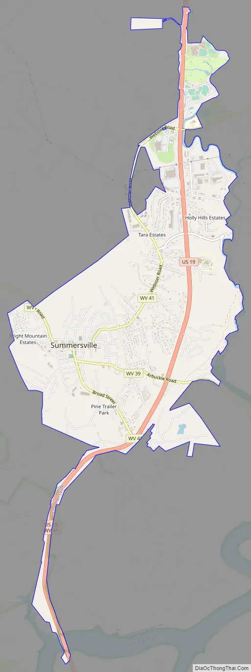
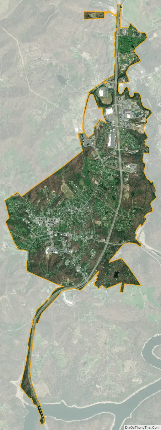
Summersville city Satellite Map
Geography
Summersville is located at 38°17′0″N 80°50′39″W / 38.28333°N 80.84417°W / 38.28333; -80.84417 (38.283342, -80.844207). It is located just north of the Gauley River which is famous for its challenging whitewater. The river is impounded by a large dam which creates Summersville Lake, creating flatwater recreation as well.
According to the United States Census Bureau, the town has a total area of 4.26 square miles (11.03 km), of which 4.22 square miles (10.93 km) is land and 0.04 square miles (0.10 km) is water.
Climate
The climate in this area has mild differences between highs and lows, and there is adequate rainfall year-round. According to the Köppen Climate Classification system, Summersville has a marine west coast climate, abbreviated “Cfb” on climate maps.
See also
Map of West Virginia State and its subdivision:- Barbour
- Berkeley
- Boone
- Braxton
- Brooke
- Cabell
- Calhoun
- Clay
- Doddridge
- Fayette
- Gilmer
- Grant
- Greenbrier
- Hampshire
- Hancock
- Hardy
- Harrison
- Jackson
- Jefferson
- Kanawha
- Lewis
- Lincoln
- Logan
- Marion
- Marshall
- Mason
- McDowell
- Mercer
- Mineral
- Mingo
- Monongalia
- Monroe
- Morgan
- Nicholas
- Ohio
- Pendleton
- Pleasants
- Pocahontas
- Preston
- Putnam
- Raleigh
- Randolph
- Ritchie
- Roane
- Summers
- Taylor
- Tucker
- Tyler
- Upshur
- Wayne
- Webster
- Wetzel
- Wirt
- Wood
- Wyoming
- Alabama
- Alaska
- Arizona
- Arkansas
- California
- Colorado
- Connecticut
- Delaware
- District of Columbia
- Florida
- Georgia
- Hawaii
- Idaho
- Illinois
- Indiana
- Iowa
- Kansas
- Kentucky
- Louisiana
- Maine
- Maryland
- Massachusetts
- Michigan
- Minnesota
- Mississippi
- Missouri
- Montana
- Nebraska
- Nevada
- New Hampshire
- New Jersey
- New Mexico
- New York
- North Carolina
- North Dakota
- Ohio
- Oklahoma
- Oregon
- Pennsylvania
- Rhode Island
- South Carolina
- South Dakota
- Tennessee
- Texas
- Utah
- Vermont
- Virginia
- Washington
- West Virginia
- Wisconsin
- Wyoming