Middleton is a city in Canyon County, Idaho, United States. The population amounted to 9,091 at the 2021 census estimate, up from 5,524 at the 2010 census and 2,978 in 2000. It is part of the Boise City–Nampa, Idaho Metropolitan Statistical Area.
| Name: | Middleton city |
|---|---|
| LSAD Code: | 25 |
| LSAD Description: | city (suffix) |
| State: | Idaho |
| County: | Canyon County |
| Incorporated: | 1910 |
| Elevation: | 2,398 ft (731 m) |
| Total Area: | 5.58 sq mi (14.45 km²) |
| Land Area: | 5.54 sq mi (14.34 km²) |
| Water Area: | 0.04 sq mi (0.11 km²) |
| Total Population: | 5,524 |
| Population Density: | 1,529.26/sq mi (590.45/km²) |
| ZIP code: | 83644 |
| Area code: | 208 |
| FIPS code: | 1652660 |
| GNISfeature ID: | 0373932 |
| Website: | www.middleton.id.gov |
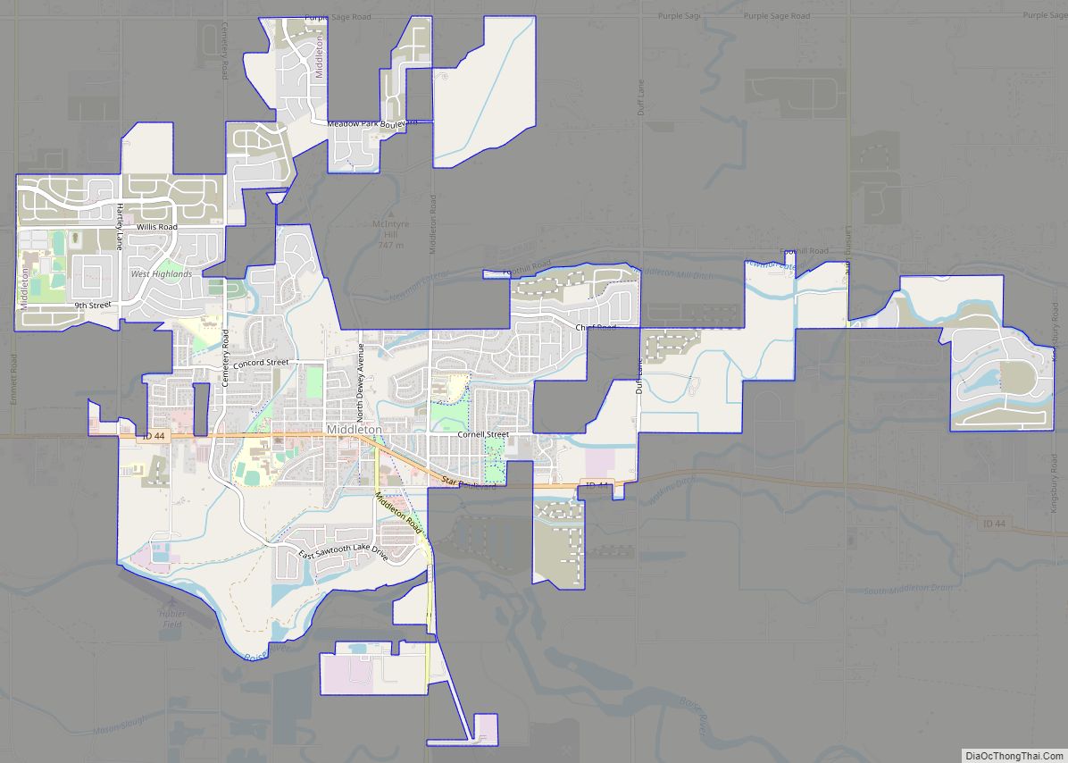
Online Interactive Map
Click on ![]() to view map in "full screen" mode.
to view map in "full screen" mode.
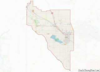
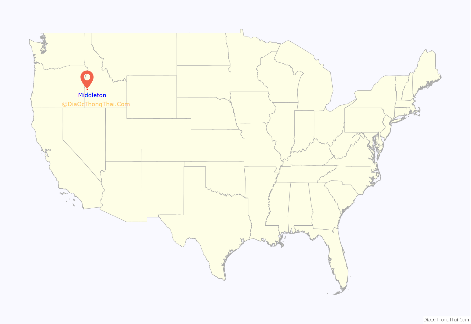
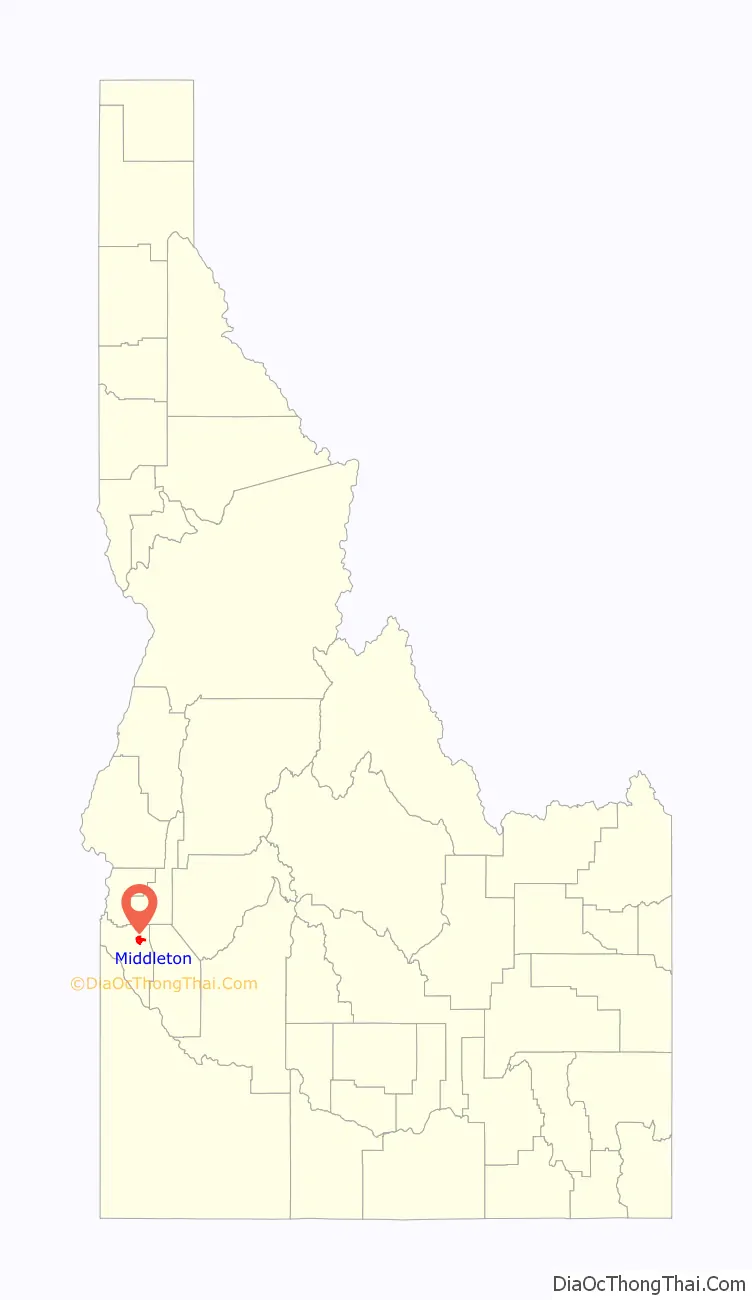
Middleton location map. Where is Middleton city?
History
Middleton was named for its location between the old fort Boise and Keeney’s Ferry; it being the midpoint between the two. It served as a rest stop for those heading for Keeney’s Ferry. It had a stage station in the early days of the Oregon Trail, a post office in 1866 and a water powered grist mill in 1871. The Ward Massacre occurred near the site in 1854.
Middleton is the oldest settlement in Canyon County, with the land being parceled out in 1863 by William N. Montgomery. The Boise River flooded in 1872 and cut a new channel, isolating the town on an island; as a result, the town moved to a new location in the years after 1880. The town incorporated as a city in 1910, although the certificate was not issued until 1971. The present mayor is Steve Rule.
On February 1, 2007, 78% of Middleton High School burned down, caused by the overheating of a fan above the weight room. The 42-year-old building was built when fire codes required sprinklers to be installed, but there was no provision for their functionality. To save money during the construction of the school in the 1960s, the sprinklers were installed but were never connected to a water source.
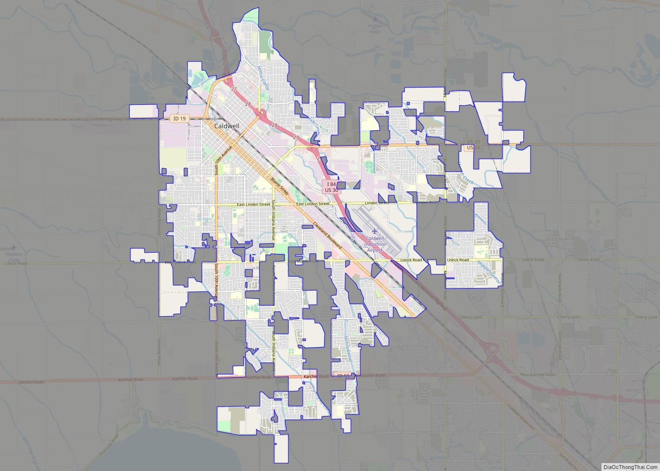
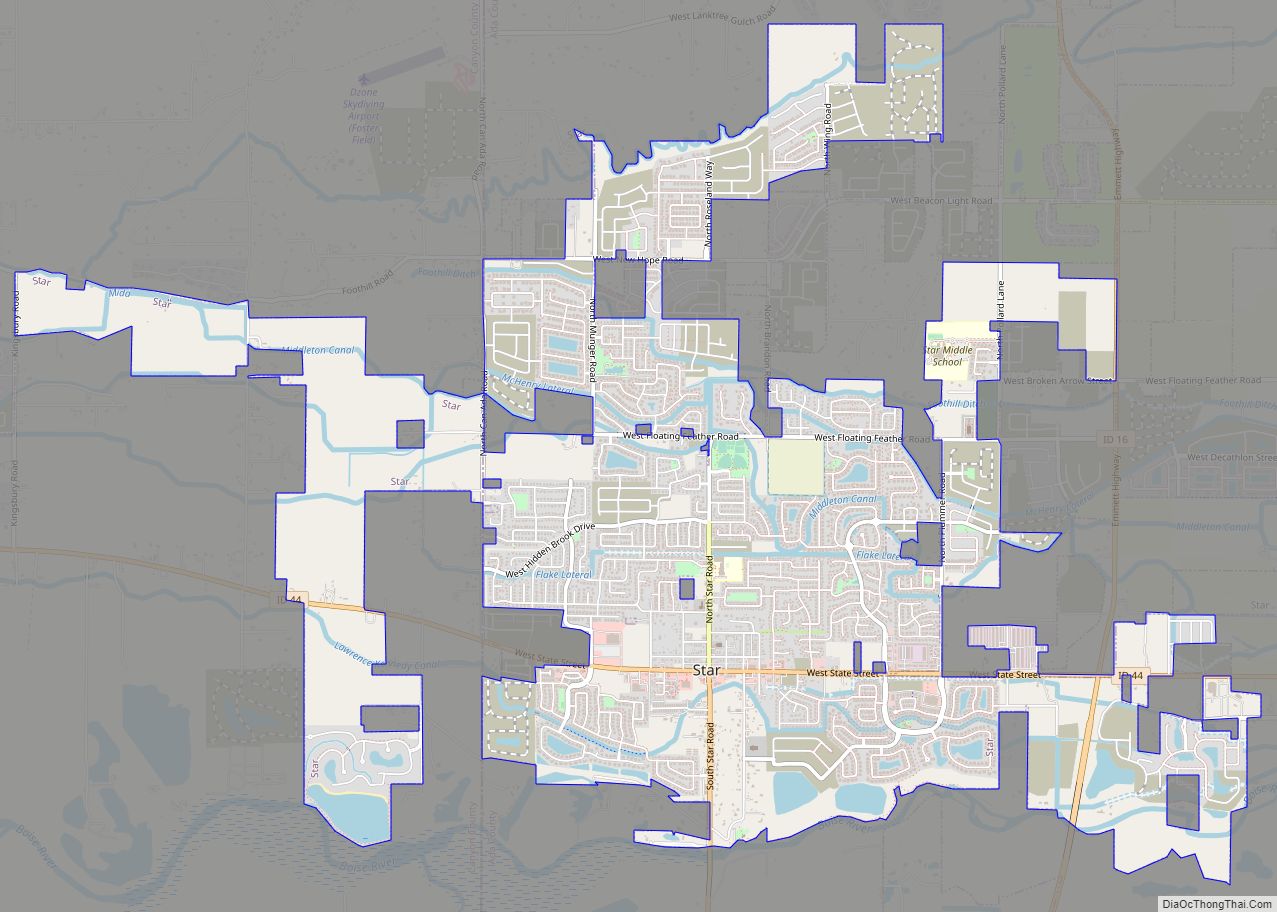
Middleton Road Map

Middleton city Satellite Map

Geography
According to the United States Census Bureau, the city has a total area of 5.71 square miles (14.79 km), of which, 5.66 square miles (14.66 km) is land and 0.05 square miles (0.13 km) is water.
See also
Map of Idaho State and its subdivision:- Ada
- Adams
- Bannock
- Bear Lake
- Benewah
- Bingham
- Blaine
- Boise
- Bonner
- Bonneville
- Boundary
- Butte
- Camas
- Canyon
- Caribou
- Cassia
- Clark
- Clearwater
- Custer
- Elmore
- Franklin
- Fremont
- Gem
- Gooding
- Idaho
- Jefferson
- Jerome
- Kootenai
- Latah
- Lemhi
- Lewis
- Lincoln
- Madison
- Minidoka
- Nez Perce
- Oneida
- Owyhee
- Payette
- Power
- Shoshone
- Teton
- Twin Falls
- Valley
- Washington
- Alabama
- Alaska
- Arizona
- Arkansas
- California
- Colorado
- Connecticut
- Delaware
- District of Columbia
- Florida
- Georgia
- Hawaii
- Idaho
- Illinois
- Indiana
- Iowa
- Kansas
- Kentucky
- Louisiana
- Maine
- Maryland
- Massachusetts
- Michigan
- Minnesota
- Mississippi
- Missouri
- Montana
- Nebraska
- Nevada
- New Hampshire
- New Jersey
- New Mexico
- New York
- North Carolina
- North Dakota
- Ohio
- Oklahoma
- Oregon
- Pennsylvania
- Rhode Island
- South Carolina
- South Dakota
- Tennessee
- Texas
- Utah
- Vermont
- Virginia
- Washington
- West Virginia
- Wisconsin
- Wyoming