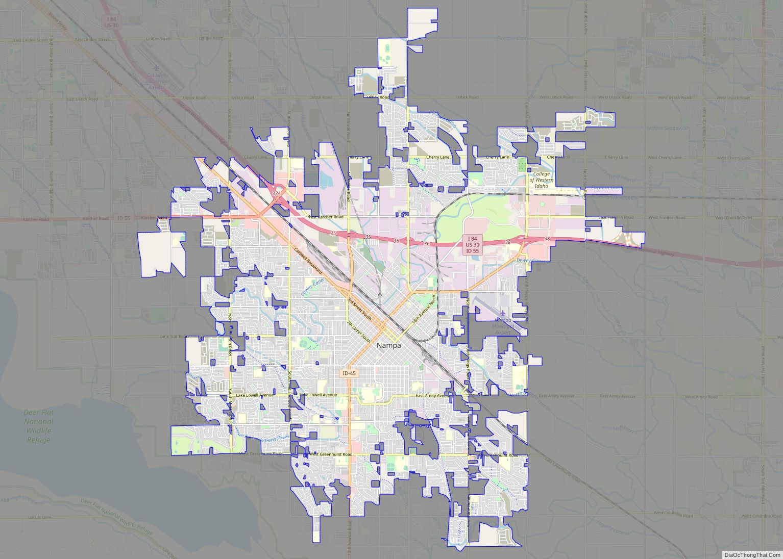
Nampa (/ˈnæmpə/ (listen)) is the largest city in Canyon County, Idaho, United States. Its population was 100,200 at the time of the 2020 Census. It is Idaho’s third-most populous city. Nampa is about 20 miles (32 km) west of Boise along Interstate 84, and six miles (10 km) west of Meridian. It is the second principal city of the Boise metropolitan area. The name “Nampa” may have come from a Shoshoni word meaning either moccasin or footprint. According to toponymist William O. Bright the name comes from the Shoshoni word /nampai/, meaning “foot”.
| Name: | Nampa city |
|---|---|
| LSAD Code: | 25 |
| LSAD Description: | city (suffix) |
| State: | Idaho |
| County: | Canyon County |
| Founded: | 1886 |
| Incorporated: | 1891 |
| Elevation: | 2,517 ft (767 m) |
| Land Area: | 32.82 sq mi (85.00 km²) |
| Water Area: | 0.15 sq mi (0.39 km²) |
| Population Density: | 3,024.89/sq mi (1,167.92/km²) |
| Area code: | 208 |
| FIPS code: | 1656260 |
| GNISfeature ID: | 0396943 |
| Website: | CityofNampa.US |
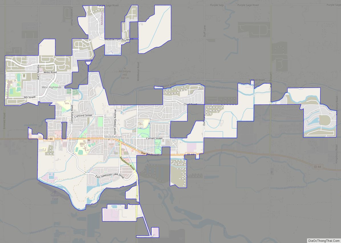
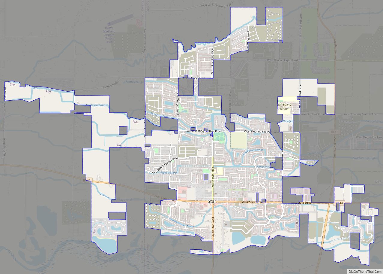
Online Interactive Map
Click on ![]() to view map in "full screen" mode.
to view map in "full screen" mode.
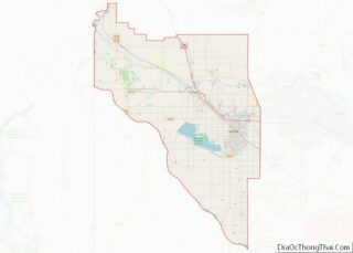
Nampa location map. Where is Nampa city?


History
Nampa had its beginnings in the early 1880s when the Oregon Short Line Railroad built a line from Granger, Wyoming, to Huntington, Oregon, which passed through Nampa. In Nampa there is a history museum marking the significance of the railroad company. More railroad lines sprang up running through Nampa, making it a very important railroad town. Alexander and Hannah Duffes established one of the town’s first homesteads, eventually forming the Nampa Land and Improvement Company with the help of their friend and co-founder, James McGee. In spite of the name, many of the first settlers referred to the town as “New Jerusalem” because of the strong religious focus of its citizens. After only a year the town had grown from 15 homes to 50. As new amenities were added to the town, Nampa continued its growth and was incorporated in 1891.
Unlike most towns in that historic era with streets running true north and south, Nampa’s historic roads run perpendicular to the railroad tracks that travel northwest to southeast through the town. Thus, the northside is really the northeast side of the tracks, and the southside is really the southwest side of the railroad tracks. Founder Alexander Duffes laid out Nampa’s streets this way to prevent an accident like one that occurred earlier in a town he had platted near Toronto, Ontario, Canada. In that town, a woman and her two children were killed by a train when they started across the railroad tracks in a buggy and the wheel got stuck. As the Oregon Short Line railroad originally bypassed Boise, Nampa has the fanciest of many railroad depots built in the area.
The first elementary school was built in the 1890s. Lakeview School was on a hill on 6th Street and 12th Avenue North, with a view of Lake Ethel. Just after the school’s centennial celebration, it was condemned as a school and sold to the First Mennonite Church. In 2008 the building was refurbished, and is now being used by the Idaho Arts Charter School.
Lake Ethel – an irrigation reservoir – had long been the site of community picnics, and many citizens fished, swam, boated and even hunted on the lake and its surrounding property. The hunting didn’t last for long, however, as O.F. Persons, owner of the adjoining homestead, took offense when local hunters started shooting his pet ducks.
The city later auctioned off the lake. E.H. Dewey (a former Nampa mayor) was the only bidder. But occasional flooding led to a series of lawsuits from neighbors. Dewey eventually drained Lake Ethel. Not long after, the city council became interested in buying back the Fritz Miller property as well as the Dewey home. Pressure had been building for more than four years. Nampa citizens wanted another park. On August 7, 1924, the city council passed an ordinance to purchase the Miller property and name it Lakeview Park. A bandstand was completed in 1928, and the municipal swimming pool opened on August 13, 1934. Swim tickets cost 10 cents each or 15 for a dollar. It is Nampa’s largest park and many community celebrations are held there.
Colonel William H. Dewey, a man who made a fortune mining in Silver City, built the Dewey Palace Hotel in 1902 for a quarter of a million dollars. Colonel Dewey died in his hotel in 1903, leaving his son one million dollars. The hotel survived the great fire of 1909, which burned several blocks of downtown Nampa, but was razed in 1963 after redevelopment plans failed. Relics from the hotel, such as the chandelier and the hotel safe can be found at the Canyon County Historical Museum, which is housed in the old train depot on Front Street and Nampa City Hall. After demolition the location on First Street between 11th and 12th Ave. South was sold to private enterprise including a bank and tire store replacing this historic building with the current modern structures. A public-use postage stamp sized park was later placed across the street from the old palace property as a collaboration between the Downtown Alliance of Nampa (the local business council) and an Eagle Scout Project for the Boy Scouts of America. The park includes a large mural/wall sculpture of running horses commissioned for the project.
A Carnegie library was built downtown in 1908; it burned down after the library moved in 1966. Nampa Public Library was then located on the corner of 1st Street and 11th Avenue South in the old bank building. A new library, located on 12th Avenue South, was opened in March 2015.
Deer Flat Reservoir, an offstream irrigation storage reservoir, was constructed by the United States Bureau of Reclamation between 1906 and 1911. Known locally as Lake Lowell, it is surrounded by the Deer Flat National Wildlife Refuge, which was established in 1909 by President Theodore Roosevelt. The refuge is administered by the U.S. Fish and Wildlife Service. Lake Lowell is filled by the concrete New York Canal; the water is diverted from the Boise River a few miles below Lucky Peak Dam.
The Idaho State School and Hospital was built northwest of Nampa in 1910, for the state’s developmentally challenged population, and opened in 1918. The institution was largely self-sufficient, with a large farm staffed by the residents. The higher-functioning residents also cared for residents who could not care for themselves. Much has changed in the care of persons with developmental disabilities from the time of the state school’s opening. The land for the old farm was sold and are now golf courses (Centennial and Ridgecrest), and the residents no longer give primary care to other residents. The institution is modernized and remains in operation, though a few of the oldest buildings are now used to house juvenile offenders.
Nampa held an annual harvest festival and farmers’ market from about 1908, a time of celebration and community fun. From this festival emerged the Snake River Stampede Rodeo in 1937, which continues to this day. It is one of the top 12 rodeos in the pro rodeo circuits.
A local congregation of the Church of the Nazarene built a small elementary school in 1913, later growing to Northwest Nazarene College in 1915 and finally to Northwest Nazarene University. The university currently has a student body of 2,500 undergraduate and graduate students.
Karcher Mall opened in 1965, the first enclosed shopping mall in the Treasure Valley. Many area residents have memories of having an Orange Julius, sitting on Santa’s lap, or playing games at the Red Baron arcade in the mall. Karcher Mall was “the place to gather” for several decades until the Boise Towne Square mall was built in Boise in 1988, drawing business away. Karcher Mall struggled for many years, but is making a comeback. With a new I-84 interchange nearby, the area is booming with new business.
The Idaho Press-Tribune is the local newspaper for the Canyon County area. Since early 2009, the facility has been the contract printer for The Idaho Statesman, whose antiquated press equipment was retired and not replaced.
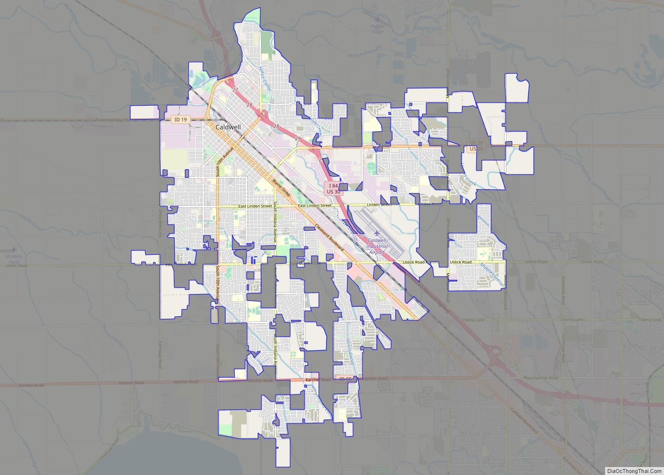
Nampa Road Map

Nampa city Satellite Map

Geography
Nampa is located at 43°34′29″N 116°33′49″W / 43.57472°N 116.56361°W / 43.57472; -116.56361 (43.574807, -116.563559).
According to the U.S. Census Bureau, the city has an area of 31.34 square miles (81.17 km), of which, 31.19 square miles (80.78 km) is land and 0.15 square miles (0.39 km) is water.
ZIP codes: 83651, 83653, 83686, 83687.
See also
Map of Idaho State and its subdivision:- Ada
- Adams
- Bannock
- Bear Lake
- Benewah
- Bingham
- Blaine
- Boise
- Bonner
- Bonneville
- Boundary
- Butte
- Camas
- Canyon
- Caribou
- Cassia
- Clark
- Clearwater
- Custer
- Elmore
- Franklin
- Fremont
- Gem
- Gooding
- Idaho
- Jefferson
- Jerome
- Kootenai
- Latah
- Lemhi
- Lewis
- Lincoln
- Madison
- Minidoka
- Nez Perce
- Oneida
- Owyhee
- Payette
- Power
- Shoshone
- Teton
- Twin Falls
- Valley
- Washington
- Alabama
- Alaska
- Arizona
- Arkansas
- California
- Colorado
- Connecticut
- Delaware
- District of Columbia
- Florida
- Georgia
- Hawaii
- Idaho
- Illinois
- Indiana
- Iowa
- Kansas
- Kentucky
- Louisiana
- Maine
- Maryland
- Massachusetts
- Michigan
- Minnesota
- Mississippi
- Missouri
- Montana
- Nebraska
- Nevada
- New Hampshire
- New Jersey
- New Mexico
- New York
- North Carolina
- North Dakota
- Ohio
- Oklahoma
- Oregon
- Pennsylvania
- Rhode Island
- South Carolina
- South Dakota
- Tennessee
- Texas
- Utah
- Vermont
- Virginia
- Washington
- West Virginia
- Wisconsin
- Wyoming