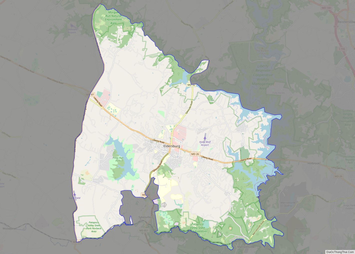
Eldersburg is an unincorporated community and census-designated place (CDP) in Carroll County, Maryland, United States. The population was 30,531 at the 2010 census.
| Name: | Eldersburg CDP |
|---|---|
| LSAD Code: | 57 |
| LSAD Description: | CDP (suffix) |
| State: | Maryland |
| County: | Carroll County |
| Elevation: | 643 ft (196 m) |
| Total Area: | 42.36 sq mi (109.72 km²) |
| Land Area: | 39.83 sq mi (103.16 km²) |
| Water Area: | 2.54 sq mi (6.57 km²) |
| Total Population: | 32,582 |
| Population Density: | 818.03/sq mi (315.84/km²) |
| ZIP code: | 21784 |
| Area code: | 410,443,667 |
| FIPS code: | 2425575 |
| GNISfeature ID: | 0590147 |
| Website: | www.eldersburgofficial.com |
Online Interactive Map
Click on ![]() to view map in "full screen" mode.
to view map in "full screen" mode.
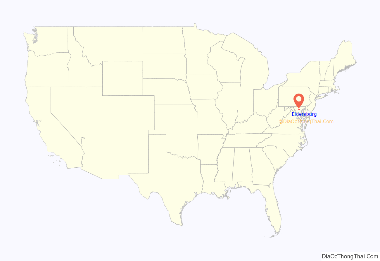
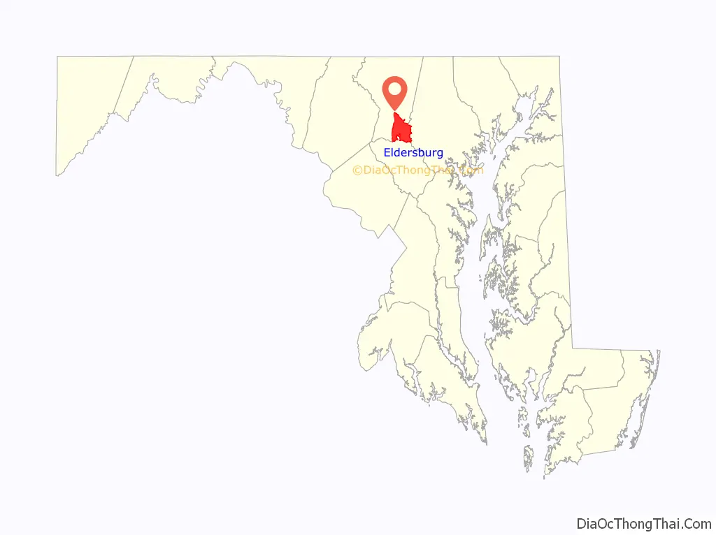
Eldersburg location map. Where is Eldersburg CDP?
History
Eldersburg is named after John Elder, who was given a land grant from the King of England. The community was served by a post office in April 1850 in the Howard district of Anne Arundel County with the name “Eldersburgh.” In 1851, Howard County was formed, and on October 28, 1871, the post office moved to Carroll County, retaining the “Eldersburgh” spelling. In December 1894, “Eldersburgh” was shortened to “Eldersburg”. The Moses Brown House was listed on the National Register of Historic Places in 1980. Wesley Chapel Methodist Episcopal Church was listed in 1984.
Eldersburg Road Map
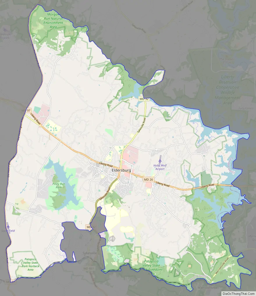
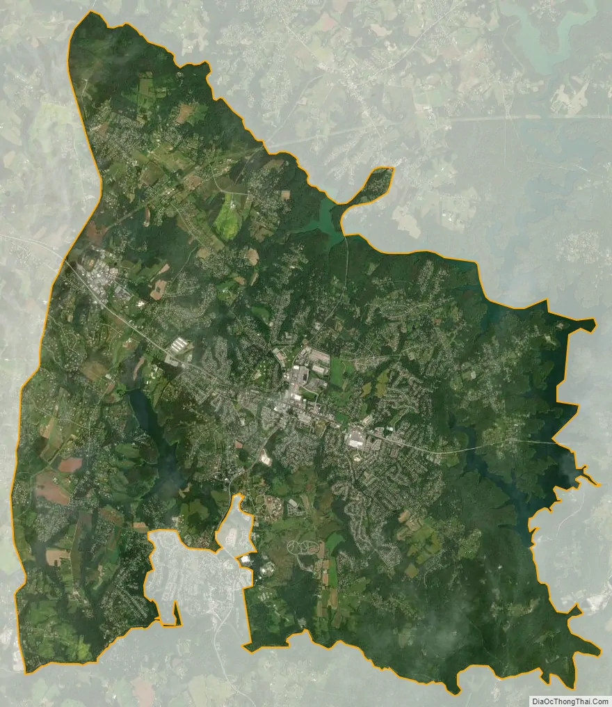
Eldersburg city Satellite Map
Geography
Eldersburg is located in the southeastern portion of Carroll County at 39°24′3″N 76°57′5″W / 39.40083°N 76.95139°W / 39.40083; -76.95139 (39.400802, −76.951475). It is bordered to the east by Baltimore County and to the south by Howard County, except where it is bordered by the town of Sykesville.
The center of Eldersburg is at the intersection of Maryland Route 26 (Liberty Road) and Maryland Route 32 (Sykesville Road). MD 26 leads east 20 miles (32 km) to downtown Baltimore and west 28 miles (45 km) to Frederick, while MD 32 leads north 15 miles (24 km) to Westminster, the Carroll County seat, and south 20 miles (32 km) to Columbia.
According to the United States Census Bureau, the Eldersburg CDP has a total area of 42.2 square miles (109.4 km), of which 39.7 square miles (102.8 km) is land and 2.5 square miles (6.6 km), or 6.00%, is water.
See also
Map of Maryland State and its subdivision: Map of other states:- Alabama
- Alaska
- Arizona
- Arkansas
- California
- Colorado
- Connecticut
- Delaware
- District of Columbia
- Florida
- Georgia
- Hawaii
- Idaho
- Illinois
- Indiana
- Iowa
- Kansas
- Kentucky
- Louisiana
- Maine
- Maryland
- Massachusetts
- Michigan
- Minnesota
- Mississippi
- Missouri
- Montana
- Nebraska
- Nevada
- New Hampshire
- New Jersey
- New Mexico
- New York
- North Carolina
- North Dakota
- Ohio
- Oklahoma
- Oregon
- Pennsylvania
- Rhode Island
- South Carolina
- South Dakota
- Tennessee
- Texas
- Utah
- Vermont
- Virginia
- Washington
- West Virginia
- Wisconsin
- Wyoming