Queensland is a census-designated place south of Upper Marlboro in Prince George’s County, Maryland, United States. The population of the CDP was 2,191 at the 2020 census. It was formerly known as Queenland until 2014 when its name was changed to Queensland and a small portion of its geography was transferred to Upper Marlboro.
| Name: | Queensland CDP |
|---|---|
| LSAD Code: | 57 |
| LSAD Description: | CDP (suffix) |
| State: | Maryland |
| County: | Prince George’s County |
| Elevation: | 120 ft (40 m) |
| Total Area: | 4.74 sq mi (12.27 km²) |
| Land Area: | 4.73 sq mi (12.25 km²) |
| Water Area: | 0.01 sq mi (0.02 km²) |
| Total Population: | 2,191 |
| Population Density: | 463.21/sq mi (178.86/km²) |
| Area code: | 301, 240 |
| FIPS code: | 2464568 |
Online Interactive Map
Click on ![]() to view map in "full screen" mode.
to view map in "full screen" mode.
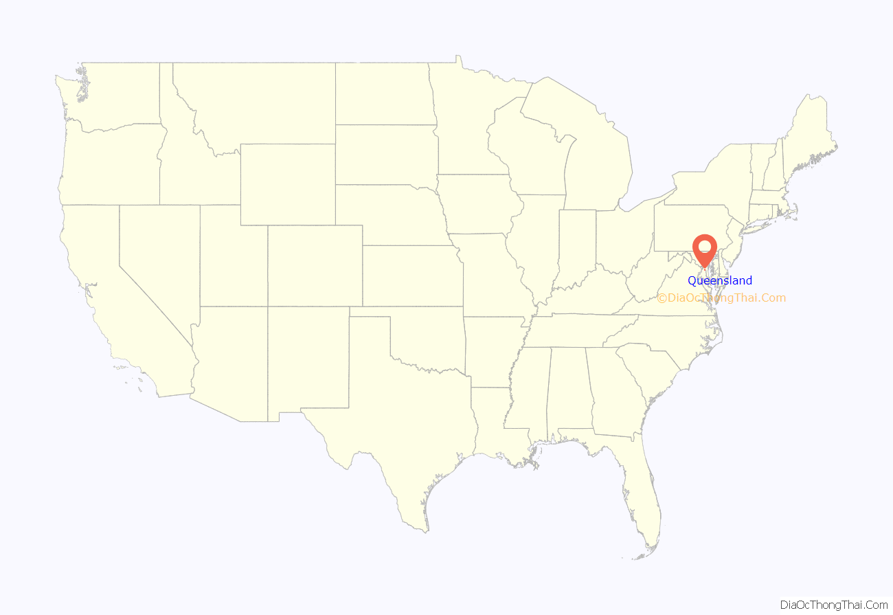
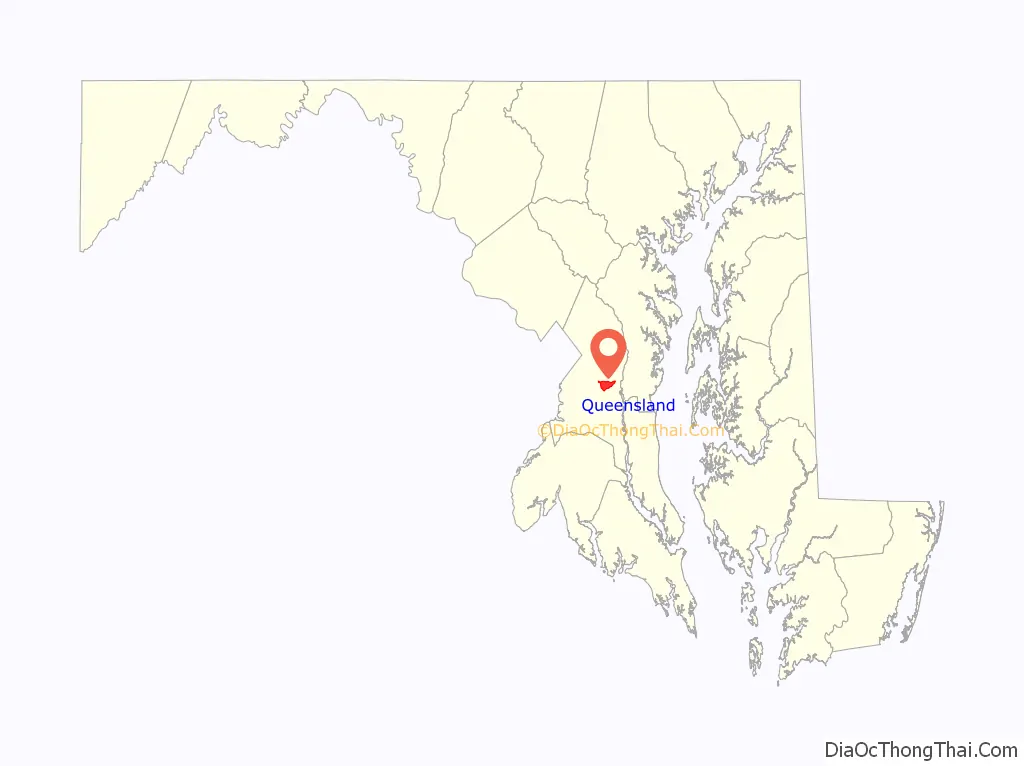
Queensland location map. Where is Queensland CDP?
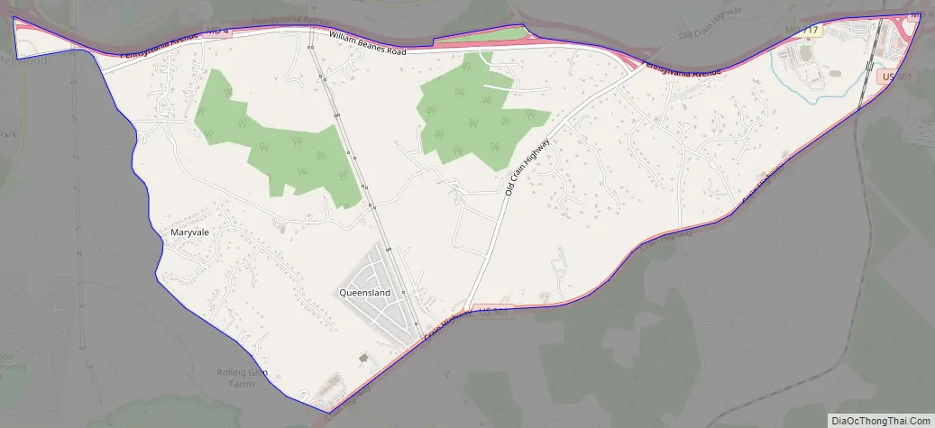
Queensland Road Map
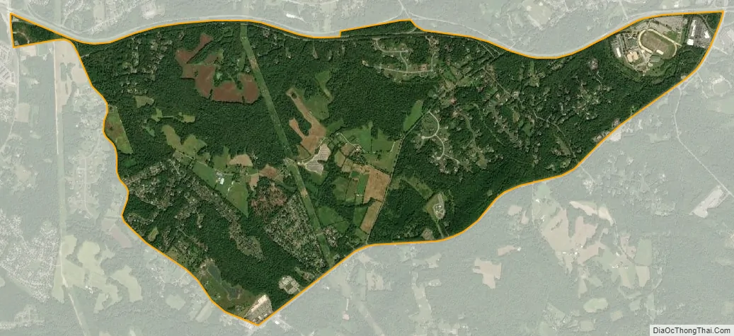
Queensland city Satellite Map
Geography
According to the U.S. Census Bureau as of 2010, Queenland has a total area of 4.9 square miles (12.6 km), of which 0.012 square miles (0.03 km), or 0.26%, is water.
The CDP is bordered to the north by Maryland Route 4, to the south and east by U.S. Route 301, and to the west by Marlboro Pike and South Osborne Road. The CDPs of Westphalia, Marlboro Village, and Brock Hall border Queensland to the north, Croom is to the southeast, Marlton is to the south, and Rosaryville is to the southwest.
See also
Map of Maryland State and its subdivision: Map of other states:- Alabama
- Alaska
- Arizona
- Arkansas
- California
- Colorado
- Connecticut
- Delaware
- District of Columbia
- Florida
- Georgia
- Hawaii
- Idaho
- Illinois
- Indiana
- Iowa
- Kansas
- Kentucky
- Louisiana
- Maine
- Maryland
- Massachusetts
- Michigan
- Minnesota
- Mississippi
- Missouri
- Montana
- Nebraska
- Nevada
- New Hampshire
- New Jersey
- New Mexico
- New York
- North Carolina
- North Dakota
- Ohio
- Oklahoma
- Oregon
- Pennsylvania
- Rhode Island
- South Carolina
- South Dakota
- Tennessee
- Texas
- Utah
- Vermont
- Virginia
- Washington
- West Virginia
- Wisconsin
- Wyoming


