Westphalia is a census-designated place in southern Prince George’s County, Maryland, United States. The population of the CDP was 11,770 at the 2020 census.
| Name: | Westphalia CDP |
|---|---|
| LSAD Code: | 57 |
| LSAD Description: | CDP (suffix) |
| State: | Maryland |
| County: | Prince George’s County |
| Elevation: | 180 ft (50 m) |
| Total Area: | 9.91 sq mi (25.68 km²) |
| Land Area: | 9.91 sq mi (25.66 km²) |
| Water Area: | 0.01 sq mi (0.02 km²) |
| Total Population: | 11,770 |
| Population Density: | 1,188.05/sq mi (458.71/km²) |
| Area code: | 301, 240 |
| FIPS code: | 2483290 |
Online Interactive Map
Click on ![]() to view map in "full screen" mode.
to view map in "full screen" mode.
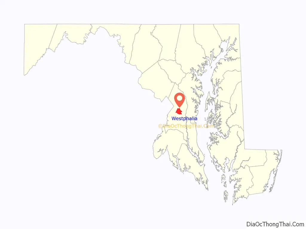
Westphalia location map. Where is Westphalia CDP?

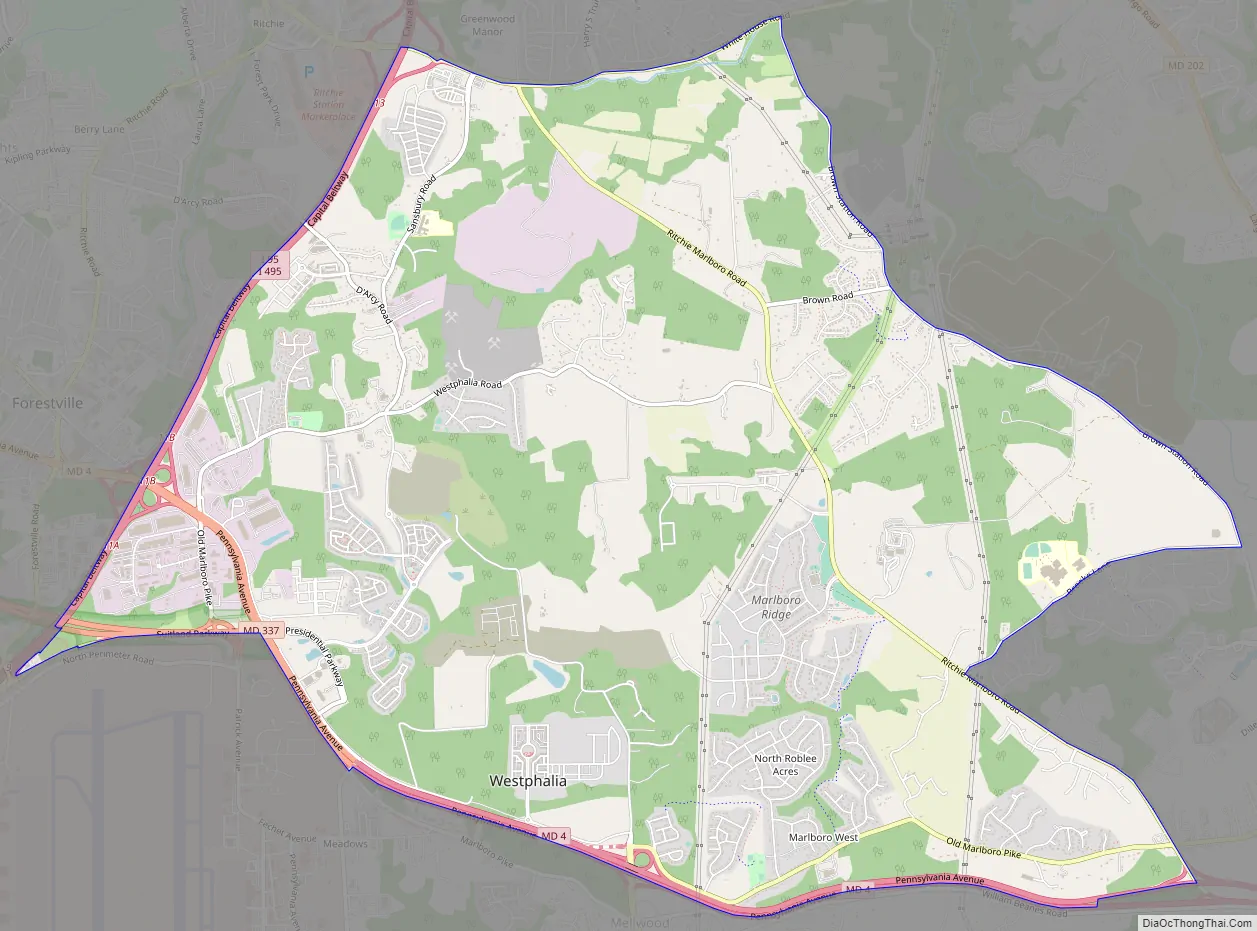
Westphalia Road Map
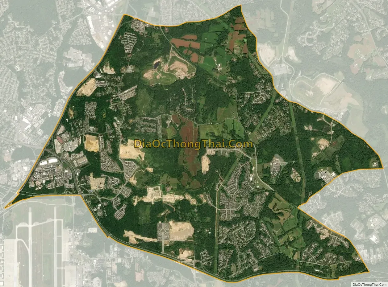
Westphalia city Satellite Map
Geography
According to the U.S. Census Bureau, Westphalia has a total area of 13.3 square miles (34.4 km), of which 0.03 square miles (0.07 km), or 0.20%, is water. The CDP is bordered to the west by the Capital Beltway (I-495/95) and to the south by Maryland Route 4. The CDP of Largo borders Westphalia to the north, Brock Hall is to the northeast, Marlboro Village is to the east, Queenland, Rosaryville and Melwood are to the south, Andrews Air Force Base is to the southwest, and Forestville is to the west.
See also
Map of Maryland State and its subdivision: Map of other states:- Alabama
- Alaska
- Arizona
- Arkansas
- California
- Colorado
- Connecticut
- Delaware
- District of Columbia
- Florida
- Georgia
- Hawaii
- Idaho
- Illinois
- Indiana
- Iowa
- Kansas
- Kentucky
- Louisiana
- Maine
- Maryland
- Massachusetts
- Michigan
- Minnesota
- Mississippi
- Missouri
- Montana
- Nebraska
- Nevada
- New Hampshire
- New Jersey
- New Mexico
- New York
- North Carolina
- North Dakota
- Ohio
- Oklahoma
- Oregon
- Pennsylvania
- Rhode Island
- South Carolina
- South Dakota
- Tennessee
- Texas
- Utah
- Vermont
- Virginia
- Washington
- West Virginia
- Wisconsin
- Wyoming


