Summerfield is a census-designated place near Landover in Prince George’s County, Maryland. As of the 2020 census, the population was 14,758. It is a suburb of Washington, D.C.
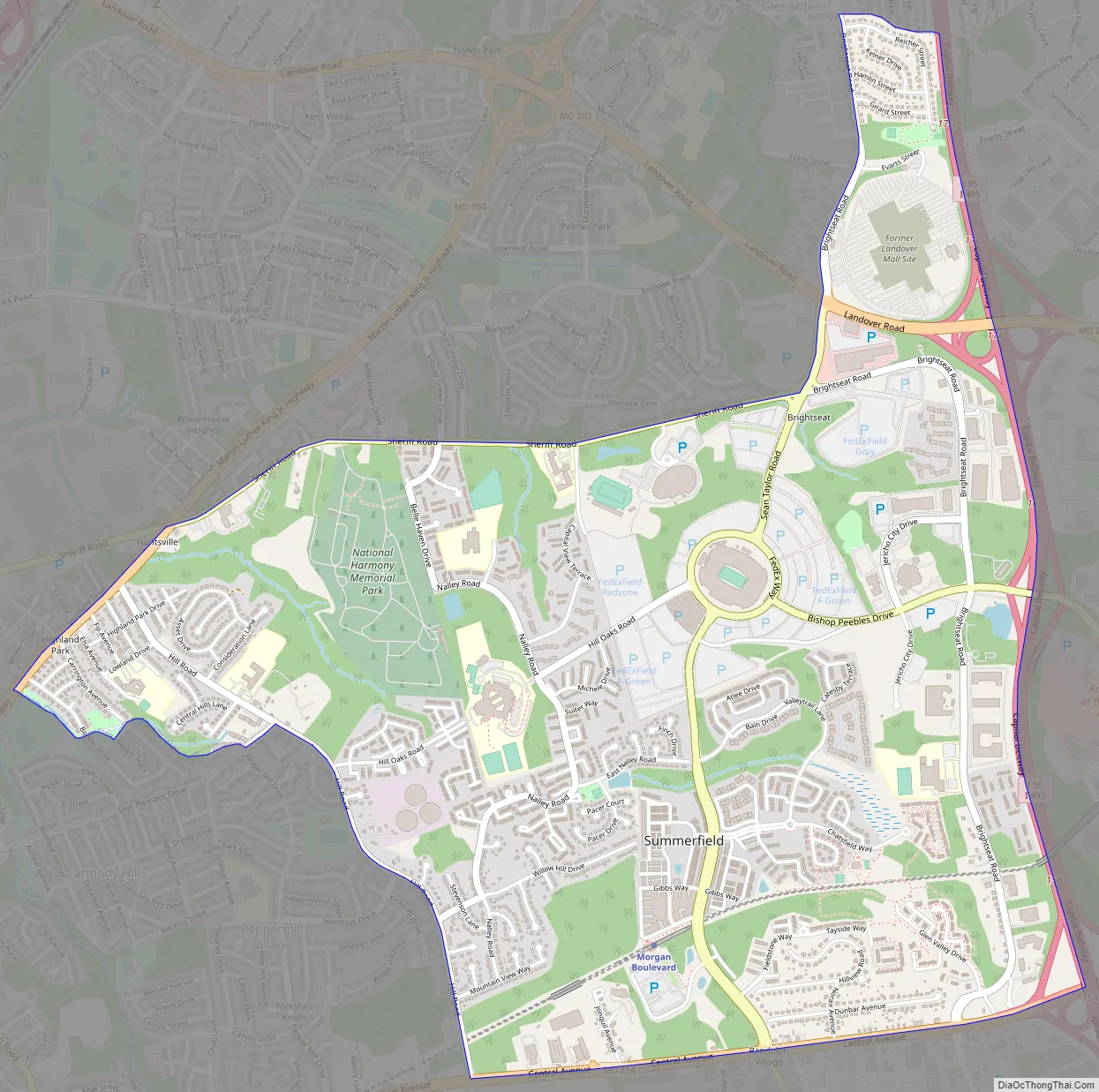
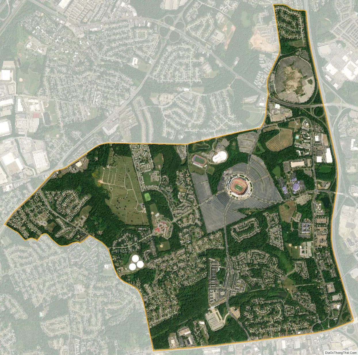
FedExField is located in Summerfield CDP, as is the Prince George’s County Sports and Learning Complex.
Prior to the 2010 Census, the area was not covered by another census-designated place.
| Name: | Summerfield CDP |
|---|---|
| LSAD Code: | 57 |
| LSAD Description: | CDP (suffix) |
| State: | Maryland |
| County: | Prince George’s County |
| Elevation: | 240 ft (70 m) |
| Total Area: | 3.65 sq mi (9.46 km²) |
| Land Area: | 3.64 sq mi (9.43 km²) |
| Water Area: | 0.01 sq mi (0.03 km²) |
| Total Population: | 14,758 |
| Population Density: | 4,054.40/sq mi (1,565.38/km²) |
| Area code: | 301, 240 |
| FIPS code: | 2475810 |
Online Interactive Map
Click on ![]() to view map in "full screen" mode.
to view map in "full screen" mode.
Summerfield location map. Where is Summerfield CDP?


Summerfield Road Map
Summerfield city Satellite Map
Geography
According to the U.S. Census Bureau, Summerfield has a total area of 3.6 square miles (9.4 km), of which 0.012 square miles (0.03 km), or 0.03%, is water. The CDP is bordered to the east by the Capital Beltway (I-495/95) and to the south by Maryland Route 214 (Central Avenue). The CDP of Landover borders Summerfield to the north, the city of Glenarden is to the northeast, Lake Arbor is to the east, Largo is to the southeast, Walker Mill is to the southwest, and Peppermill Village and Seat Pleasant border Summerfield to the west.
See also
Map of Maryland State and its subdivision: Map of other states:- Alabama
- Alaska
- Arizona
- Arkansas
- California
- Colorado
- Connecticut
- Delaware
- District of Columbia
- Florida
- Georgia
- Hawaii
- Idaho
- Illinois
- Indiana
- Iowa
- Kansas
- Kentucky
- Louisiana
- Maine
- Maryland
- Massachusetts
- Michigan
- Minnesota
- Mississippi
- Missouri
- Montana
- Nebraska
- Nevada
- New Hampshire
- New Jersey
- New Mexico
- New York
- North Carolina
- North Dakota
- Ohio
- Oklahoma
- Oregon
- Pennsylvania
- Rhode Island
- South Carolina
- South Dakota
- Tennessee
- Texas
- Utah
- Vermont
- Virginia
- Washington
- West Virginia
- Wisconsin
- Wyoming


