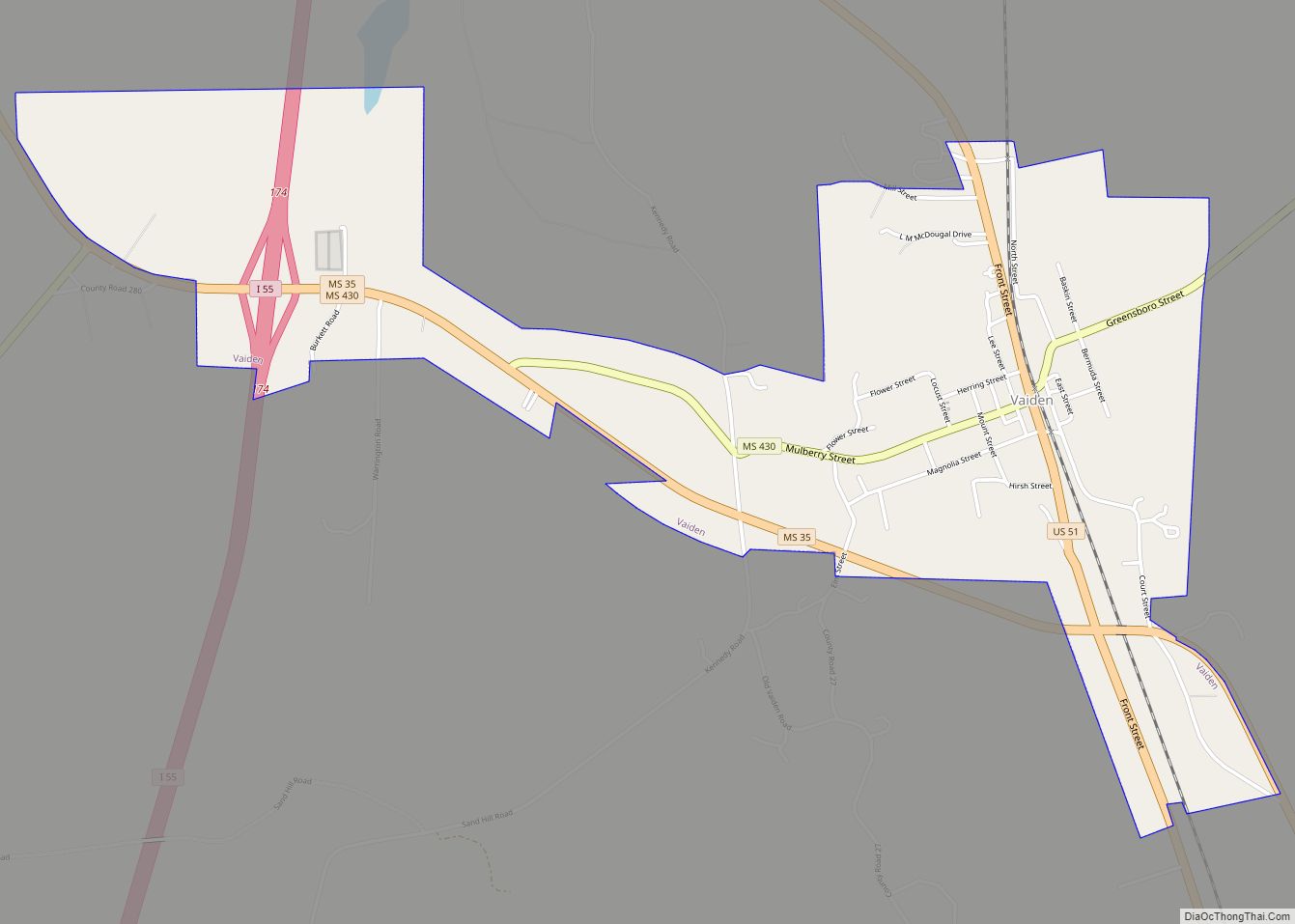
Carrollton is a town in and the second county seat of Carroll County, Mississippi, United States, which is within the Mississippi Delta. The population was 190 at the 2010 census, down from 408 in 2000. Centrally located in the county, the town is part of the Greenwood, Mississippi micropolitan area. The first county seat, Vaiden, Mississippi, was founded in the eastern part of the county during its early settlement.
| Name: | Carrollton town |
|---|---|
| LSAD Code: | 43 |
| LSAD Description: | town (suffix) |
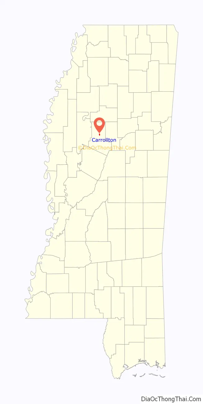
| State: | Mississippi |
| County: | Carroll County |
| Elevation: | 289 ft (88 m) |
| Total Area: | 0.81 sq mi (2.11 km²) |
| Land Area: | 0.81 sq mi (2.11 km²) |
| Water Area: | 0.00 sq mi (0.00 km²) |
| Total Population: | 423 |
| Population Density: | 520.30/sq mi (200.92/km²) |
| ZIP code: | 38917 |
| Area code: | 662 |
| FIPS code: | 2811580 |
| GNISfeature ID: | 0668097 |
| Website: | www.carrolltonms.com |
Online Interactive Map
Click on ![]() to view map in "full screen" mode.
to view map in "full screen" mode.
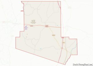
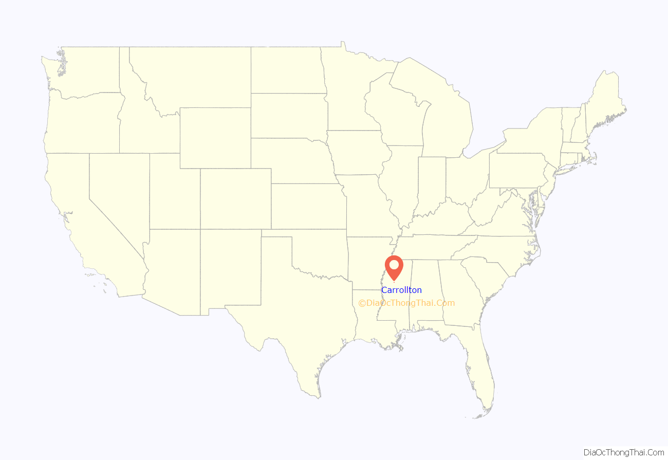
Carrollton location map. Where is Carrollton town?
History
The town was developed as the county seat and trading center for rural Carroll County, which was devoted to cotton agriculture and plantations in the antebellum era.
The town was the location of the Carroll County Courthouse Massacre, in 1886.
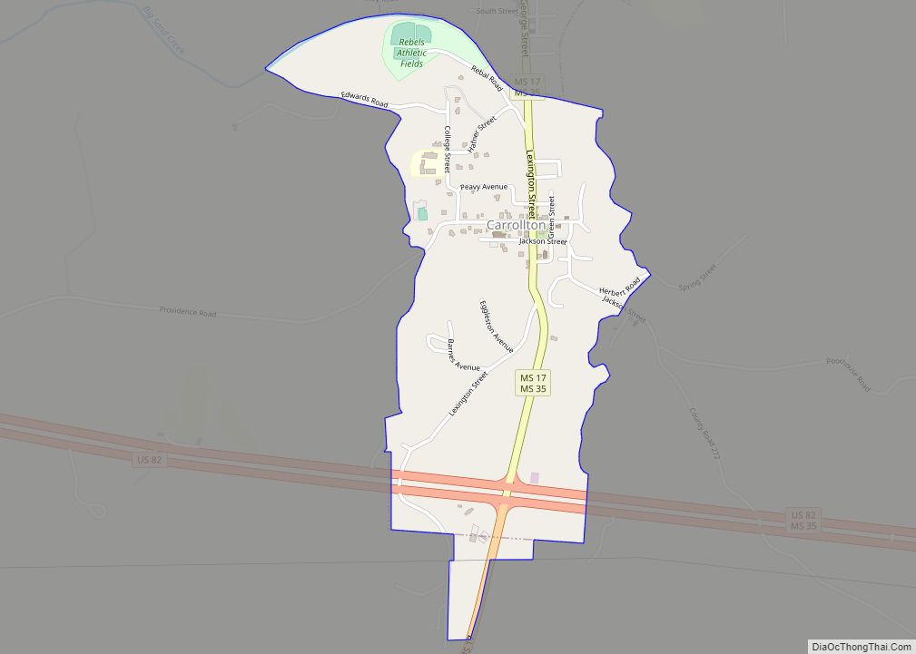
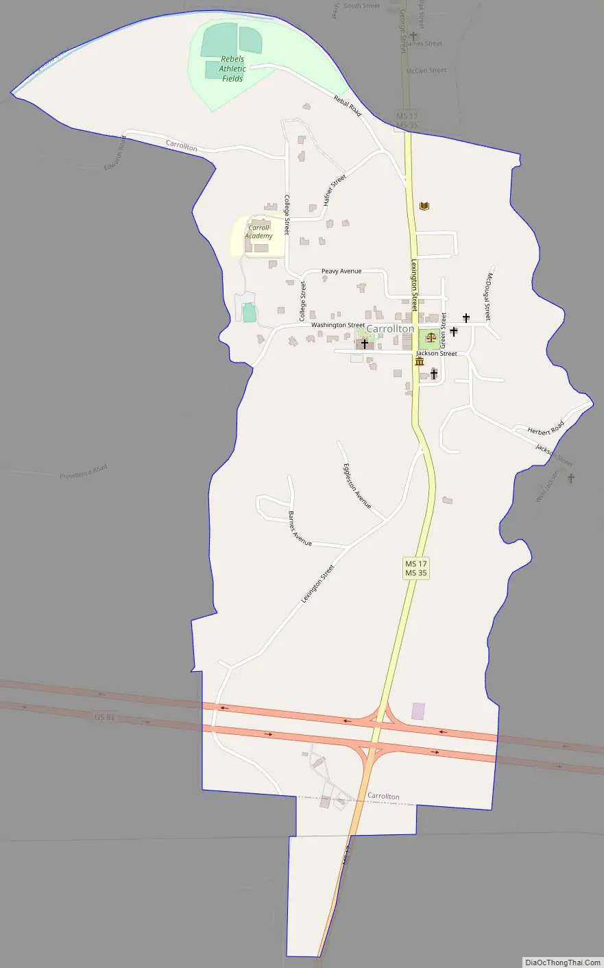
Carrollton Road Map
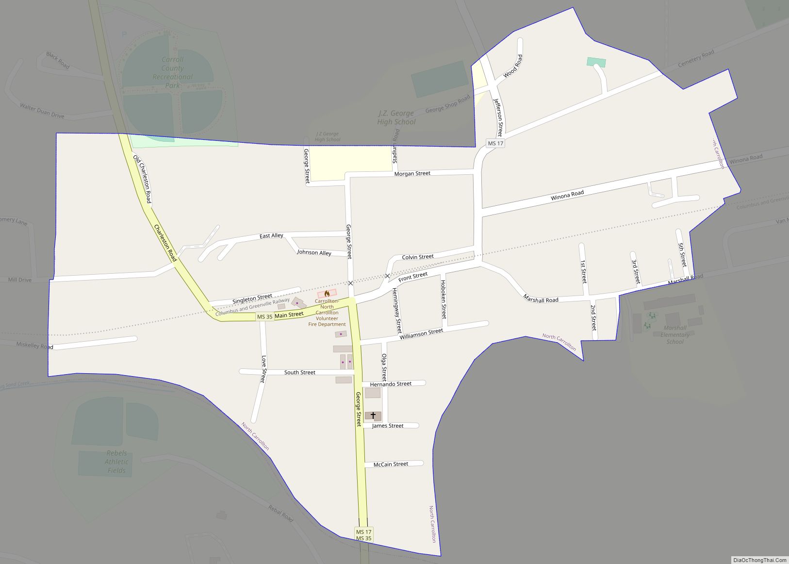
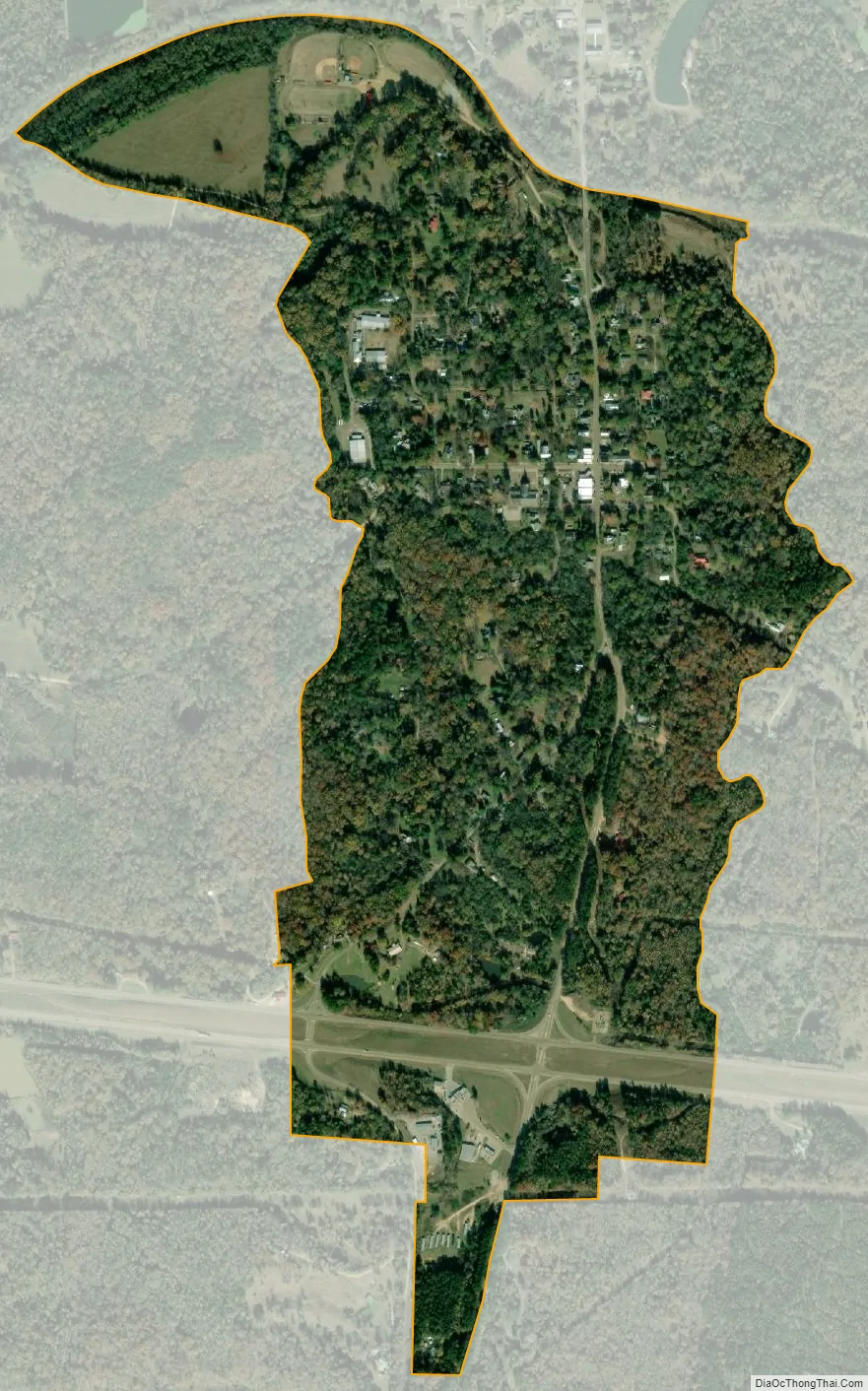
Carrollton city Satellite Map
Geography
Carrollton is located in central Carroll County on the south side of Big Sand Creek, a tributary of the Yalobusha River. According to the United States Census Bureau, Carrollton has a total area of 0.8 square miles (2.1 km), all land.
The town borders North Carrollton, which is located directly to the north across the creek. Mississippi Highways 17 and 35 pass through the center of Carrollton, leading north into North Carrollton. Many residents of Carrollton and North Carrollton consider the towns a single entity, simply referred to as Carrollton.
Highway 35 continues north 21 miles (34 km) to Holcomb; in the other direction, it leads southeast 18 miles (29 km) to Vaiden, the other county seat. Highway 17 leads south 30 miles (48 km) to Lexington. U.S. Route 82, a four-lane divided highway, passes through the southern part of Carrollton, leading east 11 miles (18 km) to Winona and west 18 miles (29 km) to Greenwood.
Climate
The climate in this area is characterized by hot, humid summers and generally mild to cool winters. According to the Köppen Climate Classification system, Carrollton has a humid subtropical climate, abbreviated “Cfa” on climate maps.
See also
Map of Mississippi State and its subdivision:- Adams
- Alcorn
- Amite
- Attala
- Benton
- Bolivar
- Calhoun
- Carroll
- Chickasaw
- Choctaw
- Claiborne
- Clarke
- Clay
- Coahoma
- Copiah
- Covington
- Desoto
- Forrest
- Franklin
- George
- Greene
- Grenada
- Hancock
- Harrison
- Hinds
- Holmes
- Humphreys
- Issaquena
- Itawamba
- Jackson
- Jasper
- Jefferson
- Jefferson Davis
- Jones
- Kemper
- Lafayette
- Lamar
- Lauderdale
- Lawrence
- Leake
- Lee
- Leflore
- Lincoln
- Lowndes
- Madison
- Marion
- Marshall
- Monroe
- Montgomery
- Neshoba
- Newton
- Noxubee
- Oktibbeha
- Panola
- Pearl River
- Perry
- Pike
- Pontotoc
- Prentiss
- Quitman
- Rankin
- Scott
- Sharkey
- Simpson
- Smith
- Stone
- Sunflower
- Tallahatchie
- Tate
- Tippah
- Tishomingo
- Tunica
- Union
- Walthall
- Warren
- Washington
- Wayne
- Webster
- Wilkinson
- Winston
- Yalobusha
- Yazoo
- Alabama
- Alaska
- Arizona
- Arkansas
- California
- Colorado
- Connecticut
- Delaware
- District of Columbia
- Florida
- Georgia
- Hawaii
- Idaho
- Illinois
- Indiana
- Iowa
- Kansas
- Kentucky
- Louisiana
- Maine
- Maryland
- Massachusetts
- Michigan
- Minnesota
- Mississippi
- Missouri
- Montana
- Nebraska
- Nevada
- New Hampshire
- New Jersey
- New Mexico
- New York
- North Carolina
- North Dakota
- Ohio
- Oklahoma
- Oregon
- Pennsylvania
- Rhode Island
- South Carolina
- South Dakota
- Tennessee
- Texas
- Utah
- Vermont
- Virginia
- Washington
- West Virginia
- Wisconsin
- Wyoming