Holcomb is an unincorporated community and census-designated place (CDP) in Grenada County, Mississippi, United States. It is part of the Grenada Micropolitan Statistical Area. As of the 2010 census the community had a population of 600.
Holcomb has a post office with the ZIP Code of 38940.
| Name: | Holcomb CDP |
|---|---|
| LSAD Code: | 57 |
| LSAD Description: | CDP (suffix) |
| State: | Mississippi |
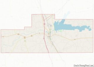
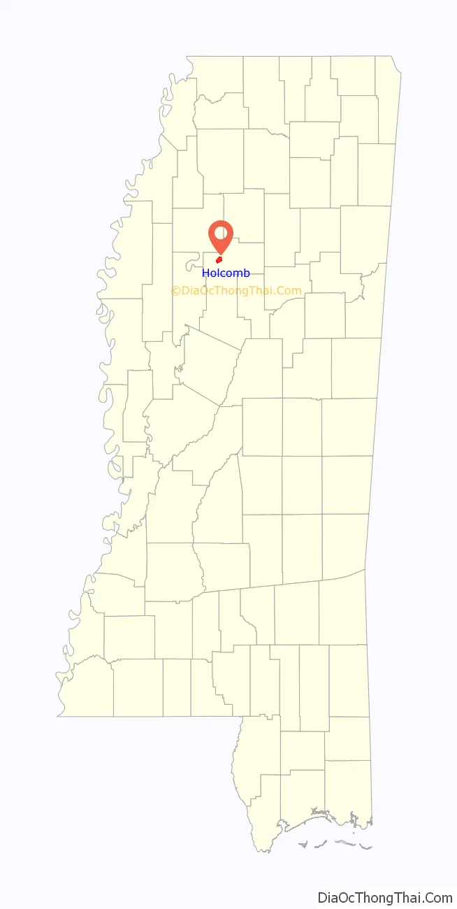
| County: | Grenada County |
| Elevation: | 194 ft (59 m) |
| Total Area: | 4.75 sq mi (12.31 km²) |
| Land Area: | 4.75 sq mi (12.31 km²) |
| Water Area: | 0.00 sq mi (0.00 km²) |
| Total Population: | 568 |
| Population Density: | 119.55/sq mi (46.16/km²) |
| ZIP code: | 38929 |
| Area code: | 662 |
| FIPS code: | 2832820 |
| GNISfeature ID: | 671276 |
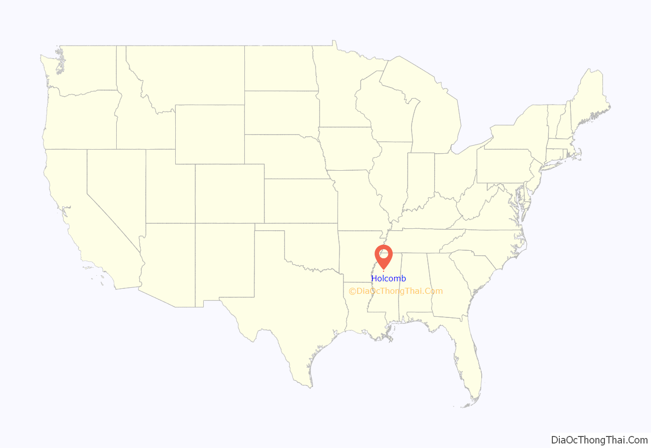
Online Interactive Map
Click on ![]() to view map in "full screen" mode.
to view map in "full screen" mode.
Holcomb location map. Where is Holcomb CDP?
History
The community was founded in 1901 on land that once was the home site of Choctaw Indian Chief Isaac Perry.
Holcomb is located on the former Illinois Central Railroad.
At one time, Holcomb was home to a stave factory, Munger System Gin, axe handle factory, church, saw mill, and several general stores. The Bank of Holcomb was established in 1905.
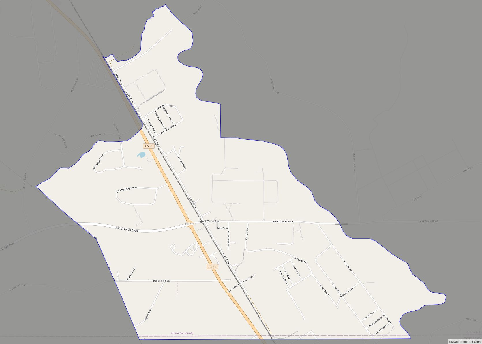
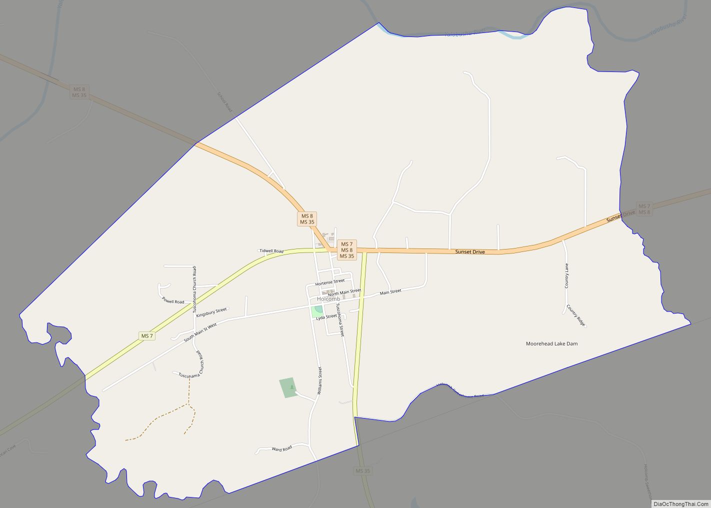
Holcomb Road Map

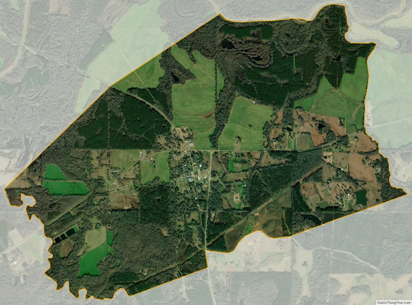
Holcomb city Satellite Map
Geography
Holcomb is in western Grenada County, on the south side of the valley of the Yalobusha River. Mississippi Highways 7 and 8 pass through the community, together leading east 10 miles (16 km) east to Grenada, the county seat. The two highways split in Holcomb, with Highway 7 leading southwest 23 miles (37 km) to Greenwood and Highway 8 leading west 35 miles (56 km) to Ruleville. Mississippi Highway 35 passes through Holcomb as well, leading south 21 miles (34 km) to Carrollton and north 20 miles (32 km) to Charleston.
According to the U.S. Census Bureau, the Holcomb CDP has an area of 4.7 square miles (12.3 km), all of it land.
Climate
The climate in this area is characterized by hot, humid summers and generally mild to cool winters. According to the Köppen Climate Classification system, Holcomb has a humid subtropical climate, abbreviated “Cfa” on climate maps.
See also
Map of Mississippi State and its subdivision:- Adams
- Alcorn
- Amite
- Attala
- Benton
- Bolivar
- Calhoun
- Carroll
- Chickasaw
- Choctaw
- Claiborne
- Clarke
- Clay
- Coahoma
- Copiah
- Covington
- Desoto
- Forrest
- Franklin
- George
- Greene
- Grenada
- Hancock
- Harrison
- Hinds
- Holmes
- Humphreys
- Issaquena
- Itawamba
- Jackson
- Jasper
- Jefferson
- Jefferson Davis
- Jones
- Kemper
- Lafayette
- Lamar
- Lauderdale
- Lawrence
- Leake
- Lee
- Leflore
- Lincoln
- Lowndes
- Madison
- Marion
- Marshall
- Monroe
- Montgomery
- Neshoba
- Newton
- Noxubee
- Oktibbeha
- Panola
- Pearl River
- Perry
- Pike
- Pontotoc
- Prentiss
- Quitman
- Rankin
- Scott
- Sharkey
- Simpson
- Smith
- Stone
- Sunflower
- Tallahatchie
- Tate
- Tippah
- Tishomingo
- Tunica
- Union
- Walthall
- Warren
- Washington
- Wayne
- Webster
- Wilkinson
- Winston
- Yalobusha
- Yazoo
- Alabama
- Alaska
- Arizona
- Arkansas
- California
- Colorado
- Connecticut
- Delaware
- District of Columbia
- Florida
- Georgia
- Hawaii
- Idaho
- Illinois
- Indiana
- Iowa
- Kansas
- Kentucky
- Louisiana
- Maine
- Maryland
- Massachusetts
- Michigan
- Minnesota
- Mississippi
- Missouri
- Montana
- Nebraska
- Nevada
- New Hampshire
- New Jersey
- New Mexico
- New York
- North Carolina
- North Dakota
- Ohio
- Oklahoma
- Oregon
- Pennsylvania
- Rhode Island
- South Carolina
- South Dakota
- Tennessee
- Texas
- Utah
- Vermont
- Virginia
- Washington
- West Virginia
- Wisconsin
- Wyoming