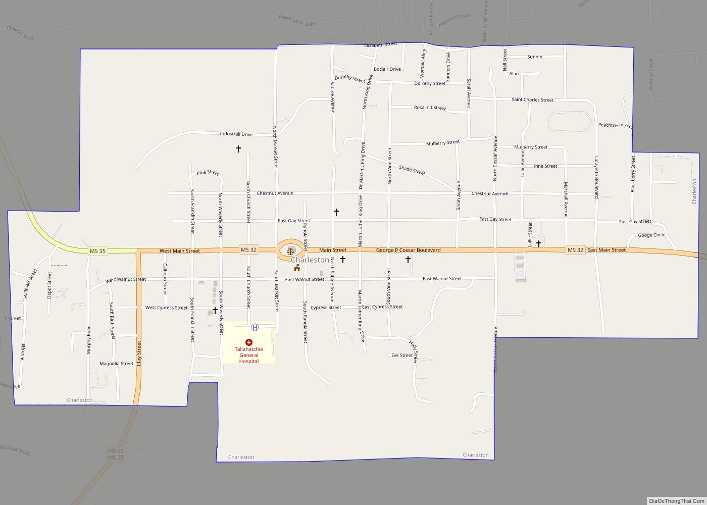
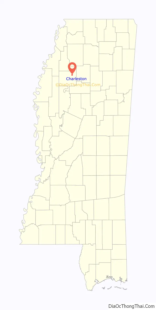
Charleston is a city in north central Mississippi and one of the two county seats of Tallahatchie County, which is located on both sides of the Tallahatchie River. This city is located east of the river and its population was 2,193 at the 2010 census.
| Name: | Charleston city |
|---|---|
| LSAD Code: | 25 |
| LSAD Description: | city (suffix) |
| State: | Mississippi |
| County: | Tallahatchie County |
| Elevation: | 217 ft (66 m) |
| Total Area: | 1.36 sq mi (3.52 km²) |
| Land Area: | 1.35 sq mi (3.51 km²) |
| Water Area: | 0.00 sq mi (0.01 km²) |
| Total Population: | 1,884 |
| Population Density: | 1,390.41/sq mi (536.81/km²) |
| ZIP code: | 38921, 38958 |
| Area code: | 662 |
| FIPS code: | 2812900 |
| GNISfeature ID: | 0668347 |
Online Interactive Map
Click on ![]() to view map in "full screen" mode.
to view map in "full screen" mode.
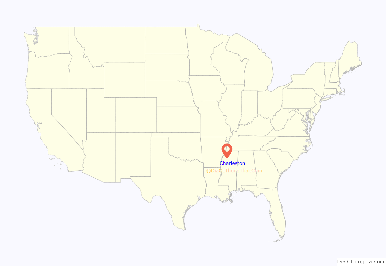
Charleston location map. Where is Charleston city?
History
The original county seat, Old Tillatoba, was discovered to have a defective land title, so the seat was removed to Charleston in 1837.
The Charleston Female school, established in 1852, flourished for several years. The Tallahatchie Herald, a Democratic weekly newspaper, was established in 1892. In 1901, the Charleston Bank was established. By the early 1900s, Charleston had a brick courthouse and jail, three churches, schools, a Masonic hall, an Odd Fellows lodge, and two cotton gins. Its leading agricultural staple was cotton. The population in 1906 was 800.
In 1931, a magnitude 4.6 earthquake occurred in Charleston, the most powerful earthquake in Mississippi.
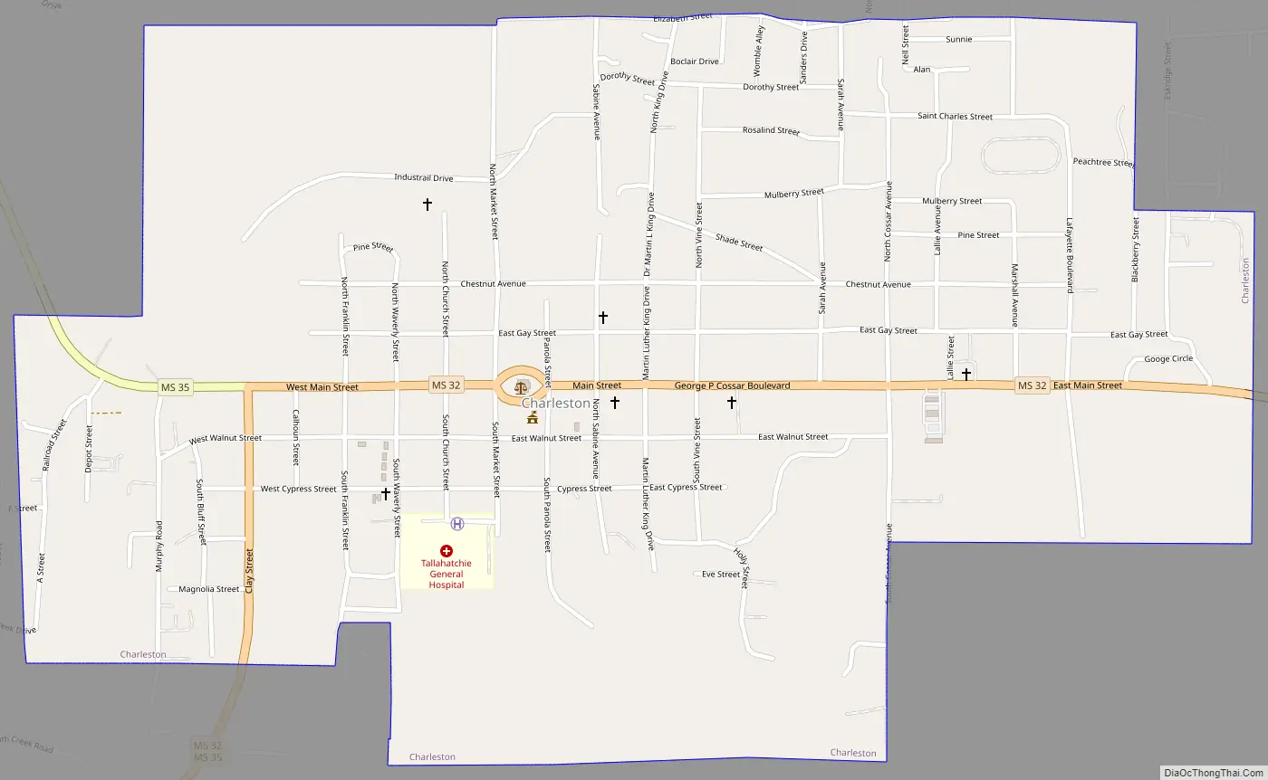
Charleston Road Map
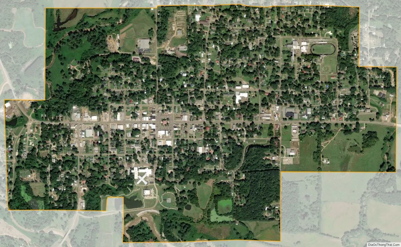
Charleston city Satellite Map
Geography
According to the United States Census Bureau, the city has a total area of 1.4 square miles (3.6 km), of which 1.4 square miles (3.6 km) is land and 0.73% is water. It is also situated on the northern end of the concurrency of Mississippi Highways 32 and 35.
The city’s official nickname is “Gateway to the Delta”.
See also
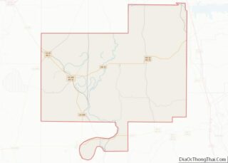
Map of Mississippi State and its subdivision:- Adams
- Alcorn
- Amite
- Attala
- Benton
- Bolivar
- Calhoun
- Carroll
- Chickasaw
- Choctaw
- Claiborne
- Clarke
- Clay
- Coahoma
- Copiah
- Covington
- Desoto
- Forrest
- Franklin
- George
- Greene
- Grenada
- Hancock
- Harrison
- Hinds
- Holmes
- Humphreys
- Issaquena
- Itawamba
- Jackson
- Jasper
- Jefferson
- Jefferson Davis
- Jones
- Kemper
- Lafayette
- Lamar
- Lauderdale
- Lawrence
- Leake
- Lee
- Leflore
- Lincoln
- Lowndes
- Madison
- Marion
- Marshall
- Monroe
- Montgomery
- Neshoba
- Newton
- Noxubee
- Oktibbeha
- Panola
- Pearl River
- Perry
- Pike
- Pontotoc
- Prentiss
- Quitman
- Rankin
- Scott
- Sharkey
- Simpson
- Smith
- Stone
- Sunflower
- Tallahatchie
- Tate
- Tippah
- Tishomingo
- Tunica
- Union
- Walthall
- Warren
- Washington
- Wayne
- Webster
- Wilkinson
- Winston
- Yalobusha
- Yazoo
- Alabama
- Alaska
- Arizona
- Arkansas
- California
- Colorado
- Connecticut
- Delaware
- District of Columbia
- Florida
- Georgia
- Hawaii
- Idaho
- Illinois
- Indiana
- Iowa
- Kansas
- Kentucky
- Louisiana
- Maine
- Maryland
- Massachusetts
- Michigan
- Minnesota
- Mississippi
- Missouri
- Montana
- Nebraska
- Nevada
- New Hampshire
- New Jersey
- New Mexico
- New York
- North Carolina
- North Dakota
- Ohio
- Oklahoma
- Oregon
- Pennsylvania
- Rhode Island
- South Carolina
- South Dakota
- Tennessee
- Texas
- Utah
- Vermont
- Virginia
- Washington
- West Virginia
- Wisconsin
- Wyoming