Webb is a town in Tallahatchie County, Mississippi. The population was 565 at the 2010 census.
| Name: | Webb town |
|---|---|
| LSAD Code: | 43 |
| LSAD Description: | town (suffix) |
| State: | Mississippi |
| County: | Tallahatchie County |
| Elevation: | 151 ft (46 m) |
| Total Area: | 0.42 sq mi (1.09 km²) |
| Land Area: | 0.42 sq mi (1.09 km²) |
| Water Area: | 0.00 sq mi (0.00 km²) |
| Total Population: | 416 |
| Population Density: | 985.78/sq mi (380.92/km²) |
| ZIP code: | 38966 |
| Area code: | 662 |
| FIPS code: | 2878480 |
| GNISfeature ID: | 0679411 |
| Website: | www.city-data.com/city/Webb-Mississippi.html |
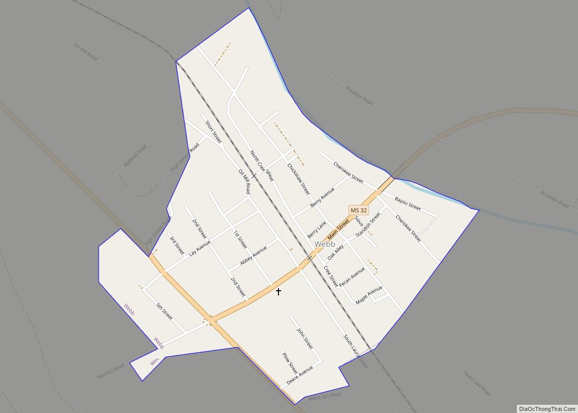
Online Interactive Map
Click on ![]() to view map in "full screen" mode.
to view map in "full screen" mode.
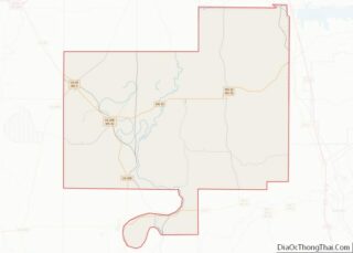
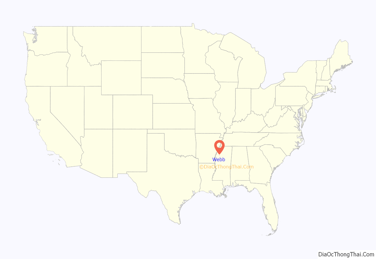
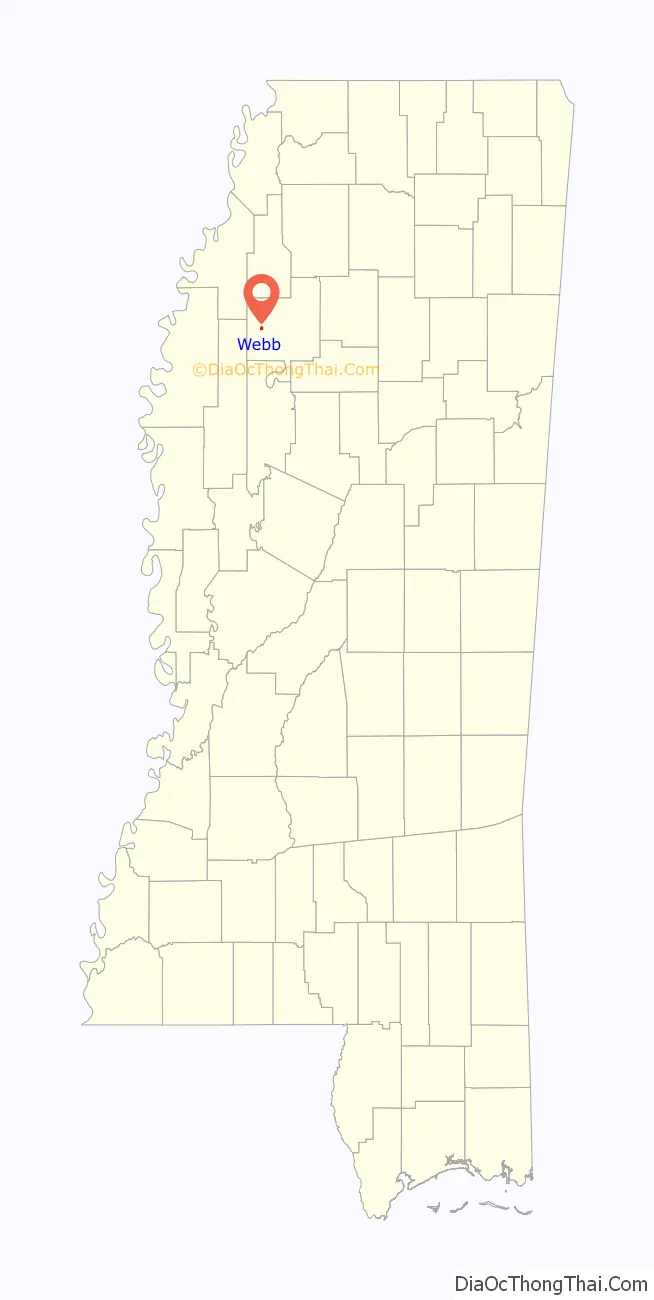
Webb location map. Where is Webb town?
History
Webb was founded circa 1880. The first post office was founded in 1880 and named Hood for one of the earlier settlers. In 1882, Judge James L.A. Webb, a Confederate veteran and a University of North Carolina graduate, operated the only store there and later the Hood Masonic Lodge was built. There was one saloon at that time called “The Razzle Dazzle”. The town was incorporated in 1905.
In those days most of the groceries and necessities were brought to Hood by flat bottom boat from Sharkey, being hauled down the river from Friars Point. Cassidy Bayou was navigable then and was maintained by the government from Sharkey to Hood. The town was later renamed in honor of Judge Webb.
In July 2001, Earnestine Dixon became the first African American mayor of the town, serving one term (2001-05).
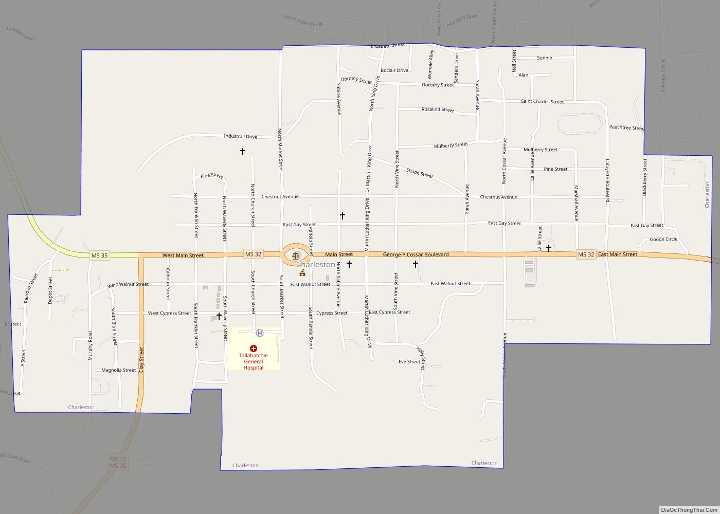
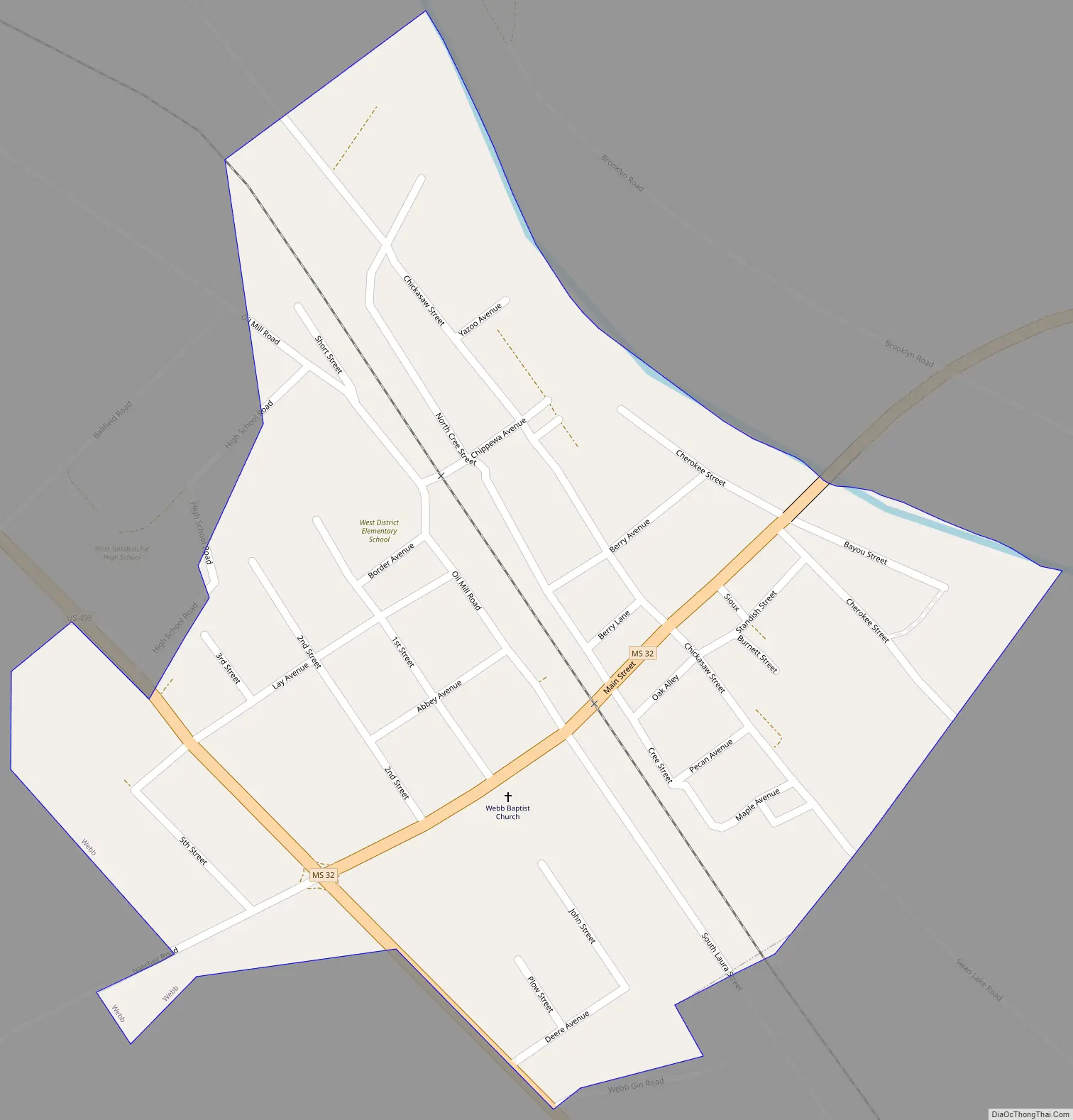
Webb Road Map
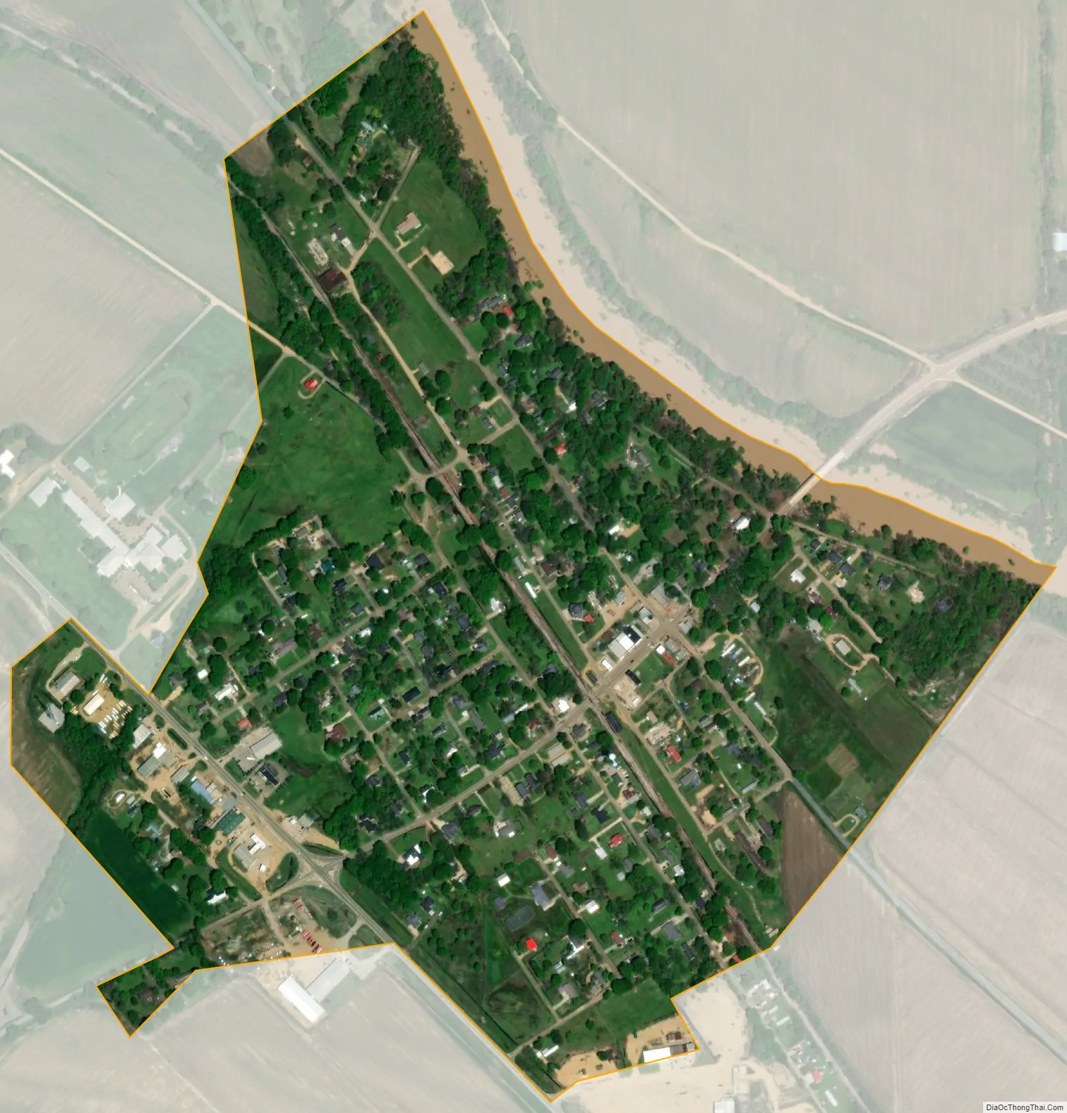
Webb city Satellite Map
Geography
Webb is located at 33°56′49″N 90°20′43″W / 33.94694°N 90.34528°W / 33.94694; -90.34528 (33.947045, -90.345304).
According to the United States Census Bureau, the town has a total area of 0.4 square miles (1.0 km), all land.
See also
Map of Mississippi State and its subdivision:- Adams
- Alcorn
- Amite
- Attala
- Benton
- Bolivar
- Calhoun
- Carroll
- Chickasaw
- Choctaw
- Claiborne
- Clarke
- Clay
- Coahoma
- Copiah
- Covington
- Desoto
- Forrest
- Franklin
- George
- Greene
- Grenada
- Hancock
- Harrison
- Hinds
- Holmes
- Humphreys
- Issaquena
- Itawamba
- Jackson
- Jasper
- Jefferson
- Jefferson Davis
- Jones
- Kemper
- Lafayette
- Lamar
- Lauderdale
- Lawrence
- Leake
- Lee
- Leflore
- Lincoln
- Lowndes
- Madison
- Marion
- Marshall
- Monroe
- Montgomery
- Neshoba
- Newton
- Noxubee
- Oktibbeha
- Panola
- Pearl River
- Perry
- Pike
- Pontotoc
- Prentiss
- Quitman
- Rankin
- Scott
- Sharkey
- Simpson
- Smith
- Stone
- Sunflower
- Tallahatchie
- Tate
- Tippah
- Tishomingo
- Tunica
- Union
- Walthall
- Warren
- Washington
- Wayne
- Webster
- Wilkinson
- Winston
- Yalobusha
- Yazoo
- Alabama
- Alaska
- Arizona
- Arkansas
- California
- Colorado
- Connecticut
- Delaware
- District of Columbia
- Florida
- Georgia
- Hawaii
- Idaho
- Illinois
- Indiana
- Iowa
- Kansas
- Kentucky
- Louisiana
- Maine
- Maryland
- Massachusetts
- Michigan
- Minnesota
- Mississippi
- Missouri
- Montana
- Nebraska
- Nevada
- New Hampshire
- New Jersey
- New Mexico
- New York
- North Carolina
- North Dakota
- Ohio
- Oklahoma
- Oregon
- Pennsylvania
- Rhode Island
- South Carolina
- South Dakota
- Tennessee
- Texas
- Utah
- Vermont
- Virginia
- Washington
- West Virginia
- Wisconsin
- Wyoming