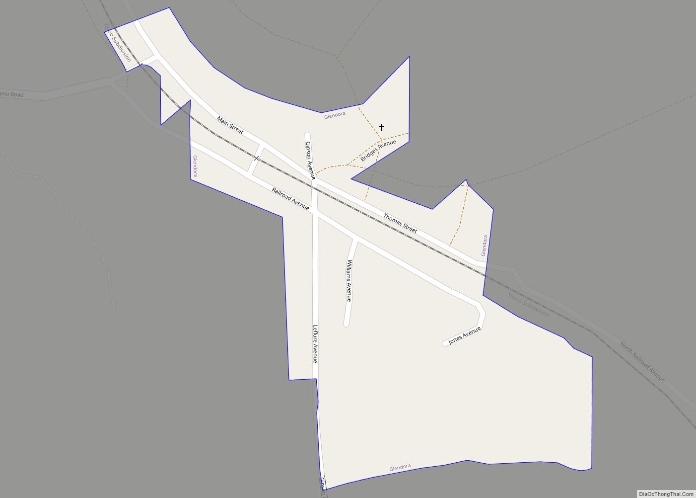
Glendora is a village in Tallahatchie County, Mississippi. The population was 285 at the 2000 census.
| Name: | Glendora village |
|---|---|
| LSAD Code: | 47 |
| LSAD Description: | village (suffix) |
| State: | Mississippi |
| County: | Tallahatchie County |
| Elevation: | 148 ft (45 m) |
| Total Area: | 0.14 sq mi (0.37 km²) |
| Land Area: | 0.14 sq mi (0.37 km²) |
| Water Area: | 0.00 sq mi (0.00 km²) |
| Total Population: | 154 |
| Population Density: | 1,069.44/sq mi (411.86/km²) |
| ZIP code: | 38928 |
| Area code: | 662 |
| FIPS code: | 2827660 |
| GNISfeature ID: | 0670435 |
| Website: | glendorams.com |
Online Interactive Map
Click on ![]() to view map in "full screen" mode.
to view map in "full screen" mode.
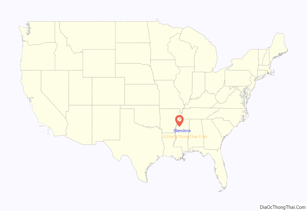
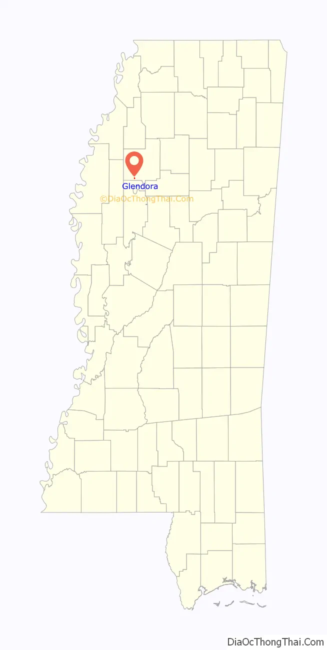
Glendora location map. Where is Glendora village?
History
Glendora was developed by White Americans as a small sawmill site. Logs were floated down the river from around the vicinity of Webb to be processed here.
The first settlement developed two miles south of Glendora at Black Bayou. When the railroad was built through the territory in 1883, a station was located there and called Glendora. The town immediately grew. A post office was established in 1900 and a voting precinct was established.
Cane Lake Lumber Company built a large sawmill here which operated until 1909. It was moved to another site.
In December 1955, Elmer Kimbrell, a white man, shot and killed Clinton Melton, an African-American resident, in front of three witnesses after an argument about how much gas Melton had pumped into Kimbrell’s car. Kimbrell was acquitted by an all-white jury after a short trial. Shortly before this murder, he was involved in the Emmett Till murder in Money, Mississippi. At this time, most blacks in Mississippi were still disenfranchised due to state barriers; they were not part of the jury pool because they were not registered voters and they were excluded from the political system.
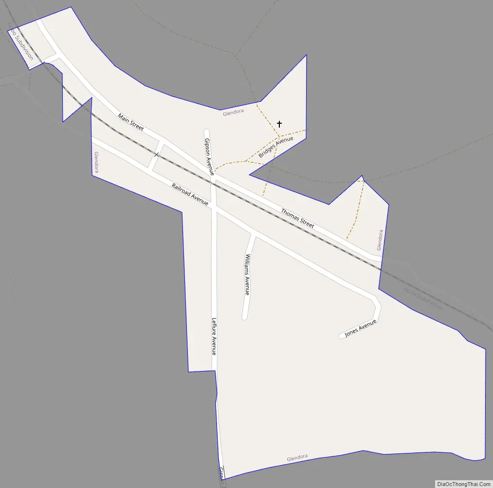
Glendora Road Map
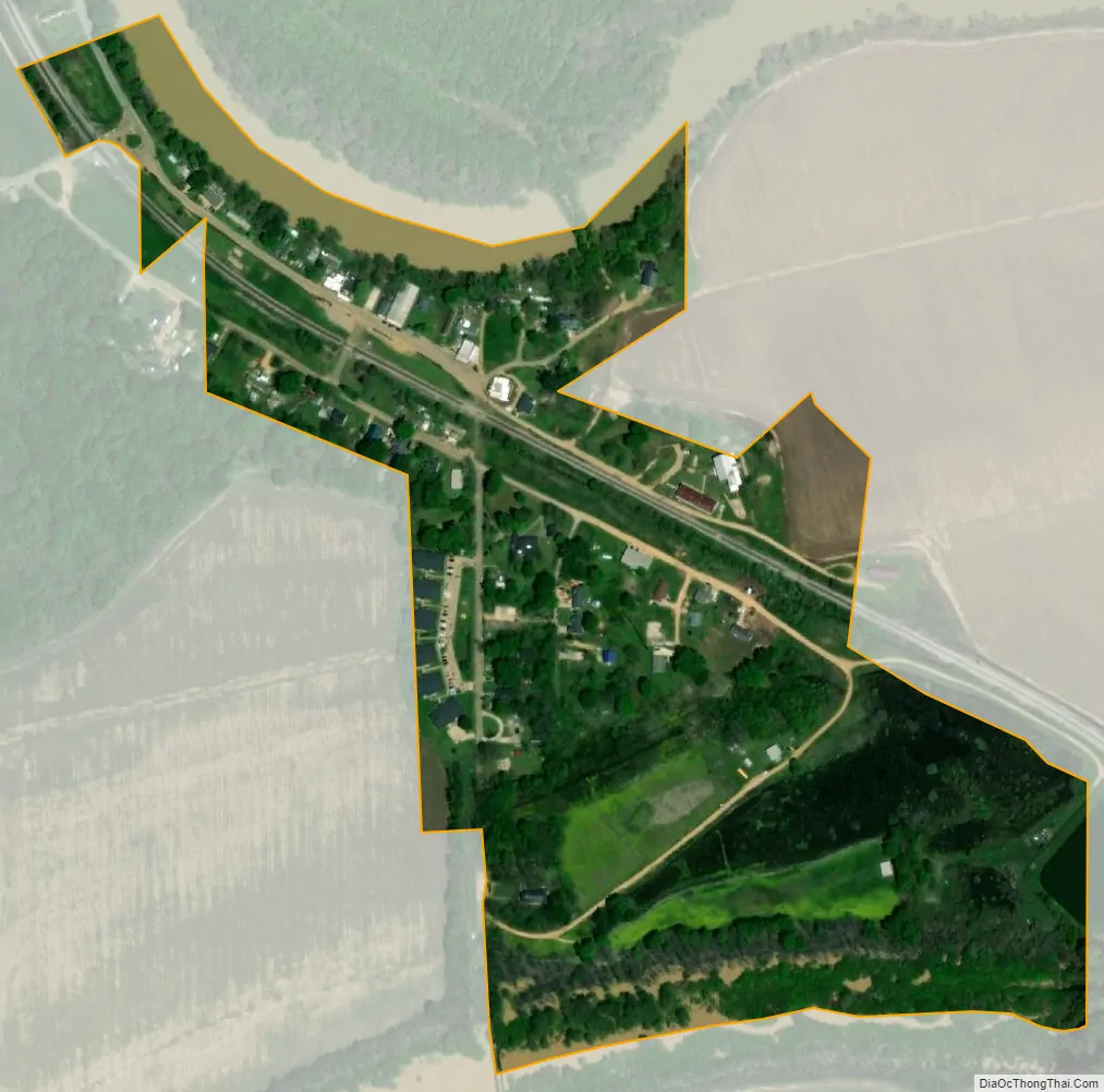
Glendora city Satellite Map
Geography
According to the United States Census Bureau, the village has a total area of 0.1 square miles (0.26 km), all land.
See also
Map of Mississippi State and its subdivision:- Adams
- Alcorn
- Amite
- Attala
- Benton
- Bolivar
- Calhoun
- Carroll
- Chickasaw
- Choctaw
- Claiborne
- Clarke
- Clay
- Coahoma
- Copiah
- Covington
- Desoto
- Forrest
- Franklin
- George
- Greene
- Grenada
- Hancock
- Harrison
- Hinds
- Holmes
- Humphreys
- Issaquena
- Itawamba
- Jackson
- Jasper
- Jefferson
- Jefferson Davis
- Jones
- Kemper
- Lafayette
- Lamar
- Lauderdale
- Lawrence
- Leake
- Lee
- Leflore
- Lincoln
- Lowndes
- Madison
- Marion
- Marshall
- Monroe
- Montgomery
- Neshoba
- Newton
- Noxubee
- Oktibbeha
- Panola
- Pearl River
- Perry
- Pike
- Pontotoc
- Prentiss
- Quitman
- Rankin
- Scott
- Sharkey
- Simpson
- Smith
- Stone
- Sunflower
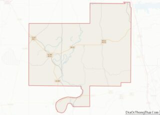
- Tallahatchie
- Tate
- Tippah
- Tishomingo
- Tunica
- Union
- Walthall
- Warren
- Washington
- Wayne
- Webster
- Wilkinson
- Winston
- Yalobusha
- Yazoo
- Alabama
- Alaska
- Arizona
- Arkansas
- California
- Colorado
- Connecticut
- Delaware
- District of Columbia
- Florida
- Georgia
- Hawaii
- Idaho
- Illinois
- Indiana
- Iowa
- Kansas
- Kentucky
- Louisiana
- Maine
- Maryland
- Massachusetts
- Michigan
- Minnesota
- Mississippi
- Missouri
- Montana
- Nebraska
- Nevada
- New Hampshire
- New Jersey
- New Mexico
- New York
- North Carolina
- North Dakota
- Ohio
- Oklahoma
- Oregon
- Pennsylvania
- Rhode Island
- South Carolina
- South Dakota
- Tennessee
- Texas
- Utah
- Vermont
- Virginia
- Washington
- West Virginia
- Wisconsin
- Wyoming