Columbia is a U.S. city in and the county seat of Marion County, Mississippi, which was formed six years before Mississippi was admitted to statehood. Columbia was named for Columbia, South Carolina, from which many of the early settlers had migrated. The population was 6,582 as of the 2010 census, and 5,864 in 2020.
| Name: | Columbia city |
|---|---|
| LSAD Code: | 25 |
| LSAD Description: | city (suffix) |
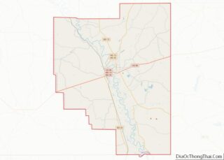
| State: | Mississippi |
| County: | Marion County |
| Elevation: | 148 ft (45 m) |
| Total Area: | 6.76 sq mi (17.50 km²) |
| Land Area: | 6.75 sq mi (17.49 km²) |
| Water Area: | 0.00 sq mi (0.01 km²) |
| Total Population: | 5,864 |
| Population Density: | 868.23/sq mi (335.20/km²) |
| ZIP code: | 39429 |
| Area code: | 601 |
| FIPS code: | 2815340 |
| GNISfeature ID: | 0668715 |
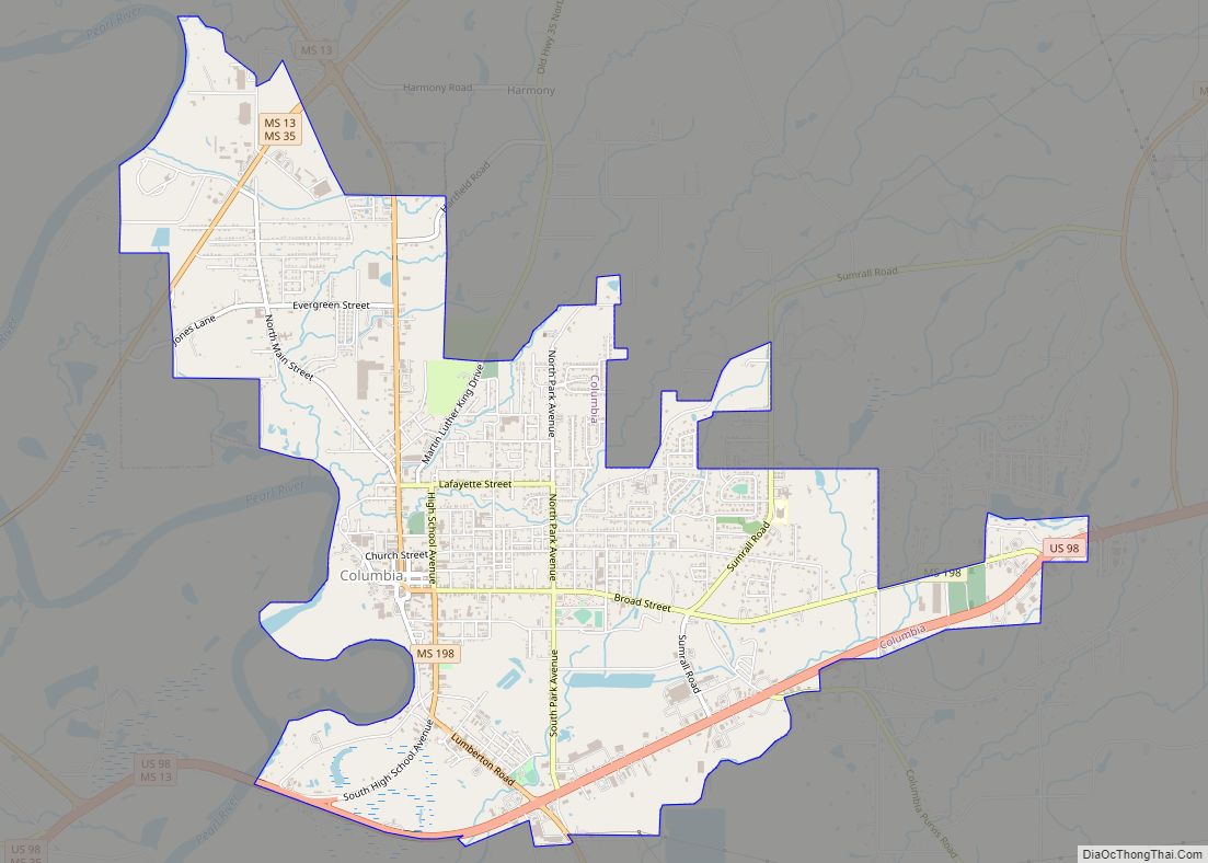
Online Interactive Map
Click on ![]() to view map in "full screen" mode.
to view map in "full screen" mode.
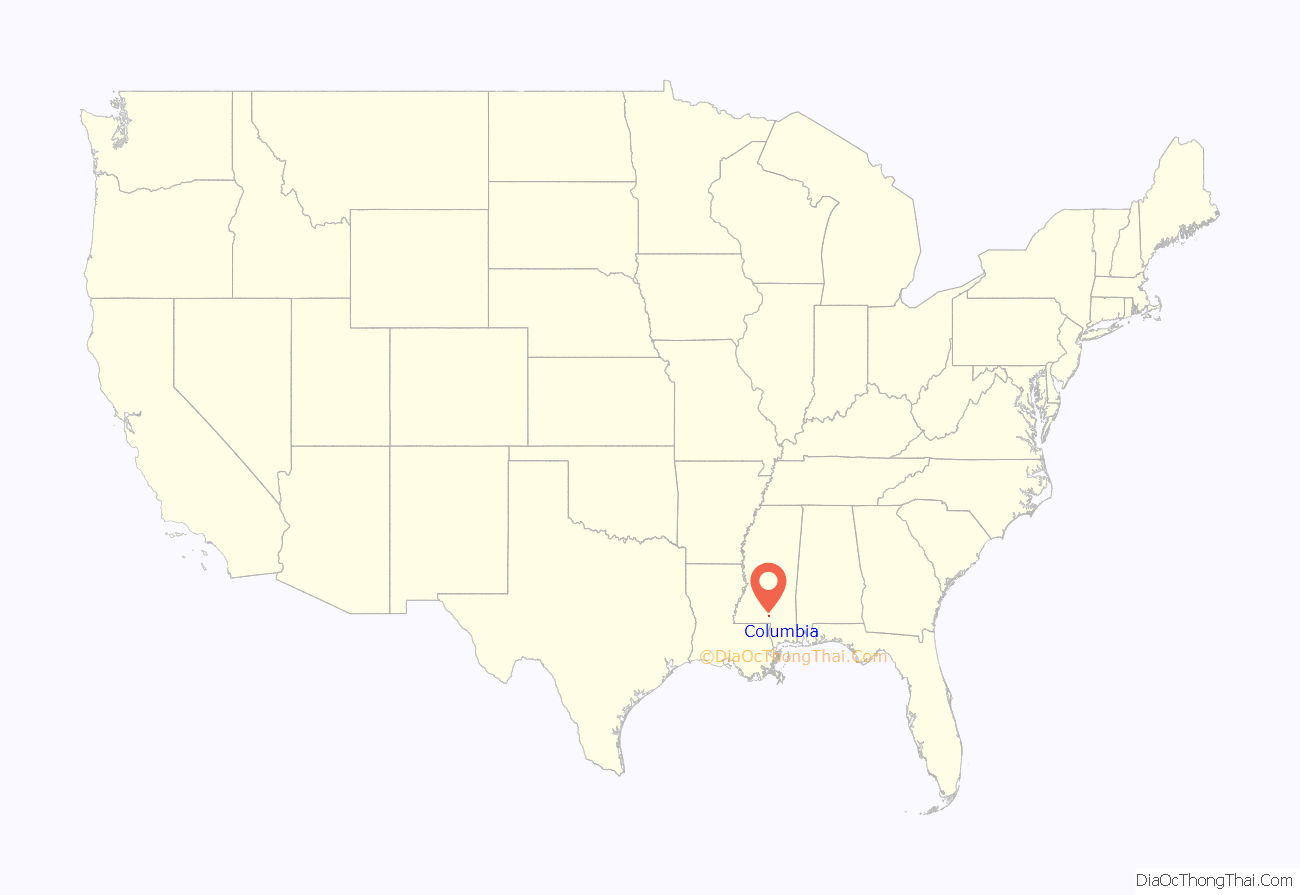
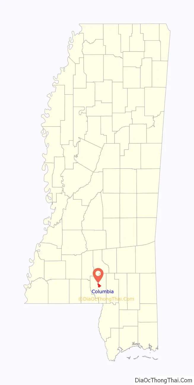
Columbia location map. Where is Columbia city?
History
Columbia is the county seat of Marion County, Mississippi. Marion County was created out of Amite County in 1811, encompassing the southwest quarter of the current state of Mississippi. Before statehood in 1816, there were three territorial census/poll tax records taken of what was deemed Marion County at the time. These records reveal that during 1813, several Lott men arrived and settled on the Pearl River in what is now Columbia. In 1813, William Lott was the largest slave holder near present-day Columbia, owning 28 slaves. There were five men, who settled south of present-day Columbia on 2,789 acres of land with 65 slaves. North of present-day Columbia, on what was the earliest attempt at a town, was Timothy Terrell on 3,151 acres with 32 slaves.
The land on which the current City of Columbia resides was first purchased for cash on April 18, 1820, by William Lott and John Lott. This land is Township 3 East, Range 18 West, Section 5 (640 acres), which is the center of the City of Columbia today. Other early patent holders of Columbia include James Phillips, Jr., and John Cooper (1825), in Section 4 next to John and William Lott.
Columbia was officially incorporated on June 25, 1819, becoming the fourth municipality in the state of Mississippi. It served as the temporary capital of Mississippi from November 1821, when the 5th session of the Mississippi Legislature first met there, until 1822. In that year, a special session of the legislature met in Columbia, inaugurating Governor Walter Leake, and selecting LeFleur’s Bluff (now Jackson) as the permanent capital.
Columbia, “The City of Charm on the River Pearl”, has always been in danger of flooding, due to its bordering the Pearl River. The county courthouse, with its records dating back to pre-statehood, has managed to survive war, floods, tornadoes and hurricanes. In its first 100 years, Columbia relied on the Pearl River for transportation of goods. The river was much deeper and wider than it is now. Steamboat captains, such as John Black, lived in Columbia.
During the Civil War, United States troops under the command of General Davidson camped outside Columbia, taking provisions from the citizens of the Confederate States of America. The courthouse was spared. The Southern Claims Commission Files detail these events.
In 1935, Mississippi’s first rodeo was held in Columbia. In 2016, the Mississippi Rodeo Hall of Fame was founded and headquartered in Columbia.
During the Civil Rights Movement, Columbia, and Marion County were the site of the most peaceful demonstrations, due to the diligent insistence of non-violence by Sheriff John Homer Willoughby. The town is known for its citizens ability to work together.
In 2005, Columbia suffered extensive damage from Hurricane Katrina. Once again, the courthouse survived. There was very limited looting, and citizens worked together with local churches, civic officials, and law enforcement to provide for citizens during the extensive power loss. Individuals immediately began helping their neighbors clear roads and escape being trapped in debris.
The day after Hurricane Katrina struck, several inmates took advantage of the storm damage and escaped from the Marion County Jail (some of whom were charged with Murder). Marion County Deputies along with the help of the Mississippi National Guard and Kentucky State Police, captured all but one escapee who was later apprehended in Texas just before he could get to the Mexican Border.
Former Mississippi governor and Columbia native Hugh L. White introduced white squirrels to the area, and they are still common in Columbia City Park. His home still stands today, a stately reminder of architecture of the past.
In 2014, a tornado measuring EF3 on the Enhanced Fujita scale struck Columbia, causing widespread damage. Mutual aid took place between Columbia, Mississippi and Columbia, South Carolina following this natural disaster and the 1000 year flood in South Carolina,
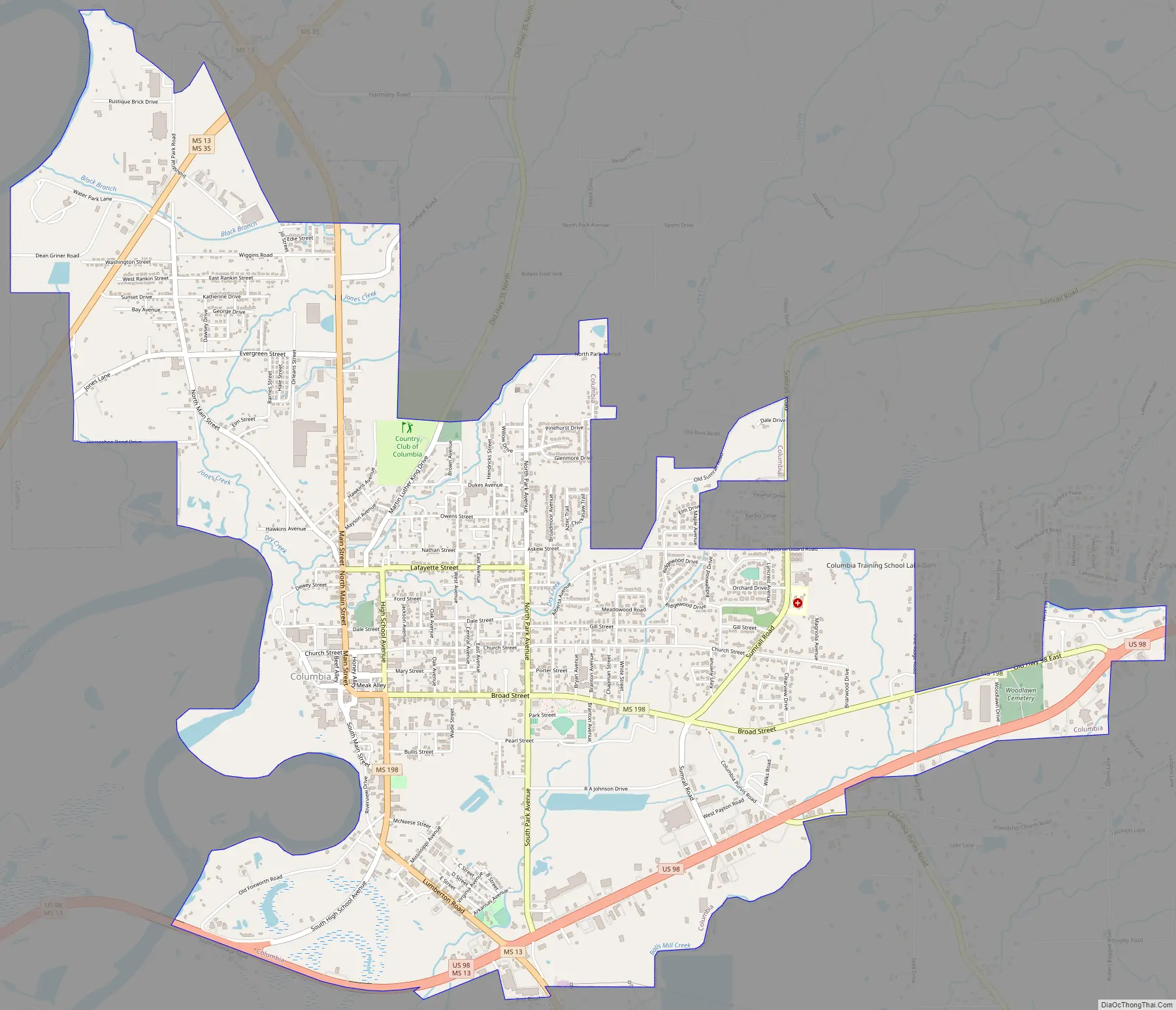
Columbia Road Map
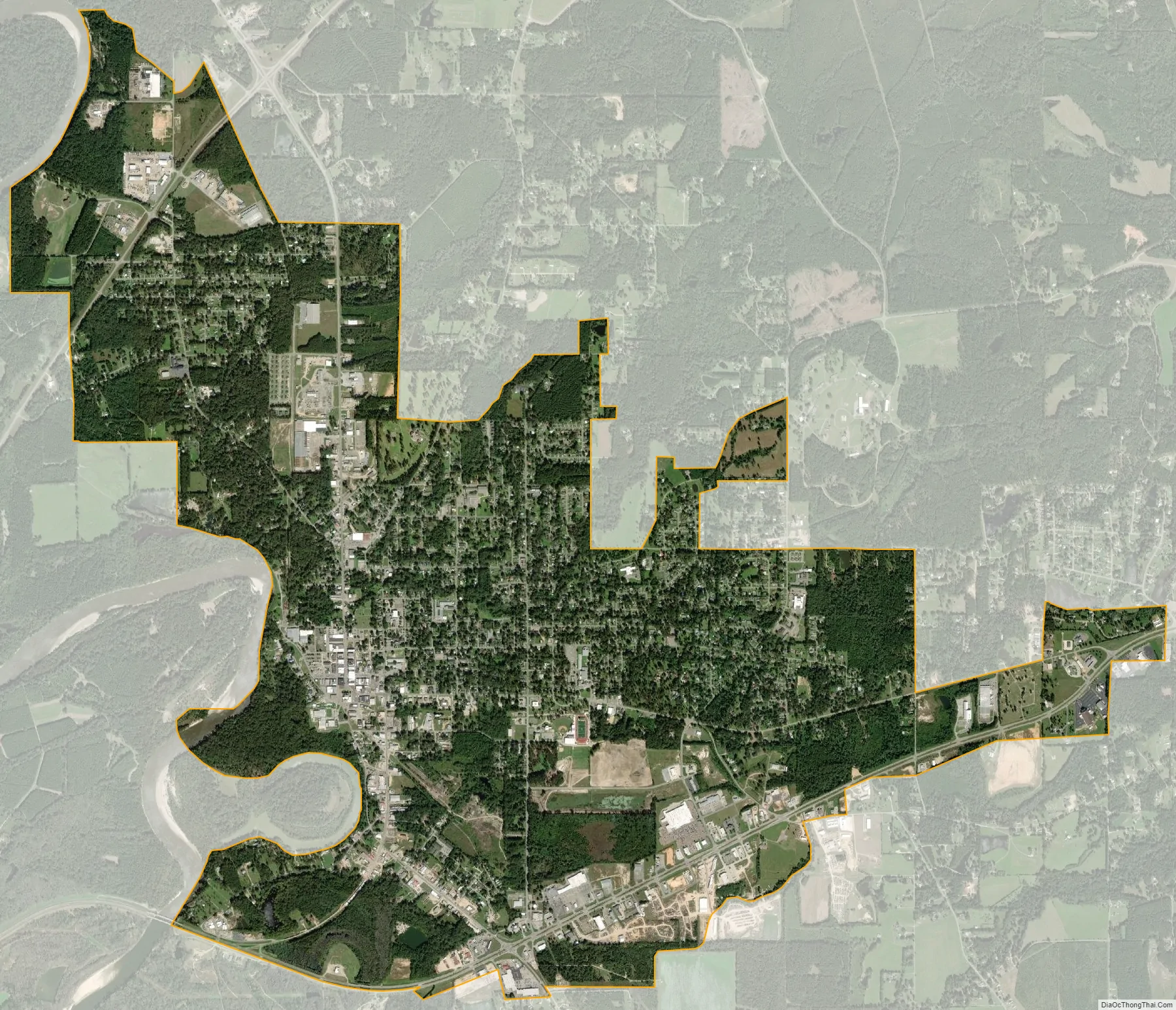
Columbia city Satellite Map
Geography
Columbia is located on the east bank of the Pearl River and is 81 miles south of Jackson, Mississippi and 103 miles north of New Orleans, Louisiana. According to the United States Census Bureau, the city has a total area of 6.4 square miles (17 km), all land.
See also
Map of Mississippi State and its subdivision:- Adams
- Alcorn
- Amite
- Attala
- Benton
- Bolivar
- Calhoun
- Carroll
- Chickasaw
- Choctaw
- Claiborne
- Clarke
- Clay
- Coahoma
- Copiah
- Covington
- Desoto
- Forrest
- Franklin
- George
- Greene
- Grenada
- Hancock
- Harrison
- Hinds
- Holmes
- Humphreys
- Issaquena
- Itawamba
- Jackson
- Jasper
- Jefferson
- Jefferson Davis
- Jones
- Kemper
- Lafayette
- Lamar
- Lauderdale
- Lawrence
- Leake
- Lee
- Leflore
- Lincoln
- Lowndes
- Madison
- Marion
- Marshall
- Monroe
- Montgomery
- Neshoba
- Newton
- Noxubee
- Oktibbeha
- Panola
- Pearl River
- Perry
- Pike
- Pontotoc
- Prentiss
- Quitman
- Rankin
- Scott
- Sharkey
- Simpson
- Smith
- Stone
- Sunflower
- Tallahatchie
- Tate
- Tippah
- Tishomingo
- Tunica
- Union
- Walthall
- Warren
- Washington
- Wayne
- Webster
- Wilkinson
- Winston
- Yalobusha
- Yazoo
- Alabama
- Alaska
- Arizona
- Arkansas
- California
- Colorado
- Connecticut
- Delaware
- District of Columbia
- Florida
- Georgia
- Hawaii
- Idaho
- Illinois
- Indiana
- Iowa
- Kansas
- Kentucky
- Louisiana
- Maine
- Maryland
- Massachusetts
- Michigan
- Minnesota
- Mississippi
- Missouri
- Montana
- Nebraska
- Nevada
- New Hampshire
- New Jersey
- New Mexico
- New York
- North Carolina
- North Dakota
- Ohio
- Oklahoma
- Oregon
- Pennsylvania
- Rhode Island
- South Carolina
- South Dakota
- Tennessee
- Texas
- Utah
- Vermont
- Virginia
- Washington
- West Virginia
- Wisconsin
- Wyoming