Escatawpa is an unincorporated community and census-designated place (CDP) in Jackson County, Mississippi, United States. It is part of the Pascagoula Metropolitan Statistical Area. The population was 3,254 at the 2020 census.
| Name: | Escatawpa CDP |
|---|---|
| LSAD Code: | 57 |
| LSAD Description: | CDP (suffix) |
| State: | Mississippi |
| County: | Jackson County |
| Elevation: | 13 ft (4 m) |
| Total Area: | 6.92 sq mi (17.92 km²) |
| Land Area: | 6.68 sq mi (17.30 km²) |
| Water Area: | 0.24 sq mi (0.62 km²) |
| Total Population: | 3,254 |
| Population Density: | 487.27/sq mi (188.13/km²) |
| ZIP code: | 39552 |
| Area code: | 228 |
| FIPS code: | 2822900 |
| GNISfeature ID: | 0669806 |
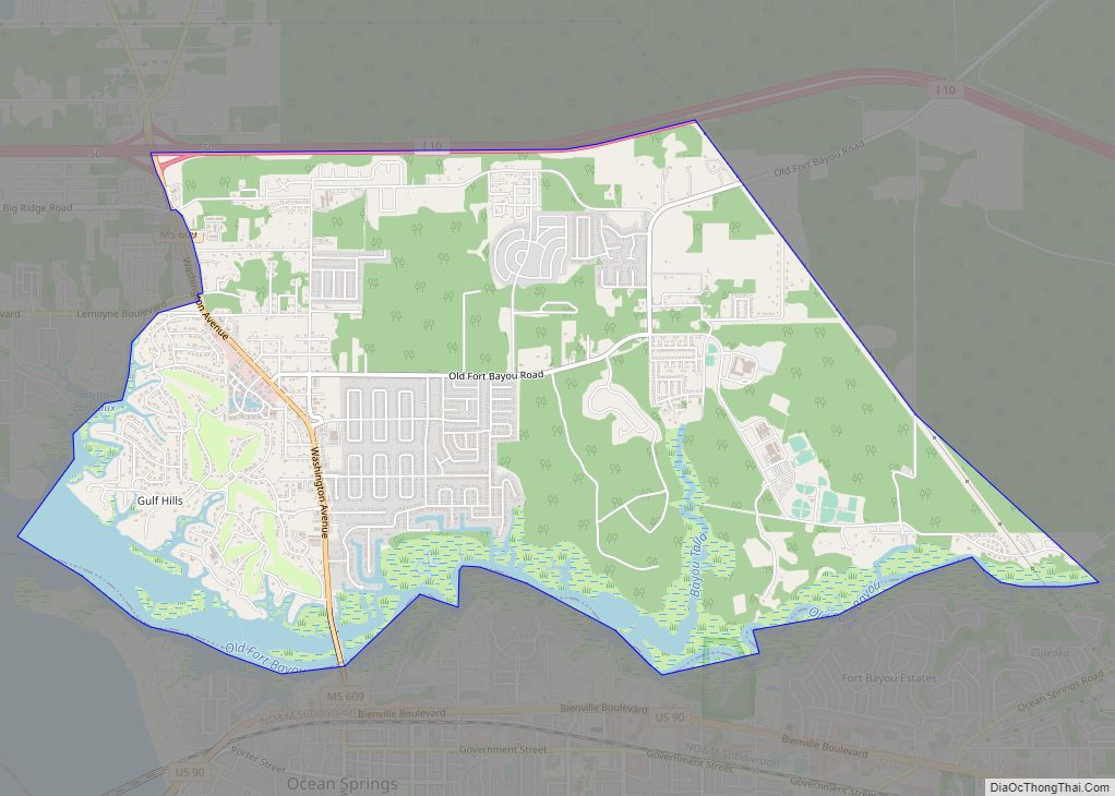
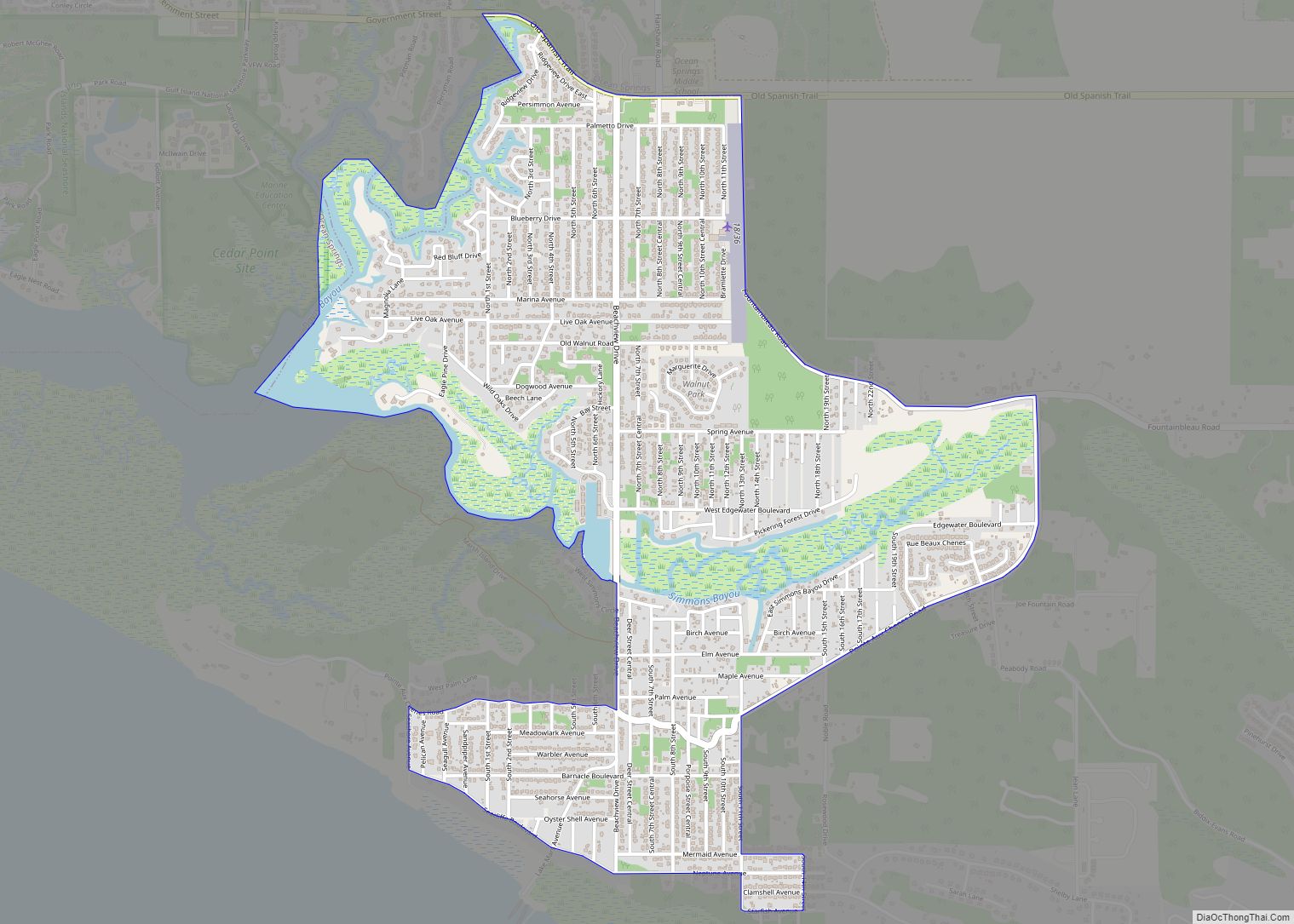
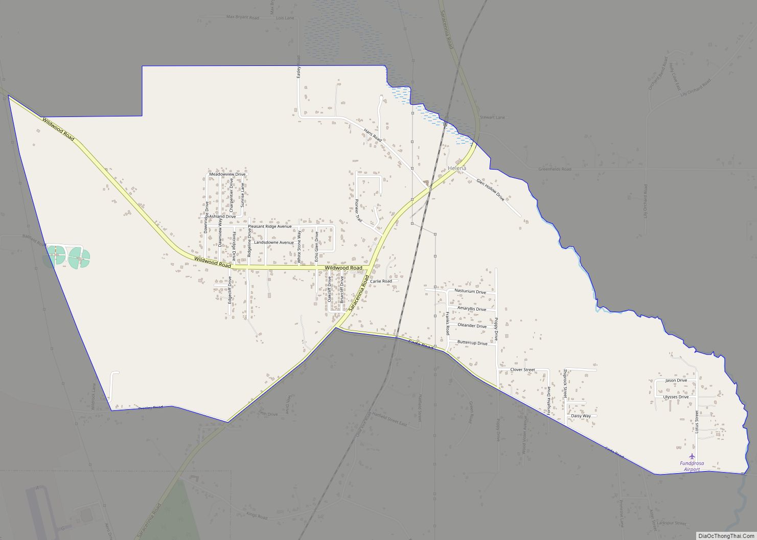
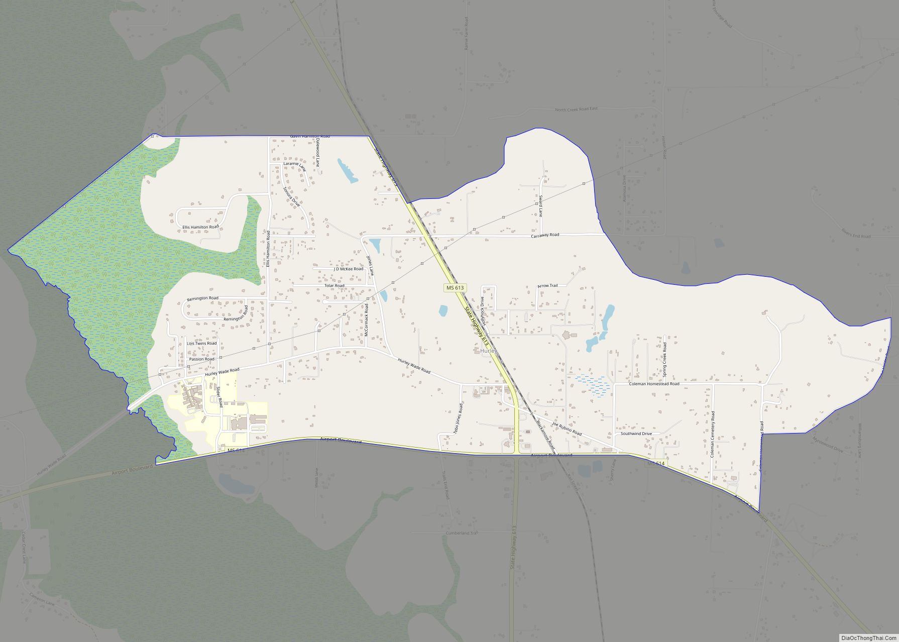
Online Interactive Map
Click on ![]() to view map in "full screen" mode.
to view map in "full screen" mode.
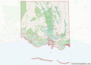
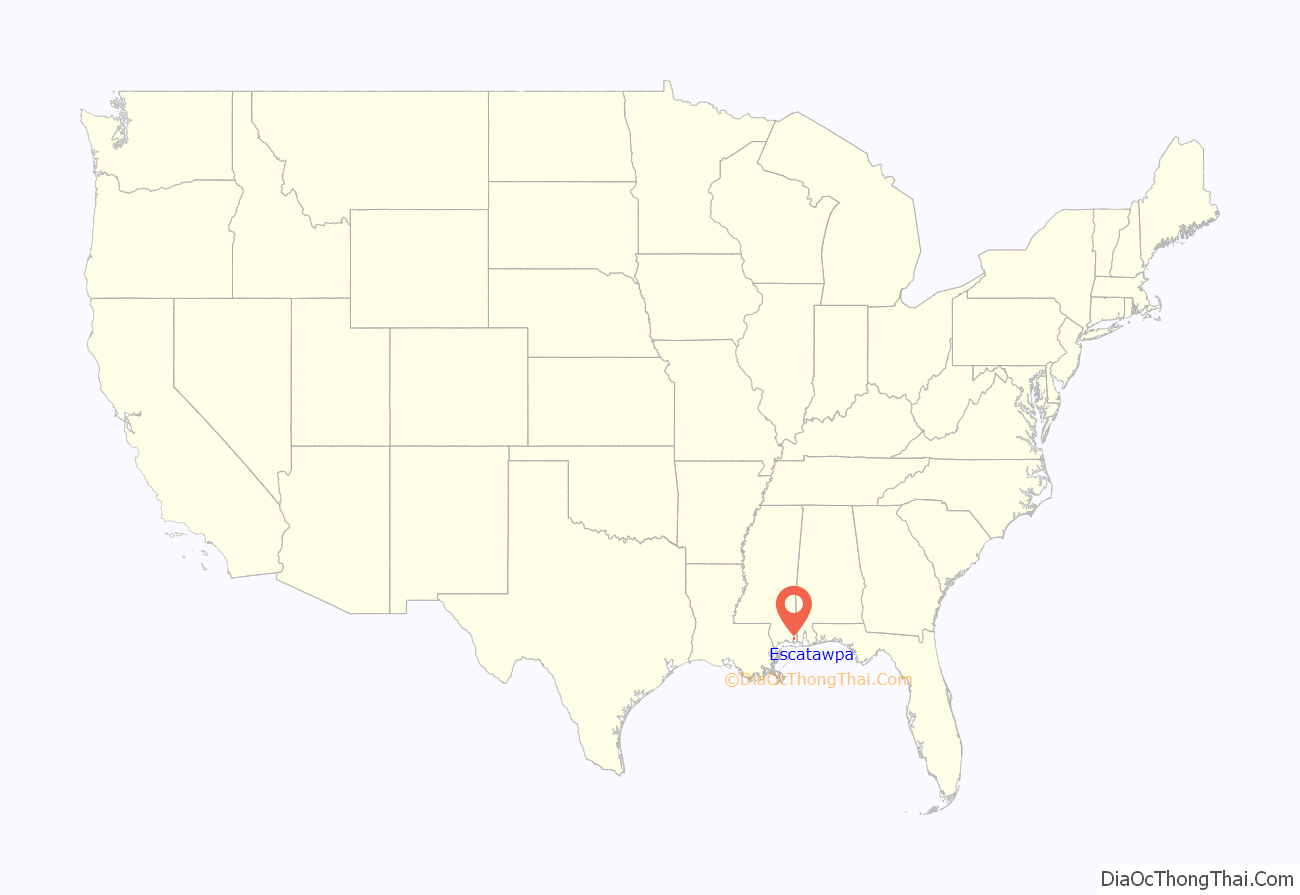
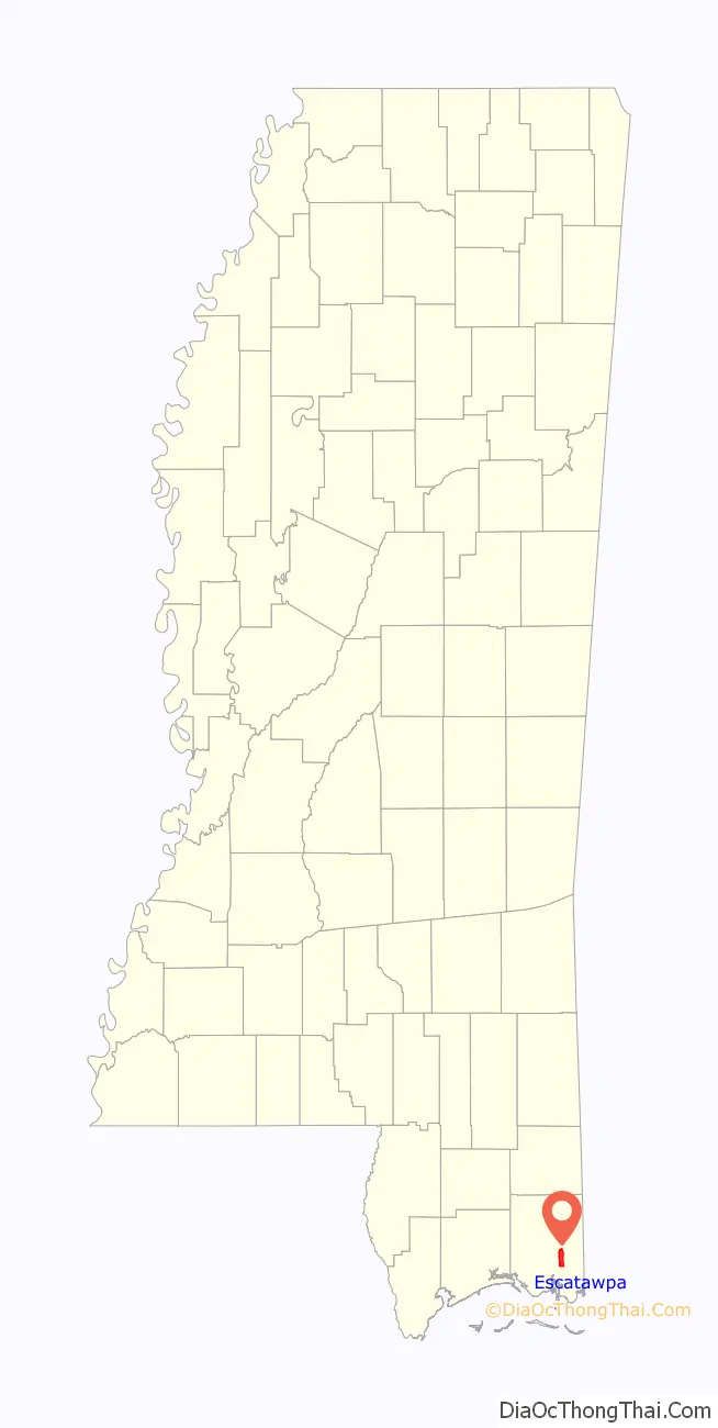
Escatawpa location map. Where is Escatawpa CDP?
History
The community takes its name from the Escatawpa River. A post office called Escatawpa was established in 1885.
In 1990, the original center of Escatawpa was annexed into the city of Moss Point, located just to the south. The adjoining unincorporated area north of Moss Point is the current Escatawpa census-designated place. The city was devastated by Hurricane Katrina on August 29, 2005. Escatawpa is the home of the rock band 3 Doors Down. Escatawpa is six miles north of Pascagoula. In 1906, the population of Escatawpa was 500.
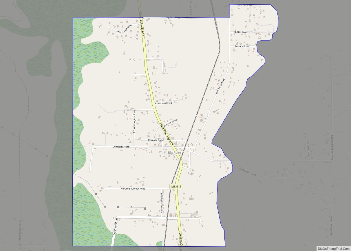
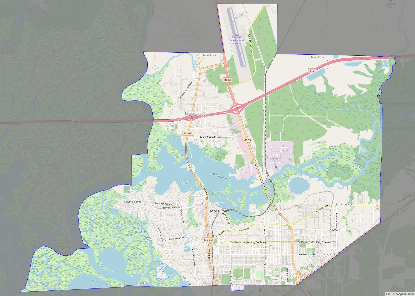
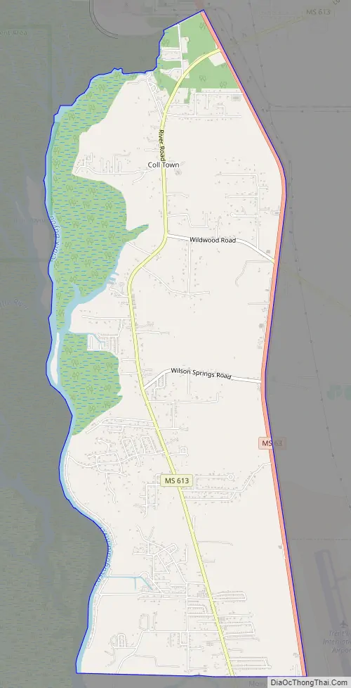
Escatawpa Road Map
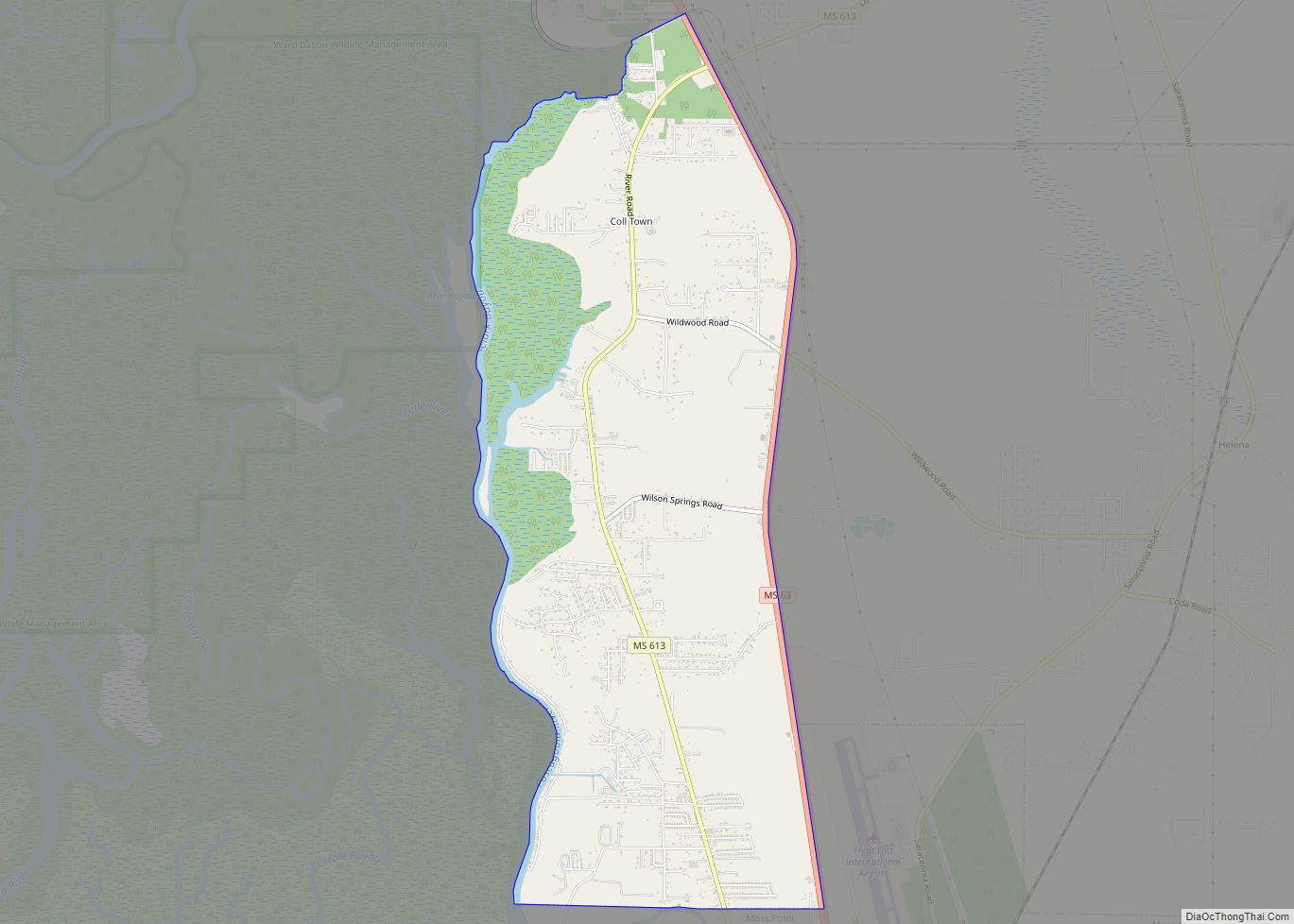
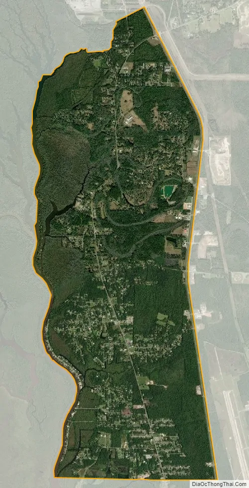
Escatawpa city Satellite Map
Geography
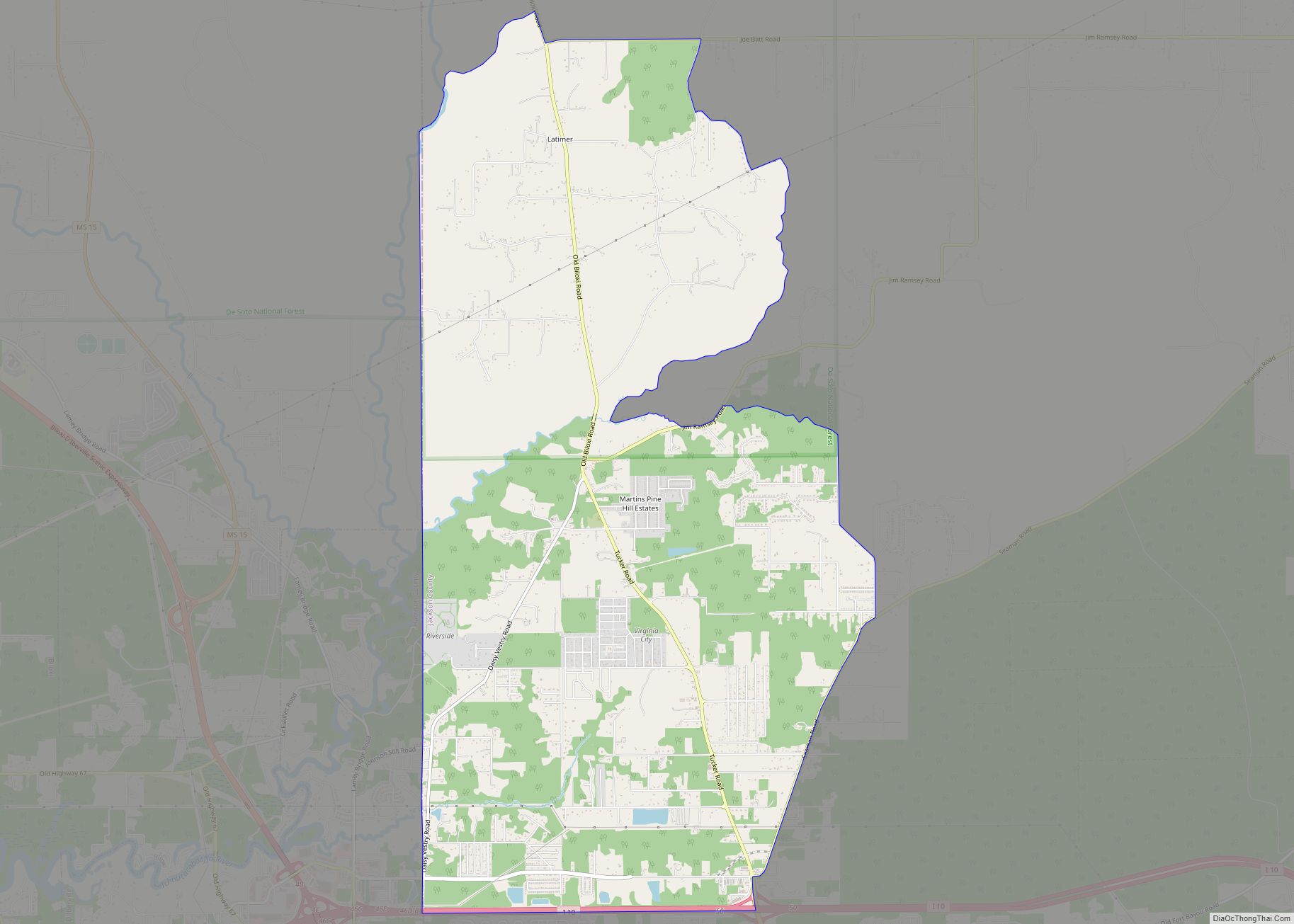
The Escatawpa CDP is in eastern Jackson County on the east side of the Pascagoula River. It is bordered to the south by the city of Moss Point. The original community of Escatawpa, now a neighborhood in Moss Point, was centered just north of present-day Interstate 10. The current CDP is 5 miles (8 km) north of the center of Moss Point and 9 miles (14 km) north of Pascagoula, the Jackson county seat. Mississippi Highway 613 is the main road through the center of Escatawpa, and four-lane Mississippi Highway 63 forms the eastern edge of the community.
According to the United States Census Bureau, the Escatawpa CDP has a total area of 6.9 square miles (17.9 km), of which 6.7 square miles (17.3 km) are land and 0.2 square miles (0.6 km), or 3.49%, are water.
See also
Map of Mississippi State and its subdivision:- Adams
- Alcorn
- Amite
- Attala
- Benton
- Bolivar
- Calhoun
- Carroll
- Chickasaw
- Choctaw
- Claiborne
- Clarke
- Clay
- Coahoma
- Copiah
- Covington
- Desoto
- Forrest
- Franklin
- George
- Greene
- Grenada
- Hancock
- Harrison
- Hinds
- Holmes
- Humphreys
- Issaquena
- Itawamba
- Jackson
- Jasper
- Jefferson
- Jefferson Davis
- Jones
- Kemper
- Lafayette
- Lamar
- Lauderdale
- Lawrence
- Leake
- Lee
- Leflore
- Lincoln
- Lowndes
- Madison
- Marion
- Marshall
- Monroe
- Montgomery
- Neshoba
- Newton
- Noxubee
- Oktibbeha
- Panola
- Pearl River
- Perry
- Pike
- Pontotoc
- Prentiss
- Quitman
- Rankin
- Scott
- Sharkey
- Simpson
- Smith
- Stone
- Sunflower
- Tallahatchie
- Tate
- Tippah
- Tishomingo
- Tunica
- Union
- Walthall
- Warren
- Washington
- Wayne
- Webster
- Wilkinson
- Winston
- Yalobusha
- Yazoo
- Alabama
- Alaska
- Arizona
- Arkansas
- California
- Colorado
- Connecticut
- Delaware
- District of Columbia
- Florida
- Georgia
- Hawaii
- Idaho
- Illinois
- Indiana
- Iowa
- Kansas
- Kentucky
- Louisiana
- Maine
- Maryland
- Massachusetts
- Michigan
- Minnesota
- Mississippi
- Missouri
- Montana
- Nebraska
- Nevada
- New Hampshire
- New Jersey
- New Mexico
- New York
- North Carolina
- North Dakota
- Ohio
- Oklahoma
- Oregon
- Pennsylvania
- Rhode Island
- South Carolina
- South Dakota
- Tennessee
- Texas
- Utah
- Vermont
- Virginia
- Washington
- West Virginia
- Wisconsin
- Wyoming