Moss Point is a city in Jackson County, Mississippi, United States. The population was 12,147 in 2020, a decline from the figure of 13,704 in 2010. The Moss Point Historic District and several individual buildings are listed on the National Register of Historic Places’ Jackson County listings.
| Name: | Moss Point city |
|---|---|
| LSAD Code: | 25 |
| LSAD Description: | city (suffix) |
| State: | Mississippi |
| County: | Jackson County |
| Incorporated: | 1901 (as a city) |
| Elevation: | 16 ft (5 m) |
| Total Area: | 26.57 sq mi (68.80 km²) |
| Land Area: | 24.11 sq mi (62.45 km²) |
| Water Area: | 2.45 sq mi (6.35 km²) |
| Total Population: | 12,147 |
| Population Density: | 503.75/sq mi (194.50/km²) |
| ZIP code: | 39562, 39563, 39581 |
| Area code: | 228 |
| FIPS code: | 2849240 |
| GNISfeature ID: | 0673878 |
| Website: | cityofmosspoint.org |
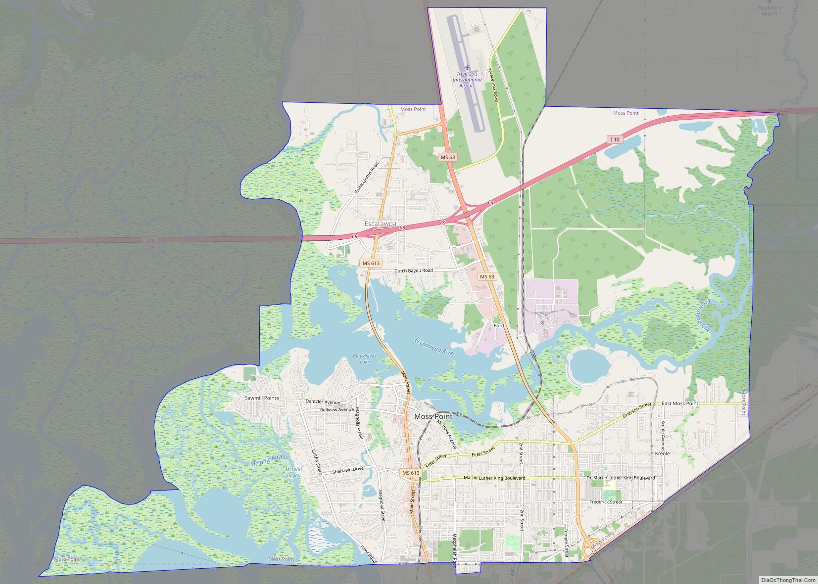
Online Interactive Map
Click on ![]() to view map in "full screen" mode.
to view map in "full screen" mode.
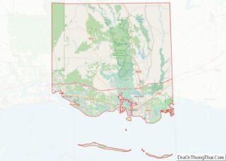
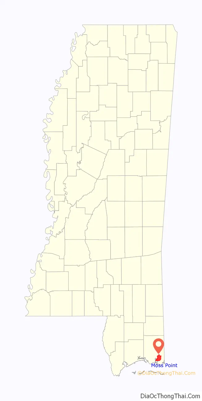
Moss Point location map. Where is Moss Point city?

History
On August 29, 2005, Moss Point was hit by the strong east side of Hurricane Katrina, and much of the city was flooded or destroyed (see details below). Moss Point is home to Trent Lott International Airport and the Mississippi Export Railroad.
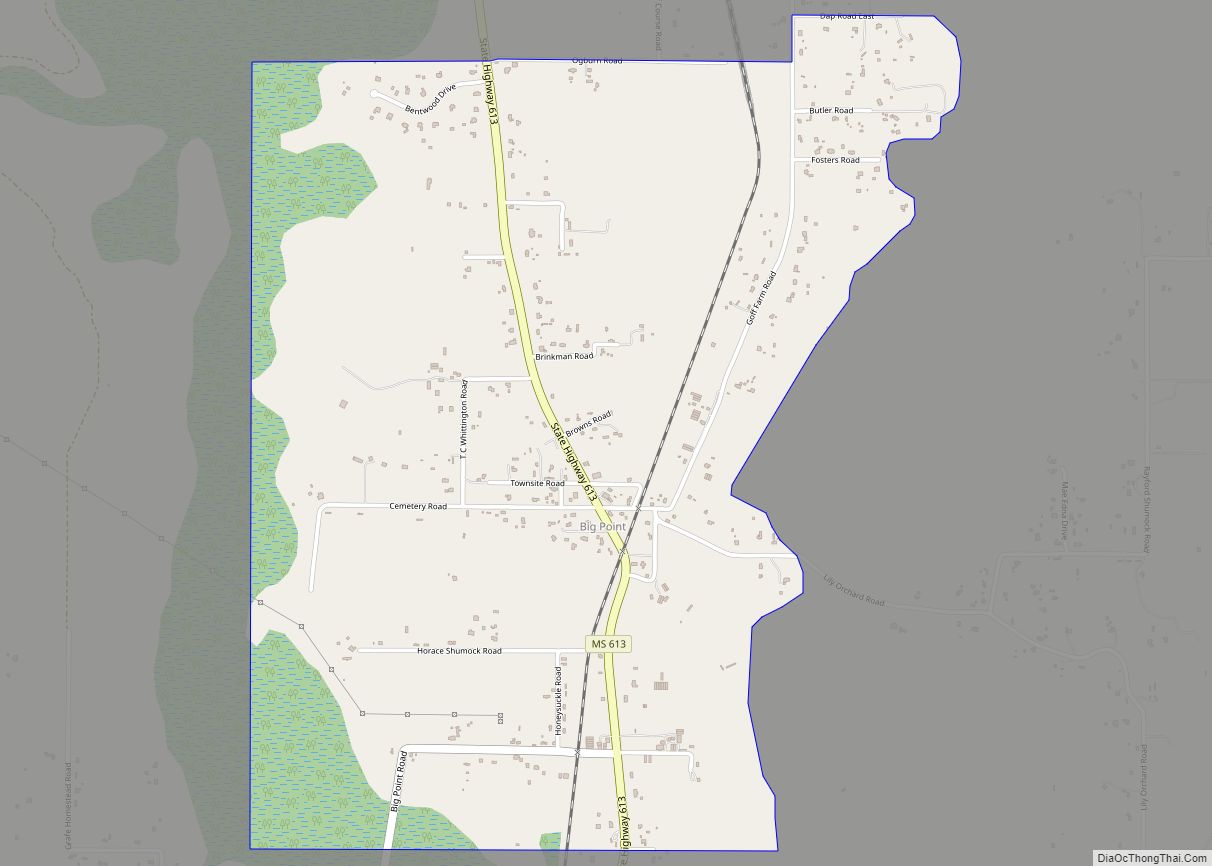
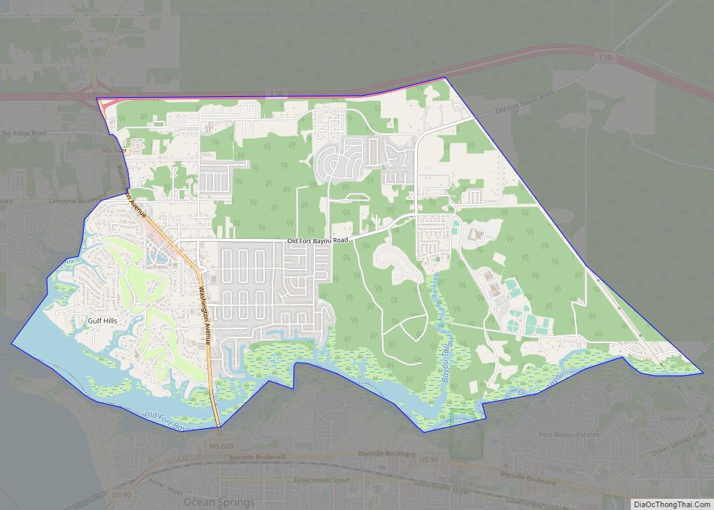
Moss Point Road Map
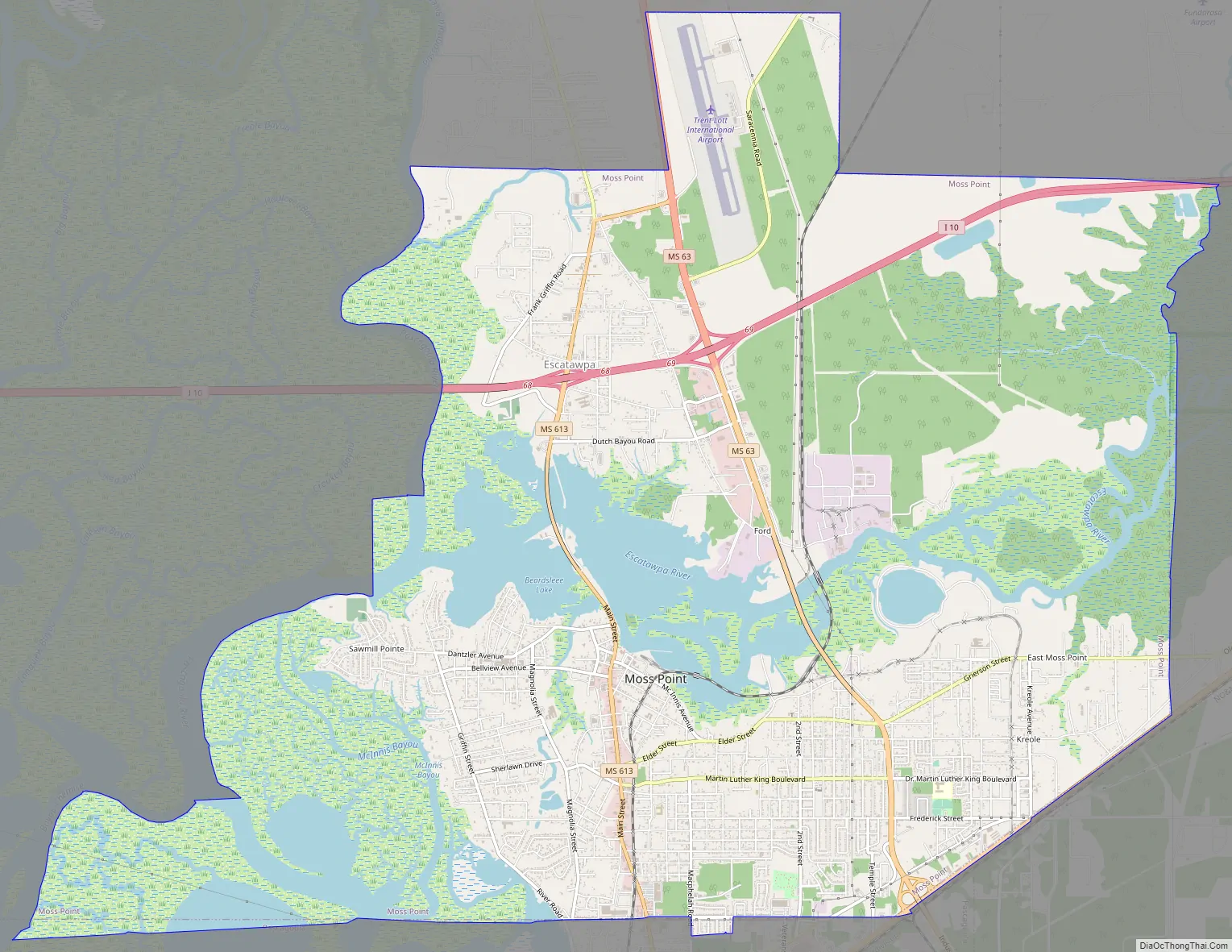
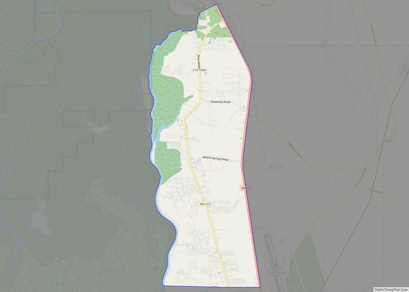
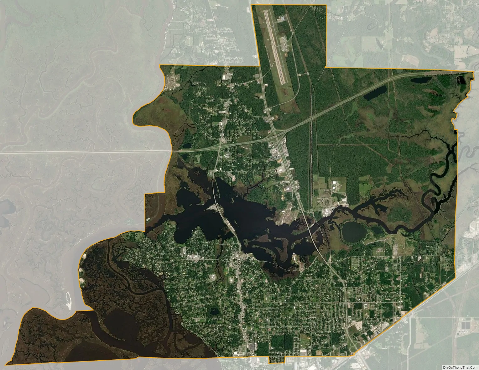
Moss Point city Satellite Map
Geography
Moss Point is in southeastern Jackson County, on the east side of the Pascagoula River. It is bordered to the south by the city of Pascagoula, the county seat, and to the north by unincorporated Escatawpa. The Escatawpa River flows east–west through the city into the Pascagoula River.
U.S. Route 90 forms the southeastern boundary of Moss Point, leading southwestward into Pascagoula and northeastward to Interstate 10, which runs through the northern part of the Moss Point city limits. I-10 leads west 22 miles (35 km) to the Biloxi area and northeast 36 miles (58 km) to Mobile, Alabama. Mississippi Highways 63 and 613 (Main Street) are north–south roads through Moss Point. Highway 63 leads south to US-90 and north 38 miles (61 km) to Lucedale, while Highway 613 leads south 4 miles (6 km) to the center of Pascagoula and north 5 miles (8 km) to Escatawpa.
Moss Point has a total area of 26.6 square miles (68.8 km), of which 24.2 square miles (62.6 km) are land and 2.4 square miles (6.3 km), or 9.11%, are water.
See also
Map of Mississippi State and its subdivision:- Adams
- Alcorn
- Amite
- Attala
- Benton
- Bolivar
- Calhoun
- Carroll
- Chickasaw
- Choctaw
- Claiborne
- Clarke
- Clay
- Coahoma
- Copiah
- Covington
- Desoto
- Forrest
- Franklin
- George
- Greene
- Grenada
- Hancock
- Harrison
- Hinds
- Holmes
- Humphreys
- Issaquena
- Itawamba
- Jackson
- Jasper
- Jefferson
- Jefferson Davis
- Jones
- Kemper
- Lafayette
- Lamar
- Lauderdale
- Lawrence
- Leake
- Lee
- Leflore
- Lincoln
- Lowndes
- Madison
- Marion
- Marshall
- Monroe
- Montgomery
- Neshoba
- Newton
- Noxubee
- Oktibbeha
- Panola
- Pearl River
- Perry
- Pike
- Pontotoc
- Prentiss
- Quitman
- Rankin
- Scott
- Sharkey
- Simpson
- Smith
- Stone
- Sunflower
- Tallahatchie
- Tate
- Tippah
- Tishomingo
- Tunica
- Union
- Walthall
- Warren
- Washington
- Wayne
- Webster
- Wilkinson
- Winston
- Yalobusha
- Yazoo
- Alabama
- Alaska
- Arizona
- Arkansas
- California
- Colorado
- Connecticut
- Delaware
- District of Columbia
- Florida
- Georgia
- Hawaii
- Idaho
- Illinois
- Indiana
- Iowa
- Kansas
- Kentucky
- Louisiana
- Maine
- Maryland
- Massachusetts
- Michigan
- Minnesota
- Mississippi
- Missouri
- Montana
- Nebraska
- Nevada
- New Hampshire
- New Jersey
- New Mexico
- New York
- North Carolina
- North Dakota
- Ohio
- Oklahoma
- Oregon
- Pennsylvania
- Rhode Island
- South Carolina
- South Dakota
- Tennessee
- Texas
- Utah
- Vermont
- Virginia
- Washington
- West Virginia
- Wisconsin
- Wyoming