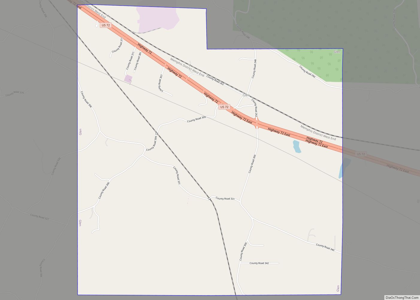
Glen is a town in Alcorn County, Mississippi. The population was 382 at the 2020 census, down from 412 at the 2010 census.
| Name: | Glen town |
|---|---|
| LSAD Code: | 43 |
| LSAD Description: | town (suffix) |
| State: | Mississippi |
| County: | Alcorn County |
| Total Area: | 4.67 sq mi (12.09 km²) |
| Land Area: | 4.66 sq mi (12.07 km²) |
| Water Area: | 0.01 sq mi (0.02 km²) |
| Total Population: | 382 |
| Population Density: | 81.97/sq mi (31.65/km²) |
| ZIP code: | 38846 |
| Area code: | 662 |
| FIPS code: | 2827540 |
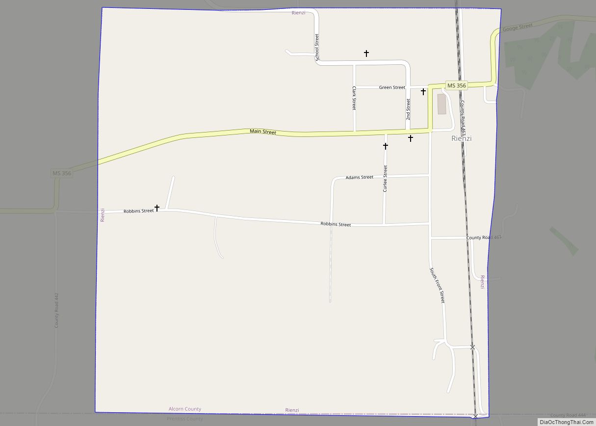
Online Interactive Map
Click on ![]() to view map in "full screen" mode.
to view map in "full screen" mode.
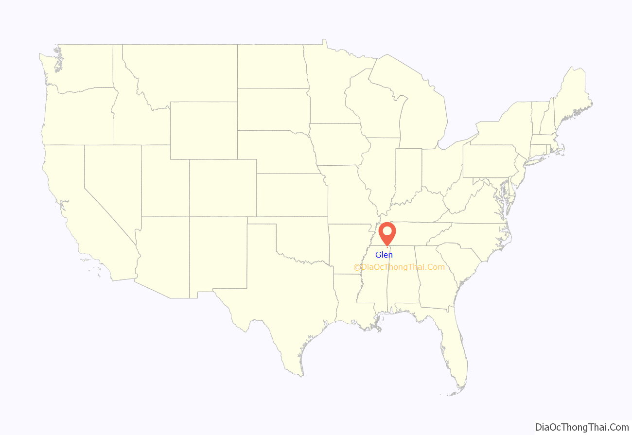
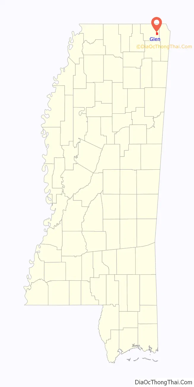
Glen location map. Where is Glen town?
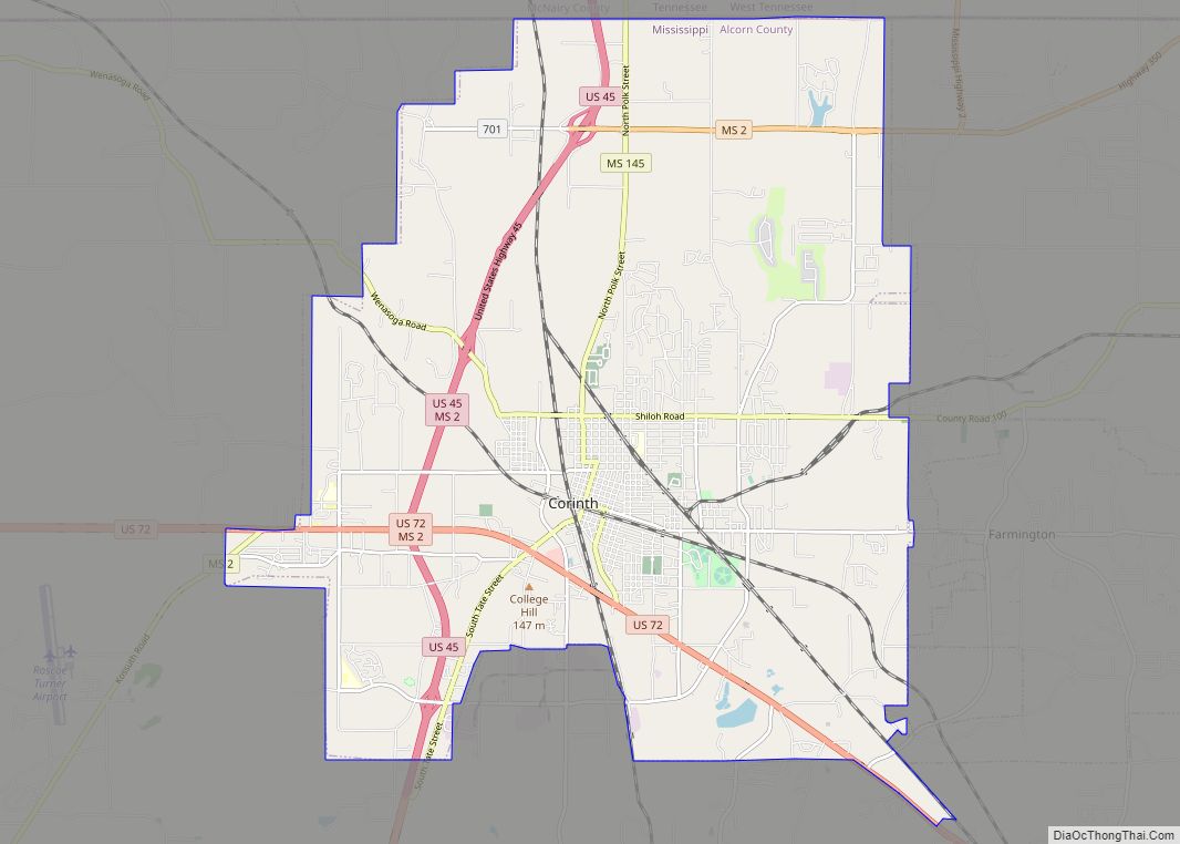
History
The town of Glen, located 9 miles (14 km) southeast of Corinth, owes its beginning to the Memphis & Charleston Railroad. Glen was originally called “Glendale” and is marked as such on old railroad maps.
Glen Road Map
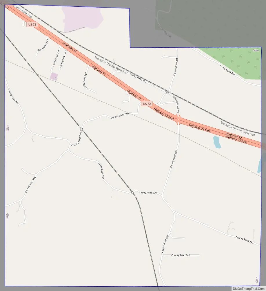
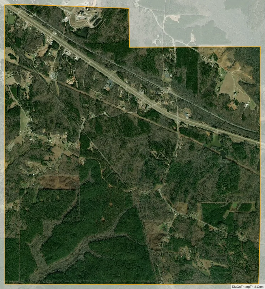
Glen city Satellite Map
Geography
Glen is located at 34°51′36″N 88°25′7″W / 34.86000°N 88.41861°W / 34.86000; -88.41861 (34.859967, -88.418633).
According to the United States Census Bureau, the town has a total area of 4.7 square miles (12 km), of which 4.7 square miles (12 km) is land and 0.21% is water.
See also
Map of Mississippi State and its subdivision:- Adams
- Alcorn
- Amite
- Attala
- Benton
- Bolivar
- Calhoun
- Carroll
- Chickasaw
- Choctaw
- Claiborne
- Clarke
- Clay
- Coahoma
- Copiah
- Covington
- Desoto
- Forrest
- Franklin
- George
- Greene
- Grenada
- Hancock
- Harrison
- Hinds
- Holmes
- Humphreys
- Issaquena
- Itawamba
- Jackson
- Jasper
- Jefferson
- Jefferson Davis
- Jones
- Kemper
- Lafayette
- Lamar
- Lauderdale
- Lawrence
- Leake
- Lee
- Leflore
- Lincoln
- Lowndes
- Madison
- Marion
- Marshall
- Monroe
- Montgomery
- Neshoba
- Newton
- Noxubee
- Oktibbeha
- Panola
- Pearl River
- Perry
- Pike
- Pontotoc
- Prentiss
- Quitman
- Rankin
- Scott
- Sharkey
- Simpson
- Smith
- Stone
- Sunflower
- Tallahatchie
- Tate
- Tippah
- Tishomingo
- Tunica
- Union
- Walthall
- Warren
- Washington
- Wayne
- Webster
- Wilkinson
- Winston
- Yalobusha
- Yazoo
- Alabama
- Alaska
- Arizona
- Arkansas
- California
- Colorado
- Connecticut
- Delaware
- District of Columbia
- Florida
- Georgia
- Hawaii
- Idaho
- Illinois
- Indiana
- Iowa
- Kansas
- Kentucky
- Louisiana
- Maine
- Maryland
- Massachusetts
- Michigan
- Minnesota
- Mississippi
- Missouri
- Montana
- Nebraska
- Nevada
- New Hampshire
- New Jersey
- New Mexico
- New York
- North Carolina
- North Dakota
- Ohio
- Oklahoma
- Oregon
- Pennsylvania
- Rhode Island
- South Carolina
- South Dakota
- Tennessee
- Texas
- Utah
- Vermont
- Virginia
- Washington
- West Virginia
- Wisconsin
- Wyoming