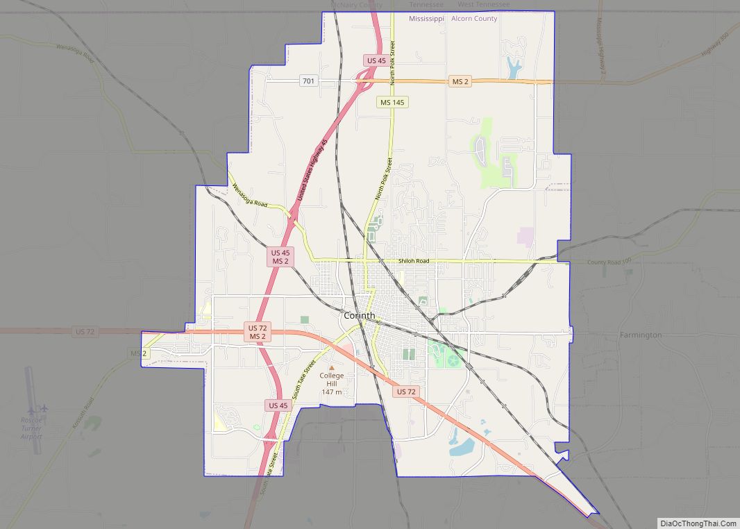
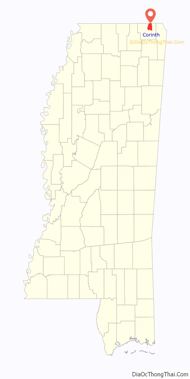
Corinth is a city in and the county seat of Alcorn County, Mississippi, United States. The population was 14,573 at the 2010 census. Its ZIP codes are 38834 and 38835. It lies on the state line with Tennessee.
| Name: | Corinth city |
|---|---|
| LSAD Code: | 25 |
| LSAD Description: | city (suffix) |
| State: | Mississippi |
| County: | Alcorn County |
| Elevation: | 440 ft (134 m) |
| Total Area: | 30.29 sq mi (78.44 km²) |
| Land Area: | 30.16 sq mi (78.12 km²) |
| Water Area: | 0.13 sq mi (0.32 km²) |
| Total Population: | 14,622 |
| Population Density: | 484.80/sq mi (187.18/km²) |
| ZIP code: | 38834–38835 |
| Area code: | 662 |
| FIPS code: | 2815700 |
| GNISfeature ID: | 0668825 |
| Website: | cityofcorinthms.com |
Online Interactive Map
Click on ![]() to view map in "full screen" mode.
to view map in "full screen" mode.
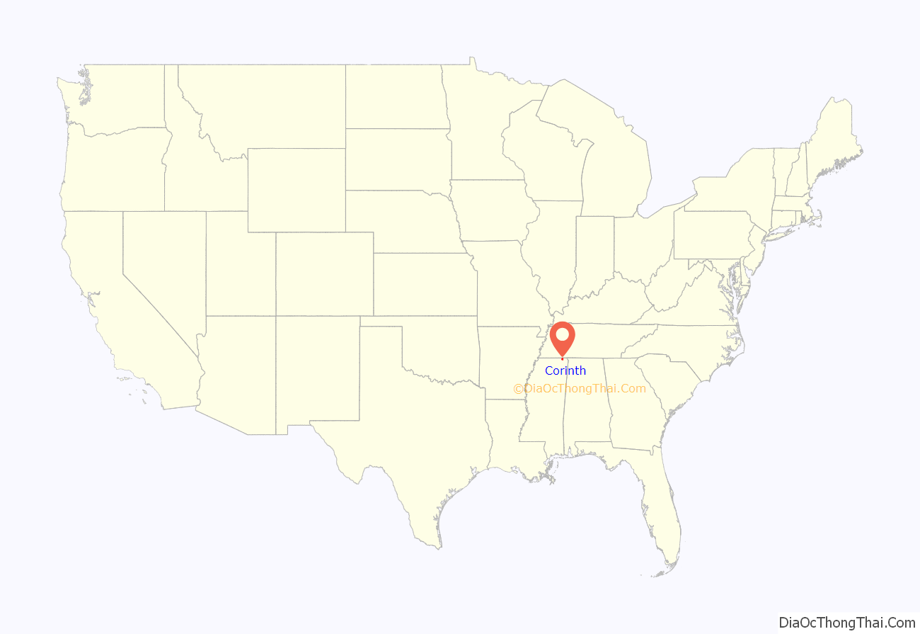
Corinth location map. Where is Corinth city?
History
Corinth was founded in 1853 as Cross City, so-called because it served as a junction for the Mobile & Ohio and Memphis & Charleston railroads. It was the town’s early newspaper editor, W. E. Gibson, who suggested its current name for the city of Corinth in Greece that also served as a crossroads.
Corinth’s location at the junction of two railroads made it strategically important to the Confederacy during the American Civil War. Confederate General P. G. T. Beauregard retreated to Corinth after the Battle of Shiloh (April 1862), pursued by Union Major General Henry W. Halleck. General Beauregard abandoned the town on May 29 when General Halleck approached, letting it fall into the Union’s hands. Since Halleck had approached so cautiously, digging entrenchments at every stop for over a month, this action has been known as the Siege of Corinth.
The Union sent Maj. Gen. William Rosecrans to Corinth as well and concentrated its forces in the city. The Second Battle of Corinth took place on October 3−4, 1862, when Confederate Maj. Gen. Earl Van Dorn attempted to retake the city.
Locales on the National Register of Historic Places
- Battery Williams (also known as Fort Williams)
- Siege and Battle of Corinth Sites
- Coliseum Theatre- built in the early 20th century in the Colonial Revival style
- Corinth National Cemetery
- Downtown Corinth Historic District
- Dr. Joseph M. Bynum House—a home in the Late Gothic Revival style built in the late 19th century
- Federal Siege Trench (also known as Harper Road Trench)
- Fort Robinette (also known as Battery Robinette)—site of the Civil War Interpretive Center
- Jacinto Courthouse (also called the Old Tishomingo County Courthouse)—built in the mid-19th century in the Federal style
- L.C. Steele House
- Midtown Corinth Historic District
- Moores Creek site—a prehistoric Native American site from 3000 to 3500 B.C.
- Old U.S. Post Office
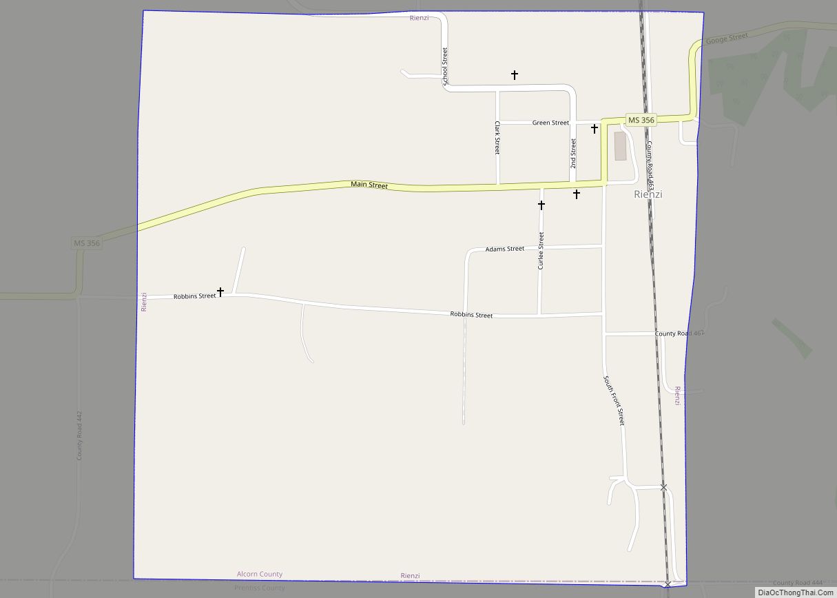
- Rienzi Commercial Historic District
- Thomas F. Dilworth House
- Union Battery F, Battle of Corinth
- Union Earthworks
- Veranda House (also known as the Curlee House)—built in 1857, it served as headquarters for Confederate generals during the Battle of Corinth
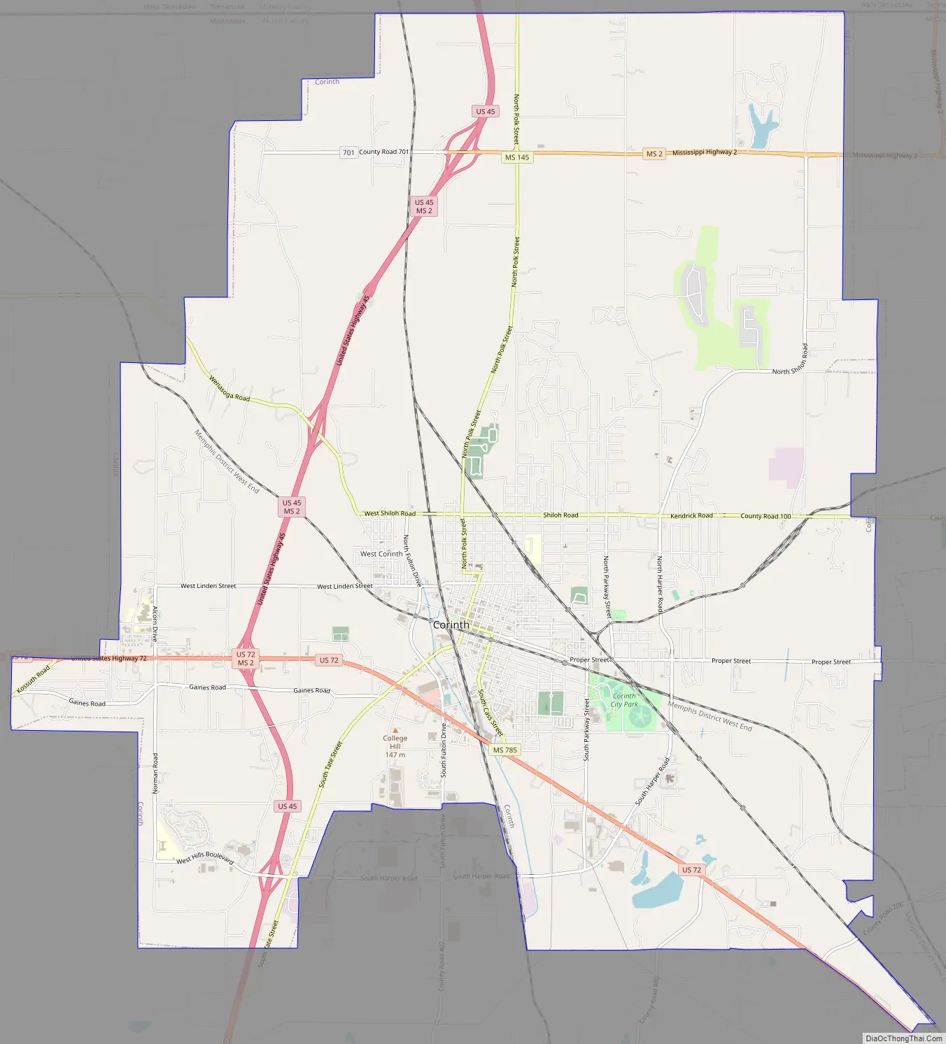
Corinth Road Map
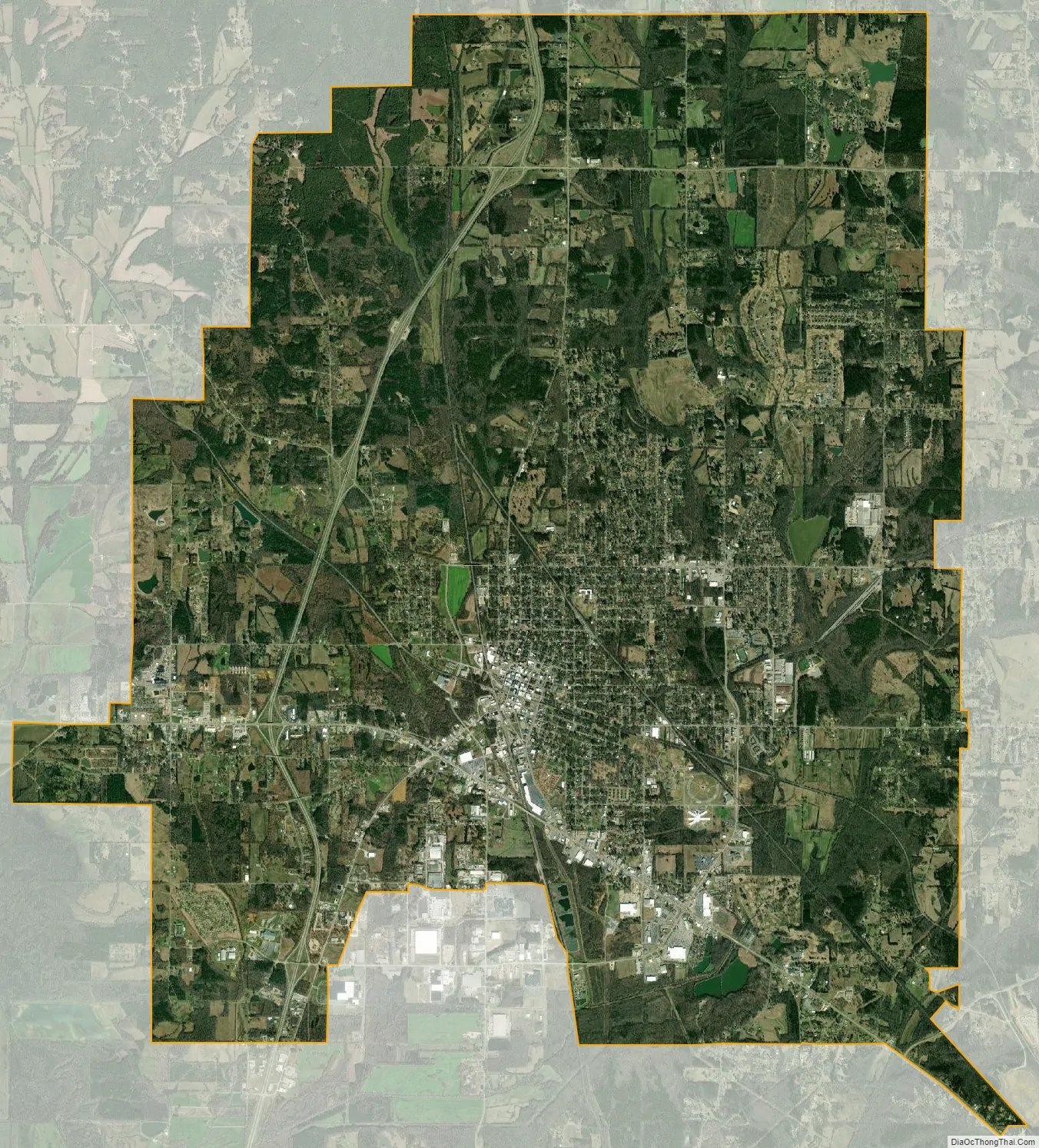
Corinth city Satellite Map
Geography
Corinth is located in northeast Mississippi at the intersection of (north/south) U.S. Route 45 and (east/west) U.S. Route 72. U.S. 45 runs to the west of the city as a bypass, leading north 19 mi (31 km) to Selmer, Tennessee, and south 21 mi (34 km) to Booneville. U.S. 72 runs through the southern part of the city, leading southeast 14 mi (23 km) to Burnsville and west 23 mi (37 km) to Walnut. It is the county seat of Alcorn County, which is the smallest county by area in the state of Mississippi.
According to the United States Census Bureau, the city has a total area of 30.3 square miles (78.4 km), of which 30.2 square miles (78.1 km) is land and 0.12 square miles (0.3 km), or 0.43%, is water.
Communities near Corinth
- Eastview, Tennessee, 9.85 miles (15.85 km)
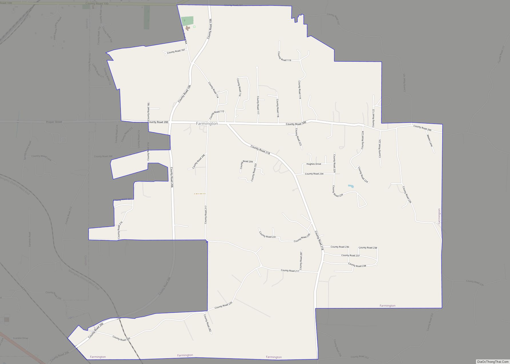
- Farmington, 3.97 miles (6.39 km)
- Guys, Tennessee, 7.24 miles (11.65 km)
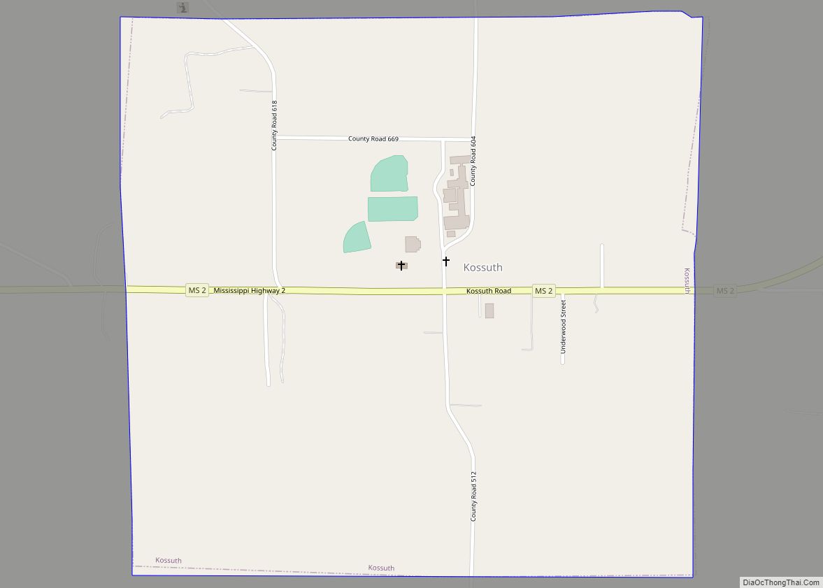
- Kossuth, 8.21 miles (13.21 km)
- Michie, Tennessee, 9.75 miles (15.69 km)
- Ramer, Tennessee, 10.92 miles (17.57 km)
Rivers and streams
- Bridge Creek
- Elam Creek
- Phillips Creek
- Turner Creek
Climate
The climate is humid subtropical (Köppen: Cfa) like all of Mississippi but with frequent and regular gusts of snow.
See also
Map of Mississippi State and its subdivision:- Adams
- Alcorn
- Amite
- Attala
- Benton
- Bolivar
- Calhoun
- Carroll
- Chickasaw
- Choctaw
- Claiborne
- Clarke
- Clay
- Coahoma
- Copiah
- Covington
- Desoto
- Forrest
- Franklin
- George
- Greene
- Grenada
- Hancock
- Harrison
- Hinds
- Holmes
- Humphreys
- Issaquena
- Itawamba
- Jackson
- Jasper
- Jefferson
- Jefferson Davis
- Jones
- Kemper
- Lafayette
- Lamar
- Lauderdale
- Lawrence
- Leake
- Lee
- Leflore
- Lincoln
- Lowndes
- Madison
- Marion
- Marshall
- Monroe
- Montgomery
- Neshoba
- Newton
- Noxubee
- Oktibbeha
- Panola
- Pearl River
- Perry
- Pike
- Pontotoc
- Prentiss
- Quitman
- Rankin
- Scott
- Sharkey
- Simpson
- Smith
- Stone
- Sunflower
- Tallahatchie
- Tate
- Tippah
- Tishomingo
- Tunica
- Union
- Walthall
- Warren
- Washington
- Wayne
- Webster
- Wilkinson
- Winston
- Yalobusha
- Yazoo
- Alabama
- Alaska
- Arizona
- Arkansas
- California
- Colorado
- Connecticut
- Delaware
- District of Columbia
- Florida
- Georgia
- Hawaii
- Idaho
- Illinois
- Indiana
- Iowa
- Kansas
- Kentucky
- Louisiana
- Maine
- Maryland
- Massachusetts
- Michigan
- Minnesota
- Mississippi
- Missouri
- Montana
- Nebraska
- Nevada
- New Hampshire
- New Jersey
- New Mexico
- New York
- North Carolina
- North Dakota
- Ohio
- Oklahoma
- Oregon
- Pennsylvania
- Rhode Island
- South Carolina
- South Dakota
- Tennessee
- Texas
- Utah
- Vermont
- Virginia
- Washington
- West Virginia
- Wisconsin
- Wyoming