Grenada /ɡrəˈneɪdə/ is a city in Grenada County, Mississippi, United States. The population was 13,092 at the 2010 census. It is the county seat of Grenada County.
| Name: | Grenada city |
|---|---|
| LSAD Code: | 25 |
| LSAD Description: | city (suffix) |
| State: | Mississippi |
| County: | Grenada County |
| Elevation: | 213 ft (65 m) |
| Total Area: | 30.03 sq mi (77.78 km²) |
| Land Area: | 30.01 sq mi (77.72 km²) |
| Water Area: | 0.03 sq mi (0.06 km²) |
| Total Population: | 12,700 |
| Population Density: | 423.23/sq mi (163.41/km²) |
| ZIP code: | 38901-38902 |
| Area code: | 662 |
| FIPS code: | 2829460 |
| GNISfeature ID: | 0670734 |
| Website: | www.cityofgrenada.net |
Online Interactive Map
Click on ![]() to view map in "full screen" mode.
to view map in "full screen" mode.
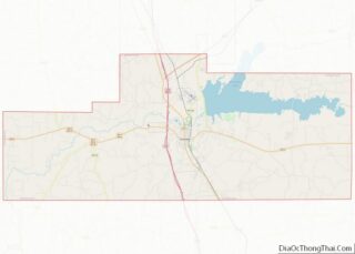
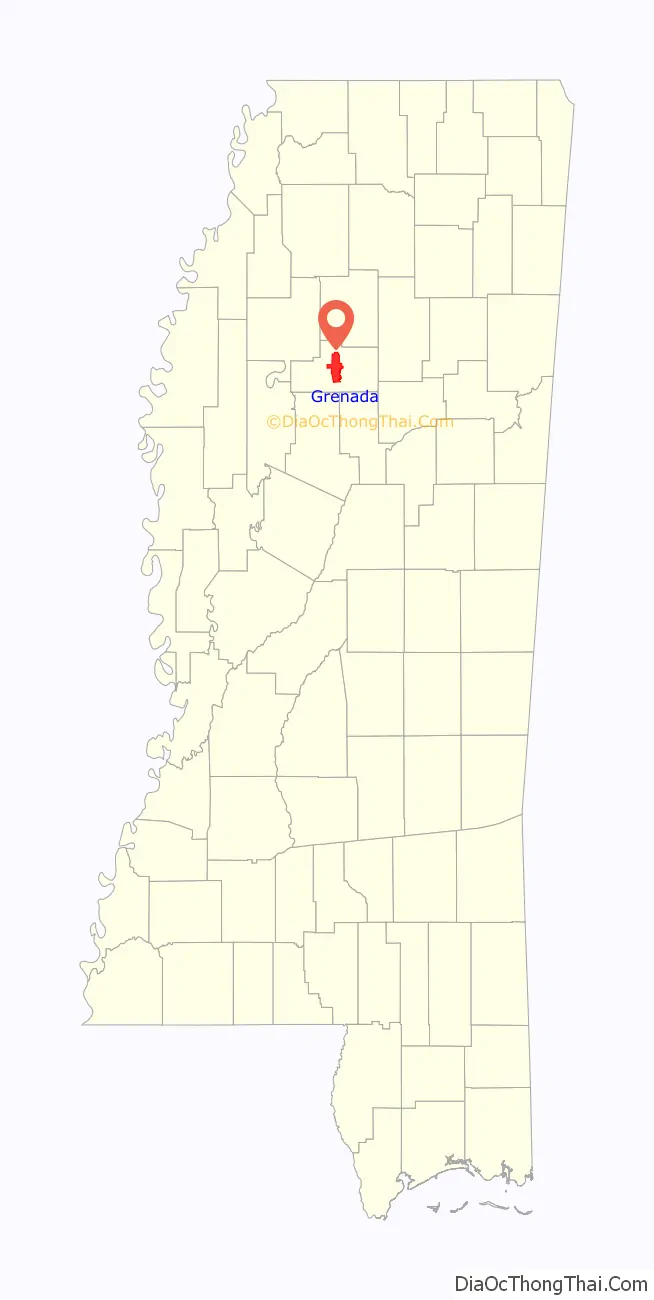
Grenada location map. Where is Grenada city?

History
Grenada was formed in 1836, after federal removal of the Choctaw people who had long occupied this territory. It was the result of the union of the two adjacent towns (separated by the present-day Line Street) of Pittsburg and Tulahoma (or Tullahoma), founded, respectively, by Franklin Plummer and Hiram Runnels.
Development included stores and businesses that supported the county court and market days. Plantations were first developed along the Yalobusha River for transportation and access to water. Cotton was the major commodity crop, dependent on the labor of enslaved African Americans.
In 1851, Grenada townspeople founded the Yalobusha Baptist Female Institute for education of their young white women. In 1882, the school was taken over by the Methodists and renamed as Grenada College. Classified in the 20th century as a junior college, it encountered financial troubles during the Great Depression. The church closed the college in 1936 and transferred its assets to Millsaps College.
In December 1862, Confederate general Earl Van Dorn, whose troops had been encamped in Grenada, led the three brigades under his command in an attempt to destroy the Union supply depot at Holly Springs, Mississippi.
In 1885 two white men, Perry McChristian and Felix Williams, were accused of murdering two white peddlers and were lynched. During the lynching, they implicated two Black men, Bartley James and John Campbell, who were then also lynched by a mob of white men.
Civil rights era
In 1966, Martin Luther King Jr. and Dick Gregory, spent about a week demonstrating in Grenada against discrimination and for voters rights. During that time, town officials cooperated and protected marchers with local police. Six black voter registrars were hired, and registered 1,000 black residents during that week. After the march passed through, the county fired the registrars, and the town never entered the 1,000 new black voters on official rolls; they had to start over again to gain official voter registration.
As the civil rights movement continued to press in 1966 and 1967 for voter registration and opportunities in employment, the Southern Christian Leadership Conference (SCLC) ran a civil rights organizing project in Grenada which lasted at least 11 months. They worked to register voters and gain concessions for hiring African Americans in local businesses and restaurants. These were still segregated, despite the Federal anti-segregation and voting rights laws.
In August of 1966, a federal judge ordered Grenada to allow African-American students to enroll in the previously all-white schools. White leaders used threats of eviction and firing to coerce Black parents to withdraw from school. While the intimidation caused 200 out of 450 students to withdraw, the remaining 250 students attempted to enter school on September 12, 1966. A large mob of whites met them at the school and chased them away, pursuing them through the streets and beating the children with chains, pipes, and clubs. The mob went so far as to beat reporters as well. The mob repeated this for the first week of school, while local law enforcement did nothing. Federal protection for the children began on September 17, and 13 members of the mob were arrested.
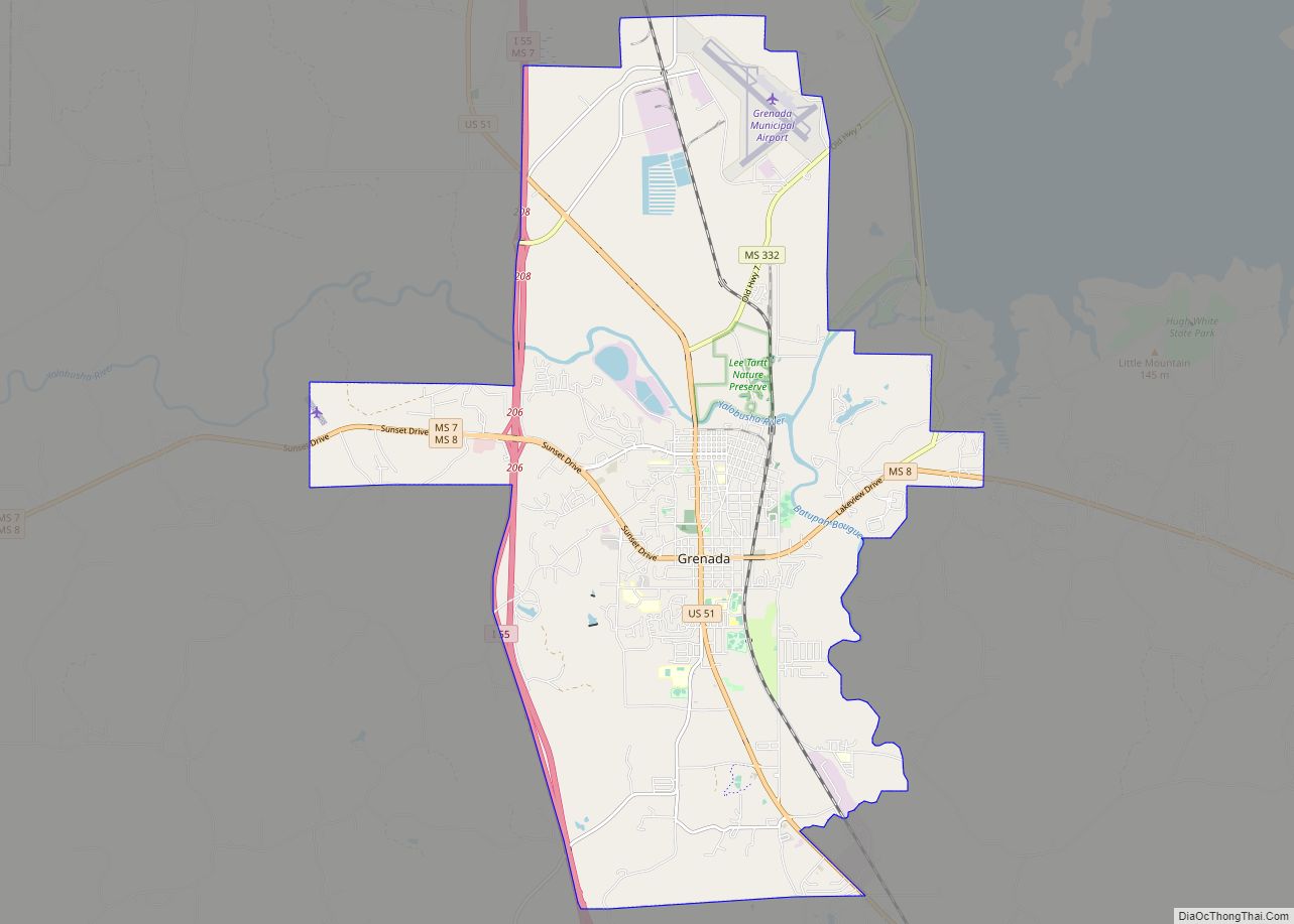
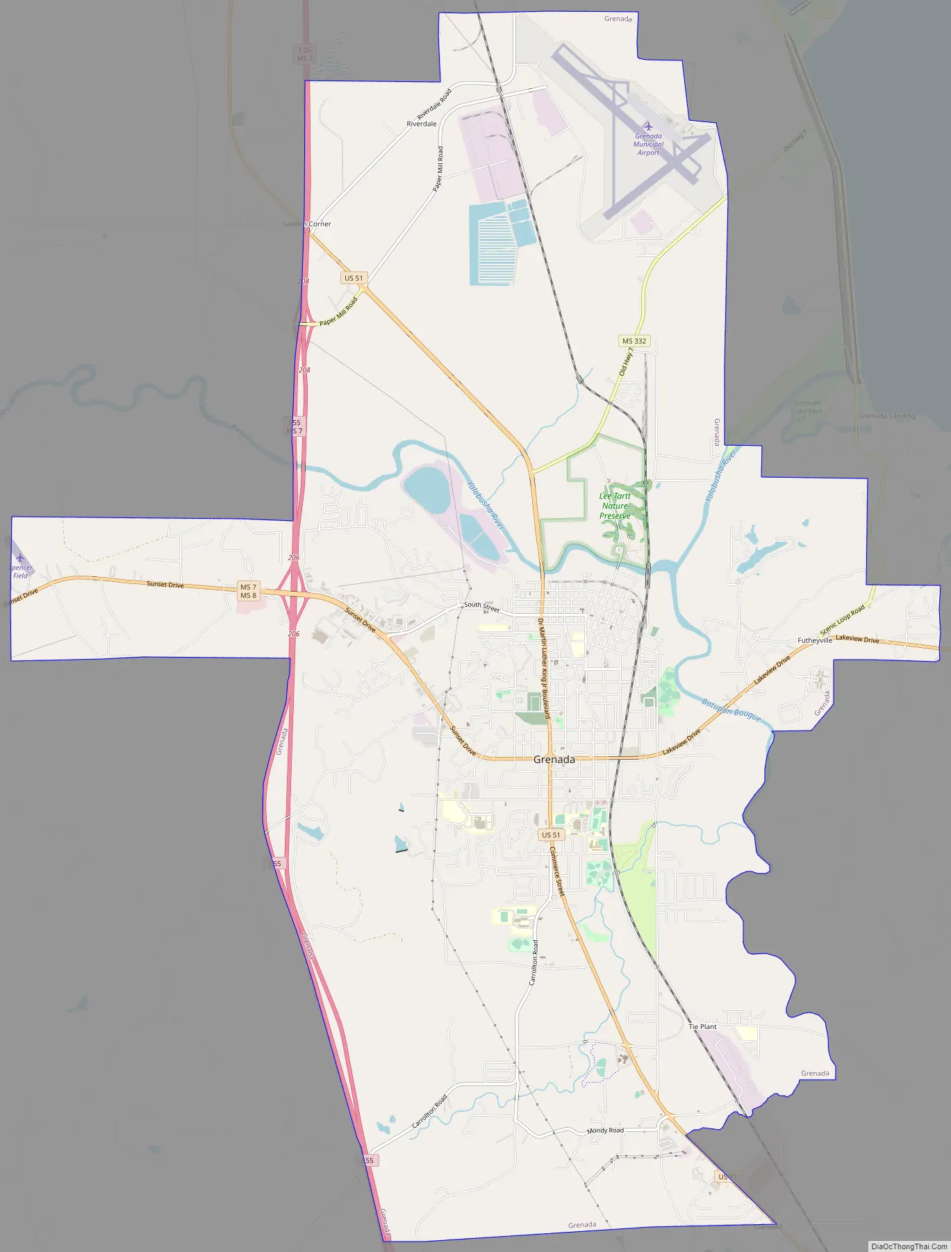
Grenada Road Map
Grenada city Satellite Map
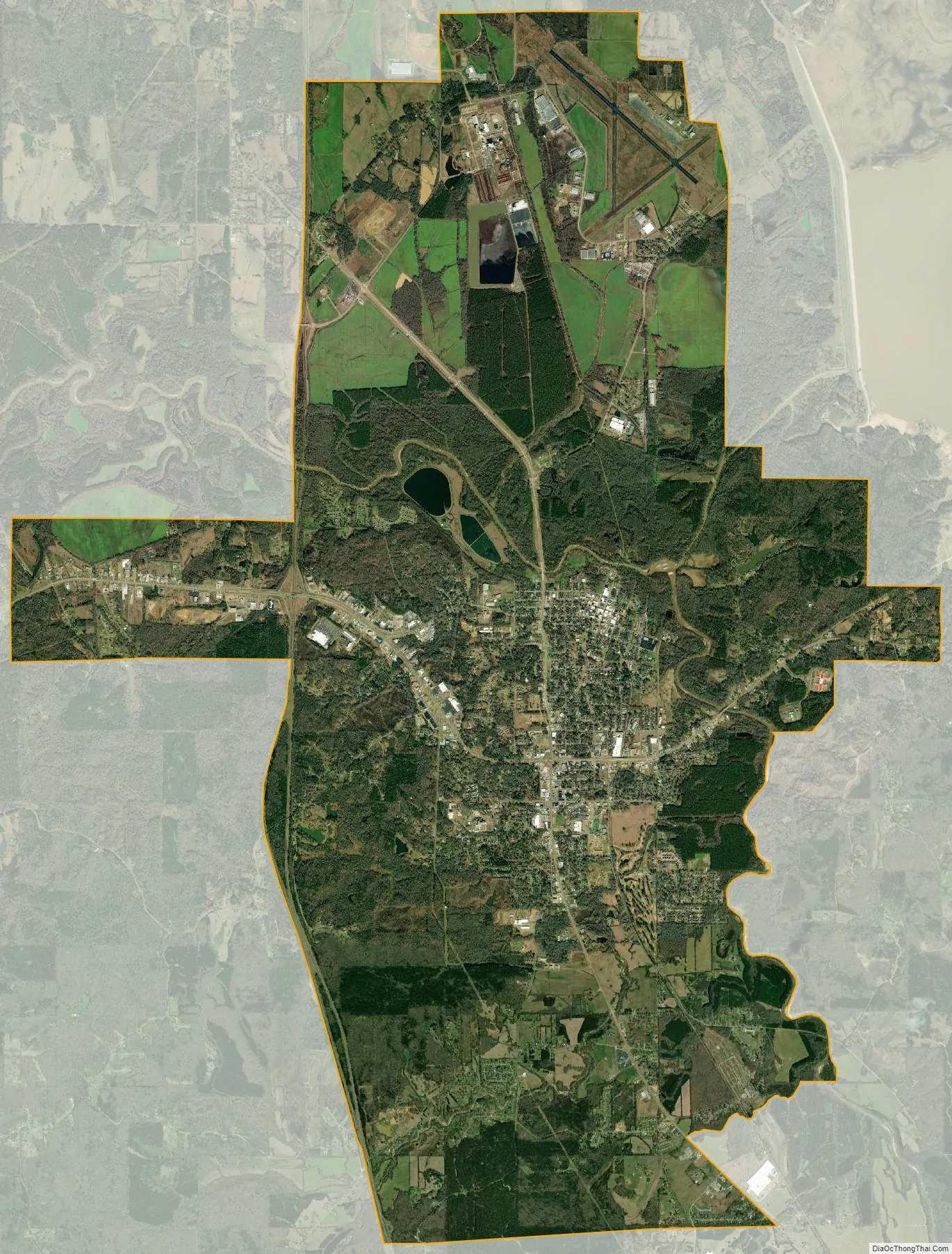
Geography
The Yalobusha River flows through Grenada. Grenada Lake is located a short distance east of the city.
According to the United States Census Bureau, the city has a total area of 30.0 square miles (78 km), of which 30.0 square miles (78 km) is land and 0.03% is water.
See also
Map of Mississippi State and its subdivision:- Adams
- Alcorn
- Amite
- Attala
- Benton
- Bolivar
- Calhoun
- Carroll
- Chickasaw
- Choctaw
- Claiborne
- Clarke
- Clay
- Coahoma
- Copiah
- Covington
- Desoto
- Forrest
- Franklin
- George
- Greene
- Grenada
- Hancock
- Harrison
- Hinds
- Holmes
- Humphreys
- Issaquena
- Itawamba
- Jackson
- Jasper
- Jefferson
- Jefferson Davis
- Jones
- Kemper
- Lafayette
- Lamar
- Lauderdale
- Lawrence
- Leake
- Lee
- Leflore
- Lincoln
- Lowndes
- Madison
- Marion
- Marshall
- Monroe
- Montgomery
- Neshoba
- Newton
- Noxubee
- Oktibbeha
- Panola
- Pearl River
- Perry
- Pike
- Pontotoc
- Prentiss
- Quitman
- Rankin
- Scott
- Sharkey
- Simpson
- Smith
- Stone
- Sunflower
- Tallahatchie
- Tate
- Tippah
- Tishomingo
- Tunica
- Union
- Walthall
- Warren
- Washington
- Wayne
- Webster
- Wilkinson
- Winston
- Yalobusha
- Yazoo
- Alabama
- Alaska
- Arizona
- Arkansas
- California
- Colorado
- Connecticut
- Delaware
- District of Columbia
- Florida
- Georgia
- Hawaii
- Idaho
- Illinois
- Indiana
- Iowa
- Kansas
- Kentucky
- Louisiana
- Maine
- Maryland
- Massachusetts
- Michigan
- Minnesota
- Mississippi
- Missouri
- Montana
- Nebraska
- Nevada
- New Hampshire
- New Jersey
- New Mexico
- New York
- North Carolina
- North Dakota
- Ohio
- Oklahoma
- Oregon
- Pennsylvania
- Rhode Island
- South Carolina
- South Dakota
- Tennessee
- Texas
- Utah
- Vermont
- Virginia
- Washington
- West Virginia
- Wisconsin
- Wyoming