Leakesville is a town in and the county seat of Greene County, Mississippi, United States. It is located along the Chickasawhay River in Greene County, Mississippi, United States. It is served by the junction of Mississippi routes 57 and 63. As of the 2010 census, the rural town population was 898, down from 1,026 at the 2000 census.
| Name: | Leakesville town |
|---|---|
| LSAD Code: | 43 |
| LSAD Description: | town (suffix) |
| State: | Mississippi |
| County: | Greene County |
| Elevation: | 108 ft (33 m) |
| Total Area: | 6.29 sq mi (16.30 km²) |
| Land Area: | 6.28 sq mi (16.27 km²) |
| Water Area: | 0.01 sq mi (0.03 km²) |
| Total Population: | 3,775 |
| Population Density: | 600.83/sq mi (231.97/km²) |
| ZIP code: | 39451 |
| Area code: | 601 |
| FIPS code: | 2839840 |
| GNISfeature ID: | 0672343 |
| Website: | leakesvillems.com |
Online Interactive Map
Click on ![]() to view map in "full screen" mode.
to view map in "full screen" mode.
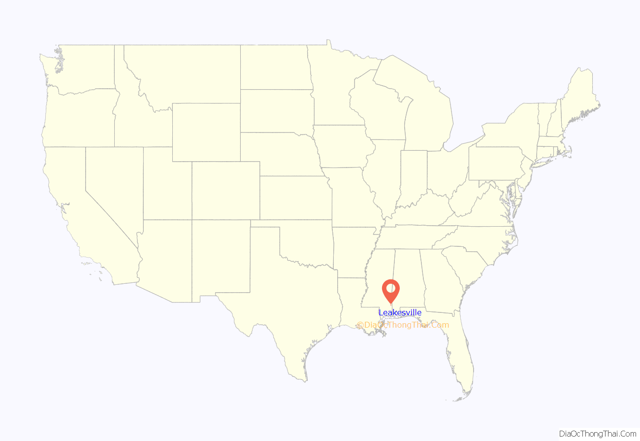
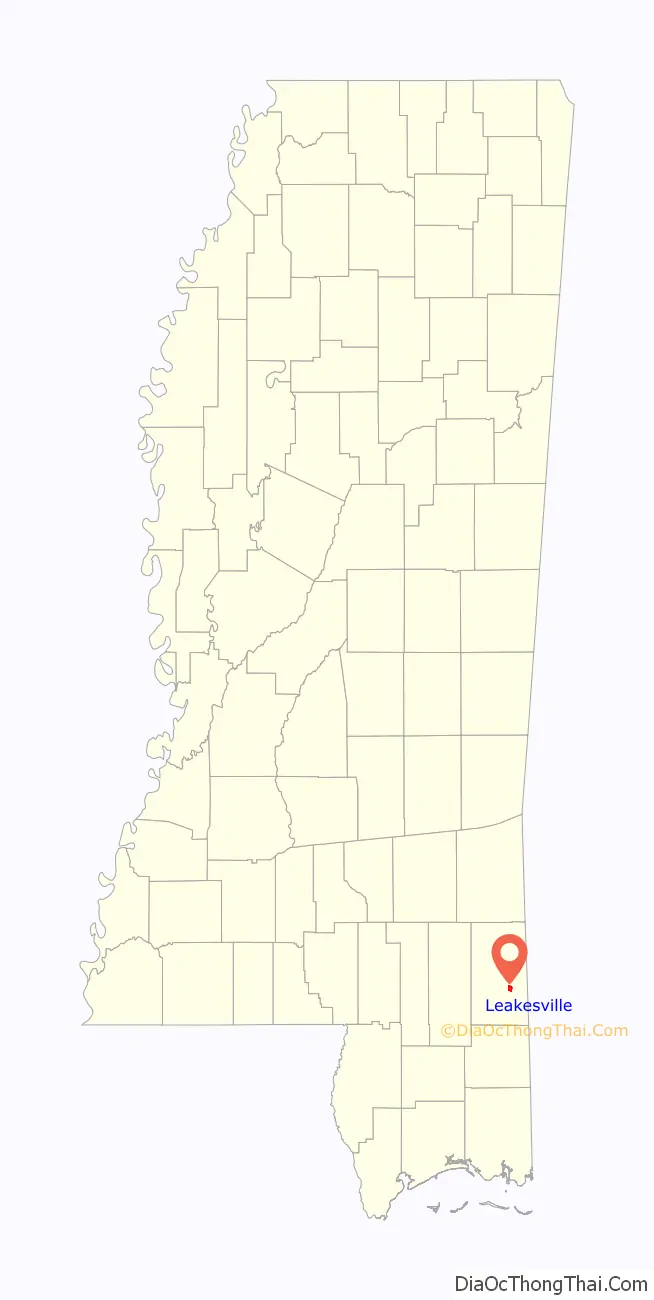
Leakesville location map. Where is Leakesville town?
History
Like most of Mississippi, this area was part of the traditional territory of the historic Choctaw. Under the Indian Removal Act of 1830, they were forced to cede their lands in this area to the United States. The Choctaw were the first of the Southeast Five Civilized Tribes to be removed to Indian Territory (now Oklahoma), west of the Mississippi River. Some members remained in the state and their descendants have maintained cultural identity. They gained federal recognition as the Mississippi Band of Choctaw Indians.
A post office called Leakesville has been in operation since 1829, when European Americans established a settlement here. The town was named for Walter Leake, third governor of Mississippi. The area was developed for cotton plantations in the nineteenth century, and remains mostly rural.
In 1927, an African-American man named Bernice Raspberry, aged 23, who had been arrested for alleged improper conduct with a white woman, was taken from the jail and lynched.
Leakesville Road Map

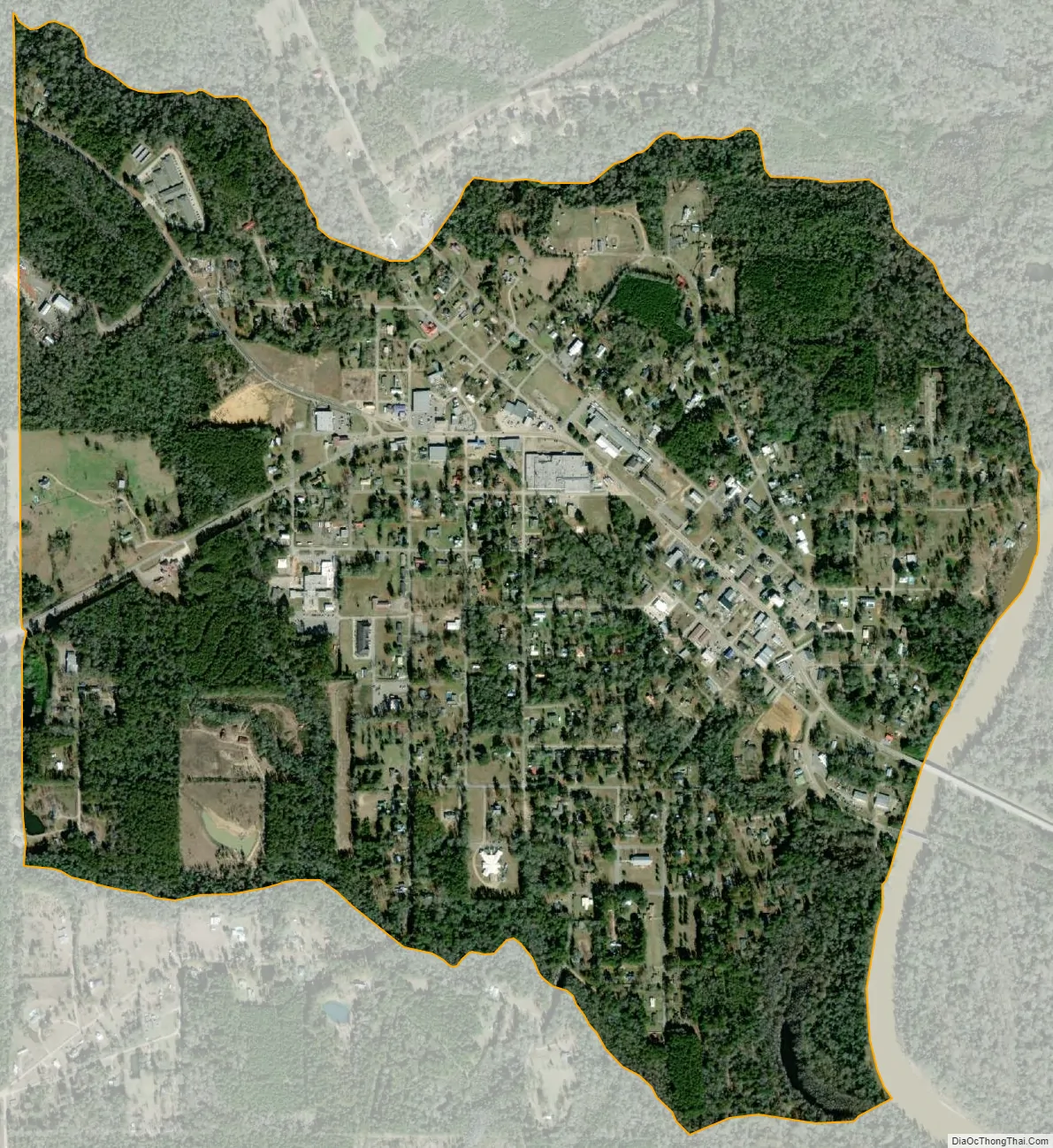
Leakesville city Satellite Map
Geography
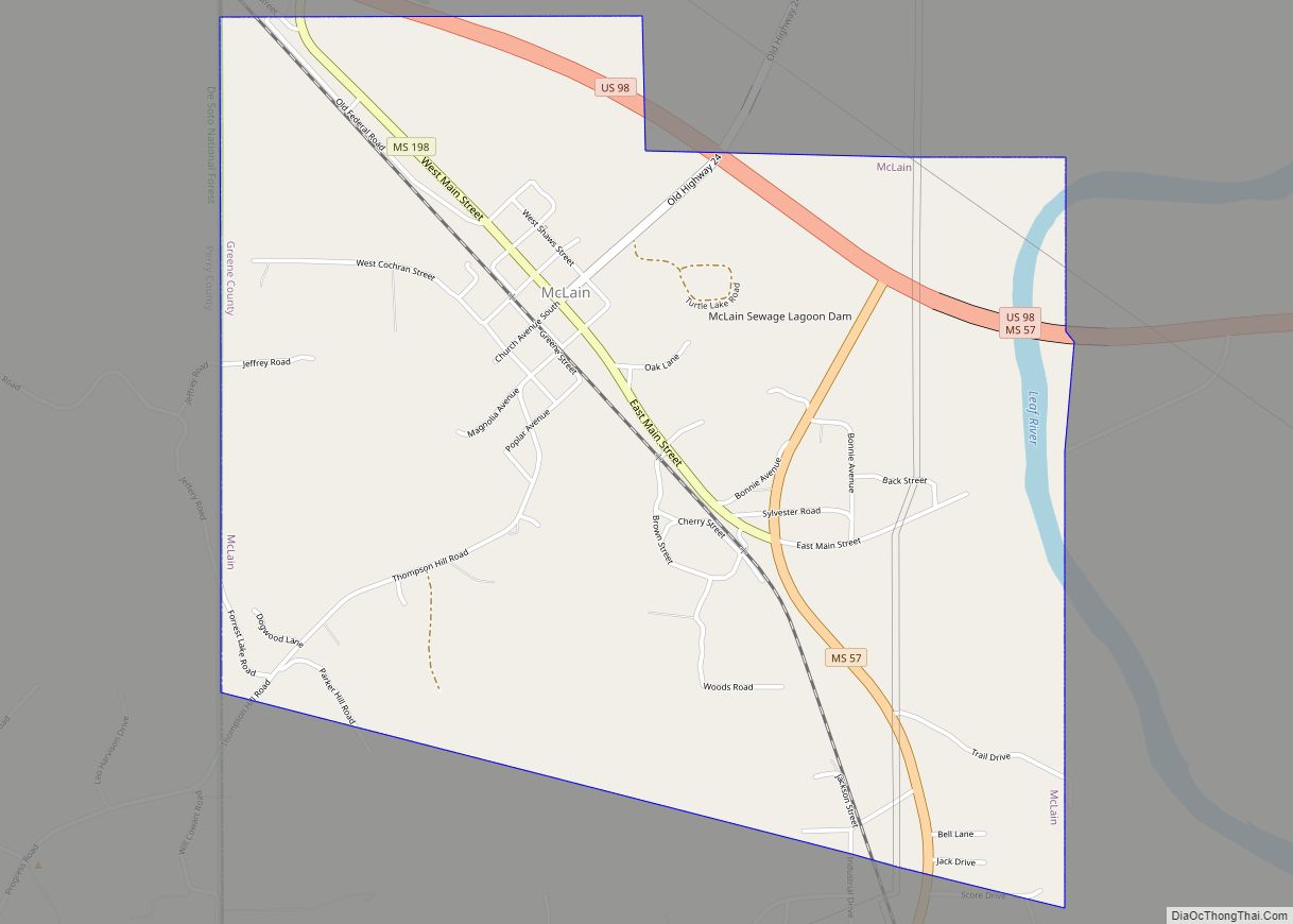
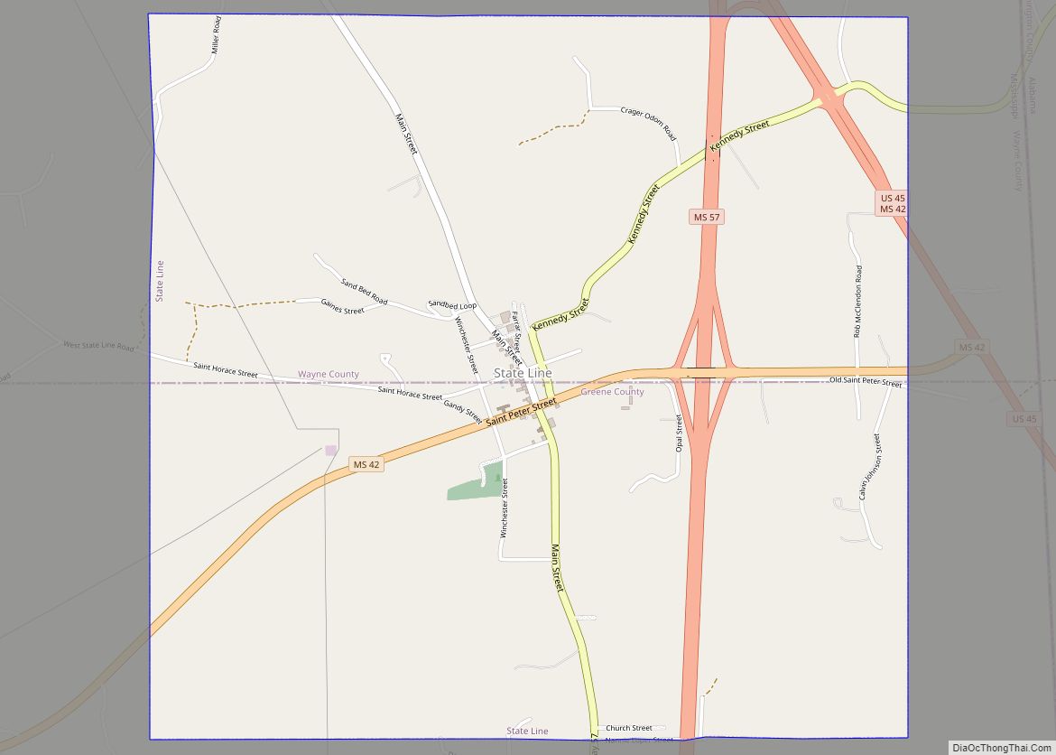
Leakesville is in southeastern Greene County, on the west side of the Chickasawhay River, a south-flowing tributary of the Pascagoula River. Via Mississippi Highway 63, it is 20 miles (32 km) south to Lucedale and 19 miles (31 km) northwest to Sand Hill. Via Highway 57, it is 24 miles (39 km) north to State Line and 17 miles (27 km) west to McLain.
According to the United States Census Bureau, Leakesville has a total area of 1.6 square miles (4.1 km), of which 0.0039 square miles (0.01 km), or 0.31%, is water.
See also
Map of Mississippi State and its subdivision:- Adams
- Alcorn
- Amite
- Attala
- Benton
- Bolivar
- Calhoun
- Carroll
- Chickasaw
- Choctaw
- Claiborne
- Clarke
- Clay
- Coahoma
- Copiah
- Covington
- Desoto
- Forrest
- Franklin
- George
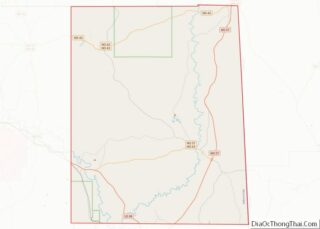
- Greene
- Grenada
- Hancock
- Harrison
- Hinds
- Holmes
- Humphreys
- Issaquena
- Itawamba
- Jackson
- Jasper
- Jefferson
- Jefferson Davis
- Jones
- Kemper
- Lafayette
- Lamar
- Lauderdale
- Lawrence
- Leake
- Lee
- Leflore
- Lincoln
- Lowndes
- Madison
- Marion
- Marshall
- Monroe
- Montgomery
- Neshoba
- Newton
- Noxubee
- Oktibbeha
- Panola
- Pearl River
- Perry
- Pike
- Pontotoc
- Prentiss
- Quitman
- Rankin
- Scott
- Sharkey
- Simpson
- Smith
- Stone
- Sunflower
- Tallahatchie
- Tate
- Tippah
- Tishomingo
- Tunica
- Union
- Walthall
- Warren
- Washington
- Wayne
- Webster
- Wilkinson
- Winston
- Yalobusha
- Yazoo
- Alabama
- Alaska
- Arizona
- Arkansas
- California
- Colorado
- Connecticut
- Delaware
- District of Columbia
- Florida
- Georgia
- Hawaii
- Idaho
- Illinois
- Indiana
- Iowa
- Kansas
- Kentucky
- Louisiana
- Maine
- Maryland
- Massachusetts
- Michigan
- Minnesota
- Mississippi
- Missouri
- Montana
- Nebraska
- Nevada
- New Hampshire
- New Jersey
- New Mexico
- New York
- North Carolina
- North Dakota
- Ohio
- Oklahoma
- Oregon
- Pennsylvania
- Rhode Island
- South Carolina
- South Dakota
- Tennessee
- Texas
- Utah
- Vermont
- Virginia
- Washington
- West Virginia
- Wisconsin
- Wyoming